)
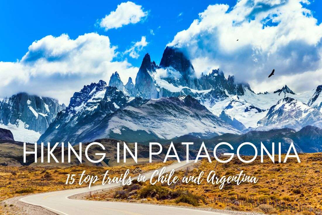
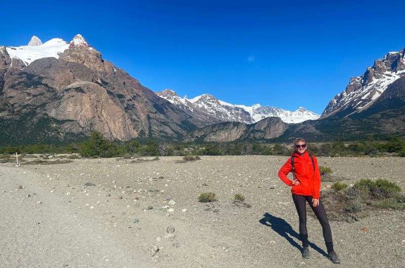
I have seen it all. And let me tell you, Patagonia is one of the most beautiful places in the world. I have seen plenty of incredible destinations on this Earth, but once you’ve visited Patagonia, it’s like you’re a different person. One that has seen things.
I’ve put together this guide for hiking in Patagonia that will go through both Chile's and Argentina's Patagonia—one that I would’ve liked to find when I was planning my own trip(s).
All of the hikes on this list are day hikes, because I like my little luxury twist at the end of a adventurous day out (read: I like to spend my nights in a real bed after a real shower). Plus, there are pumas in Patagonia and very harsh weather to boot... who does those multidays, anyway?! You can explore places like Fitz Roy and Perito Moreno in Argentina or Vicente Perez Rosales or Torres del Paine in Chile in a single day, so let’s head out!
>> Ready to go? Get my itineraries: 2 weeks in Chile | 3 weeks in Chile | 7 days in Argentina <<
On my list, you'll find a total of 15 hikes, with 9 in Chile and 6 in Argentina, so you could say Chile offers more gems than its neighbor. But both countries boast truly top-notch trails. Let's dive a bit into the specific areas where these hikes are located:
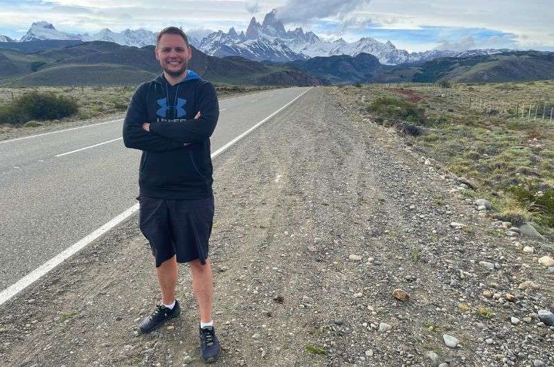
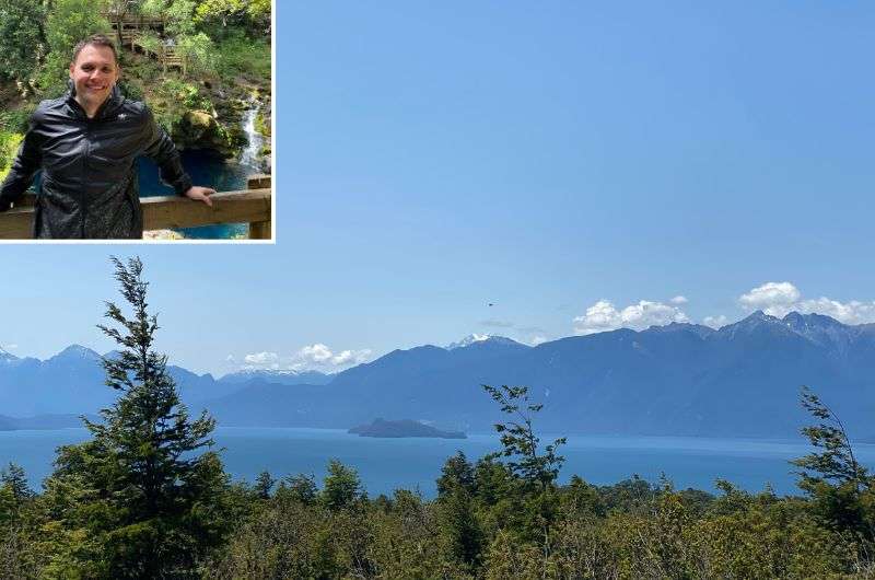
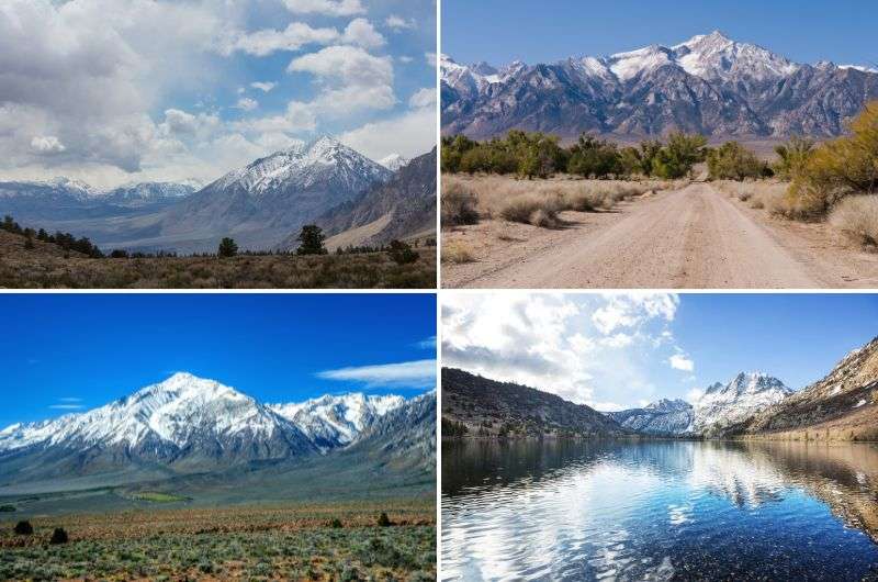
Me in the middle of beautiful nature in Patagonia
Alright, let's get on with it. Here is the list of the top 15 single-day hikes in Patagonia (no, I couldn't pick fewer):
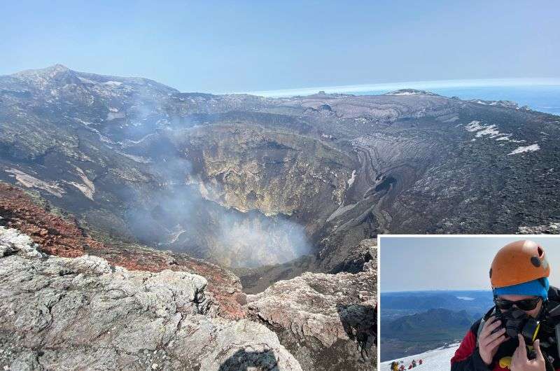
This hike is next level, but I have to say that despite the horrible altitude sickness I was suffering from, the climb was absolutely epic!
Jan’s summary: It is the toughest, most challenging trek I've ever been on. You get equipped with crampons, ice axes, and gas masks. So, prepare yourself for a real adrenaline-pumping experience.
Hike length: 8.0 km (5 mi), out & back
Elevation gain: 1,407 m (4,616 ft)
Difficulty level: Hard
Hiking time: 4-5 hours
Trailhead: Google Maps link to trailhead
Hotel recommandation: Hotel Enjoy Pucon (you'll really enjoy this one… except maybe for the price)
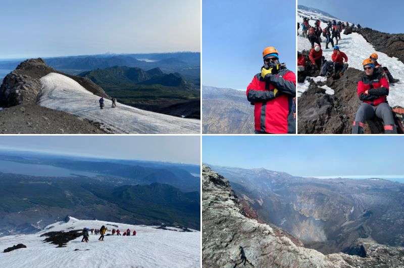
If there’s just one trail you hit in Patagonia, make it this one. It was such an epic ordeal I even wrote a whole piece on it, "All You Need to Know About Climbing Villarrica in 4 Steps," but let me tease you with some details here.
First off, you can only conquer this volcano in a guided group. If you're not one for planning, too bad—you’ll need to make an exception here. Some days, the volcano sees up to 300 tourists, and slots can fill up fast. The standard gear includes crampons, ice axes, helmets, and gas masks. It's best to arrange your tour in person at the agency and pay there. We tried booking online, and of course, they forgot about us, haha.
The aim of this hike is clear!
Expect an early start, around 6 am, then brace yourself for several hours of climbing. It’s a real treat right after you wake up. Imagine you lived on the 285th floor and your elevator just broke—that’s how high you’re going.
The first 1,500 m (4,920 ft) are a breeze, with a chill terrain that gives you plenty of time to soak in the stunning landscapes. But then, it's time to strap on the crampons because the rest of the way is covered in glacier, and it gets seriously slippery—this is where the real fun starts.
This trek is incredibly tough, so don't even think about straying from the group. You're walking on ice the whole time, and there's a real danger you could fall into crevasses over 300 m (985 ft) deep. Sticking close to the guide ensures you won't end up in any forbidden spots or face hefty fines—like the whopping $500 I heard about, which would definitely put a damper on your day. And, you know, dying would also be inconvenient.
It was unforgettable!
Once you've clawed your way to the summit, take a moment to appreciate standing on top of a volcano—it's an exhilarating feeling. The temperature at the top is notably warmer than on the way up. At the crater's edge, it hovers around 60 °C (140 °F). You can actually feel the heat emanating from beneath the ground under your feet. This is when you'll really need that oxygen mask you've been lugging around—hello, you're on one of the most active volcanoes in the world! Although there was no lava during my visit, just some mild sulfuric fumes and clear sunny weather.
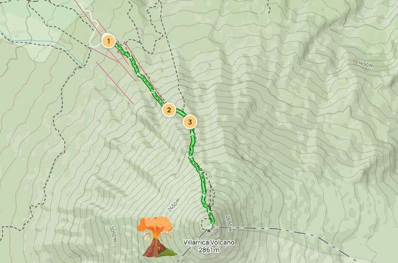
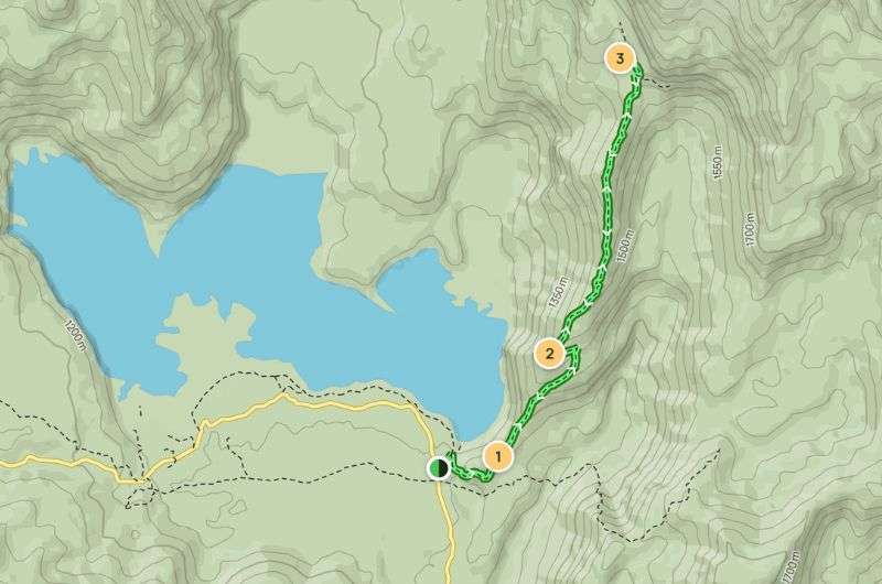
Literally the best hike in Patagonia… standing on the top of the volcano (see the map on Alltrails)
If you’re worried about the trip back down, don’t be. You literally slide on your butts! Just make sure to stand up and start walking again when you get to the end of the glacier!
Tip: Read about more Chilean Patagonia—highlights and travel tips from my trip.
The advantage of hiking in Patagonia is that the goal is a great motivation to complete the hike. You really want to see the view at the end!
Jan’s summary: A long hike that anyone that isn’t scared away by the length can do. Views at the end that’ll make your jaw hit the floor... if you’re patient with the clouds, that is!
Hike length: 17.5 km (10.9 mi), out & back
Elevation gain: 501 m (1,643 ft)
Difficulty level: Moderate
Hiking time: 5 hours
Trailhead: Google Maps link to trailhead
Hotel recommandation: Destino Sur Hotel & Spa de Montaña
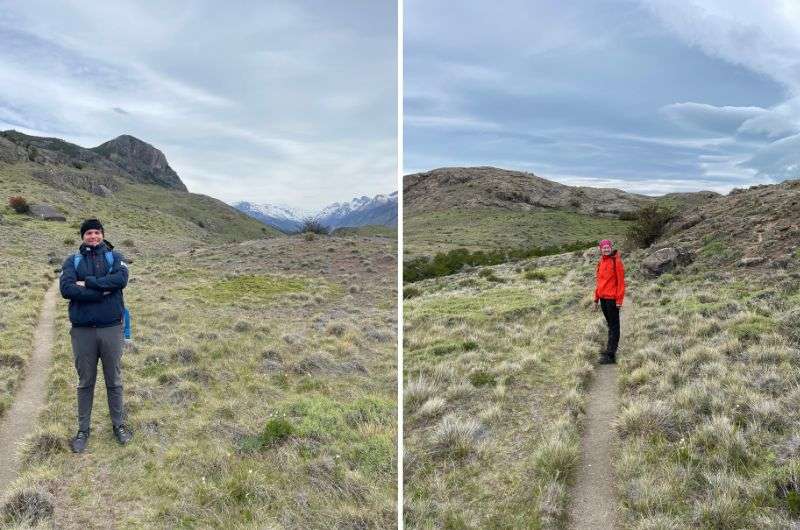
This trail starts right in El Chaltén, which is super convenient—no need to hop in a car or cab. I've marked the official trailhead in the description, and that's pretty much where I kicked off my hike too. But hey, if you want to cut through a field in El Chaltén and join the trail later, that's your call.
The trail is well-marked and the terrain isn't too challenging. The main reason this hike is rated moderate and not easy is because you'll be trekking a full 17.5 km (10.9 mi)—so it's long, but not particularly tough.
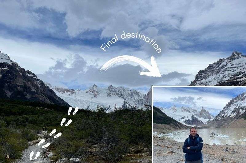
Me and my girlfriend hiking the Laguna Torre hike
The trail winds through the valley of the Rio Fitz Roy. The first 2 km (1.2 mi) is a mild ascent until you reach Mirador Margarita. From here, the views are stunning, especially of Cerro Torre and the Margarita Waterfall. Beyond that, the path isn’t too demanding, but expect some climbs until you reach Laguna Torre.
The trail is variable enough to stay interesting, but it never gets too exciting, if you know what I mean. A lot of easy-to-follow paths (see photo above), with some rockier areas, and, if it had been raining recently, you’ll probably run into a muddy pools on the trail. Nothing serious though, and you’ll do fine walking the trail even in trainers. At Laguna Torre, the mountain vistas range from “OMG wow!” to “Aw man, the clouds are covering everything.”
If the mountains are shrouded in clouds, you might just be unlucky. But I recommend waiting it out—clouds have a reputation of moving around you know! And with the wind the Laguna Torre trail gets, it’s just a matter of how fast. When we visited, a lot of people turned around too quickly, surrendering to their bad luck, having given up all hope of seeing anything, ready to write home about the stupid clouds. But not us, oh no. We waited, and were rewarded with some fantastic views of the peaks. Moral of the story is: Patience you must have, young Padawan!
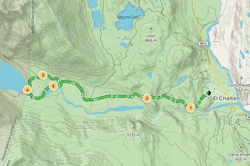
Beautiful trail in the Rio Fitz Roi river (see the map on Alltrails)
Tip: Don’t be tempted to turn back without reaching the viewpoint at the end. You may feel like you’ve seen it all before you get there, but you’d be very wrong. Make the loop anti-clockwise to get the most out of the views. Beware there are loose rocks in the last part, so turn on those ankles and watch your step.
If you're not a fan of crowded trails, I’d suggest heading out early in the morning. Sometimes, you might inadvertently set off with a group, and it can be tough to shake them off unless you sprint ahead or take an early snack break.
For the romantics who bring camping gear, you can camp by the lake. The camping spot is right off the trail, hard to miss. While I’m a romantic at heart, you wouldn’t catch me dead in a tent—I prefer the comfort of a hotel bed.
If you’re also more hotel-inclined, I recommend the Destino Sur Hotel & Spa de Montaña. The rooms are lovely—brand new. Honestly, what I remember most is sinking into that great bedding and catching some blissful sleep after wrapping up the Laguna Torre hike. That was all I needed.
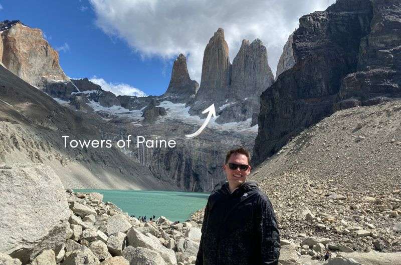
After overcoming the hiking PAIN, you will get a glimpse of the famous Torres del PAINE!
Jan’s summary: It’s a long hike but far from dull, thanks to the variety of terrains. And at the end, you’ll get to see the majestic Towers of Paine that lend their name to the whole national park.
Hike length: 20.1 km (6.03 mi), out & back
Elevation gain: 1,014 m (3,327 ft)
Difficulty level: Hard
Hiking time: 10 hours
Trailhead: Google Maps link to trailhead
Hotel recommandation: Río Serrano Hotel + Spa (because after this looong day, a spa will come in handy!)
This is one of the most iconic hikes in all of Patagonia, maybe even all of South America, so it absolutely had to make this list. The trail is part of the famous W Circuit, specifically its beginning, because the full W Circuit is a multi-day trail that requires professional equipment.
The hike starts at the visitor center of Torres del Paine National Park. You'll need to buy a ticket to enter the park, but it's valid for three days, giving you a chance to try other, easier trails there. From there, brace yourself for a challenging hike.
Let’s talk terrain, so you know what’s coming on this 10 km (6.2 mi) journey. In the first few kilometers, you’ll cross several swinging bridges, but the terrain is mostly flat. Then begins a gentle ascent through the beautiful Ascencio Valley canyon. You'll eventually reach the Refugio Chileno, a hiker's hut where you can take a break. However, I wouldn't recommend stopping too long since you're not even a third of the way through the hike yet.
Average hike, but with the most iconic views at the end (see the map on Alltrails)
The next section (about 3 km/1.86 mi) takes you through a forest with easy terrain, the only obstacles being a few streams to cross. Once you emerge from the woods, the faint-hearted might feel their knees buckle—not from the stunning scenery, but from the steep climb ahead. Yes, you're approaching the trail's final and most challenging part. The surface is quite slippery, and you really need to watch your step because there are loose stones, plus the wind gets stronger as you climb higher and higher.
The trail ends on the shores of Lake Torre, where you're treated to an incredible view of the three "Towers of Paine," the rock formations that give the national park its name. These towering spires, resembling skyscrapers, are a breathtaking sight. Standing at an elevation of 850 m (2,790 ft), you look up to see the towers rising to 3,000 m (9,500 ft)—simply stunning.
Tip: I recommend heading out for sunrise; it’s truly a magnificent sight. Not that I’ve experienced it personally, but I've seen photos, and it’s flawless. Well, almost flawless—you'll need to wake up around 4 am and make a brisk ascent.
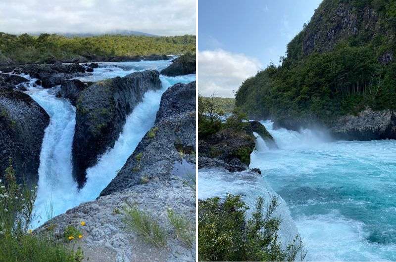
The sun didn't cooperate much with us, so we only had Petrohué Waterfalls with no view of the volcanoes. But we still loved it!
Jan’s summary: This short, easy hike ends with beautiful waterfalls featuring beautiful turquoise waters—if you're lucky and the sun cooperates.
Hike length: 1.6 km (1 mi), out & back
Elevation gain: 21 m (69 ft)
Difficulty level: Easy
Hiking time: 30 minutes
Trailhead: Google Maps link to trailhead
Hotel recommandation: Hotel Natura
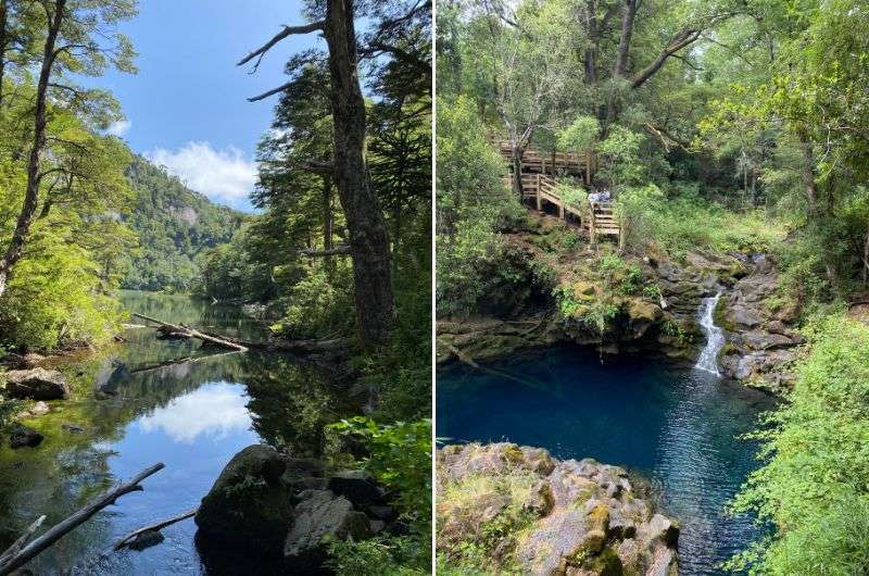
This mini trail to the Petrohué Waterfalls is located in Vicente Pérez Rosales National Park. At the park's entrance, you'll need to pay a fee of ARS 3,500 (USD 4) per person. The park has great facilities, including clean toilets, small shops for souvenirs, and even decent refreshments for being in a national park.
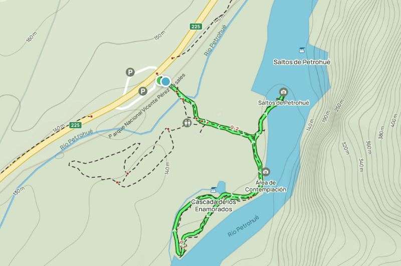
Short hike to Petrohué waterfalls (see the map on Alltrails)
The area offers plenty of other hikes, but this one is a must-do for me. It’s short and easy, which is great, but it also attracts all kinds of tourists, including those who have never worn proper hiking shoes. So, pack some patience along with your water, because some of these "tourists" might get on your nerves.
The main attraction on this trail is the Petrohué Waterfalls (Spanish: Saltos de Petrohué). It’s not a giant waterfall, and despite the hike being named after it, the waterfall is just part of the fun, not the only thing you need to look forward to. This wouldn’t be Patagonia if there weren’t views of volcanos added to the mix! That said, many people skip the second half of the trail and just go to the Petrohué Waterfalls and back to the parking lot. I think it’s worth doing the whole thing, if not just for the serenity of the loop bit where there’s a lot less people getting in your way.
The well-marked and maintained trail leads to the waterfalls and then continues through beautiful nature along the Petrohué River. The path starts on a paved road and then transitions to a pleasant forest path with easy terrain. Unfortunately, you might come across some litter. If the weather is good, the river water turns a stunning turquoise, creating a beautiful contrast with the green forests around.
Tip: If you’re worried about visiting during a dry spell, rest assured. It rains a lot throughout the year in Chile, so it’s highly unlikely you'll encounter dry waterfalls.
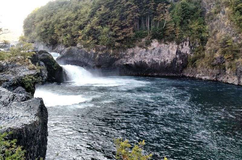
My second most favorite waterfall, right after Iguazu Falls
Interesting fact: The waterfalls stretch across a former lava field created by Osorno Volcano, which is visible from here. If you've never seen lava rocks, this is your chance.
Read more about the fantastic places in the Lake District.
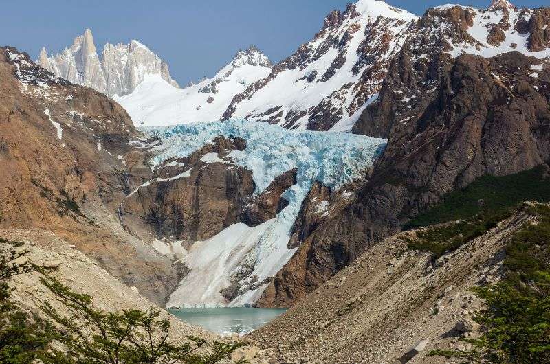
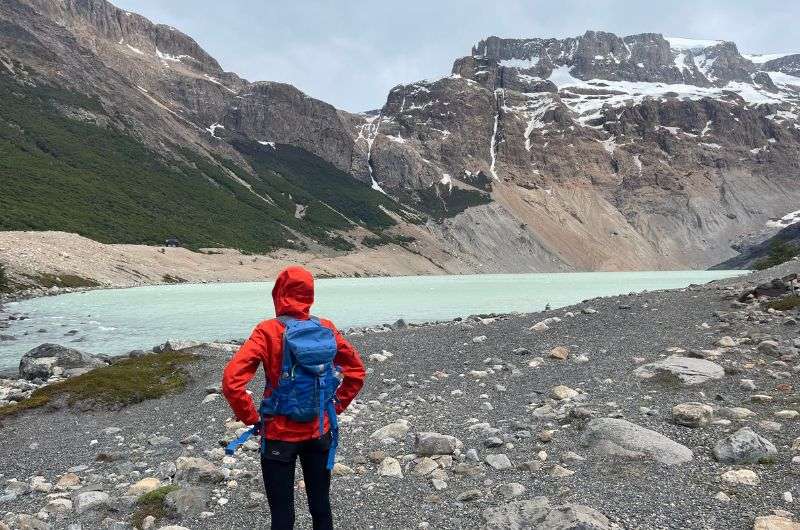
Mountains and glaciers, what a stunning combination
Jan’s summary: A gentle trail with divine views of the Piedras Blancas glacier. You can also consider extending the hike to reach Laguna de Los Tres.
Hike length: 10 km (6.2 mi), out & back
Elevation gain: 344 m (1,128 ft)
Difficulty level: Moderate
Hiking time: 3 hours
Trailhead: Google Maps link to trailhead
Hotel recommandation: Destino Sur Hotel & Spa de Montaña
The Piedras Blancas trail is less demanding than others in the area and offers equally stunning views. If you're tired or not very physically fit, I recommend the Piedras Blancas trail.
The toughest part of this hike might just be finding the starting point. The hike begins at Hostéria El Pilar, where you'll leave your car. Pay attention here: the trail starts to the right of the inn's gate—I specify this because if you think you can just drive around and spot the trail from afar, think again.
The trail mostly winds through the forest, so you'll enjoy the cool shade. The path has a gentle incline, so don't expect any grueling climbs, and the terrain is manageable. You'll encounter some stones here and there, but no giant boulders to impede your way.
Easy peasy Piedras Blancas hike in the forest (see the map on Alltrails)
At the trail's end, you'll be treated to views of Piedras Blancas Lake with the glacier and the imposing Fitz Roy in the background. If you're lucky, you might see chunks of ice breaking off. I wasn’t lucky this time, so I missed out on that spectacular display. But overall, it’s an excellent viewpoint and a spot to relax.
If you find this trail too easy and want more of a challenge, you can extend it to Laguna de Los Tres. Be prepared for it to take about 6 hours, so I recommend starting early in the morning if you choose this option.
Todos Los Santos Lake is amazing, don't forget the repellent though!
Jan’s summary: This loop hike offers views of Osorno Volcano and Todos Los Santos Lake. But watch out for the horseflies—they can ruin even the most beautiful vistas.
Hike length: 14.3 km (8.9 mi), loop
Elevation gain: 269 m (883 ft)
Difficulty level: Moderate
Hiking time: 3.5 hours
Trailhead: Google Maps link to trailhead
Hotel recommandation: Hotel Natura
Like the Petrohué Waterfalls, the Sendero Los Alerces trail is also located in Vicente Pérez Rosales National Park. You can easily combine both trails in one day and save on the park's entrance fee, ha. During the Sendero Los Alerces hike, you’ll enjoy magnificent views of Osorno Volcano and Todos Los Santos Lake.
Sendero Los Alerces is a loop (I love loops, it's like getting two hikes in one), and you can choose whether to tackle the harder section at the beginning or the end. We opted for the tougher start and the easier finish.
The trail starts beautifully ascending alongside Osorno Volcano. From there, you get stunning views of the surrounding area, especially of Todos Los Santos Lake sprawling below you. If you visit outside the rainy season (which I'd recommend), you'll be walking through dried riverbeds. When it rains, it can be quite a challenge, but luckily, we had dry conditions, so it was all good.
After about 5 km (3 mi), you’ll reach the highest point of the trail, where you can clearly see the snow-capped peak of Osorno Volcano. If you're like me and prefer going uphill rather than downhill, brace yourself for the less enjoyable part. The next 2 km (1.2 mi) will take you downhill towards Todos Los Santos Lake.
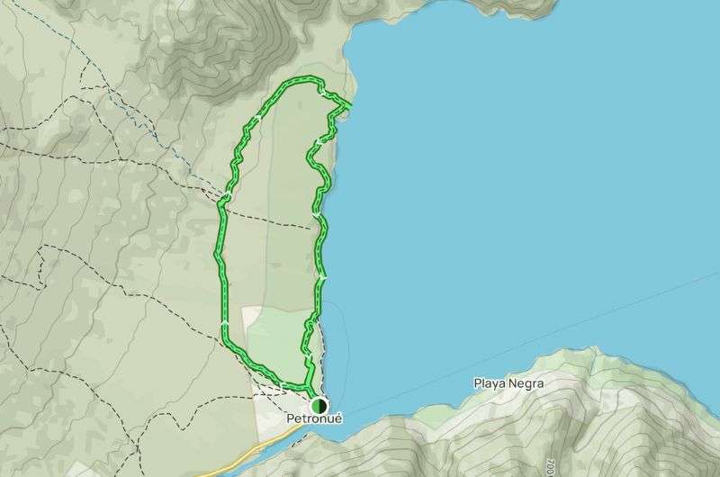
Loop hike along Lake Todos Los Santos (see the map on Alltrails)
The final stretch to the parking lot runs along the lake’s shoreline. It’s not challenging, but it’s incredibly beautiful. If you’re short on time in Vicente Pérez Rosales National Park, I recommend at least walking along the lakeshore and skipping the hike alongside the volcano.
Tip: Be ready for some sections of the hike to be in open areas without any trees for shade. Prepare for the fierce sun and, especially, the heat.
Tip no. 2: Since you’ll be walking a lot along the water, expect a lot of insects. Particularly if you go in the summer, you'll be accompanied by super annoying horseflies that can bite even through clothing.
I must say, after conquering Laguna de Lost Tres we felt really good about ourselves…
Jan’s summary: This hike will take you through a rollercoaster of emotions, from relaxing on a comfortable walk to cursing why you ventured out here in the first place. Still, I'd hit this trail again in a heartbeat.
Hike length: 21.9 km (13.6 mi), out & back
Elevation gain: 1,000 m (3,280 ft)
Difficulty level: Moderate
Hiking time: 8 hours
Trailhead: Google Maps link to trailhead
Hotel recommandation: Destino Sur Hotel & Spa de Montaña
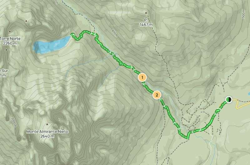
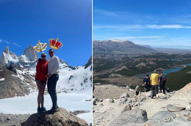
Laguna de Los Tres is one of the best treks (specifically, one of the top 7) I've taken in Argentina. Along the way, you'll pass through green plains, around mountain lakes, and see the De Los Tres glacier. As a bonus, condors will be soaring overhead.
Before you set out, be prepared for all kinds of weather—and I mean all kinds, including snow. The start of the trail seems easy enough, but the end is steep and full of rocks. Don’t expect to find any pubs along the way (surprisingly), so I recommend packing a snack. After all, you'll burn plenty of calories over 8 hours of hiking. Oh, and one more tip—if you have trekking poles, you'll find them useful on this route.
The entire journey can be divided into three sections. The steep start will make you sweat and pant a bit. Then comes the middle part of the trail, which is mostly flat—this is where you can chill. You know how they say, the calm before the storm? Well, this is the flat before death. The last part will test your physical fitness and agility on unstable terrain. There’s a steep, rocky climb waiting for you. We met an older couple on the trail who had to turn back in the last section because they just didn’t have the energy left. Since it’s an out-and-back trail, remember that every step you take up, you’ll have to take down. I found the descent through the last passage tougher than the climb.
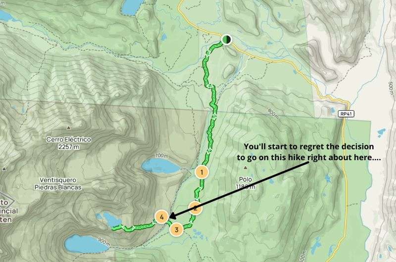
Definitely one of the most challenging hikes on this list (see the map on Alltrails)
If you conquer all three parts, you should be proud of yourself. As a reward, stunning views await you. There are beautiful panoramas along the way, but as with these trails, the best is saved for last.
So many beautiful views!!!
Jan’s summary: A mild uphill climb in the shade, surrounded by stunning nature and views of snowy mountain peaks. While that may sound slightly boring, it’s incredibly beautiful, so you’ll be sad when it’s over!
Hike length: 11.7 km (7.2 mi), out & back
Elevation gain: 605 m (1,985 ft)
Difficulty level: Moderate
Hiking time: 4 hours
Trailhead: Google Maps link to trailhead
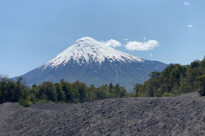
The Sendero Sierra Nevada hike in Chile is one of the prettiest on the Chilean side of Patagonia. What's great about this hike? Well, for one, almost the entire journey is shaded by trees while a mountain breeze keeps things cool—so you won’t be dying from the heat. Alongside an endless forest of araucarias, you'll see Llaima Lake and the Llaima Volcano. This volcano extinguished itself some 10,000 years ago, so don’t expect any thrilling possibility of an eruption.
The trail is part of the Conguillio National Park, so you’ll need to pay an entrance fee. This time, I bought my tickets online and I recommend you do the same. Sometimes you can't pay by card on-site, and if you're the type who doesn't carry cash, you might just end up having to head back to your hotel.
One of the best hikes in Chile (see the map on Alltrails)
The trail (or at least its first half before you turn around and head back the same way) is mostly uphill. It's not a dramatic climb, but I was thankful for the consistent shade. Along the way, you'll come across two lookout points: El Conguillío and Los Cóndores, both offering spectacular views of the park and the surrounding nature from different perspectives. If you’re lucky, you might see condors on the way. We, predictably, didn’t see a single one—but that’s hardly a surprise to me anymore. It's like with the jaguars in Calilegua National Park; we saw absolutely nothing there, either.
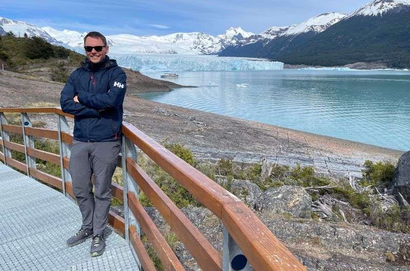
A gigantic blue glacier that you'll want to see with your own eyes @ Perito Moreno
Jan’s summary: You'll be walking the entire way on a superbly maintained path. Still, the ice might get you slipping, but oh, that glacier—what a giant.
Hike length: 4.7 km (2.9 mi), out & back
Elevation gain: 180 m (590 ft)
Difficulty level: Moderate
Hiking time: 1.5 hours
Trailhead: Google Maps link to trailhead
The Perito Moreno trail is located in Los Glaciares National Park. Expect an entry fee of ARS 12,000 (USD 13.8) per person. You’ll park your car in the parking lot, then you have two options: take a free bus to the glacier or hoof it. And as you might guess, the correct answer here is B.
At the parking area, there’s a well-equipped visitor center where you can get all the essential information and a map of the area. The best trails are the blue and red ones. After a short hike, you’ll turn into hunters watching for the falling ice, which crashes into the water with a boom. We were lucky (for once) and saw it. That’s how I imagine a bomb explosion sounds—it's absolutely deafening, and if you weren’t cold before, you’ll feel a chill run down your spine.
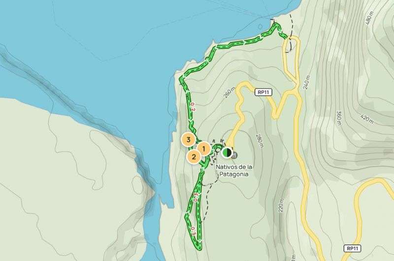
The map of the Perito Moreno Glacier tour, where you might see ice calving (if you're lucky) (see the map on Alltrails)
The park's infrastructure is excellently managed—nice smooth asphalt without any potholes. While the trail’s elevation profile and distance might seem easy, there’s a catch. You’re walking to a glacier, which means only one thing: it’s cold even in summer, and there's a constant risk of slipping. Although the whole path is made of steel and is excellently constructed, I highly recommend walking. Choosing to walk rewards you with stunning views and fewer people, as most opt for the bus.
At the glacier, you can take a boat. I don’t recommend this option; it seems pointless. Better views are had on the way up. The perspective is amusing from the path—the boats look tiny compared to the glacier’s enormity.
It’s amazing how blue the glacier is, besides being enormous. The surrounding mountains rise to 3,000 m (9,840 ft), and the glacier itself stands 50 m (165 ft) above the water level. What’s also fascinating is how flat the glacier's wall is, yet it’s beautifully cracked.
Tip: It's windy here. So, no matter which month you visit, bring proper clothing and don’t underestimate the weather conditions.
Beautiful views of Perito Moreno Glacier and my girlfriend (sorry, you’ll get just the glacier... and maybe a different girlfriend)
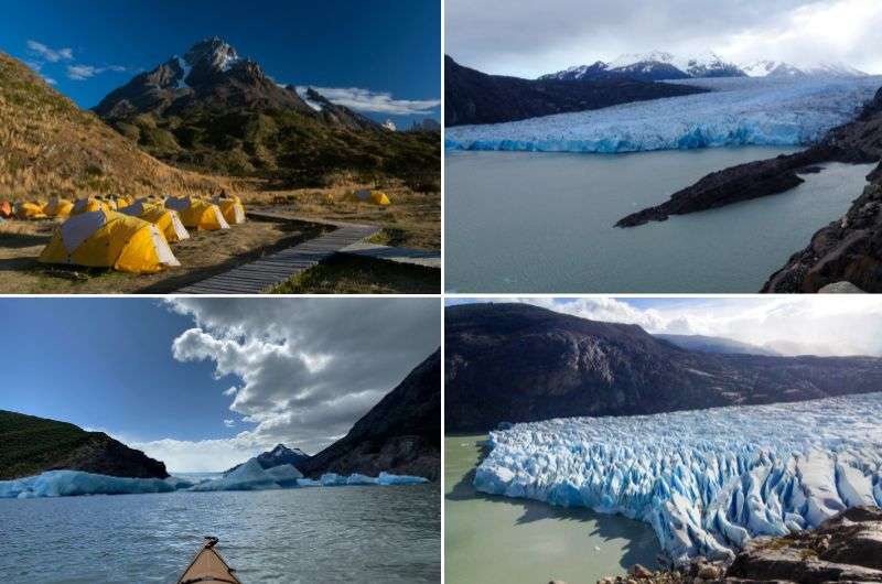
If you want to see a lot of glaciers up close, this hike is perfect for you!
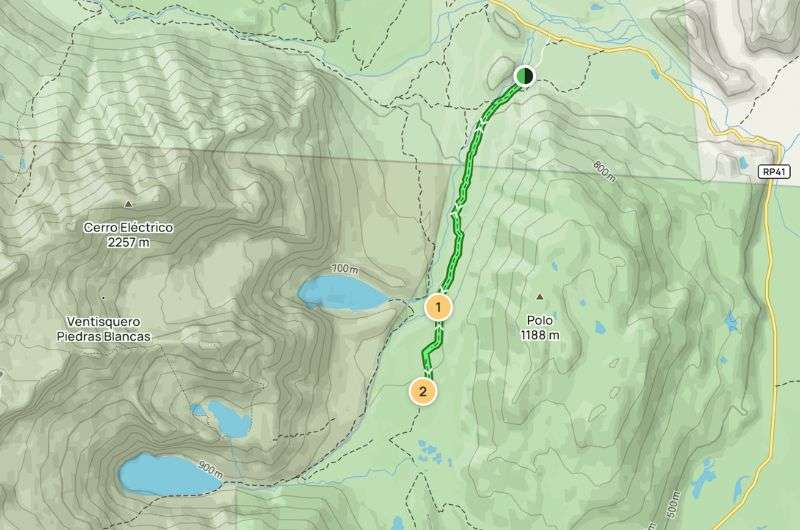
Jan’s summary: A challenge for those who fear heights, features suspension bridges with stunning views of the glacier. Otherwise this is one of the easier trials. The only downside is the need to pre-book a boat to start the trail across the lake.
Hike length: 9.7 km (12.5 mi), out & back
Elevation gain: 445 m (1,460 ft)
Difficulty level: Moderate
Hiking time: 3.5 hours
Trailhead: Google Maps link to trailhead
Hotel recommandation: Río Serrano Hotel + Spa
Do you enjoy hiking with a touch of adventure? Yes? Then the Camp Grey trail is just for you. Not only will you get a panoramic view of the glacier, but you'll also traverse several suspension bridges. If you have a fear of heights, this will be a real challenge.
Located in Torres del Paine National Park, Camp Grey is one of the easier trails. It starts at the shore of Grey Lake, where you'll follow a forest path. About 20 minutes in, the character of the trail changes as you begin to ascend. Soon, you'll encounter the first wooden walkways that lead you to your coveted destination. Along the way, there are beautiful views of the glacier, and you might even spot condors.
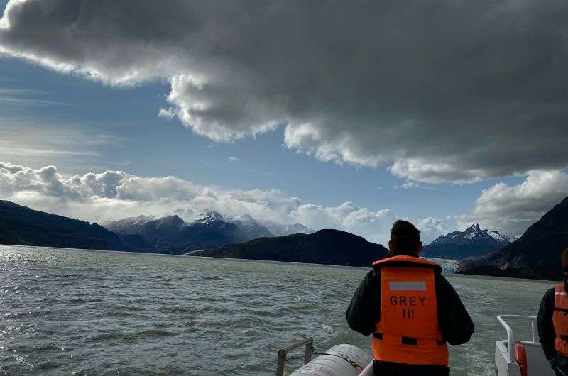
Don’t forget to book your boat trip in advance!
The trail has one drawback. To get to the starting point at Refugio Grey (Camp Grey), you need to take a boat across the lake. It's best to book this ride in advance. Also, this trail can be a bit costly since a round-trip boat ticket costs USD 100 per person. Departure times can be found on the official website.
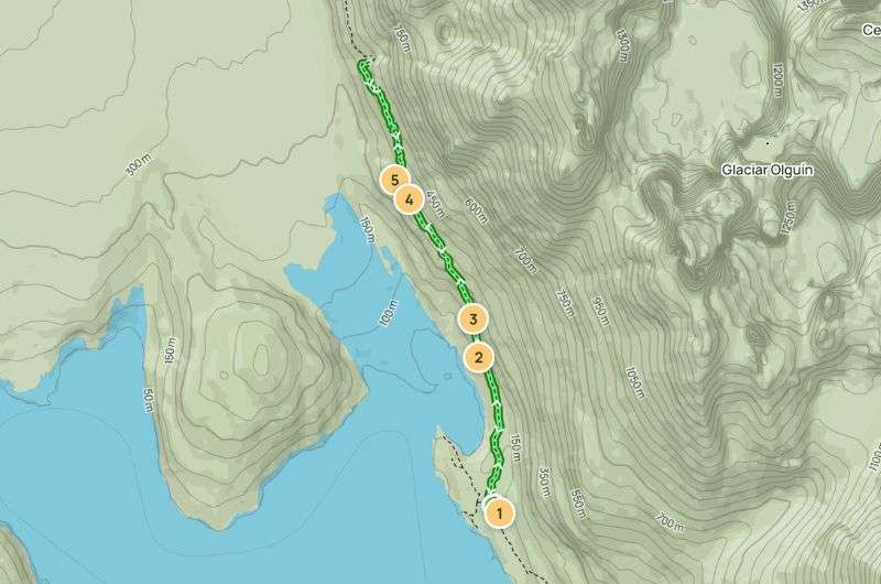
The map of the Camp Grey hike, where you have to cross plenty of bridges to reach your destination (see the map on Alltrails)
Tip: Don’t forget to bring a windbreaker and sunglasses. It gets quite windy at the trail's end, and the wind can stir up dust/sand, which is unpleasant without glasses. It still has nothing on South Africa day hikes, though.
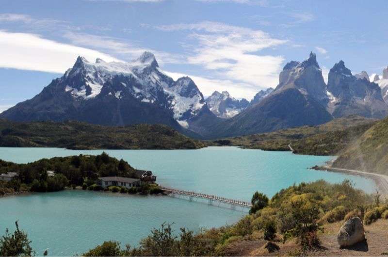
The famous viewpoint over Lake Pehoé
Jan's summary: The Condor Lookout trail is an undemanding hour-long hike leading to a viewpoint over Lake Pehoé. The main reason this hike made the list is the high likelihood of spotting condors along the way.
Hike length: 2.4 km (1.49 mi), out & back
Elevation gain: 197 m (646 ft)
Difficulty level: Moderate
Hiking time: 1 hour
Trailhead: Google Maps link to trailhead
Hotel recommandation: Río Serrano Hotel + Spa
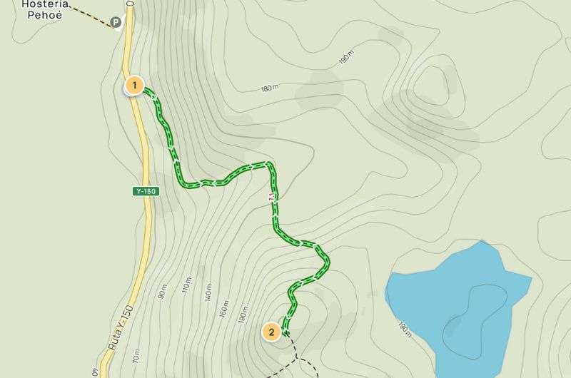
The map of the Condor lookout hike, where you might see condors (see the map on Alltrails)
Located within Torres del Paine National Park, entry fees apply—surprise, surprise. Plan your trip well, as the entrance fee is USD 39 per person per day, or USD 56 for a three-day pass. If you plan to do multiple trails in the area, the three-day pass is more economical. Still, it's quite the hit to the wallet compared to Argentina, where you pay around USD 10 or nothing at all.
Tip: Get my guide to Torres del Paine National Park.
The trail itself is not too challenging, but be warned, it is exceptionally windy here, which can complicate your trek. You might want to secure your hat to your head with a string. After a 1.2 km (0.75 mi) climb, you'll reach the viewpoint, the end of the trail. Here, a 360° panorama awaits, offering a breathtaking view of Lake Pehoé and the many other natural beauties of Chilean Patagonia. Almost every hike here gives you a chance to see a condor, and given this trail's name, I hoped this would offer the best chance... but no such luck again. Why do birds hate me?
Tip: Speaking of birds, if you’re looking to spot a variety in one place, Calilegua National Park is where you want to go. The park is home to over 400 bird species.
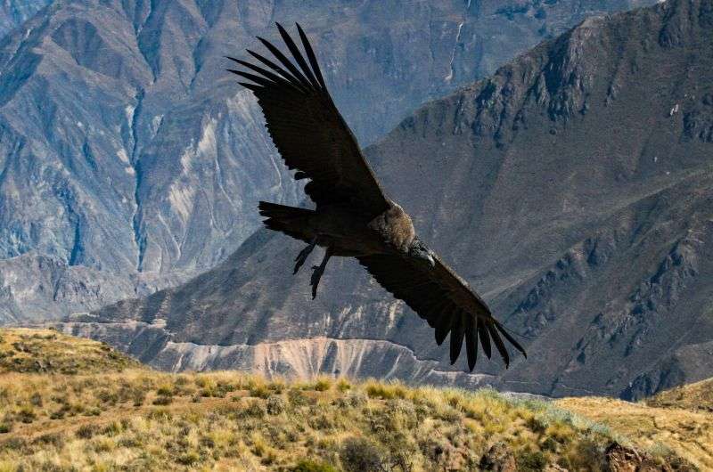
Okay, I have to confess… the photo is not mine. But I tried, I really did! The birds just don’t like me!
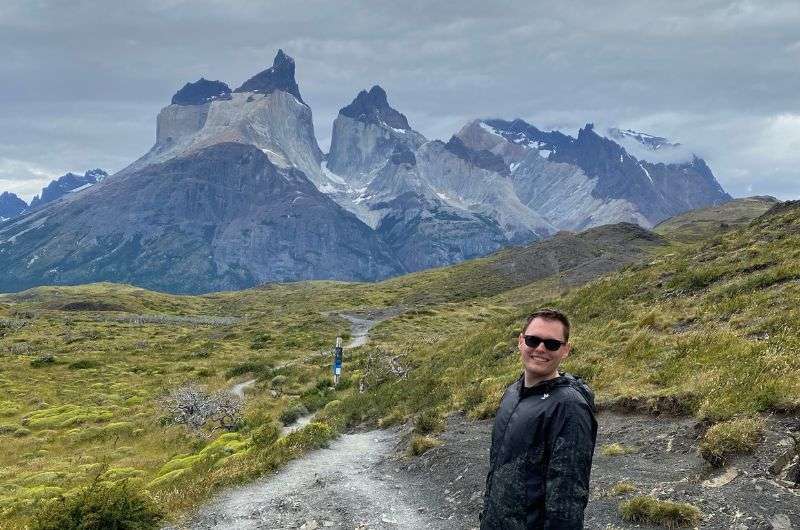
Los cuernos in Spanish means “horns”. You can see them in the background
Jan's summary: An easy trail to a lookout that takes you past beautiful waterfalls. Expect some mud along the way, but the views and the chance to encounter wild llamas make it worthwhile.
Hike length: 6.4 km (3.98 mi), out & back
Elevation gain: 170 m (557 ft)
Difficulty level: Easy
Hiking time: 2 hours
Trailhead: Google Maps link to trailhead
Hotel recommandation: Río Serrano Hotel + Spa
The Cuernos Lookout trail is one of the shorter trails in Torres del Paine National Park. Given the high cost of a one-day entry (USD 39), I recommend combining this trail with another in the area. Not a problem, Torres del Paine National Park will easily keep you busy.
The trail has an elevation gain of 170 m (557 ft), making it ideal for all groups and skill levels. The entire hike runs along Lake Nordenskjold, behind which the beauties of Chilean Patagonia unfold. Just a few minutes from the start, you'll see the Salto Grande Waterfall, connecting Lake Nordenskjold with Lake Paine.
One downside is if it rains here, even a few days before your visit, you'll almost certainly be walking through mud and puddles. The ground dries slowly, so even if it rains a few days ago, water lingers here. While most puddles can be avoided, it's good to be prepared. This is Patagonia, so expect the usual strong winds. Fortunately, it wasn't cold, just bothersome. If you have trekking poles, pack them in your backpack.
The map of the Condor lookout hike (see the map on Alltrails)
The trail is truly undemanding and offers incredible views. Another advantage is that it's not very well-known or crowded. You can easily escape the tourists and enjoy undisturbed hiking. During our hike, we were lucky enough to encounter wild llamas, which was a truly interesting experience.
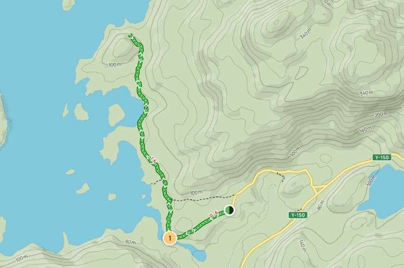
It was really cold at Laguna del Diablo, so dress well!
Jan's summary: A great warm-up trail where you can treat yourself to a meal at a restaurant at the end near Devil’s Lake.
Hike length: 13 km (8 mi), out & back
Elevation gain: 372 m (1,221 ft)
Difficulty level: Moderate
Hiking time: 3.5 hours
Trailhead: Google Maps link to trailhead
Hotel recommandation: Destino Sur Hotel & Spa de Montaña
The Laguna del Diablo trail is ideal to tackle first when you arrive in the Patagonia region. It’s not too challenging, but it still offers plenty to see. The trek is located in the Huemul Reserve. Huemul is also a type of deer, though I unfortunately didn’t come across any on the trail (is anyone even surprised anymore?). If you do spot one, you should report it since local conservationists want to keep track of them as they are protected and their numbers are monitored.
Unlike most other trails, this one has an entrance fee. So, be prepared and remember to bring cash. I paid ARS 8,700 (USD 10), but take this price as a guideline. Given the high inflation, the price in pesos can change day to day, literally (read my Argentina travel tips to learn more about the money situation).
The path is mostly uphill. From the parking area, it starts off steep and then becomes more gradual. It goes through a forest along the river flowing from Devil’s Lake. If it gets too warm, you can cool off along the way. At the end of the trail, you'll reach Devil’s Lake where there is a restaurant where you can have lunch. I highly recommend stopping at the restaurant because it offers a beautiful view of the lake and the food is quite good—ideal combination. Just account for a bit of a high-altitude markup.
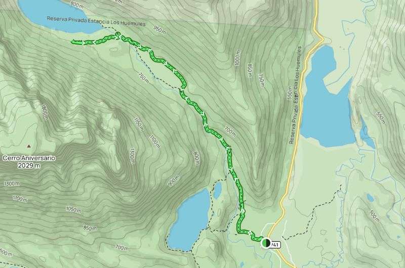
The map of the moderate Laguna del Diablo trail (see the map on Alltrails)
The entire path is well-marked, so getting lost is nearly impossible. If you want more details about the route before setting out, there is a visitor center at the start of the trail that even features a nice museum. We visited it at the end of our hike because we didn’t want to delay and risk returning too late. The trail is only open from 9 am to 1 pm.
Exercise your fitness by hiking around Sendero Lagos
Jan's summary: A moderately challenging trail through mud will lead you to the lakes of Huerquehue National Park. As you climb to the lakes, you’ll definitely give your fitness a test.
Hike length: 12.9 km (8 mi), loop
Elevation gain: 768 m (2,520 ft)
Difficulty level: Moderate
Hiking time: 6 hours
Trailhead: Google Maps link to trailhead
The Sendero Los Lagos Huerquehue trail is a mix of out & back and loop because it consists of two circuits connected by a path you will also return on. Located in Huerquehue National Park, this trail is the prettiest you’ll find in the park. Entry is reasonably priced at CLP 7,200 (USD 7.5) per person.
During the hike, you’ll pass four lakes. The journey starts at the main road. You’ll leave your car in the parking area by Lago Tinquilco and then walk along the lake to its end where the first climb begins. The path can be quite challenging in places, with a significant amount of mud present all year round—so that’s a real treat. After about 3 km (1.86 mi), you'll reach the first waterfall, Cascade Nido de Áquila. It's a lovely spot where you’ll want to sit and rest for a while.
After another approximately 500 m (1,640 ft), you’ll reach the first viewpoint of this trail. It offers a beautiful view of the valley, including Lago Tinquilco. From there, another gentle ascent leads to Cascada Trufulco waterfalls. Take a break here because the toughest climb of the journey awaits. You might curse through the next stretch, but I promise, it will be worth it.
Once you finish the climb, you’ll reach a plateau where a loop around the lakes begins. Congratulations, you’ve reached the highest point of the hike and won’t be going any higher. No more fears, as you’ll be walking on flat ground here. There are three lakes: Lago Chico, Lago Toro, and Laguna Verde. Walking the loop trail around these lakes felt like paradise—sunshine, beautiful views, and stunning nature. An absolutely fantastic combination after that brutal climb.
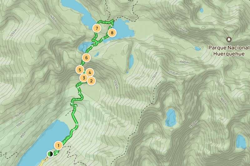
The map of the Sendero Los Lagos Huerquehue hike (see the map on Alltrails)
The descent can be a bit slippery due to the mud, so it’s somewhat treacherous. Apart from the mud, the entire trail is absolutely perfect.
Taking some cool photos on the El Pilar hike
Jan's summary: Easy peasy trek to a stunning viewpoint. Additionally, you can combine this trail with Laguna de Los Tres to turn a relaxed hike into a hardcore, full-day effort.
Hike length: 5.5 km (3.4 mi), out & back
Difficulty level: Easy
Hiking time: 1.5 hours
Trailhead: Google Maps link to trailhead
Hotel recommandation: Destino Sur Hotel & Spa de Montaña
The El Pilar hike is kind of a loophole for people who say they want to hike, but don’t really like walking. You basically get to the first viewpoint (which is worth it), offered by this route and then you can turn back and return to your car.
You can park your car for free at a restaurant. From there, you'll have about a 15-minute walk along the road to the entrance of the national park. Then, you'll proceed through the forest on a paved path. The forest looks like out of Lord of the Rings, luckily we didn’t encounter any orcs. After about 2 km (1.24 mi), you'll reach the viewpoint, the destination of this trail. From here, you have a beautiful view of Laguna de las Piedras Blancas and the valley.
The map of the short El Pilar hike
If this trail isn’t enough for you or if you find the motivation along the way to keep going, you can continue. This path can actually take you all the way to Laguna de Los Tres. But think it over, because the journey to Los Tres is a real challenge (hike no. 7 on this list)!
My pro tip is going to Patagonia either in November or April as those months are great to combine with other parts of Argentina or Chile which might be a bit too much warm in the summer. As a bonus, prices are much more affordable in the shoulder season. Though El Chalten was packed with people in November so…
You may read that the best months to go to Patagonia are November to April, but each part of Patagonia is different and some parts are much warmer like Chilean Lake district than others like Puerto Natales or Ushuaia. So it all depends on where you’re heading.
I would probably skip January if you want also northern Patagonia as there are significant problems with Tabanos—Helicopter size like flyes that are bloodsuckling bastards. Generally, you can expect weather like you would in the summer in Central Europe or New England US if you go in those months in the north.
And southern part is more like Scotland or Norway—chilly and rainy with occasional snow, but you want to see Patagonia as an adventure anyways so why be bothered by a bit of snow.
The best 2-week itinerary for Argentina
Patagonia Travel Guide: 7 Days of Exploring El Chaltén and El Calafate
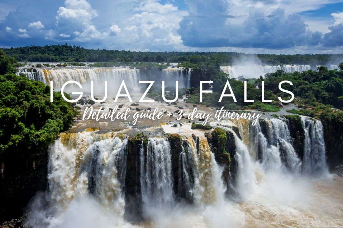
How to plan a trip to Iguazu Falls (3-day plan)
12 epic day hikes in Argentina of all difficulty levels
27 fun facts and travel tips for Argentina
This post contains affiliate links. I earn a small commission if you make bookings through my links, at no additional cost to you. Thank you for your support!


Hi, I’m Jan. I travel fast and intensely, whether I’m exploring the buzz of Tokyo in 3 days or road-tripping through mountains and beaches on a 3-week Thailand adventure. And no matter where I am, you’ll always find me in a comfortable hotel at night and eating the best food.
If that sounds like your kind of journey, hop on board, and let’s explore the world together!
I started this blog after realizing how tough it can be to find reliable, authentic travel info. You wouldn’t believe how many “travel bloggers” never even visit the places they write about! On Next Level of Travel, you can count on my full honesty and insights drawn from my firsthand experiences.
Here’s the deal: not every destination is all superlatives and unicorns. I’ll let you know if a tourist attraction isn’t worth your time, like skipping overrated stops in my 2-week Spain itinerary. And when I find something truly special—like the perfect mix of culture and nature in Cape Town—you can trust that it’s worth adding to your itinerary.
Comments | Thoughts? Give us a shout!