11 Amazing Things to Do and See in Jujuy and Salta

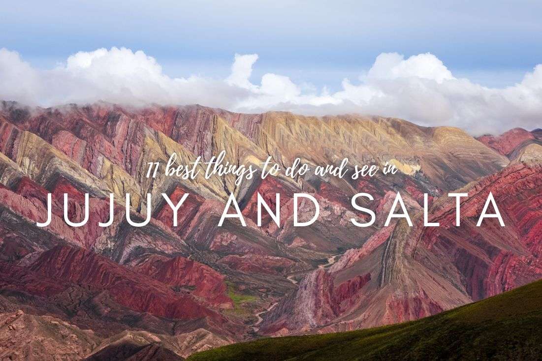
Honestly, I put Salta and Jujuy into our Argentina itinerary as an add-on since I didn’t want to see all the highlights in the country on my first visit and wanted to mix it up with places that are nice but not superb. Well, that was a fail—it turns out Salta and Jujuy are world-class in natural sightseeing and can easily compare to the western USA which is the closest sibling to it in terms of visuals. Plus, it has its own rainbow mountain which is bigger and more colorful than the one in Peru! Sorry Peru.
Find an awesome hotel Sometimes, all you need to do is take the first step... I've filtered out the best hotels in Salta for you
Save it for yourself to come back to later, or share with your friends on social media!
I've already planned your ititnerary for the trip, complete with my travel tips.
Where to eat and sleep in Salta and Jujuy
Trust me, finding a good restaurant in Argentina is like striking gold. Not quite on Georgia's level of culinary despair, but Argentina's a solid runner-up. I didn’t know it when I was there since it was the first place I visited in Argentina, but Salta and Jujuy also had the best restaurants out of our entire Argentina trip. And because I like ya, I’ll give you some recommendations of the very best restaurants in Salta and Jujuy based on my experience (we tried A LOT of them!):
- Restaurant Flor Del Pago, an Italian kitchen, stands out as one of the best restaurants I've encountered on my travels. The service is excellent, quick, and unobtrusive, with exceptional food, especially the ceviche. Plus, there's ample parking and a fantastic garden.
- Then there's La Salteñeria Empanadas—if you are an empanada fan, this place is a must in Salta. They serve up what might just be the best empanadas I've ever tasted, and they serve them up fast. The quaint garden setting and relaxed service add to the experience. The concise menu, offering around six dishes, left me utterly stuffed, with the bill for two at just ARS 1,200 (about USD 12).
Here's a pro tip: tipping isn't common practice in these parts... and to be honest, most places didn't deserve it anyway.
If you're seeking accommodation advice, try the MG Design Hotel Boutique, conveniently located a few steps away from Salta's city center. The hotel features modern decor and spacious rooms—I'm not one for cramped spaces—and, naturally, an excellent breakfast to start your day right.
And without further ado, here are the top places you need to visit in Salta and Jujuy:
1. Shells' Ravine (Quebrada de las Conchas)—Monument Valley of Argentina
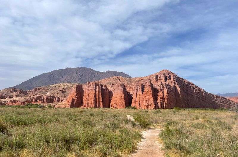
Quebrada de las Conchas
Sometimes, the journey is the destination, and at Shells Ravine, that's especially true. Located about a 15-minutes drive from Cafayate, this ravine stretches over 50 km (31 mi) along Highway 68. And let me tell you, you'll enjoy this ride thoroughly. Along the way, there are plenty of beautiful spots to stop at, offering top-notch views (and of course, great photos). Plus, the highway you'll be driving on is toll-free.
Shells Ravine is an absolute must-see and my top pick in the Salta and Jujuy area. If you've been to Arizona, you'll agree it's like Monument Valley on steroids. The only difference is that Shells Ravine is bigger. However, there aren't many hikes here, so if you're planning a trekking adventure, you might be a bit disappointed. But if you prefer to soak in the sights rather than hike, you'll be thrilled. The place is stunning and photogenic. At times, I felt like it must have been crafted by AI!
So, what's there to see at Quebrada de las Conchas? Epic red rock formations that make you feel like you're on Mars. Thanks to their unique shapes, some formations have earned specific nicknames, like El Amphitheatre (The Amphitheater), La Gargante del Diablo (Devil's Throat), and Los Castillos (The Castles).
This entire valley was formed by erosion millions of years ago. It got its name from the marine fossils found here, which lived on the ocean floor 15 million years ago.
You can visit Shell’s Ravine year-round. Just be prepared for desert-like weather. If you're going in summer (July to August), I'd suggest getting an early start, or the midday heat will suck the life right out of you.
2. Car trek in Canyon of the Arrows (Quebradas de las Flechas)
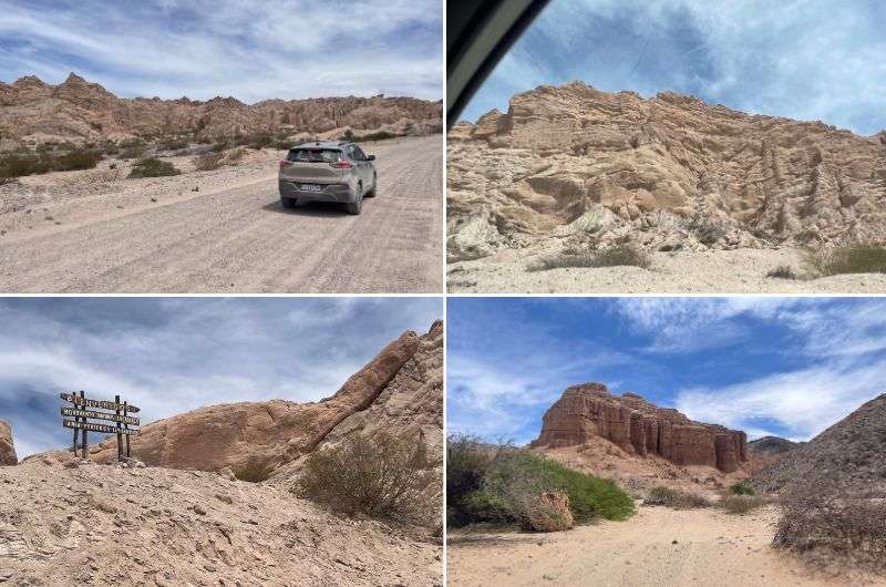
Quebradas de las Flechas
Heading south from Salta, a 4-hour drive will get you to the Canyon of the Arrow. I know, it sounds like a very long trip, but trust me, this place is worth the journey. The whole rock formation is massive and downright divine, stretching around 30 km (18.6 mi) in length. Even if you're rolling in a city car, don't sweat it; Highway 40, which you'll be cruising on, is a breeze for any vehicle.
Now, if you're a space enthusiast who can't quite afford a ticket to Mars (like most of us), this spot might just be the next best thing. The landscape here makes you feel like you're on a different planet. I've never seen anything quite like it. But a heads-up, gravity's the same here as it is on Earth, so don't expect to feel any lighter.
If you're imagining a leisurely stroll through this area, good luck with that, because the temperatures are out of this world! Think more along the lines of a car hike, with the AC cranked up so you can retreat to your private chilled oasis after each stop. And it's still absolutely stunning.
The route is flanked by sharp, tilted rock formations that look like they might break off and tumble onto your car at any moment. They sort of bow down as if paying homage to the wind. Some reach up to 20 m (65.6 ft) high, so a little bit of fear is reasonable. But don't worry, these rocks have been around for up to 20 million years, so the chances of them collapsing precisely when you drive by are slim (but not zero...). If I ever switch from being a traveler and successful blogger to a movie director, I'll shoot my first sci-fi movie here.
You might be wondering what's with the arrows in the name. The whole structure was formed during the Precambrian era when tectonic movements lifted granite rocks. In some areas, these rocks uplifted the sedimentary layers, tilting them skywards up to that impressive height of 20 m (65.6 ft). Erosion over time sculpted these formations into their current shape, resembling the tips of arrows.
3. Salinas Grandes—Great Salt Flats in Argentina
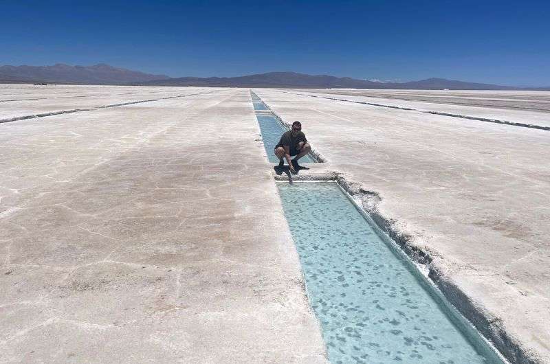
A salty paradise
Salinas Grandes is another natural marvel you've got to hit up when you're in the Salta and Jujuy region. But before I dive into the why, what, and how, let me throw some numbers at you. The Salinas Grandes salt flats span roughly 6,000 km2 (1,236 mi2) and sit at an elevation of 3,450 m (11,318 ft) above sea level. And here's a free tip: Mountain sickness kicks in at around 3,000 m (9,800 ft) above sea level. So, brace yourself for potential symptoms like nausea, headache, and lethargy—read more about all things mountain sickness.
Your visit to the Salinas Grandes salt flats will be one for the books. Everywhere you look, you'll see a white crust of salt stretching out before you. Below that salt is water, so theoretically, you could break through the salt and plunge into the super salty water below (scary much??). And when I say super salty, I mean it's like nothing you've experienced (maybe unless you’ve been to the Dead Sea). Dip your hand in, and it'll feel like it's submerged in oil.
There are loads of salty pools to explore around here. The salt crystallizes right out of the water. Fascinating stuff! If you're lucky, you'll catch locals harvesting the salt, which is precisely how these salty plains come into being. Another cool spot is Ojos de Salar, a natural spring that emerges at Salinas Grandes and creates a crystal-clear, deep salty lake on the surface. If you dip your toes or fingers in the water, expect them to turn snow white from the salt. Pro tip: Don’t touch your eyes with said salty fingers! I know because I know.
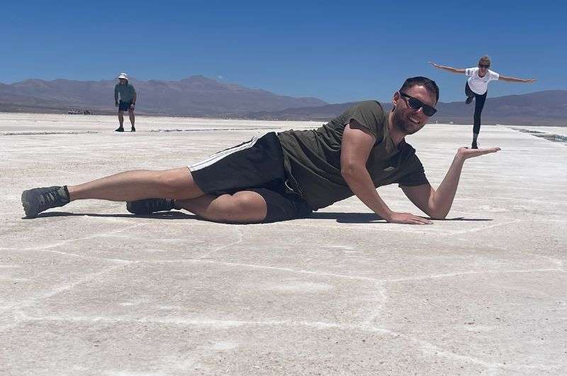
It’s basically mandatory to take some forced perspective pics in the salt flats. We did good, no?
How do you get to the Salinas Grandes? Driving there in your own car is best, in my opinion. It's the quickest and most comfortable way. We just showed up and arranged a guide on the spot. Without a guide, you're not getting into Salinas Grandes. There are plenty of guides available. It'll set you back about ARS 5,000 (USD 6) per car, and the setup is you drive your car while the guide leads on a motorcycle. You can also join an organized group tour.
Tip: Check out my article, How to Visit Salinas Grandes in 2024: Top 15 Questions Answered. And honestly, if you still have questions after that, I'll be shocked. That article covers it all.
4. Quebradas de las Señoritas—Trekking in a red rock desert
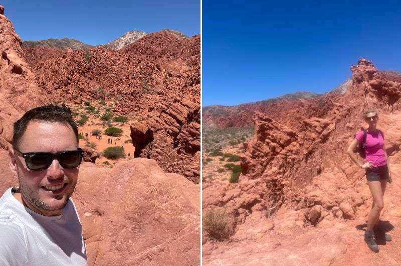
Quebradas de las Señoritas
You've probably gotten the hint by now that many spots in Argentina feel like they're from another planet. Quebradas de las Señoritas is no exception. Picture a vast desert expanse peppered with red rock formations, nestled at an altitude of 2,900 m (9,500 ft)—just below the altitude where you might start feeling the pangs of acute mountain sickness (close call, huh?).
You can drive right up to the starting point of Quebradas de las Señoritas. Just keep going until you hit a manned parking lot. That's where we parked and headed for the entrance gate.
If you're itching for a hike, you'll need to cough up some cash for a guide—they won't let you wander solo. There are two trails to choose from: a 3-hour hike and a 1.5-hour hike. We opted for the quicker one, which set us back ARS 3200 (USD 4). The hikes are usually in groups of around six people. We had to wait about 20 minutes for more tourists to show up (a bit of a drag).
Most of the year, it's quite hot here, so like us, you'll probably be thankful for the shorter route. But trust me, it's still a breathtaking experience and totally worth it. Just don't forget to pack plenty of water, as there's nowhere to refill your bottle—remember, you're in the desert.
And a heads-up if you want to communicate with your guide: you might want to download an offline dictionary since cell service is spotty. I know a bit of Spanish, so we managed to get by, but if English is your only language, brace yourself—the guides’ English might remind you of someone who just downloaded Duolingo two days ago.
- Open daily 8:30 am–6 pm
- Tickets: ARS 800 (USD 1) + tour guide fee
5. Los Cardones National Park
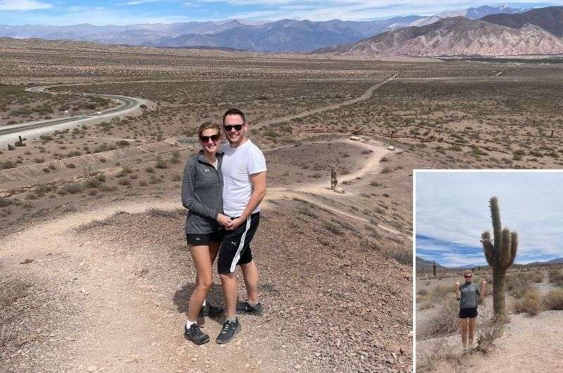
Los Cardones National Park
Located in northwestern Argentina, Los Cardones National Park spans over 650 km2 (250 mi2) and offers a diverse landscape, including mountains, valleys, ravines, and some very cool cacti. The park's elevation ranges from 2,700 to 5,070 m (8,858–16,634 ft), and you can comfortably drive right into the park.
Los Cardones is essentially an arid landscape, so I left my swimsuit back at the hotel. The main "greenery" here is the cacti, and boy, are there a lot of them. The valley is even named after the Cardon Grande cactus. They really do prick, my girlfriend didn't believe it and had to find out the hard way.
The park has several marked trails ranging from tens of minutes to several hours in duration. Feeling ambitious, we opted for what seemed like the longest one, the Valle Encantado trail (Enchanted Valley). The hike took us about three hours, and I highly recommend it. I'm not sure if it qualifies as a hike per se; it's more of a scenic stroll with the colorful Cerro Tintin mountain in the background, showcasing layers of sediment.
Except for the local birds, we had the trail to ourselves. With over 100 bird species, if you've got a camera with a good zoom, you're in for some stunning wildlife shots. My iPhone might not fit that bill, but it captured the cacti just fine.
If the cacti at Los Cardones aren't enough for you, just a stone's throw away is Camino las Coloradas. It's practically a cactus forest, or at least that's how it seems from a distance. Up close, though, the cacti are quite spaced out. Plus, each cactus seems to have its own unique, shall we say, gesture of defiance. Every cactus is an original; you won't find two that are exactly alike. Interestingly, these cacti can grow up to 10 m (32.8 ft) tall if they survive the first 8-10 years of their life, which is when they're merely 5 cm (2 inch) tall and at their most vulnerable. I think that's enough cactus talk for now…
- Open daily 9:30–to 6 pm
6. Mirador A la cercanía de los 14 Colores del Hornocal aka Rainbow mountain in Argentina
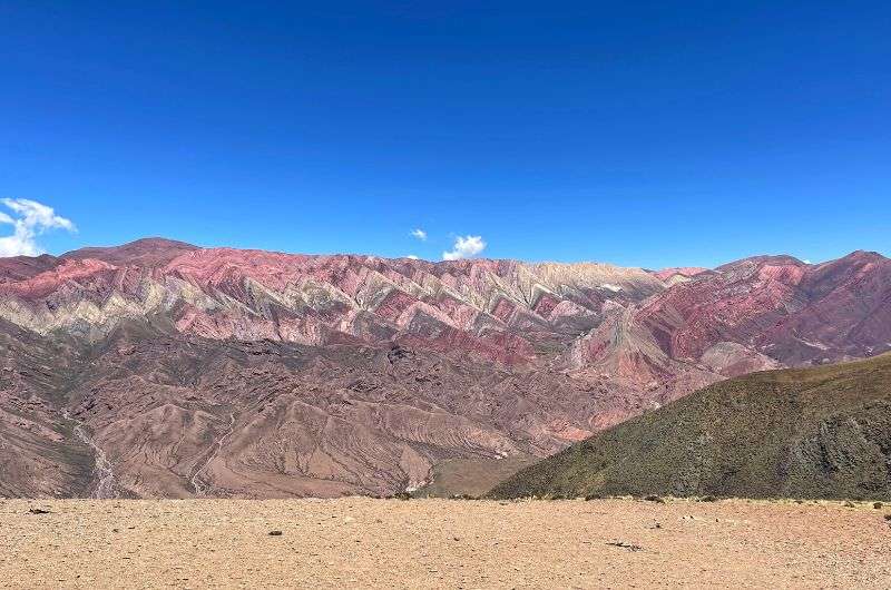
Can you see all 14 of them? Los 14 Colores del Hornocal
The 14 Colored Mountains is another must-visit spot on this list. If you head north from Salta, after about a 3-hour drive, you'll reach the entrance to this... don’t make me type the whole name again.
If you search for photos of this colossal colorful mountain, you might think it's all Photoshop wizardry or AI imagination. But I'm here to burst that bubble. It's all real, possibly even more stunning in person. It's like standing in front of a canvas where someone just painted their masterpiece, except that someone is Mother Nature.
There's an entrance fee of about ARS 800 (USD 1) per car—unbelievable, I know. The road to the viewpoint is rocky but manageable even in a front-wheel drive. Expect the final stretch to take around 45 minutes to an hour. The good news is you don't have to hike; you can reach everywhere comfortably by car. Just remember, the site closes at 6 pm, so plan accordingly.
On your way up, you'll hit a breathtaking 4,350 m (14,272 ft) where you'll catch an incredible view of this unique colorful mountain. It might remind you of Peru's Rainbow Mountain, but trust me, this one's on a whole other scale. Now, about that altitude—you've probably figured out by now that I'm not exactly a fan of lofty heights. This time around, I played it smart by not eating much, so I didn't feel all nauseous up there. I'm green with envy (not nausea!) of folks like my girlfriend, who seems utterly unfazed by the altitude. Some people have all the luck.
Tip alert: If you've never been this high up, do yourself a favor and read up on 'The Big 3 of Altitude Sickness.' It's always better to know what you're up against.
In the Andes, tranquility is the name of the game, and this spot is no exception. It's calm and serene, with only the occasional car and fellow tourists to keep you company. Fancy a little high-altitude challenge? There are several trails starting from the parking area near the viewpoint. These hikes are breathtaking (literally and figuratively) and are mostly under 1 km (0.62 mi), but don't be fooled—not every kilometer is the same. On some trails, you might cover a kilometer horizontally but also climb over 700 m (2,300 ft) vertically. Brace yourself; it's a thigh-burner.
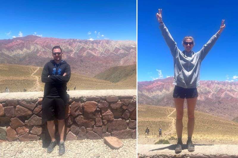
We loved the views! And you can clearly tell which one of us is prone to altitude sickness and which one isn’t
Curious about the reason behind the '14 colors' name? It's all about sedimentation. Different colored layers settled on top of each other at the ocean floor. After the water receded and erosion did its thing, these layers were revealed, creating the stunning panorama you see today. So, there you have it – nature's own masterpiece, no filters needed.
- Open daily 10 am–6 pm
- Tickets: ARS 800 (USD 1) per car
7. Calilegua National Park—A hiking oasis
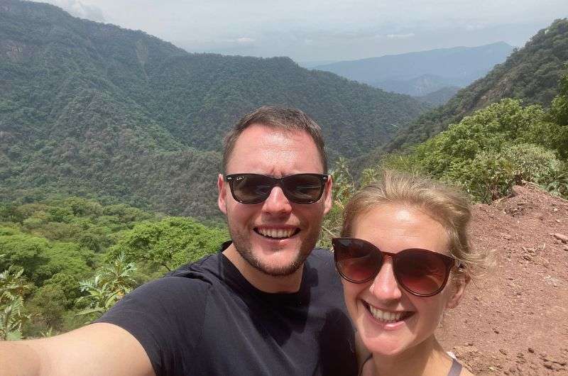
We are huge hiking lovers, and this nature hike was great!
Unlike some of the previous spots I've mentioned, this place boasts a tropical climate, much like a jungle. And it indeed looks like a jungle here. The entire park spans 23 km (14.3 mi) and can be comfortably navigated by car. Like in other parks in the Salta and Jujuy area, entry here is free. What's "different" and better here, though, is that you have normal cell signal and even internet in some places, which is quite unusual for such locations.
If you're on the hunt to spot some wildlife, this place supposedly gives you a golden ticket. At least, that's what the guidebooks will tell you. Personally, I didn't bump into a single animal during my visit. But here's a fun fact: this park is home to 200 of Argentina's total 300 jaguars. Yeah, you heard that right. So, keep your eyes peeled; maybe you'll have better luck than I did.
Funny tip: If you're worried about a jaguar attack, consider wearing a hoodie. It acts like chainmail armor... or so my girlfriend claims. I'm not sure what a jaguar would think of that.
The park is crammed with trails, and I'm all for it. Most of them kick off right at the entrance or just a few kilometers in. These treks are on the shorter side—expect to spend about 1 to 1.5 hours walking. We went for Sendero La Lagunita. It's roughly an hour-long hike, but in the heat, it felt like a mini marathon. Over a distance of 2.5 km (1.6 mi), you'll tackle an elevation of 200 m (656 ft). At the end, you'll reach a small river, but think of it more as a safari where you might (or might not) spot some cool wildlife; think snakes, spiders, and especially birds.
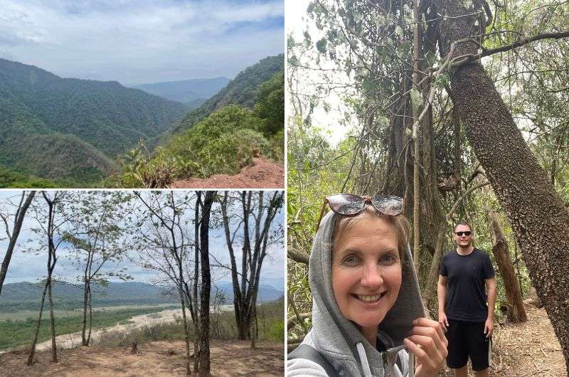
My girlfriend in her jaguar-repellent armor
Sendero Bosque del Cielo is a trail at the far end of the park. You'll need to drive through the entire 23 km (14.3 mi) to get there, which should take about 45 minutes. It's a loop of under 1 km, and unlike the lower hikes, it's relatively cool and humid—a huge plus in my book. It's a totally different forest, kinda gives me Monteverde in Costa Rica vibes. And watch out, my girlfriend insists there are treacherous butterflies out there ready to attack you from behind!
If the park alone doesn't satisfy your nature cravings, make a beeline for San Lorenzo, 16 km (10 mi) away from Calilegua. The views there are just wow. Imagine mountains soaring over 5,000 m (16,404 ft), draped in jungle. You won't see this anywhere else. The mountains in San Lorenzo are easily some of the best I've ever seen.
En route to San Lorenzo, you'll find Termas del Río Jordán, natural pools with hot springs. If you're keen on visiting, aim for the weekend; they're supposedly closed on weekdays. Or so they told us, though I found online they should be open daily. Maybe they just didn't feel like working.
Tip: Don't forget your bug spray when visiting Calilegua NP. Trust me, you'll need it. Don't be like us.
Read my full Calilegua National Park guide if you’re ready to start planning your trip!
- Open daily 8 am–7 pm
8. Cuesta del Obispo (Bishop's Hill)
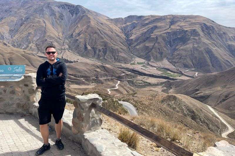
Scenic drive through Cuesta del Obispo
Attention, fans of winding roads and stunning vistas! Cuesta del Obispo is a scenic drive that ascends to an altitude of 3,348 m (10,984 ft), offering breathtaking views of the surrounding landscape. This gem is a segment of Route 33, starting from the town of El Maray. With a total length of around 20 km (12.4 mi), you'll be climbing an elevation of 1,200 m (3,937 ft), so expect your ears to pop.
The entire journey gave me vibes of a mix between the USA and South Africa. Along the way, you'll encounter gigantic cacti, dramatic cliffs, and stunning rock formations. The road is named after Bishop Julián Cortazar, who was the first to complete this route. Back then, there wasn't a perfect asphalt road like there is today, so I don't envy his journey one bit. After the challenging ascent, you'll be rewarded with views of Lerma Valley and Calchaqui Valley.
Fun fact: Along the way, you'll pass La Herradura, where uranium was first discovered in the Salta region in 1959. I didn't come across any two-headed dogs, but perhaps you'll be luckier.
9. Salta, the provincial capital
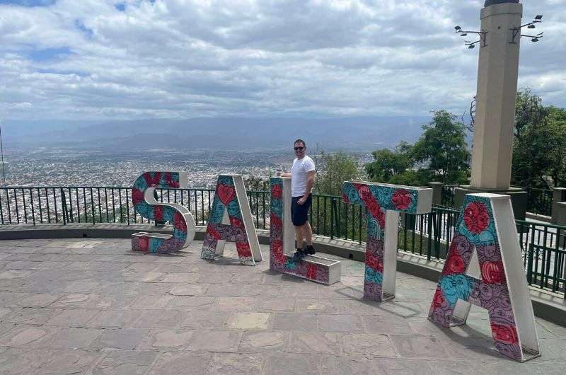
The city of Salta
Salta is the capital city of the same named province, nestled in the Valle de Lemra. It's Argentina's 8th largest city, home to 554,000 residents. The city sits at an average altitude of 1,187 m (3,894 ft). Salta is a whopping 20-hour drive from Argentina's capital, Buenos Aires, but thankfully, you don't have to worry about that since Salta has its own airport.
There's a decent amount to see in Salta. If you've been following my blog, you know museums are one of my most favorite things, so naturally, kicking off the city tour with one makes sense. In Salta, I'd recommend hitting up the MAAM - Museo de Arqueologia de Alta Montana de Salta (Museum of High Altitude Archaeology). You'll find some of Argentina's most significant finds here, like the best-preserved Inca mummies discovered at an altitude of 6,793 m (22,287 ft), comprising three children aged 6 to 7 years. Similar mummies have been found in Peru and Chile, but Argentina's are considered the most well-preserved.
Wondering why children were found? It's due to sacrificial rituals. Around 1,500 kids were offered to the gods. The ritual involved drugging the children with coca leaves and alcohol, then killing them and burying them in small chambers about 1.5 m (5 ft) underground. The whole thing sends shivers down my spine. To add a layer of eeriness, the mummies in the MAAM museum are displayed in freezers, which, frankly, ramps up the morbid factor a notch.
If you're up for another museum visit, I'd suggest the Guemes History Museum. The tour takes 1 to 2 hours, depending on your curiosity level. What scored big with me at this museum was the immersive experience. Inside, there are QR codes scattered on the floor, which, when scanned, share a fun fact with you. The museum is dedicated to Martin Miguel de Guemes, a native of Salta and a 19th-century Argentine national hero who played a significant role in Argentina's independence war.
Another spot I'd like to recommend reminds me a bit of Barcelona. It's the San Bernardo Hill (Cerro San Bernardo), which offers a breathtaking view of the entire city. The summit of San Bernardo sits at 1,472 m (4,829 ft), and you can reach it either by foot or cable car. If you're in the mood to get a little sweaty and opt for the hike, there are two paths: one with 1,021 steps or a 2 km (1.24 miles) uphill route. I was already overheated, so I took the easiest option—the cable car. It's quite slow, taking about 10 minutes to reach the top, but compared to the hike, it's like Formula 1.
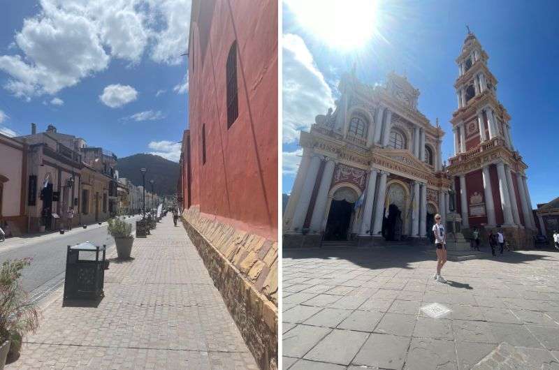
The Cathedral of Salta sort of reminded me of a Barbie house tbh
At the summit, you'll be greeted with a stunning city view. For the romantics, I'd recommend heading there for sunrise or sunset. On the other side of the lookout, you can stroll through a park adorned with artificial waterfalls and a plethora of trees and flowers. While it's not groundbreaking, it'll at least rack up some steps in your fitness app.
If Warner Bros. ever ran out of budget for movie sets for the Barbie film, they'd likely head over to finish shooting at the Cathedral of Salta. Not that it looks entirely like a dollhouse for Barbie, but it's entirely pink, so I can see it happening. Plus, it's a really lovely baroque cathedral. Built in the 19th century, it's located on the main square, Plaza 9 de Julio, so you'll inevitably pass by it. When I was in Salta, there happened to be a mass going on inside the cathedral, which was truly awesome. If you have more time in Salta, try to catch a mass there. It's worth it.
The last stop I'd definitely recommend in Salta is the Basilica Menor y Convento de San Francisco. Its history dates back to the 16th century, but it only got its final shape in 1872. Inside, it's a classic church, nothing extraordinarily interesting. For me, the most beautiful part is its exterior. An interesting fact is that it survived two fires.
The church has a magnificently tall tower, which, along with the church itself, is very photogenic. The tower stands at 54 m (177.2 ft) and is the tallest in South America. The only thing missing for me was a square in front of the church. There's just a small public space, no bench or anything like that.
10. Pucara de Tilcara—An Inca fortress
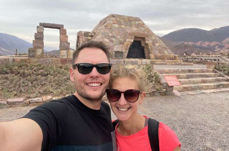
Inca Fortress—Pucara de Tilcara
Just about a 15-minute walk from the town of San Francisco de Tilcara lies a pretty well-preserved Inca fortress—Pucara de Tilcara. This fortress once served as the capital of the province and was constructed around the 12th century. For strategic reasons, it was built on a hill, offering a stunning view of the surroundings. Visiting the entire fortress will take you no more than an hour.
Setting aside Peru, Pucara de Tilcara feels like the largest Inca fortress I've ever seen, and I’ve been to a lot of them in Peru. And no wonder, as at its peak, it covered an area of 61,000 m2 (656,598 ft2) and housed 2,000 residents. Within the fortress grounds, there are plenty of informative signs, but sadly, you won't learn much about the Incas there. Seems like they weren't the best at keeping records.
In 2012, the fortress was added to the UNESCO list. Whether it deserves that status, I'll leave up to you. Don't expect hordes of tourists; Pucara de Tilcara welcomes just 100,000 visitors a year (274 people a day).
- Opening daily 9 am–6 pm
- Tickets: ARS 1000 (USD 1.20)
11. Cafayate wineries
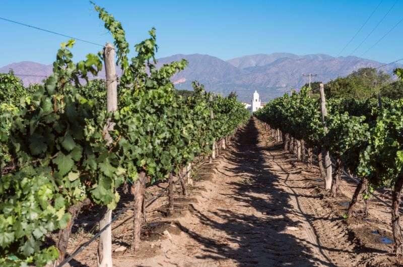
We'll finish with a real Argentinian wine
Argentina is famous for its stunning natural beauty and fine wine. We've covered a lot of nature, so let's shift to wine. One of Argentina's prominent wine regions is the Cafayte area. Besides wine, this region also offers mountains, which are quite a sight to behold with a glass in hand. If you're planning to visit northern Argentina (which I assume since you're reading this article), definitely make a stop here.
The region is characterized by a drier climate, cooler nights, and warmer days. Combined with the relatively high altitude (1,700 m/5,600 ft), it's the perfect spot for winemaking. The signature grape variety of this landscape is Torrontés.
Thanks to these conditions, experts say the wine has a fresh and smooth taste. I'm no wine connoisseur, so my discerning abilities don't stretch that far. Sometimes, local winemakers might even offer a taste of their labor for free, a rarity I haven't encountered elsewhere. Winemakers around the world, take note.
You can leave your car in the town of Cafayte and head to the vineyards on foot. Considering you'll be consuming alcohol, I'd recommend it. If you don't feel like walking, you can rent bicycles in Cafayte.
Each vineyard has its own visitor policy. Some don't require reservations—you just show up, and they'll happily pour you a glass. At others, you need to book tastings in advance. And at some, you don't need to book the tasting, but you do need to schedule a tour of the vineyard. Fortune favors the prepared, so do some internet browsing before visiting the vineyards.
After the tastings, they'll undoubtedly offer bottles for purchase. If you discover a gem you enjoy, don't hesitate to buy it. While you can find bottles in stores, purchasing directly supports the winemakers, and that's what I call Fairtrade.
- Website of Bodega winery (my no. 1)
- Tickets: depends on the winery
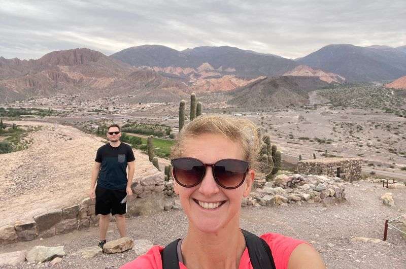
And that’s it. Are you on your way to Jujuy and Salta yet?!
Find an awesome hotel Sometimes, all you need to do is take the first step... I've filtered out the best hotels in Salta for you
Save it for yourself to come back to later, or share with your friends on social media!
I've already planned your ititnerary for the trip, complete with my travel tips.
You might also be interested in reading:
The best 2-week itinerary for Argentina
Patagonia Travel Guide: 7 Days of Exploring El Chaltén and El Calafate
How to plan a trip to Iguazu Falls (3-day plan)
12 epic day hikes in Argentina of all difficulty levels
27 fun facts and travel tips for Argentina
This post contains affiliate links. I earn a small commission if you make bookings through my links, at no additional cost to you. Thank you for your support!


Comments | Thoughts? Give us a shout!
Recommended articles
Want to peek into rich indigenous culture and history? Then you have to visit Quebrada de Humahuaca. This valley is brimming with tradition, and the region's cultural heritage, with some dating back to pre-Columbian times.
I liken Calilegua to a hiking oasis, and not to toot my own horn, but this comparison hits the nail on the head. The park has a tropical climate and a jungle environment, and, if you're lucky, you'll see jaguars!
Argentina is a treasure chest brimming with natural wonders begging to be visited. And let me tell you, Salinas Grandes is a gem that shines bright on the top of its list of highlights!
About me
Hi, I’m Jan. I travel fast and intensely, whether I’m exploring the buzz of Tokyo in 3 days or road-tripping through mountains and beaches on a 3-week Thailand adventure. And no matter where I am, you’ll always find me in a comfortable hotel at night and eating the best food.
If that sounds like your kind of journey, hop on board, and let’s explore the world together!
I started this blog after realizing how tough it can be to find reliable, authentic travel info. You wouldn’t believe how many “travel bloggers” never even visit the places they write about! On Next Level of Travel, you can count on my full honesty and insights drawn from my firsthand experiences.
More about meHere’s the deal: not every destination is all superlatives and unicorns. I’ll let you know if a tourist attraction isn’t worth your time, like skipping overrated stops in my 2-week Spain itinerary. And when I find something truly special—like the perfect mix of culture and nature in Cape Town—you can trust that it’s worth adding to your itinerary.
Next Level of Travel s.r.o.
ID: CZ07036612
Adress: Voctářova 2449/5, Praha, Czech Republic
Created by myTimi