




Best Yosemite hikes ranked at a glance
My practical Yosemite hiking picks
Where to find the best Yosemite hikes
2. Sentinel Dome and Taft Point
4. Four Mile Trail to Glacier Point
10. Panorama Trail from Glacier Point
13. Tuolumne Meadows and Soda Springs
My 7 best viewpoints in Yosemite
I’ve visited Yosemite four times, most recently in 2026, and it is still my favorite national park. The best hikes in Yosemite are a difficult list to rank: something near the bottom would be the highlight somewhere else. The harder question is what to leave out when you have two or three days and rather optimistic ideas about your legs.
Below is my priority order. For a first visit, I favor variety before adding several full-day climbs; the practical picks show what I would actually put into a short trip.
Read more from my California travel guide.
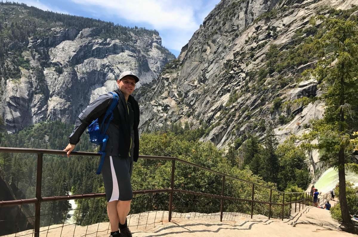
Ranking 15 hikes was hard, putting the Mist Trail first was not
1. Mist Trail to Nevada Fall
2. Sentinel Dome and Taft Point
3. Upper Yosemite Falls
4. Four Mile Trail to Glacier Point — not personally hiked
5. Clouds Rest — not personally hiked
6. Cathedral Lakes
7. Tenaya Lake walk
8. Lembert Dome
9. Half Dome — summit not personally climbed
10. Panorama Trail — my experience is a partial out-and-back
11. Valley Loop Trail — I prefer selected stretches
12. Artist Point — optional Tunnel View extension
13. Tuolumne Meadows and Soda Springs
14. Mirror Lake
15. Mount Dana — optional, not personally hiked
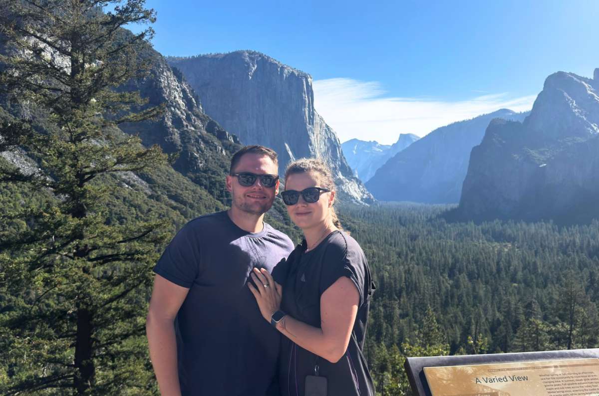
El Capitan, Half Dome and a sign that calls it A Varied View, all a few steps from the car
Hikes I would consider, but haven’t personally completed: Four Mile Trail, Clouds Rest, Half Dome, and Mount Dana. Their positions reflect planning priorities, not firsthand comparisons of completed trails.
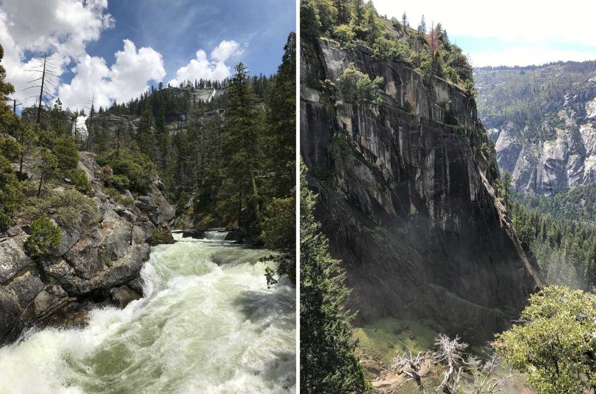
Yosemite Valley
For the best hikes in Yosemite for first-timers, I would plan one area at a time:
For easy hikes in Yosemite, consider Lower Yosemite Fall, Mirror Lake’s shorter approach, or Soda Springs. Among the best short hikes in Yosemite, Olmsted Point offers exceptional scenery: its hilly trail is not wheelchair accessible, but the roadside overlook is. Hiking times below exclude hotel driving and parking.
If you would rather let someone else handle the driving and the parking, there are also guided tours in Yosemite National Park.
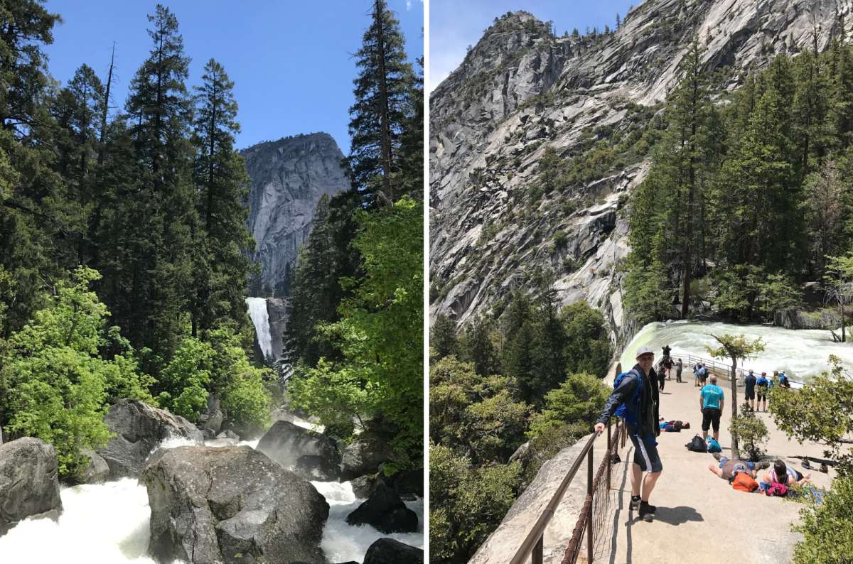
Two turnaround options on the Mist Trail, the view of Vernal Fall from the river and the reward for climbing it
Nevada leads my selection of the best Yosemite hikes. I have been up this way three times, with different turnarounds beyond the waterfalls. For a first visit, I would aim for the scenery above Nevada rather than treat Vernal as the compulsory finish.
For less time or climbing, the top of Vernal is 2.4 miles / 3.9 km round trip, about 3 hours. Its staircase has over 600 granite steps. The footbridge is 1.6 miles / 2.6 km, 1–1.5 hours, and avoids that staircase entirely. These are alternatives, not three separate hikes to schedule.
Early summer is my favorite. The difference between a weak waterfall and a roaring one is enormous here, and I have experienced both. I have also usually finished wet. Waterfall spray is enjoyable in warm weather and considerably less appealing when you are cold.
Park early at the trailhead parking beyond Curry Village or at Curry itself, then walk to Happy Isles; there is no public parking at the start. That access walk is additional. I prefer retracing my route when the steps and closures allow it. A John Muir Trail return is longer but can be preferable to slippery stairs. Stay behind barriers and out of the river.
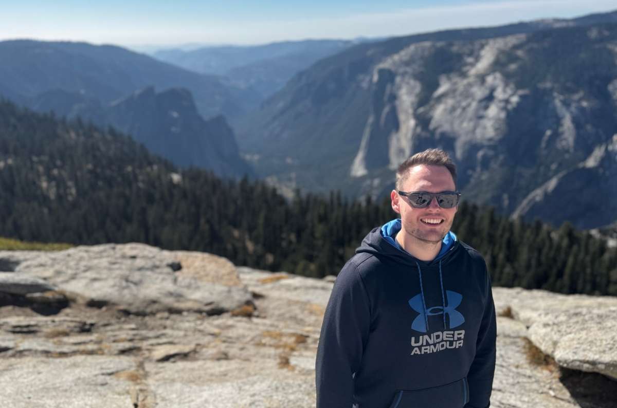
The top of Sentinel Dome
My strongest recommendation when you want walking and exceptional views without a whole-day climb. I rate the hike and views 10/10. It feels leisurely compared with the routes climbing out of the Valley, though the dome and cliff edges still require care.
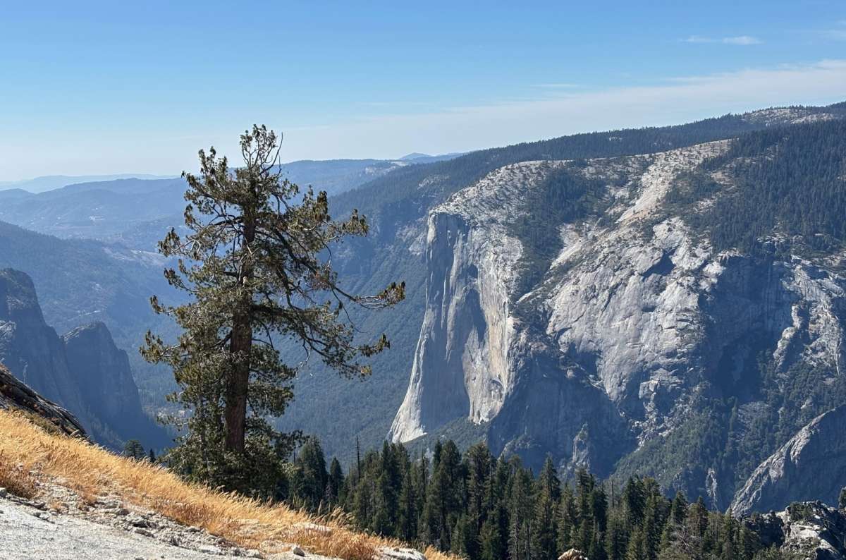
El Capitan from the slopes of Sentinel Dome
What I like is how different the two viewpoints are. Sentinel gives you the broad panorama of granite mountains; Taft brings you to the sheer rim, with El Capitan and the Valley below. They also feel different from Glacier Point, so visiting all three is not simply collecting the same photograph.
I would walk Sentinel to Taft, using the signed connecting route; you can include the Roosevelt Point section. We spent roughly two hours walking and another hour enjoying the views. This is the hike I would protect in a short Yosemite visit.
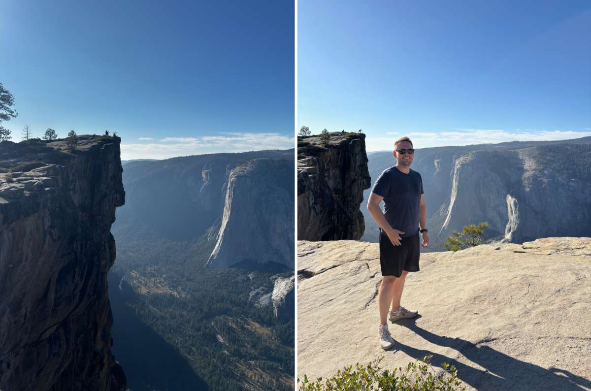
On Taft Point, the safest photo spot is the boring one a few steps back
The shared trailhead parking filled exceptionally quickly during my visit. Arrive early and check Glacier Point Road access. This is my favorite sunset area, but sunset means a return with a headlamp. Keep well back from Taft's edges and fissures; avoid exposed domes in thunderstorms.
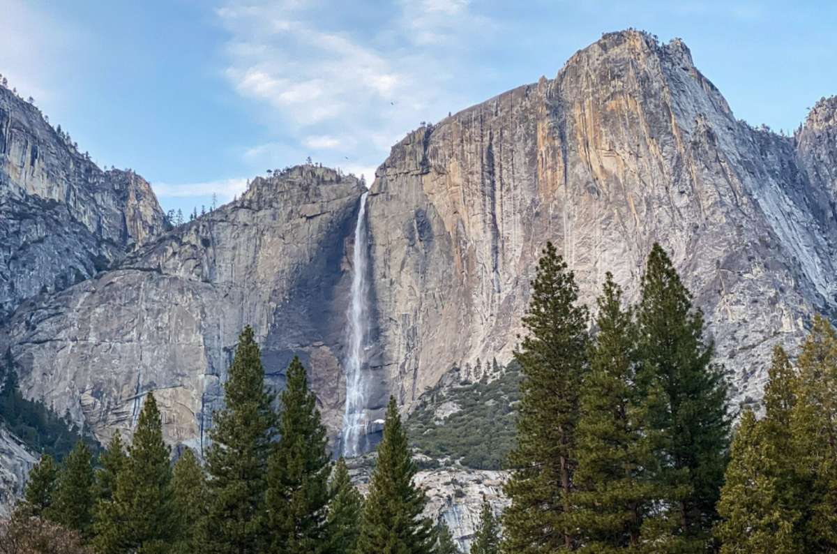
Upper Yosemite Fall from the Valley floor, the whole climb happens on that wall to the left of it
Among the best hiking trails in Yosemite for a serious Valley climb, especially when the waterfall is powerful. My spring visit brought the dramatic version; on three other visits, the falls were dry. I still liked the rock face, but I would not promise the same experience in September.
Columbia Rock offers a shorter uphill option: 2 miles round trip and 2–3 hours, still with about 1,000 feet of climbing. The easy Lower Yosemite Fall loop is a different trail, about 1 mile / 1.6 km. Choose the lower walk if seeing the falls matters more than spending the day climbing beside them.
The total waterfall drop is 2,425 feet / 739 m, including its separate sections. My rating for the Yosemite Falls experience is 10/10 in spring, 8–9/10 in late summer. That does not make the upper hike an automatic choice for every short trip.
Use Yosemite Falls parking across from Camp 4, not the campers-only Camp 4 lot. For a two-day first visit, I would usually keep this as a replacement for Nevada, rather than trying to do both and losing the rim viewpoints.
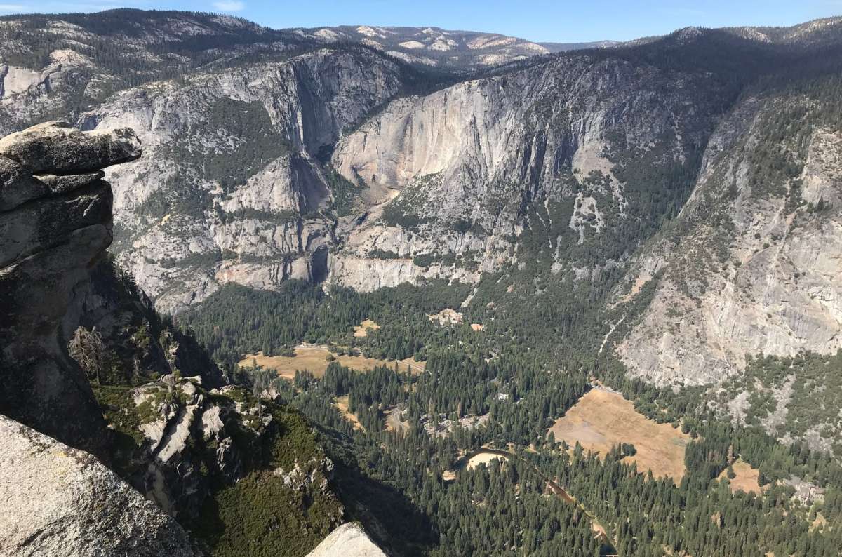
Glacier Point, the reward for a Four Mile Trail that grew to 4.8 miles and kept the old name
A strong option for hikers who want the climb itself, not the quickest way to the lookout. I have not hiked it. I have visited Glacier Point three times and love the destination, but that is not a review of the trail leading up to it.
Despite its name, the Four Mile Trail to Glacier Point is 4.8 miles / 7.7 km one way, or 9.6 miles / 15.5 km round trip, gaining 3,200 feet / 975 m. NPS allows 3–4 hours one way or 6–8 hours for the return. The name survives from an older route completed in 1872; your legs get the modern distance.
Start on Southside Drive near Sentinel Rock. The appeal is the changing Valley perspective during the ascent. For a short sightseeing visit, I would drive to Glacier Point when the road is open and spend my hiking time on Sentinel and Taft instead.
A one-way hike requires arranged transport. There is no regular free shuttle between the Valley and Glacier Point. Do not assume the bus will solve your return when you arrive. Winter snow and ice can close the trail even when parts of the Valley are accessible.
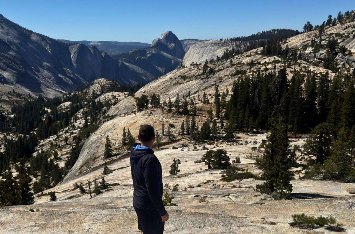
Clouds Rest from Olmsted Point
On my list, but not a hike I have completed. I would consider it for a longer, hiking-focused visit rather than recommend it as an obligatory first-trip achievement.
From Sunrise Lakes Trailhead near Tenaya Lake, the NPS figures are 14 miles / 22.5 km round trip, 2,300 feet / 700 m of gain, and 8–10 hours. The summit reaches 9,926 feet / 3,025 m, with a narrow granite ridgeline on the final approach. Avoid it when wet or during thunderstorms.
Tioga Road must be open to reach this starting point by car. Those hours are hiking time, before the drive. Among the best day hikes in Yosemite for ambitious hikers, it belongs in a different plan from a relaxed day visiting lakes and overlooks.
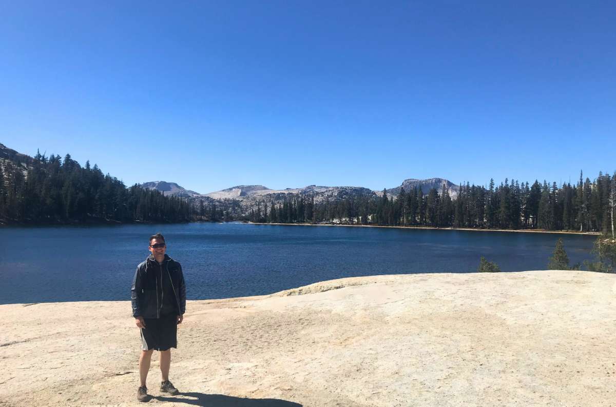
Cathedral Lakes
My favorite longer hike along Tioga Road, rated 9/10. The best Yosemite hikes are not all Valley climbs. Much of this approach was forest, which is not what excites me most here. The lake beneath the granite scenery justified it. I would bring picnic food again and allow time to enjoy reaching the water.
For the full NPS Upper Cathedral Lake route from Tuolumne Meadows Visitor Center, allow 6–7 hours for 7.6 miles / 12 km round trip, with 1,000 feet / 305 m of gain. Lower Lake uses a separate spur. Follow the current signed trailhead access.
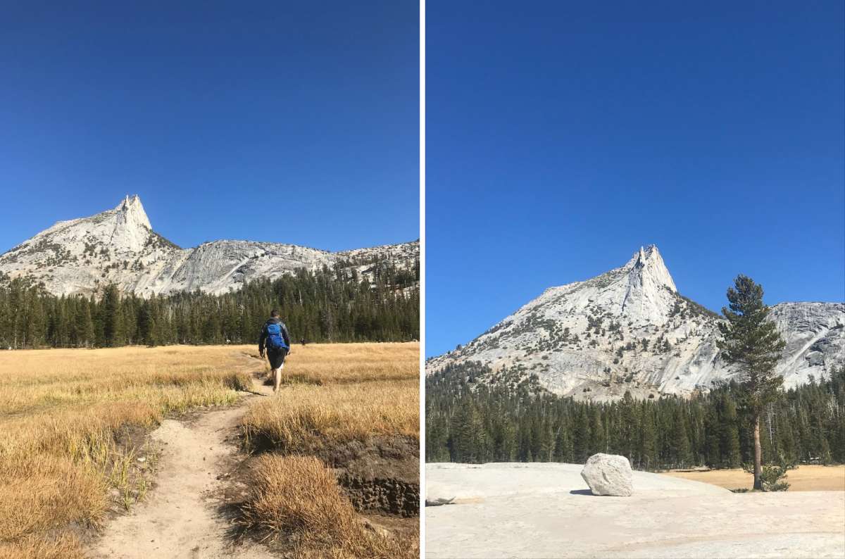
Cathedral Peak
My own outing took about three hours. Do not use that as the time allowance for every Cathedral Lakes hike: the lake you choose, starting point, altitude, and breaks change the outing.
I would put Cathedral into a four- or five-day visit as the main high-country hike. With only three days, choose between that longer outing and a broader Tioga day. Beautiful does not make it the best use of every short visit.
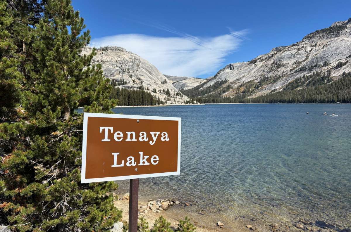
Tenaya Lake looks like a screensaver, and unlike most of Yosemite it does not ask for 2,000 feet first
Excellent scenery, but the complete walk is optional. Tenaya gets 10/10 as a place from me. I walked around in roughly 50–60 minutes and liked the changing views, though enough of the route was forested to make me question whether everyone needs the circuit.
Tenaya sits at about 8,150 feet / 2,484 m. There are several signed parking areas along Tioga Road, so you do not have to queue for the first one. It is a useful, easy break, but a short personal walking time does not certify every shoreline route or seasonal water crossing as equally straightforward.
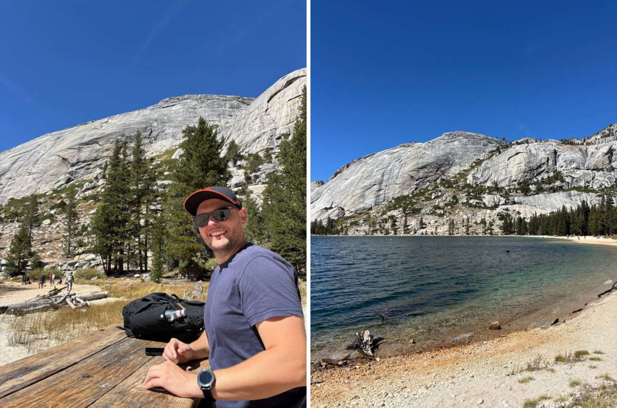
The full loop around Tenaya Lake is optional, the picnic table is not
The southwest shore gave me the views I liked best. I found the eastern side quieter. For a day with longer hiking elsewhere, I would happily use that hour for the shore and food instead.
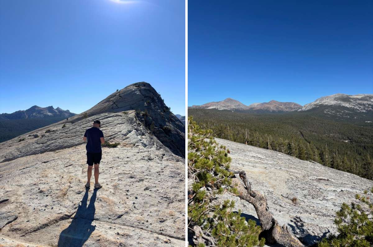
Lembert Dome
I would choose it for the summit panorama, not the approach. My ratings remain 5/10 for the trail, 11/10 for the views, and 8/10 overall. Most of my walking was in the woods. The dome revealed the meadows and surrounding granite peaks in a way the ground-level walk cannot.
My outing took about two hours; I could feel the altitude, and the last granite section was steep. That is my shorter outing, not a promise for the longer Dog Lake plus Lembert route: 3.8 miles / 6.1 km round trip, 850 feet / 260 m of gain, and 3–4 hours, from Dog Lake parking.
For hiking quality, Cathedral is my preference. Lembert fits more easily into a day with other high-country stops. Check the signed construction detour and stay off the dome in thunderstorms.
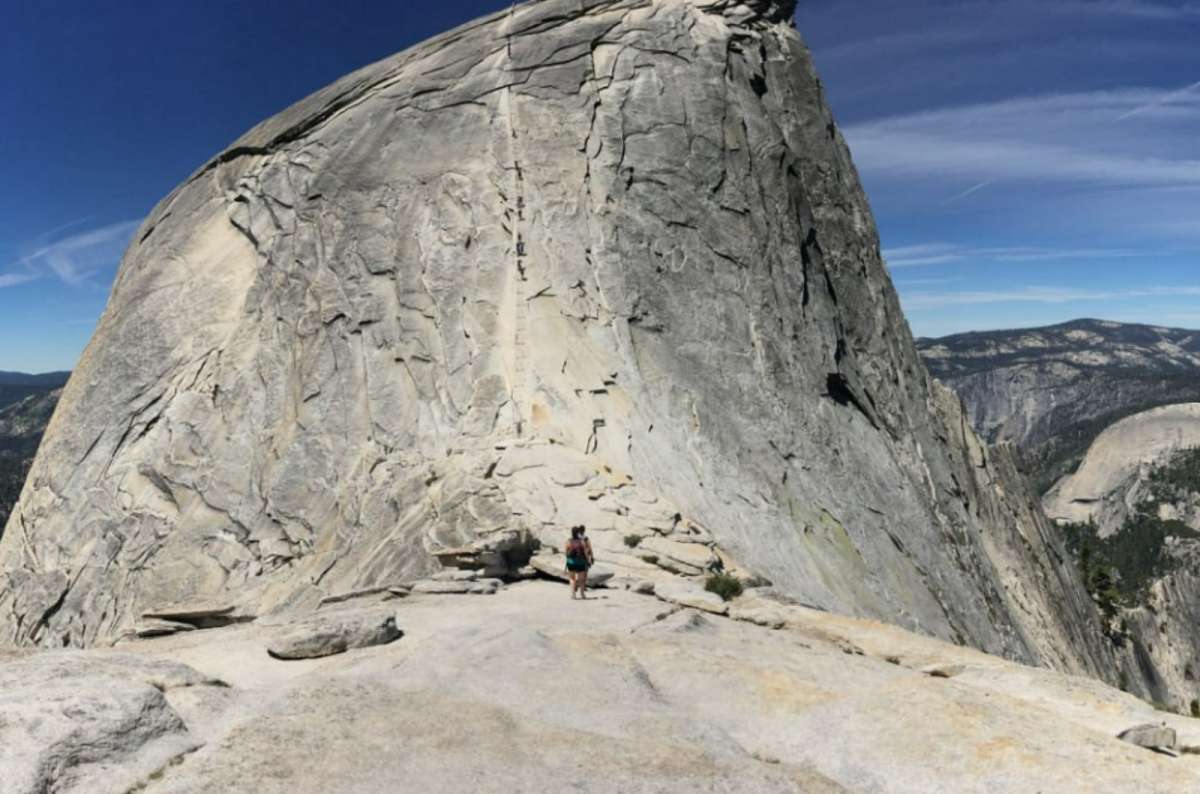
The Half Dome cables, a permit lottery and a lot of nerve away from where I stopped
A dedicated challenge, not something I think every visitor needs to do. I have not climbed the summit. Reaching its foothills on a previous outing does not count as doing the cables.
The Half Dome day hike is roughly 14–16 miles / 23–26 km round trip, gains 4,800 feet / 1,460 m, and commonly takes 10–12 hours. Fitness, preparation, weather, and comfort with exposure matter more than how famous the summit is.
When the cables are up, a permit is required beyond the base of the subdome. The lottery currently costs USD 10 per application, plus USD 10 per successful person; park admission is separate. Check current dates and rules before committing. Do not attempt the cables wet or in threatening weather.
Half Dome's fame does not put it first among Yosemite's best hikes for me. For an ordinary first visit, I would stop at Nevada. If the summit is the reason for your trip, give it its own day and reduce the other hiking accordingly.
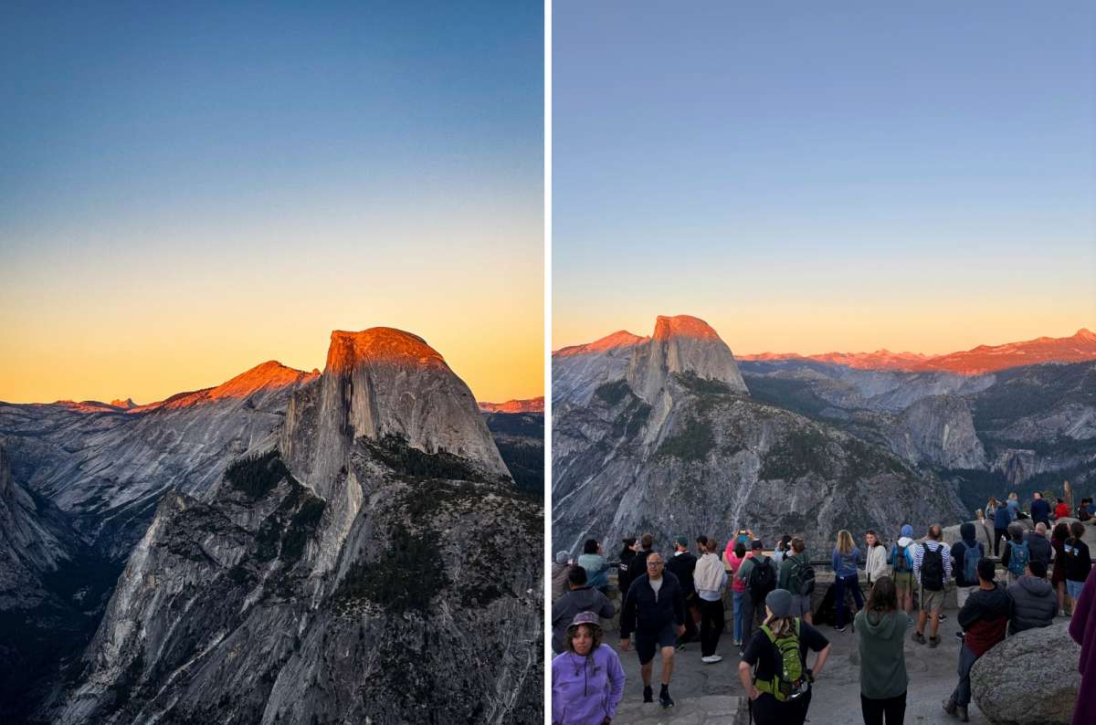
Half Dome gets the last light and Glacier Point gets everyone who checked the sunset time
I liked the perspective from above, but I would start at Glacier Point rather than keep extending a Mist Trail day. For my Glacier Point outing, we got almost as far as Nevada before turning around and climbing back. I have not done the complete one-way through-hike.
The full one-way Panorama Trail is 8.2 miles / 13.2 km and 6–8 hours to the Valley, using the Mist or John Muir Trail for the lower section. It includes an 800-foot climb after Illilouette Fall, so even the descent is not continuously downhill.
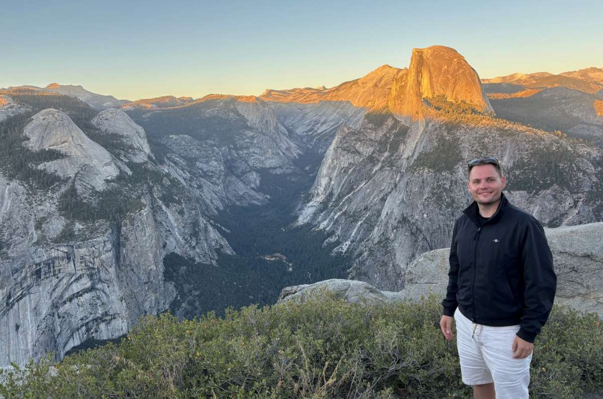
Glacier Point at sunset
That downhill start is pleasant until you remember the return. Pick your turnaround with enough energy left to climb back, not when the descent finally feels long enough.
Arrange transport first for a one-way outing. For most short visits, Nevada and the shorter rim walks are simpler choices than a long combined Four Mile–Panorama day.
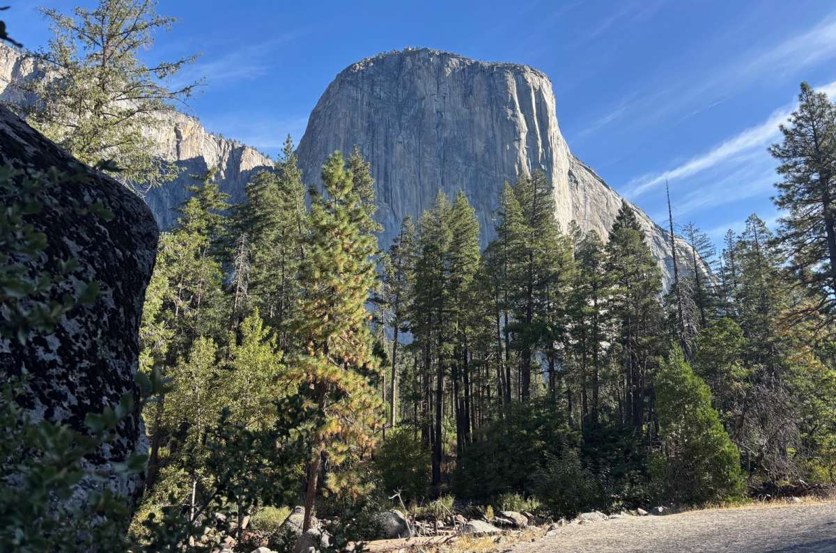
El Capitan from the Valley Loop Trail
I love seeing the cliffs from the floor, but I would walk selected stretches rather than insist on the full circuit. We explored the Valley by bicycle, which I preferred for covering ground; I am not claiming a complete Valley Loop hike.
The NPS route is 11.5 miles / 18.5 km and 5–7 hours for the full loop, or 7.2 miles / 11.6 km and 2.5–3.5 hours for its half-loop.
Choose a stretch near El Capitan rather than spend your only Valley day completing a loop. Check El Capitan Bridge restrictions before relying on a crossing.
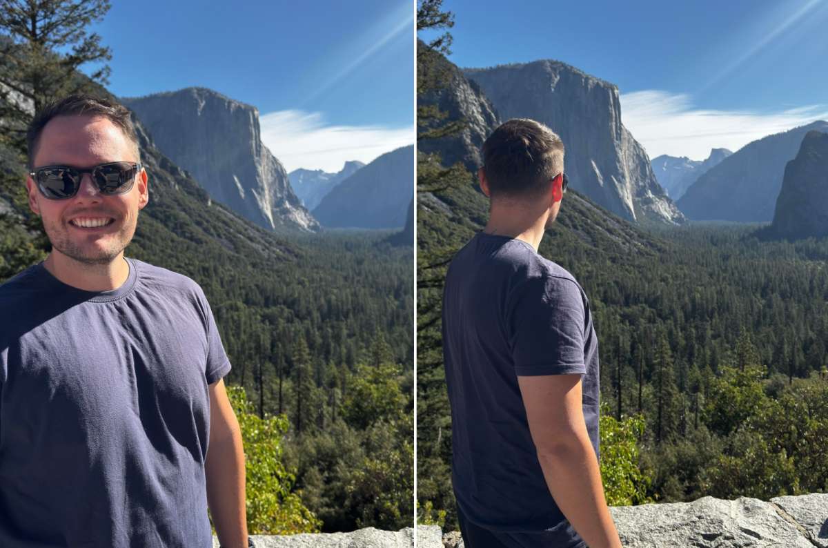
Tunnel View, close enough to Artist Point for me
An optional extension from Tunnel View, below the rim hikes in my priorities. My firsthand recommendation here is the roadside panorama; Artist Point has no separate personal score.
The Yosemite Hikes guide describes 2 miles / 3.2 km round trip, 500 feet / 150 m of gain, and 45–90 minutes, via the Pohono Trail and old stagecoach road. Download the route; use Tunnel View parking. For a quick stop, the roadside view is enough.
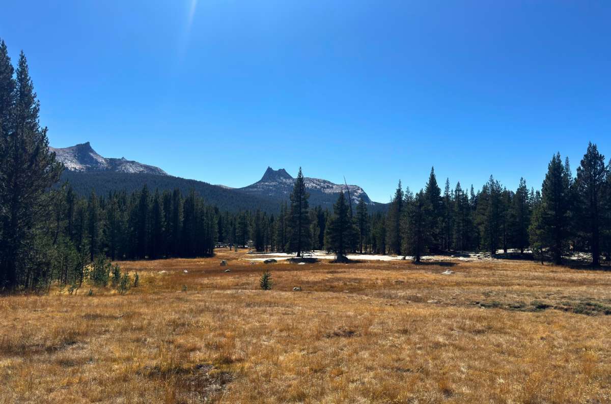
Tuolumne Meadows, flat, golden, and the easiest hour you will spend in the high country
A pleasant, easy alternative, not my first hiking priority. The open meadows appealed to me immediately, but Soda Springs gets 7/10. After Lembert, I would not add it simply to see the same meadows from below.
The Parsons Lodge and Soda Springs walk is 1.4 miles / 2.3 km round trip, mostly flat; allow an hour. Start from the visitor center or Lembert parking. Stay on established paths and bring drinking water.
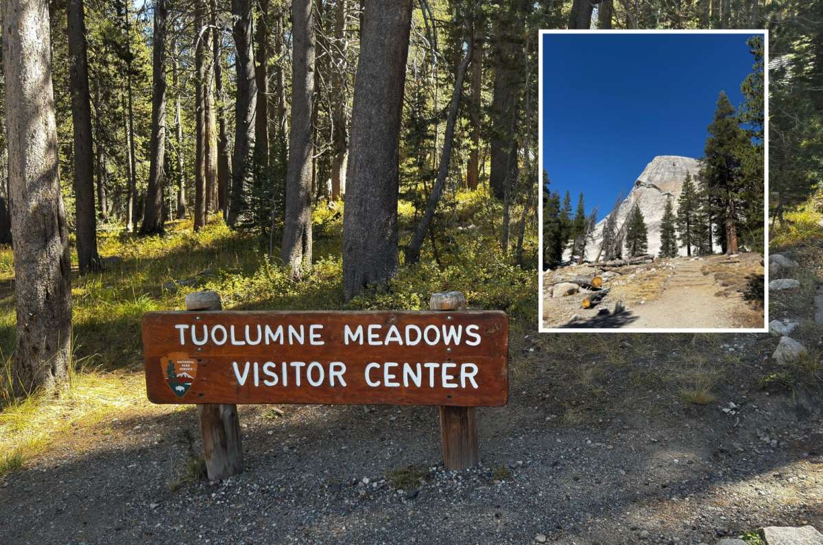
Tuolumne Meadows, the rare Yosemite walk where the parking lot and the trailhead are on speaking terms
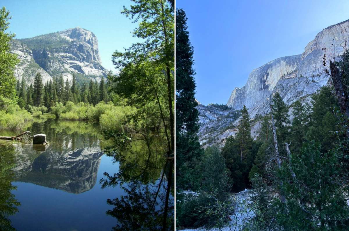
Mirror Lake, which only mirrors anything if you show up before the water leaves for the season
Useful for a gentler outing, but low on my short-trip priorities. I have visited twice: 8/10. The views beneath Half Dome are interesting; I prefer the other places above it. My September visit had no lake water.
The shorter trail is 2 miles / 3.2 km round trip and about an hour; the full loop is 5 miles / 8 km and 2–3 hours. Figures start at shuttle stop 17; add access from Curry Village. For Yosemite hikes with kids, consider the shorter paved approach according to ability and conditions. Do not shortcut across Tenaya Creek.
Planning assessment only: I have not hiked Mount Dana. I would leave this high-altitude summit for another trip. Ask a ranger about the route and conditions if it interests you.
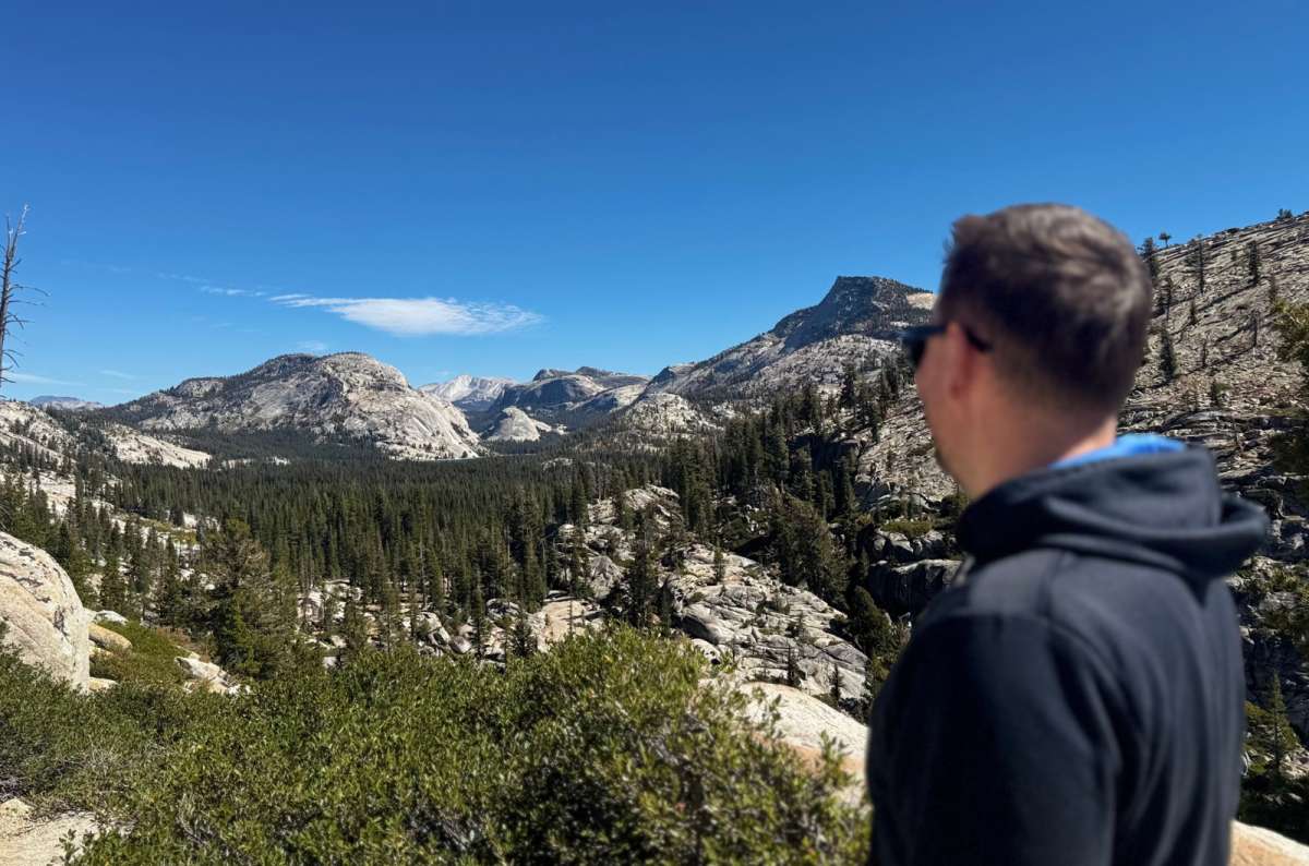
Olmsted Point, proof that some of my favorite Yosemite views came with zero summits attached
You do not need seven summit days to see these. This is my order among viewpoints I have visited, separate from the hiking ranking:
1. Sentinel Dome: my favorite broad panorama, with granite scenery in every direction. Pair it with Taft if you can.
2. Olmsted Point: 11/10 views from the other side of the high country. The signed walk is only 0.25 miles each way; I allow 40–60 minutes for the whole stop.
3. Nevada Fall: the view I would choose when the climb and waterfall experience are part of the reward. It costs considerably more time than the roadside options.
4. Glacier Point: 11/10, especially late afternoon and dusk. I love the orange-to-pink light; when clouds hide everything, I would not spend an hour driving up from the Valley.
5. El Capitan Meadow: look up at the wall and try to spot climbers. An easy 10/10 sight, with very little walking needed; use legal parking and established paths.
6. Taft Point: the sheer-drop perspective is the reason to include it as well as Sentinel, not an excuse to stand close to the edge. My favorite sunset area.
7. Tunnel View: 10/10 for the whole-Valley composition. I prefer afternoon light and allow 10–20 minutes, plus any parking wait.
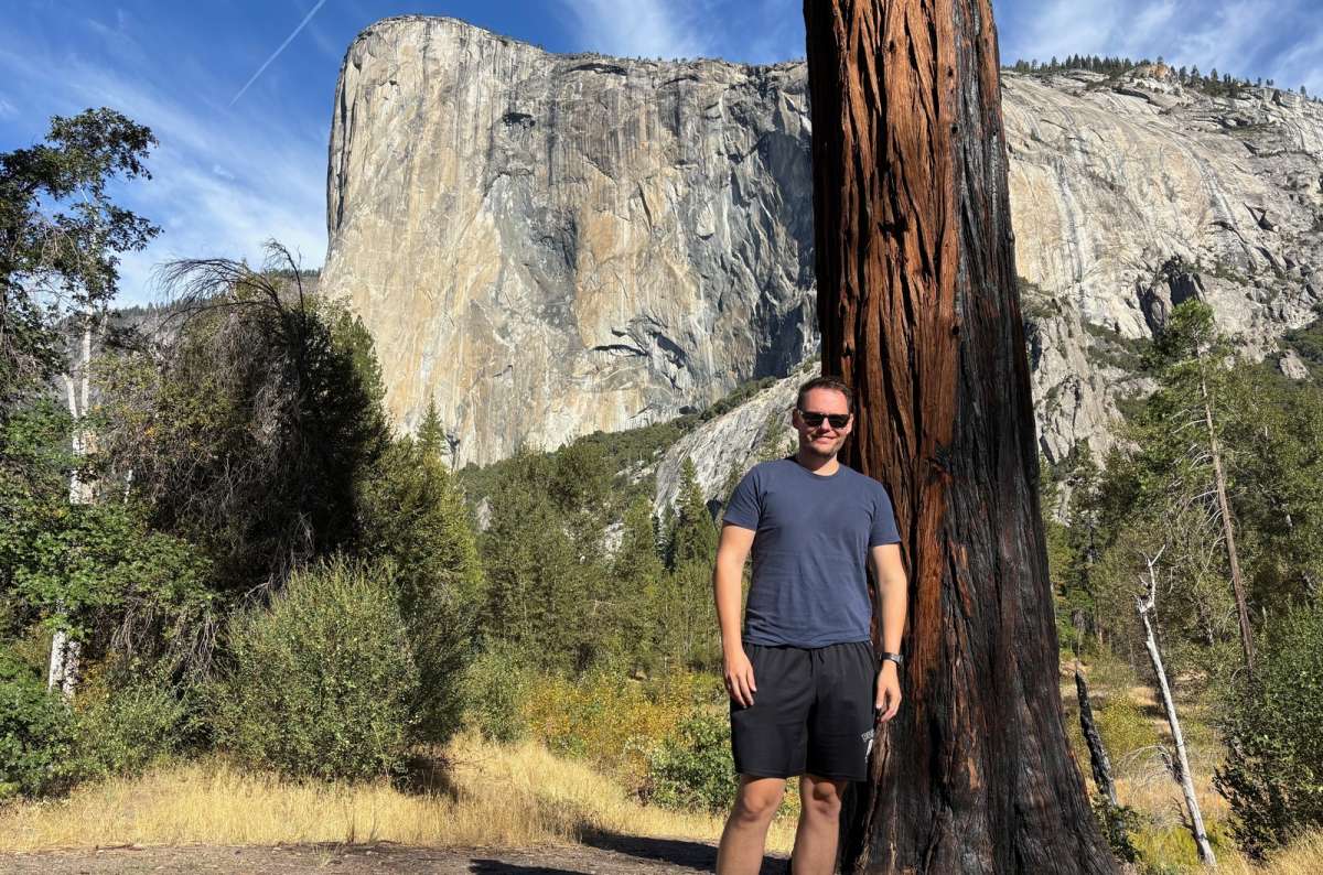
El Capitan, the best argument for a lazy Valley day after four long ones
These are full days in the park, with a car and open seasonal roads, not a challenge to complete every long trail. Hotel access and rest still need time. No car or only one day? A guided day trip to Yosemite from San Francisco covers Tunnel View and the Valley floor, though you will not fit in any of the longer hikes below.
Here is how I would select the best hikes in Yosemite around the length of the visit:
Pro tip: Coming from the Bay Area without a car, a 2-day Yosemite trip from San Francisco is the closest match to this plan.
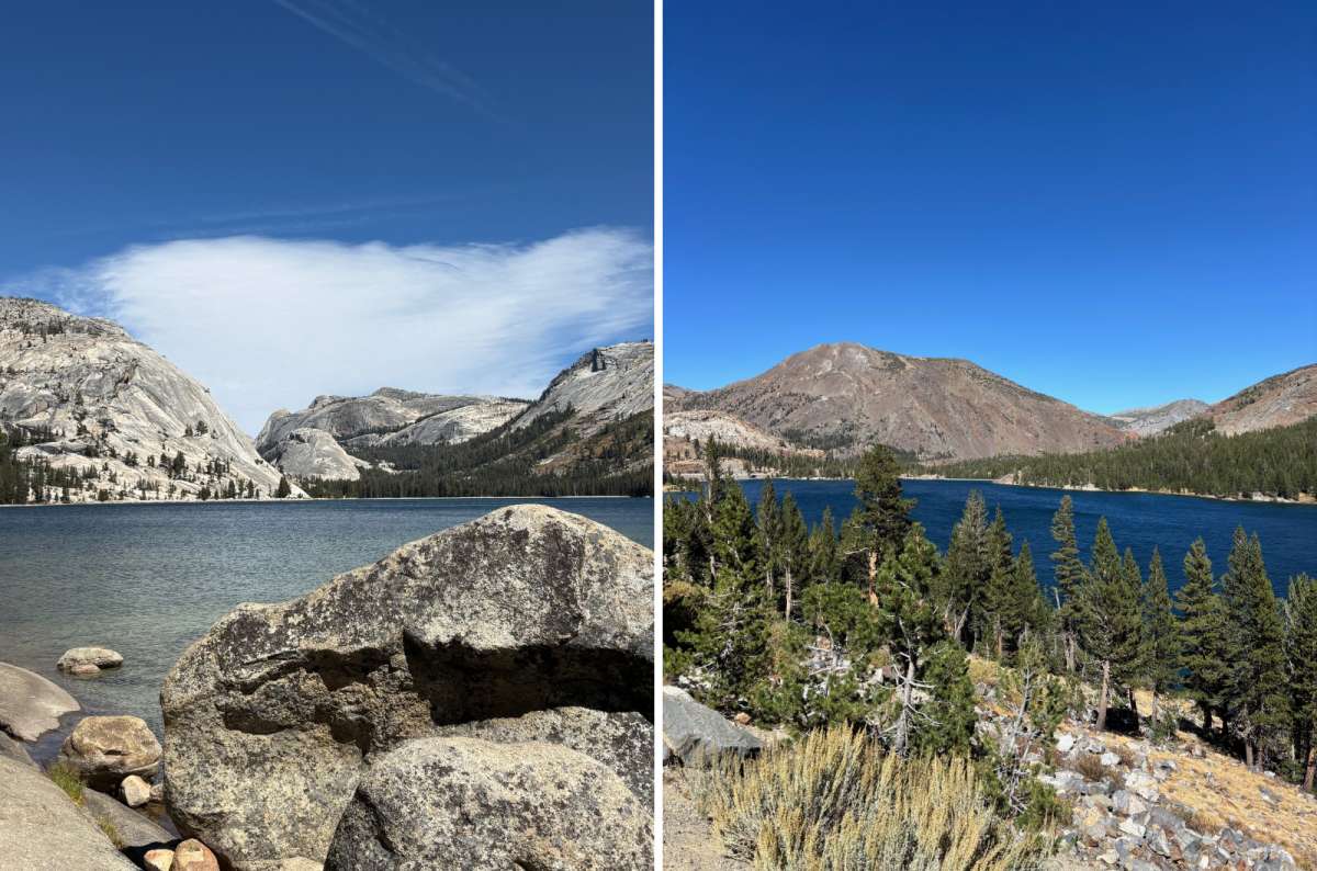
Tenaya Lake and Tioga Lake, both worth the drive and both unreachable when Tioga Road says no
The best time to hike in Yosemite depends on the route. I favor early summer for the Mist Trail's water; spring can be excellent for Valley waterfalls while high-country access remains closed or snowy. For Tioga and Glacier Point Road hikes, choose dates around road and trail conditions, not just the calendar.
Checked October 11, 2026: the NPS conditions page lists lower Mist Trail repair closures Monday–Thursday, 7 am–3:30 pm, through October, except holidays and subject to change. Check your return time too. It also lists a Lembert access detour and weekday closure of the Valley Loop crossing at El Capitan Bridge through December. Snow, fire, and smoke can change the choices above.
Most of these are hikes in Yosemite without a permit for an ordinary day outing; Half Dome beyond the subdome is the important exception here. Overnight wilderness trips have separate requirements. Yosemite admission still applies: check current park fees, rather than treating hiking as a separate attraction ticket.
Carry food, water, grip-soled shoes, a layer, a headlamp, and downloaded directions. Add rain protection for waterfall spray. Allow for slower progress at altitude. Rangers at visitor centers have helped me choose activities, and I would ask about current access before a long outing. Keep food secured and never approach cliff edges or enter water above waterfalls for a photograph.
This post contains affiliate links. If you make a booking through one of my links, I may earn a small commission—at no additional cost to you. Thank you for your support!
Best Yosemite hikes ranked at a glance
My practical Yosemite hiking picks
Where to find the best Yosemite hikes
2. Sentinel Dome and Taft Point
4. Four Mile Trail to Glacier Point
10. Panorama Trail from Glacier Point
13. Tuolumne Meadows and Soda Springs
My 7 best viewpoints in Yosemite


Hi, I’m Jan. I travel fast and intensely, whether I’m exploring the buzz of Tokyo in 3 days or road-tripping through mountains and beaches on a 3-week Thailand adventure. And no matter where I am, you’ll always find me in a comfortable hotel at night and eating the best food.
If that sounds like your kind of journey, hop on board, and let’s explore the world together!
I started this blog after realizing how tough it can be to find reliable, authentic travel info. You wouldn’t believe how many “travel bloggers” never even visit the places they write about! On Next Level of Travel, you can count on my full honesty and insights drawn from my firsthand experiences.
Here’s the deal: not every destination is all superlatives and unicorns. I’ll let you know if a tourist attraction isn’t worth your time, like skipping overrated stops in my 2-week Spain itinerary. And when I find something truly special—like the perfect mix of culture and nature in Cape Town—you can trust that it’s worth adding to your itinerary.

Comments | Thoughts? Give us a shout!