




At a glance: The best Gran Canaria hikes ranked
How much time do you need to explore the best hikes in Gran Canaria?
Suggested Gran Canaria Hiking Itinerary
Where to stay for Gran Canaria hiking
Quick tips for hiking Gran Canaria
4. Roque Bentayga hike/viewpoint walk
6. GC-210/Mirador del Molino viewpoint walk
9. Mirador de los Marteles/caldera Walk
10. Agaete natural pools and Playa de las Nieves coastal walk
11. Cactualdea cactus garden walk
12. Tejeda/Cruz de Tejeda viewpoint walk
Absolutely yes. Gran Canaria Hiking is well worth it. I visited Gran Canaria in late 2025, expecting beaches, warm weather, and maybe a few decent viewpoints. Instead, I found an amazingly good hiking island with dunes, pine forests, volcanic rocks, giant canyons, and roads that somehow make a 20 km (12.4 mi) drive feel like a small expedition.
Gran Canaria hiking is much better than I expected. The inland mountains are the real surprise of the island. One minute, I was driving through dry, Arizona-looking cliffs. Next, I was wandering around pine forests that felt weirdly alpine. At times, it reminded me of Utah, Canyonlands, Peru, and the Grand Canyon, except with more tiny villages and fewer cowboy hats (which was unfortunate… I do love to let my inner cowboy out from time to time).
I also arrived with more than 200 saved locations, which sounds organized until I realized that half the island is separated by giant ravines and curving roads (don’t forget motion sickness medicine).
The good news is that hiking in Gran Canaria is incredibly rewarding. The bad news is that weather, altitude, parking, reservations, and mountain driving can absolutely ruin your plans if you improvise too hard. I failed my first Roque Nublo hike attempt because I forgot to reserve the hike, which was very educational and mildly humiliating.
So this guide focuses on practical decisions: which Gran Canaria hikes are actually worth your vacation energy, which hikes are easy enough for normal people, which ones are hardcore, which ones need to be reserved in advance, how to combine the best hikes with viewpoints and scenic drives, and more.
Good to know: The mountain-top hikes can be surprisingly flat and manageable, which is great for those who aren’t advanced hikers.
Read more from my Canary Islands travel blog.
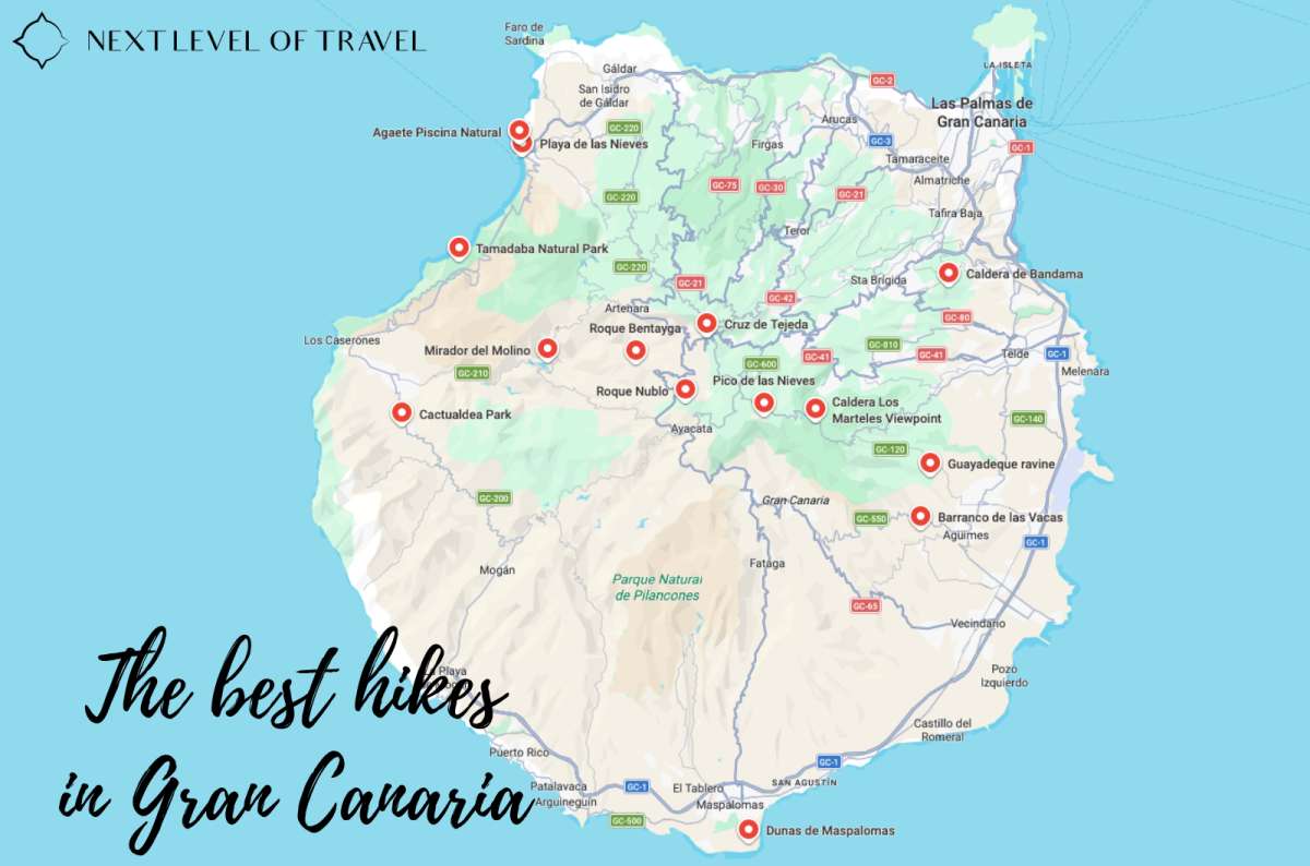
All 13 hikes are mapped out, so you can stop pretending the island is smaller than it actually is
I ranked these Gran Canaria hikes based on views, effort-to-reward ratio, route practicality, and whether I’d bother planning my day around them.
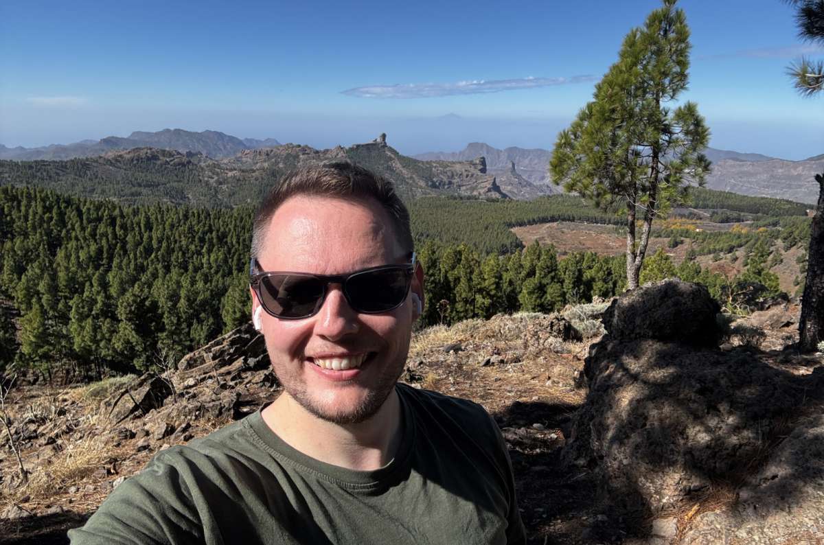
Pico de las Nieves with Roque Nublo photobombing in the background
You can experience many of the highlights of Gran Canaria Hiking in about three days, and the order isn’t a huge deal. The island is roughly circular, so Day 1 can easily become Day 3 depending on the weather, your base, or how much mountain driving you feel like doing. If you have longer, even better. The mountains are a hiker’s paradise, with everything from easy viewpoint walks to full-day adventures through many different landscapes. You could easily spend a week—or even a month—exploring the best hikes in Gran Canaria and still have trails left on the list, which is very exciting for someone who loves to explore on foot!

If you only have one day, this is the strongest route.
Verdict: This is the best concentration of mountain scenery on the island if the weather is good, and reservations have been made.
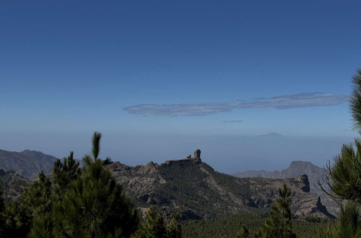
Roque Nublo in the middle, Teide hiding in the haze on the right, and me pretending I could see it clearly the whole time
Day 1: Central mountains
Day 2: Canyons and dunes
Verdict: Best balance of dunes, forests, volcanic rocks, canyons, and viewpoints.
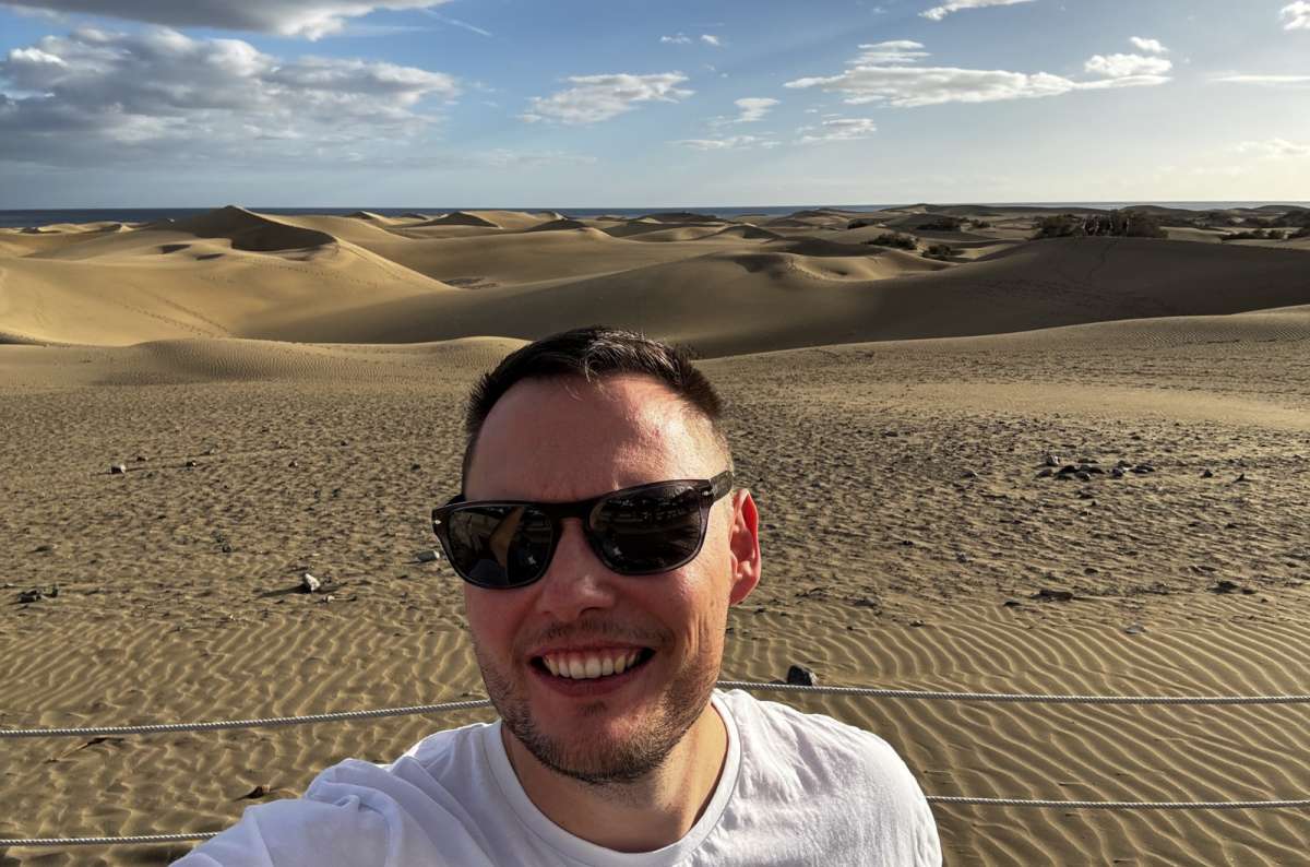
Hiking through the Maspalomas dunes will for sure humble you
Day 1: Central mountain classics
Day 2: East and south canyon route
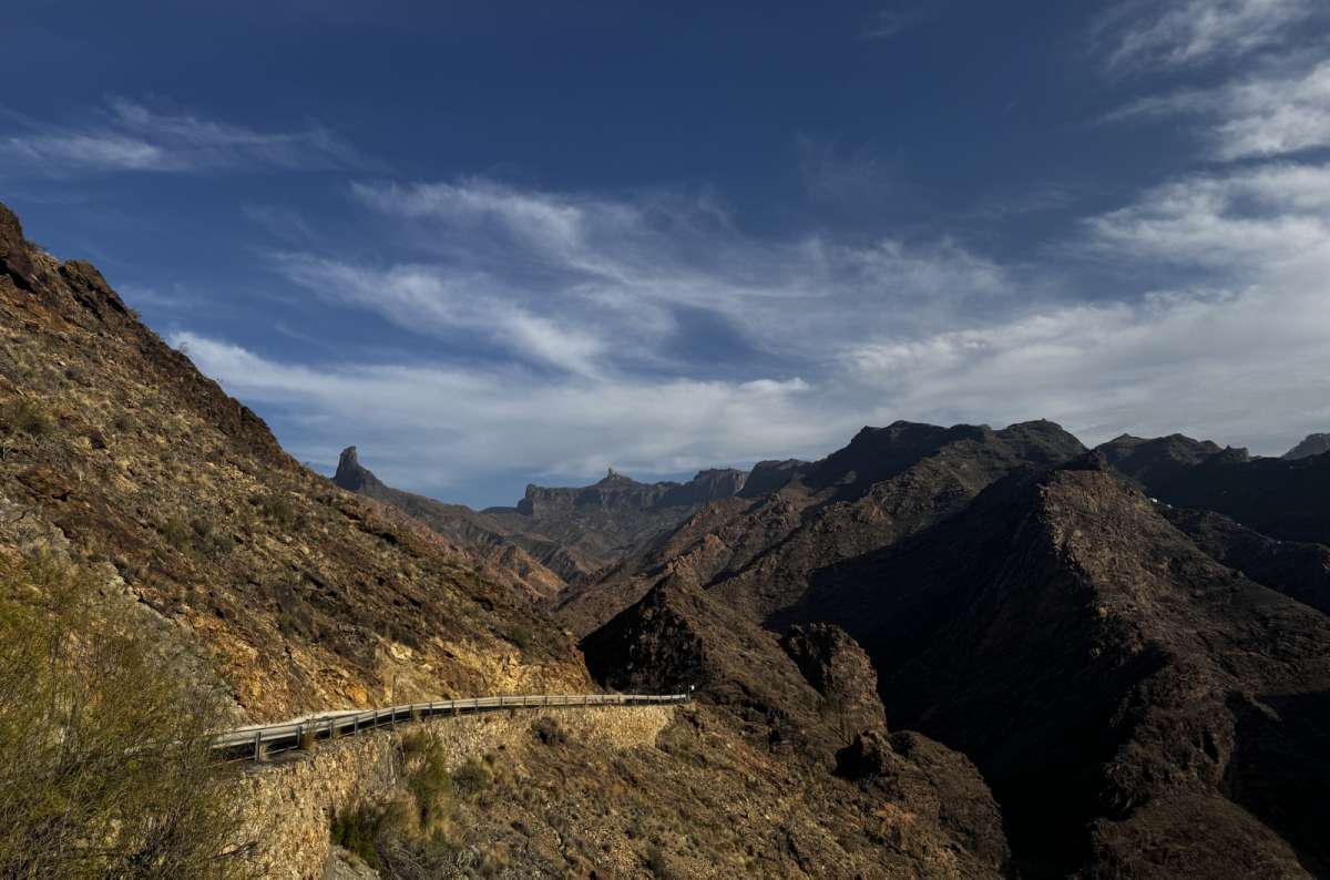
GC-210 is narrow and slightly terrifying for most of the drive, absolutely worth it
Day 3: West and north route
Verdict: This is the version I’d choose personally if hiking and landscapes were the main reasons for visiting Gran Canaria.
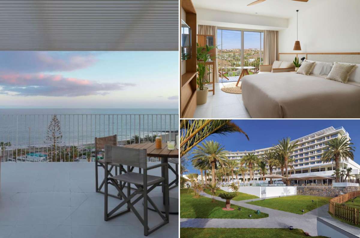
The Paradisus Gran Canaria checked every box
For this 3-day Gran Canaria Hiking itinerary, I’d stay in Maspalomas as a base because it keeps you closest to the main mountain hikes in Gran Canaria, like the Roque Nublo hike, the Pico de las Nieves hike, and the Guayadeque hike, while still being manageable for longer drives up to Tamadaba hiking in the west.
I stayed at the Paradisus Gran Canaria All Inclusive, and I was very happy… the service was great, and everything was just perfect… how often does that happen?
If you want to explore multiple Gran Canaria hiking routes, the only realistic way to get around is to rent a car. I always use DiscoverCars.
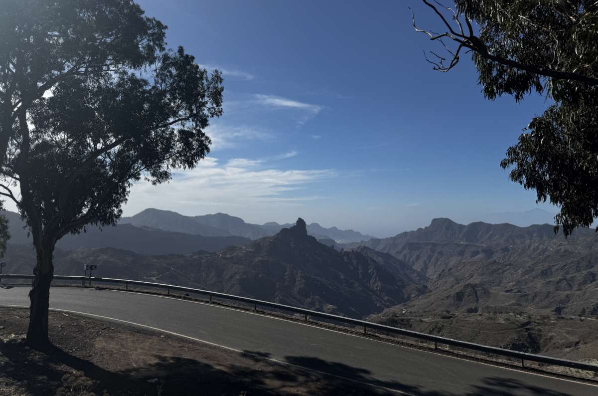
Catch Roque Nublo peeking through the landscape on basically every mountain road in central Gran Canaria
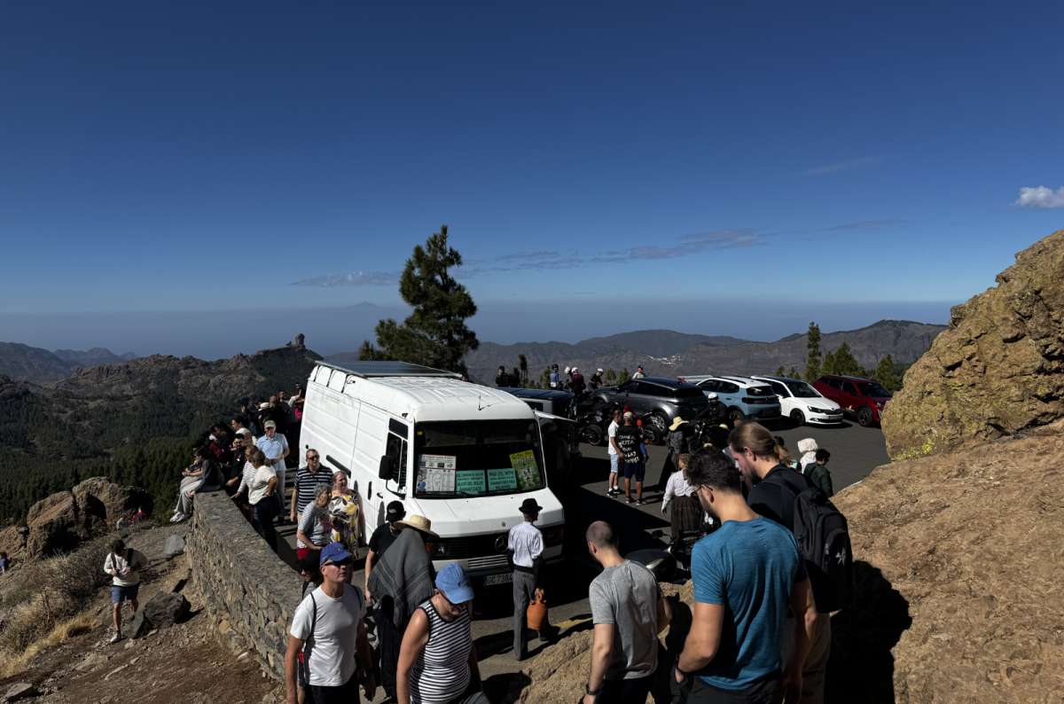
Guess how many people are going to get sick from the Pico de las Nieves climb just by their lack of sun protection
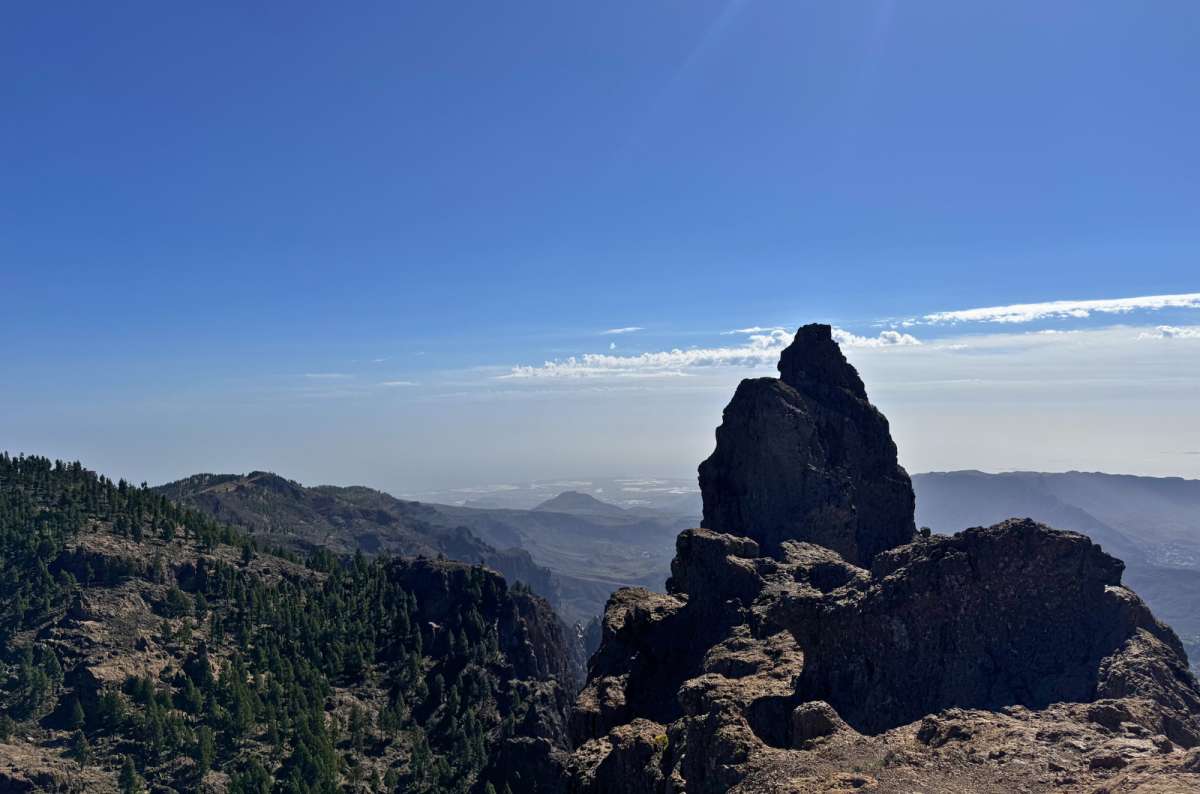
You could photograph Roque Nublo from a hundred different angles, and it would look the same in all of them
Quick facts
The best hike in Gran Canaria for effort vs views.
I did the Pico de las Nieves hike from Llanos de la Pez, and it changed from a nice forest walk to me being quickly on top of the island, which was very cool. That's exactly why I rank it as the best hike in Gran Canaria. Unlike some of the island's more famous hikes, the effort is relatively low, but the scenery is amazing. If I only had one mountain day on the island, this is the hike I'd choose.
It was an easy-ish trail, well-marked, and then boom—full 360° Gran Canaria views everywhere. Mountains, valleys, oh my…and all of it tried to steal my attention at once. I must admit that it was slightly overwhelming at first. So much beauty in one place.
What really sets it apart from places like Roque Nublo is the overall experience. You get pine forest, volcanic terrain, huge panoramic views, and the highest part of the island all wrapped into a relatively short hike. The effort-to-reward ratio is ridiculous.
On a clear day, you can see Mt. Teide in Tenerife. I saw haze, of course, because that’s my lot in life.
If you're trying to decide between the island's mountain hikes, I'd put Pico de las Nieves at the top of the list. It may not be the most famous hike in Gran Canaria, but I think it's the strongest overall mountain hike.
Good to know: Parking near the top gets full fast. It’s also way colder than the coast, which I discovered after I arrived.
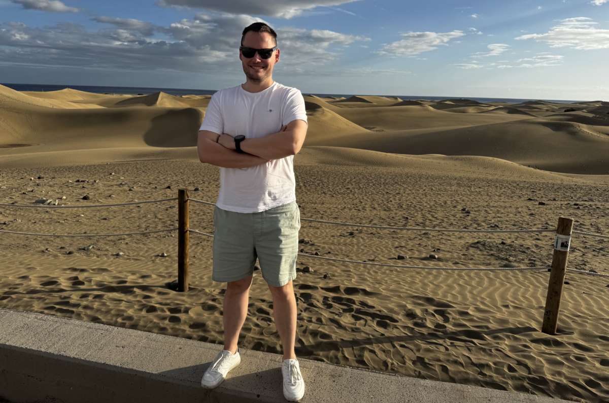
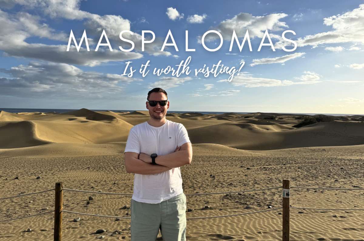
The Maspalomas dunes stretch for about 4 square kilometers and meet the ocean at one end
Quick facts
Technically more of a walk than a hike, but still one of the best easy hikes in Gran Canaria.
The Maspalomas Dunes are bizarre in the best way possible. It felt like someone copied and pasted a tiny Sahara Desert onto the island… but the dunes meet the ocean like in Namibia. It’s like a strange fever dream, and I loved every second of it. It's also one of the few places in the world where massive desert-like dunes meet the ocean, which makes the scenery feel even more surreal.
Walking through the sand is surprisingly tiring, though, as everyone already knows, so this “hike” still managed to humble me, and I felt totally tired afterwards. Luckily, you can also book a guided camel guide.
If you're visiting Gran Canaria for the first time, I think this is a must-do. The dunes are one of the island's most iconic landscapes, and unlike anything else you'll see during your trip. You don't need to dedicate an entire day to them, but I'd absolutely make time for a sunrise or sunset walk if possible. That's when the light is at its best, and the dunes look even more memorable.
Good to know: Don’t do this at midday unless you enjoy slow roasting from all directions like a glistening rotisserie chicken.
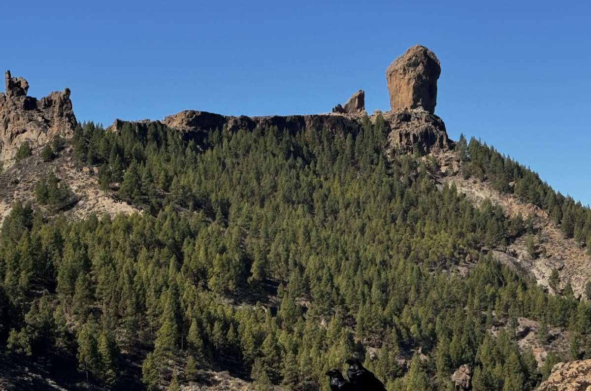
The rock just appears above the tree line as you get closer, and it's a genuinely good moment
Quick facts
The classic Gran Canaria hike. And for a very good reason. In fact, if Pico de las Nieves is my favorite overall hike, Roque Nublo is probably the most iconic hike on the entire island.
The volcanic rock itself is impressive, but the real reason for doing this hike is the scenery around it. I saw juniper forests, huge volcanic valleys, and views that felt much more like the American Southwest than a Spanish island. The only thing was that it was busy, but the beauty outweighed my personal annoyance.
The other thing to know is that this hike requires a bit of planning. Unlike most hikes in Gran Canaria, you can't always just show up and start walking. I actually drove all the way there before realizing I needed a reservation and had to turn around, which was a humbling experience that involved significantly more driving than hiking. Learn from my mistake.
Pay attention to the weather before you commit to this one—slippery volcanic rock next to cliffs is a bad combo, and it gets even worse on mountain roads like GC-600 or GC-150 in rain or fog, where tight turns will result in some super stressful moments that will definitely be full of very bad words.
Good to know: You have to reserve the hike online, where you will get a QR code. I'd strongly recommend booking as early as possible, especially during busy periods. If Roque Nublo is high on your Gran Canaria bucket list, don't leave the reservation until the last minute. There’s also the guided tour option.
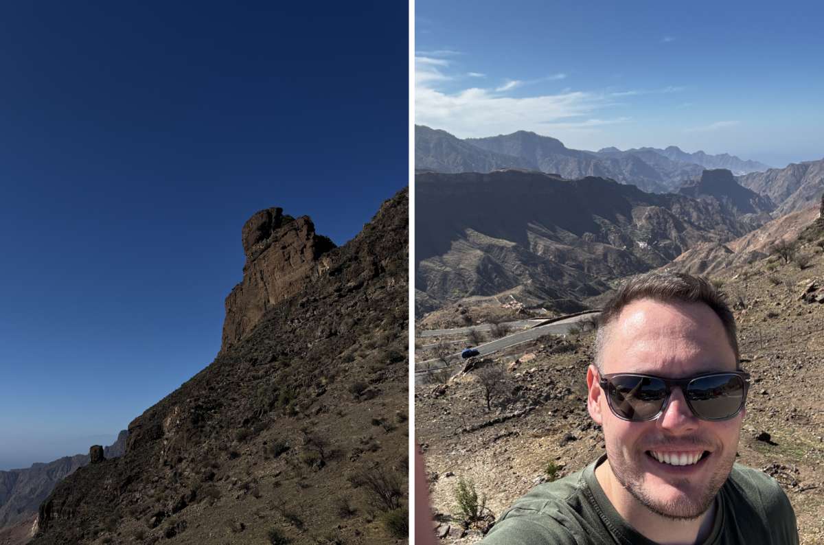
The trail to Roque Nublo is significantly less dramatic than the road you drive to get there
Quick facts
One of the most ridiculous viewpoints in Gran Canaria, and for very low effort. The walk was short and straightforward on a well-marked path. I felt only a slight incline, so really, I feel like this one is an easy win for everyone.
The Roque Bentayga hike/viewpoint walk was honestly one of the most memorable stops for me on the island. The scenery I saw was over the top—massive valleys, dramatic cliffs, Roque Nublo sitting nearby, and on clear days a view of Mt. Teide in the distance (I already mentioned it was a hazy day for me).
What really made it stand out was seeing so many of Gran Canaria's biggest landmarks from one place. Roque Nublo, Bentayga, the surrounding volcanic valleys, and potentially even Teide all combine into one of the most complete mountain views on the island.
Good to know: Parking is small and fills up quickly. This fits best as part of a central Gran Canaria hiking routes day, combined with stops around Tejeda, the GC-210 scenic drive, and viewpoints near Pico de las Nieves.
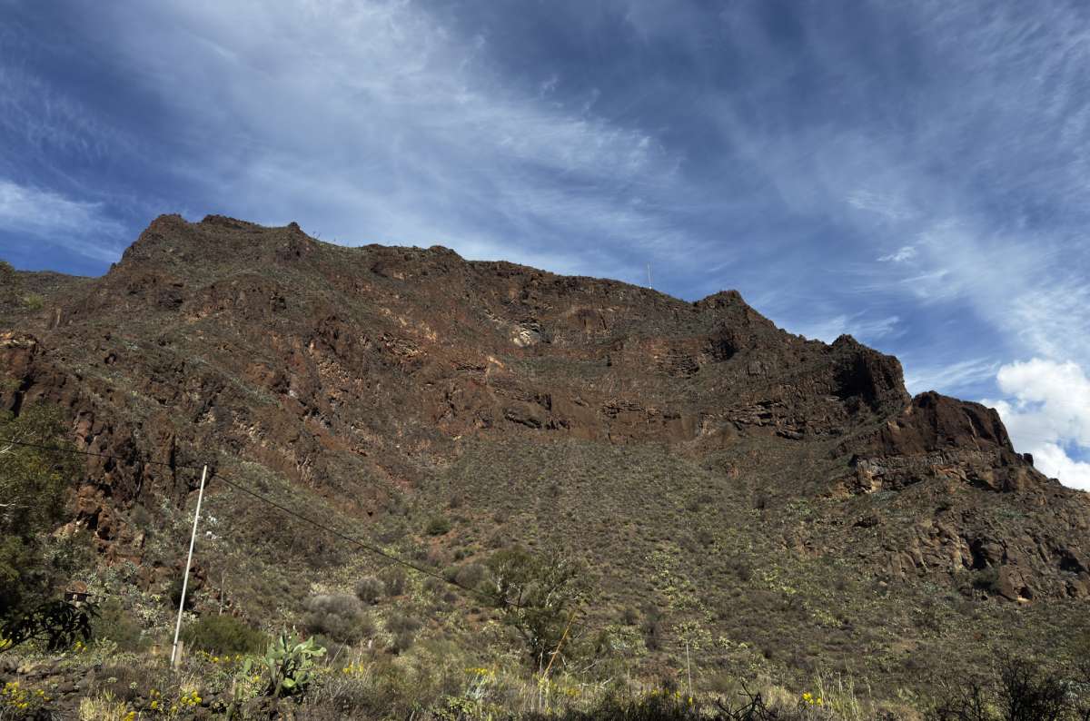
Gran Canaria's interior looks like Arizona one minute and the Canary Islands the next (check out the caves tho)
Quick facts
One of the most unusual Gran Canaria hiking routes on the island.
The Guayadeque Gorge hike took me through a massive canyon lined with cave houses carved directly into the rock. Unlike most of Gran Canaria, which often feels dry and volcanic, Guayadeque is noticeably greener and cooler, with massive cliffs on both sides of the valley.
What surprised me most was how alive the canyon felt. People still live in some of the cave dwellings, and there are even cave restaurants built into the rock. It's not every day you go for a walk in a gorge and find yourself wondering whether you should admire the scenery or someone's house.
It also got noticeably cooler there, which I appreciated after melting everywhere else on the island.
The short walk was easy, scenic, and very low effort. If you've already visited a few viewpoints and mountain peaks, Guayadeque offers something completely different... a place where nature, history, and daily life coexist.
Good to know: It’s popular because it’s on basically every Gran Canaria itinerary now, so expect other humans. Also, save a meal for the cave restaurants—they’re really interesting and not yet tourist traps. Let’s hope they stay that way because I hate it when places lose their soul and exist only for tourists.
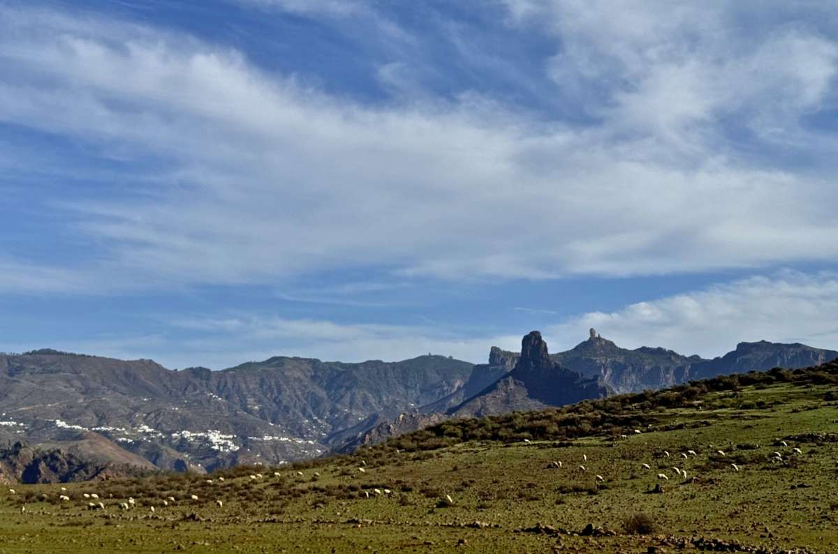
Sheep, Roque Nublo, a white village on the left, and nothing requiring my attention, GC-210 outdid itself
Quick facts
This isn’t one single hike; it’s more of a collection of short viewpoint stops connected by one slightly terrifying mountain road. Often, I found myself wondering why I don’t have a St. Christopher necklace, but then I recalled that I’m not actually religious and believe more in my driving abilities than blind faith.
The scenery along GC-210 was incredible. Every five minutes, I found myself stopping the car because the island looked even more dramatic than before. I don’t know how that’s possible, but that’s how good Gran Canaria is. I can’t stress it enough. In my opinion, this is the most spectacular scenic drive and viewpoint route on the island. If you enjoy dramatic scenery but don't necessarily want a long hike, this is one of the best experiences in Gran Canaria.
Mirador del Molino was one of my favorite quick stops, where I saw huge sweeping views and an old windmill.
Good to know: The roads are narrow, winding, and a bit scary.
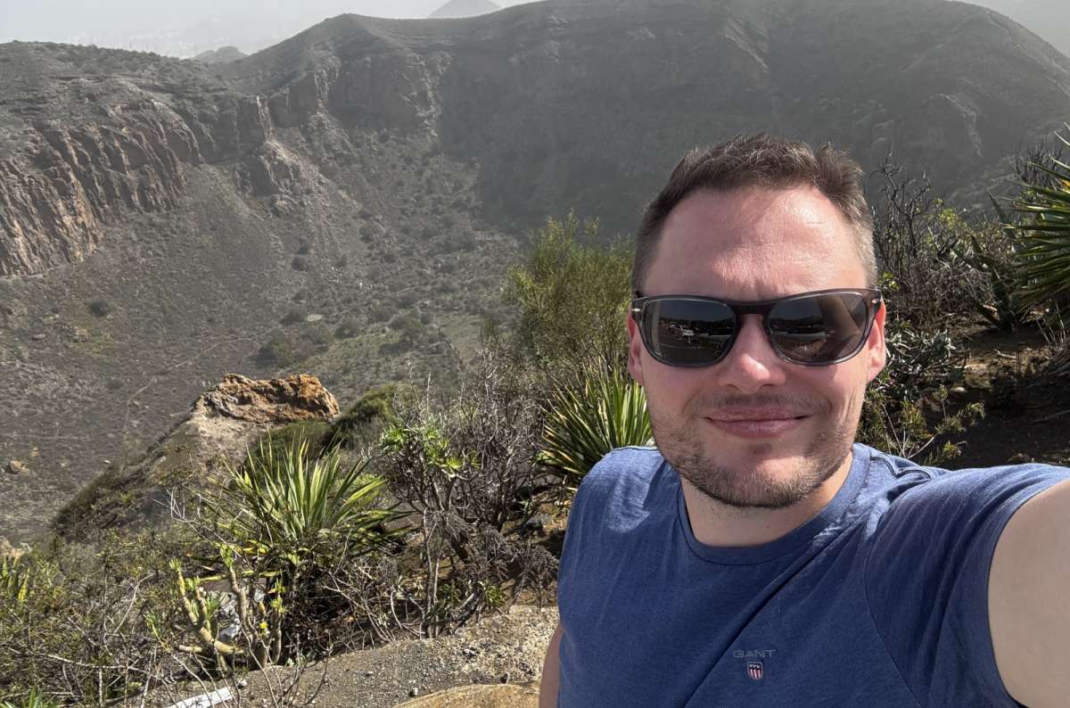
I started sweating from nervousness on the way down into this crater, which is not something I expected to say about a half-day hike near the airport
Quick facts
The Caldera de Bandama hike is one of those Gran Canaria trails where I parked near a golf course, walked into a giant volcanic hole, and then immediately realized I still had to climb back out again. I did the full loop in about 3 hours, mostly stopping for photos, and then I wondered why I thought this was a relaxing idea.
The path was easy to follow, but the drop into the crater was pretty steep, and I actually felt a bit scared at times. I even found myself sweating out of nervousness. The rim walk offers the best views, though, so just stay away from the edge, and you’ll be just fine, I promise.
What makes this hike special is that you're not just looking at a volcano—you're actually walking inside one. That's rare, and it gives the whole experience a very different feel from the island's mountain hikes and viewpoints.
Good to know: It’s an easy half-day from Las Palmas or the airport, but if you get dizzy near the edges, I’d probably just admire it from a safe distance.
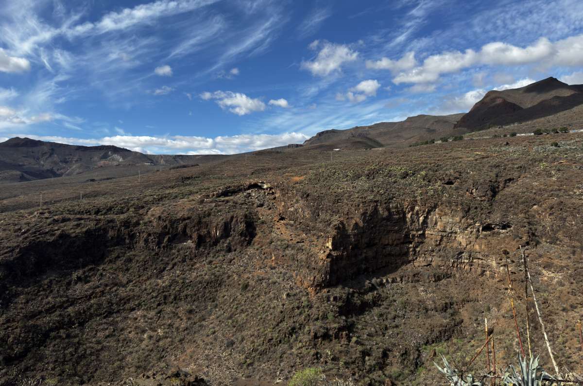
The descent into the Caldera de Bandama crater is steeper than it looks, and the climb back out is the part nobody warns you about
Quick facts
This is a bit like the Temu version of Zion National Park.
I actually skipped Barranco de las Vacas due to there being a large number of people there. From what I’ve read, though, some felt like they had been slightly scammed—it’s super small, BUT it is still good. It’s tiny, it’s over fast (oh, I could really tell a dirty joke here, but I won’t, I’m a gentleman), but it delivers smooth orange canyon walls and tiny canyon vibes that make everyone feel like a photographer for 10 minutes.
Good to know: This is one of those Gran Canaria hiking routes that’s really just a quick stop, not a proper hike—blink, and you’re basically done. And it’s annoyingly busy.
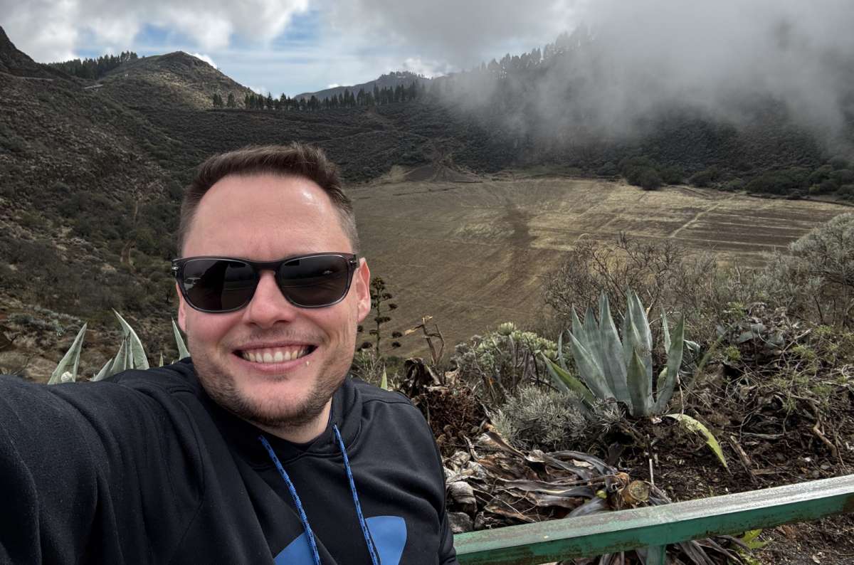
One of the most atmospheric moments on the whole trip, and I nearly skipped this one @ Mirador de los Marteles
Quick facts
One of the most underrated mountain stops.
The volcanic crater itself is impressive, but what really made it memorable for me was the weather. While I was there, I experienced such a cool thing: the weather changed, and the clouds started to roll into the caldera while I was inside it, and suddenly everything looked like a doomsday film. It was creepy and unforgettable. I loved it!
Very atmospheric. Very dramatic. Very Gran Canaria. I think it gets overlooked because places like Roque Nublo and Pico de las Nieves receive most of the attention. If you're looking for a quieter stop that still delivers volcanic scenery, this is an easy addition.
Good to know: This is one of those Gran Canaria hiking routes where there’s also a viewpoint if you don’t want to hike into the crater, so you can still get the views without fully committing your tired legs.
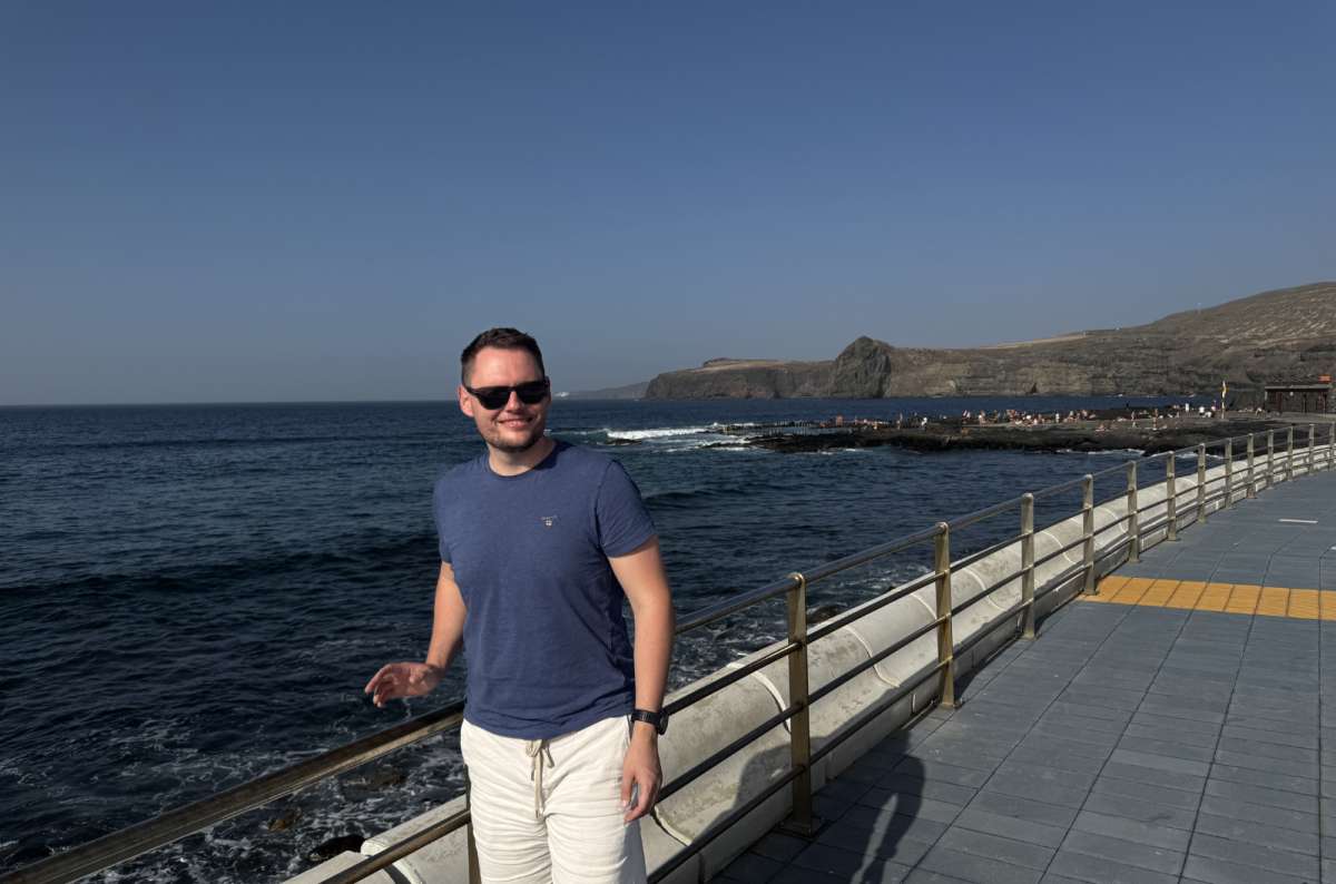
The Agaete coastal walk follows the Atlantic's edge with the natural pools on one side. The water is cold, but the walk is excellent
Quick facts
More of a scenic coastal walk than a hike, but definitely worth adding.
The Agaete coastal walk is one of those easy hikes in Gran Canaria where I followed the rugged coastline and watched the Atlantic’s huge waves crashing on dark volcanic rocks. It was loud and atmospheric. What I liked most was how wild it felt compared to the resort-heavy south. There are no giant hotels, no beach clubs, and no rows of sunbeds—just Mother Nature.
I tried the natural swimming pools, but the water was too cold for me. I really preferred the pools at my all-inclusive resort. What can I say? I am a creature of comfort.
The walk also works perfectly with a visit to Agaete, Playa de las Nieves, or Tamadaba, making it one of the easiest nature stops to add to a day exploring the northwest of the island.
Good to know: The natural pools are a safe option for swimming in the Atlantic, but can be dangerous when the sea gets rough, so pay attention to Mother Nature.
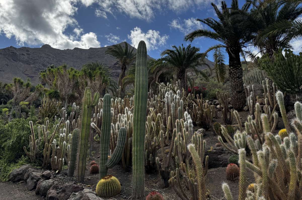
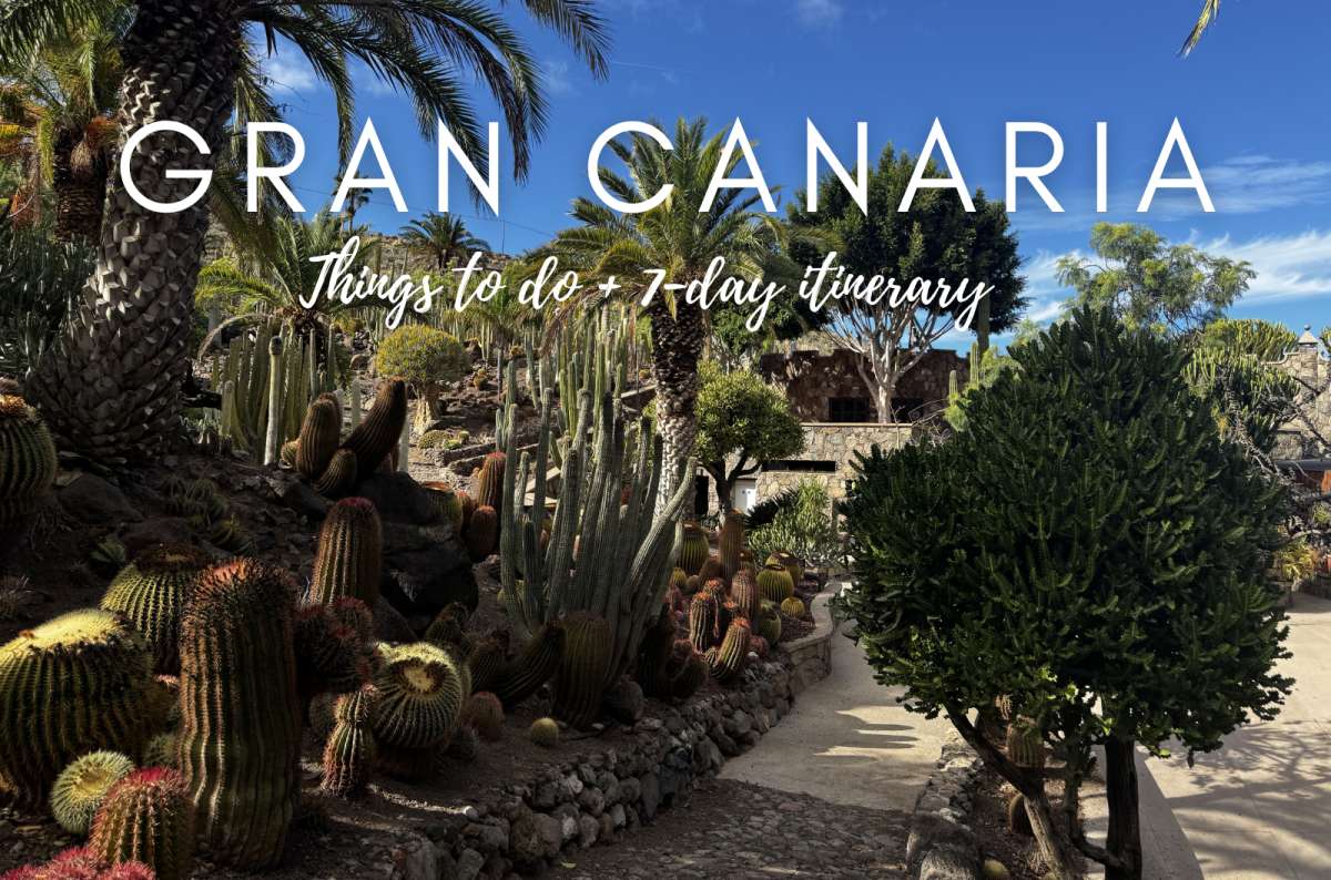
Europe's largest cactus garden was not on my radar, and it absolutely should have been @ Cactualdea
Quick facts
I did not expect one of Europe’s biggest cactus gardens to become one of my favorite random stops in Gran Canaria.
The Cactualdea cactus garden felt like what happens when someone takes a normal cactus, feeds it Miracle-Gro, and lets it grow into a monster cactus… and there are tons of them. They are huge, and they are everywhere, and the mountains in the background just gave it all a really cool desert vibe that made me feel relaxed after stressful mountain driving.
It's a great stop while touring the West Coast, but not one I’d drive across the island solely to see.
Good to know: This was a surprisingly relaxing stop from the Gran Canaria hiking routes. I really enjoyed it. However, be prepared for a lack of information about the cacti.
Price: Adults: USD 11, EUR 9.50; Children: USD 6, EUR 5
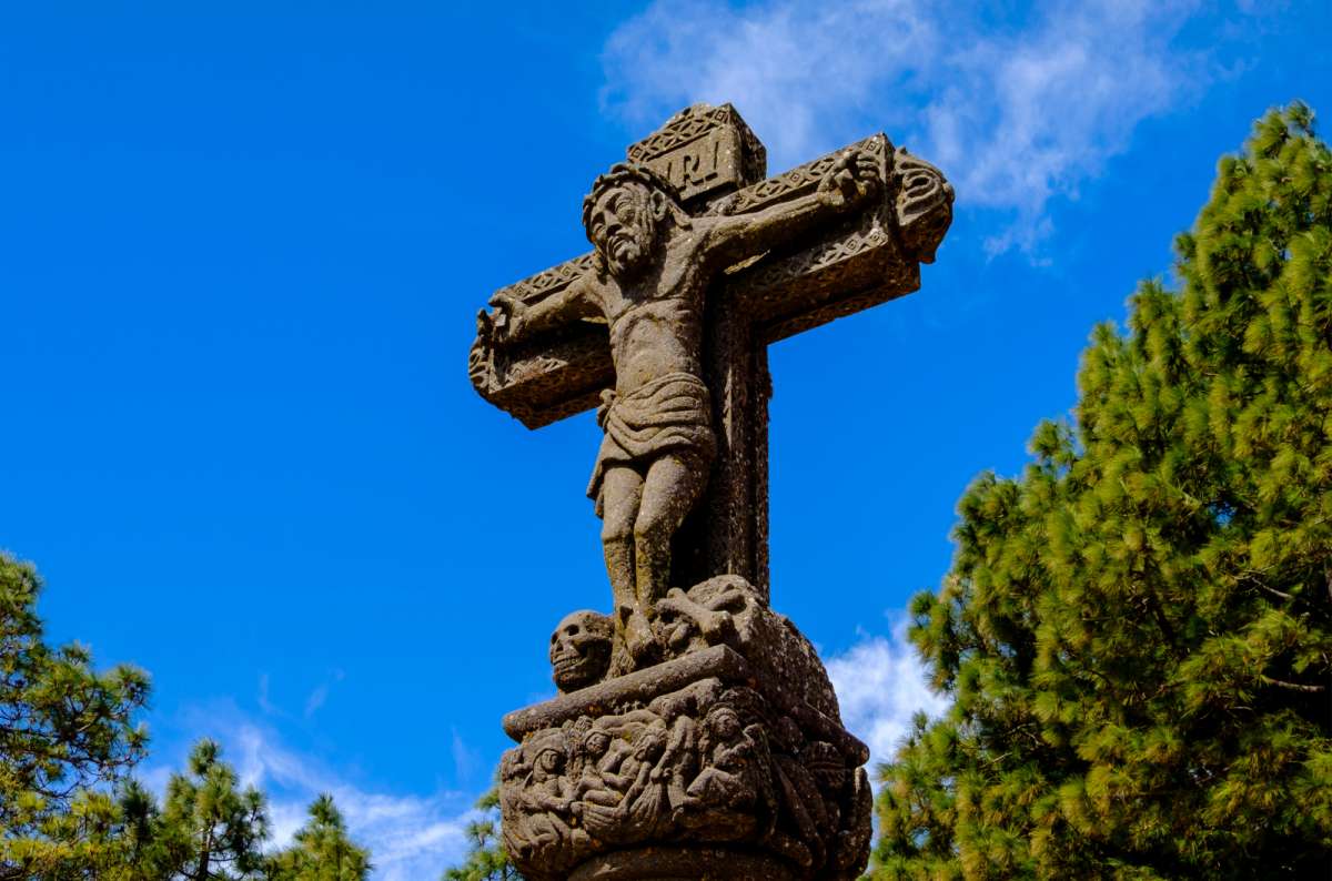
Step out of the car, look around, and pretend you earned it @ Cruz de Tejeda
Quick facts
Not a proper hike, but one of the best views for almost zero effort on the island. A no-brainer in my book.
I loved Tejeda. The little white houses seem to hang off the sides of the mountains, and the whole village has a really dramatic look to it. From there, I drove up to Cruz de Tejeda, about 500 meters (1,640 ft) higher, for incredible views of Roque Bentayga and Roque Nublo.
This is one of those Gran Canaria trail stops where you basically step out of the car, look around, and pretend you earned the view. And honestly, sometimes that's exactly the kind of hike I need.
What makes this stop special is that you get some of the best mountain scenery in Gran Canaria without having to hike anywhere. The combination of Tejeda's dramatic setting and the panoramic views from Cruz de Tejeda makes it one of the easiest ways to experience the island's interior.
Good to know: Perfect stop between the Roque Nublo hike and Pico de las Nieves. Parking can be a nightmare in both Tejeda and Cruz de Tejeda, so later in the day is usually a better bet—and the light is nicer too.
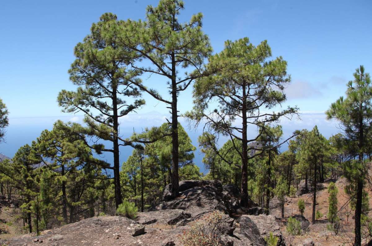
I can smell the trees to this day @ Tamadaba Natural Park
Quick facts
This is where Gran Canaria suddenly turns into a giant pine forest. I can still smell it while I type this.
I did the Llanos de la Mimbre Loop in Tamadaba hiking, a short 3 km (1.9 mi) circular walk through ancient Canary pine forest that suddenly opens to the coast. It’s very pretty, and it’s supposed to be an easy hike. I thought so, too, yet somehow my knees strongly disagreed.
If you've already done Roque Nublo, Pico de las Nieves, and some of the volcanic viewpoints, Tamadaba is a great change of pace. It feels less exposed, quieter, and much greener than most of the island's
Good to know: Some of the hikes there have sheer drops and no guardrails in places. It’s smart to stay on marked trails, and I would avoid windy or rainy weather near cliff edges unless you enjoy testing your life insurance policy.
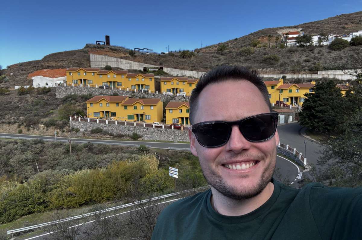
Bright yellow houses stacked on a hillside with mountain roads going in every direction, worth a stop every time @ Artenara
Absolutely yes. Gran Canaria is one of the best hiking islands in the Canary Islands because the scenery changes constantly. One hour you’re walking through dunes, then volcanic craters, then pine forests, then giant canyons that look like the American Southwest, and then boom, there’s the Atlantic Ocean.
The best hikes in Gran Canaria are also surprisingly accessible. You don’t need to be completely in shape or some ultra-hiker carrying twelve protein bars. Many of the mountain hikes are manageable for normal travelers if you plan properly.
Just don’t underestimate the island. The roads are slow, the weather changes quickly, parking fills up, and the mountains are much colder than the beaches.
But honestly? That’s part of why Gran Canaria hiking is so good. The island constantly surprises you. Book that ticket today and thank me later!
This post contains affiliate links. If you make a booking through one of my links, I may earn a small commission—at no additional cost to you. Thank you for your support!
At a glance: The best Gran Canaria hikes ranked
How much time do you need to explore the best hikes in Gran Canaria?
Suggested Gran Canaria Hiking Itinerary
Where to stay for Gran Canaria hiking
Quick tips for hiking Gran Canaria
4. Roque Bentayga hike/viewpoint walk
6. GC-210/Mirador del Molino viewpoint walk
9. Mirador de los Marteles/caldera Walk
10. Agaete natural pools and Playa de las Nieves coastal walk
11. Cactualdea cactus garden walk
12. Tejeda/Cruz de Tejeda viewpoint walk


Hi, I’m Jan. I travel fast and intensely, whether I’m exploring the buzz of Tokyo in 3 days or road-tripping through mountains and beaches on a 3-week Thailand adventure. And no matter where I am, you’ll always find me in a comfortable hotel at night and eating the best food.
If that sounds like your kind of journey, hop on board, and let’s explore the world together!
I started this blog after realizing how tough it can be to find reliable, authentic travel info. You wouldn’t believe how many “travel bloggers” never even visit the places they write about! On Next Level of Travel, you can count on my full honesty and insights drawn from my firsthand experiences.
Here’s the deal: not every destination is all superlatives and unicorns. I’ll let you know if a tourist attraction isn’t worth your time, like skipping overrated stops in my 2-week Spain itinerary. And when I find something truly special—like the perfect mix of culture and nature in Cape Town—you can trust that it’s worth adding to your itinerary.

Comments | Thoughts? Give us a shout!