


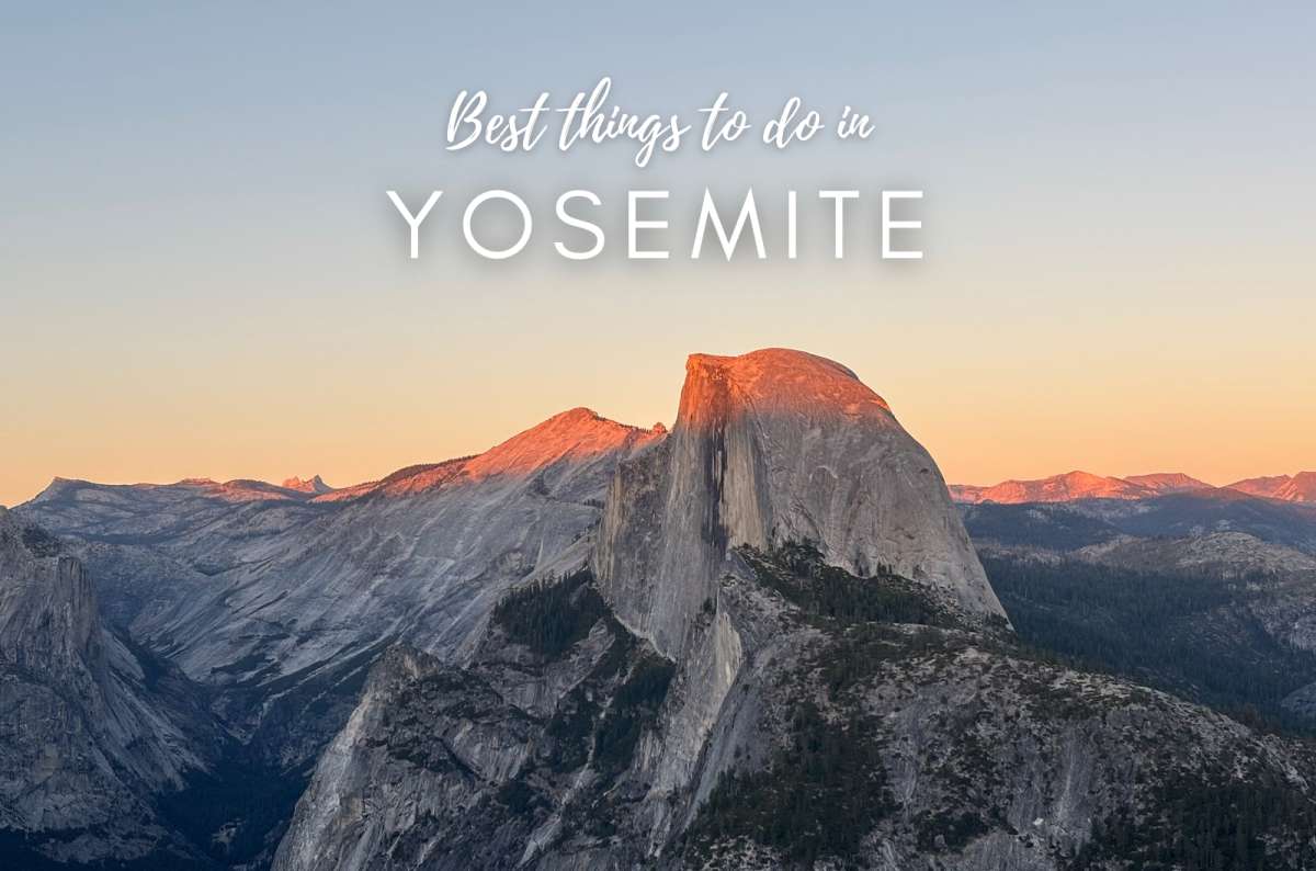


The best things to do in Yosemite are a difficult list for me to write. I’ve visited four times, and it’s hands down my favorite national park, my favorite place in California, and firmly in my top three places anywhere in the world. Something near the bottom of this list would be the main attraction somewhere else.
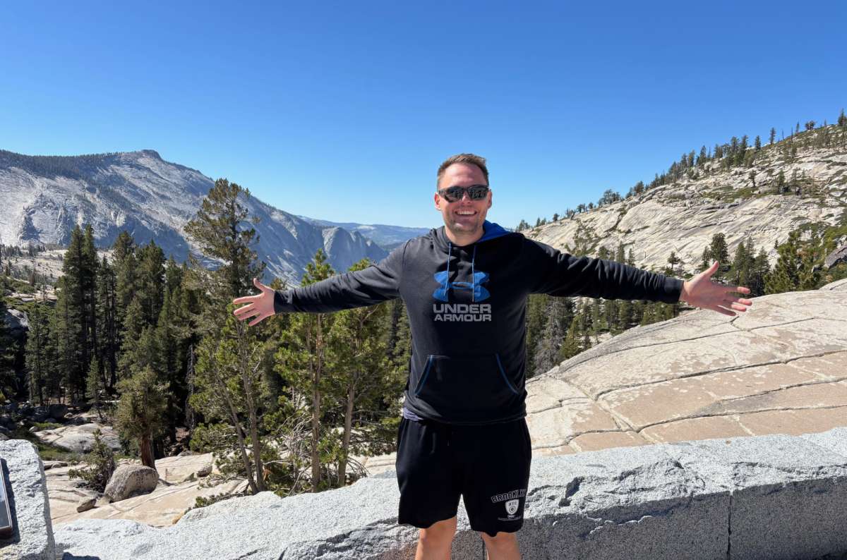
My biggest advice: combine short hikes and viewpoints before committing an entire day to one summit. I didn’t discover Sentinel Dome, Taft Point, and Olmsted Point until my fourth visit. Clearly, enthusiasm isn’t the same as good planning.
The Valley had me immediately. The high country took longer: with each visit, I loved its rounded granite slopes, pines, lakes, and meadows a little more. Across nearly 1,200 square miles (3,100 km²), trying to see everything means spending too long behind a windshield.
These are the things to do in Yosemite National Park I’d prioritize, with a short route and the costs, parking, and seasonal catches that affect your choices. The ranking reflects my preferences; the itinerary follows geography.
Even Krteček made it to Tenaya Lake. Four visits to Yosemite, and I'm still finding reasons to come back
How many days in Yosemite? I’d allow three full days: Valley, Glacier Point Road, and high country. Here’s my priority order, rather than a list sorted mechanically by scores.
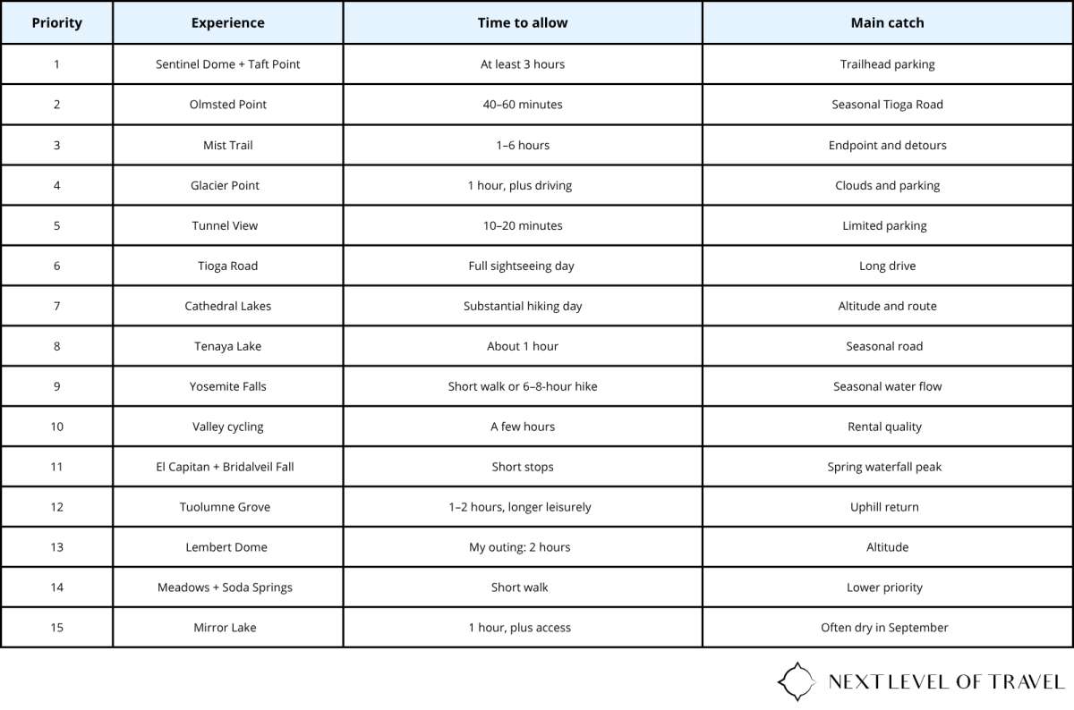
Things to do in Yosemite without hiking: Tunnel View, El Capitan, Tioga Road, and Glacier Point’s short paved approach. Things to do in Yosemite with kids: lower waterfall walks, a suitable bike ride, Tenaya Lake, ranger programs, or Mirror Lake. The wet Mist Trail steps and Taft Point’s exposed edges need much closer attention.
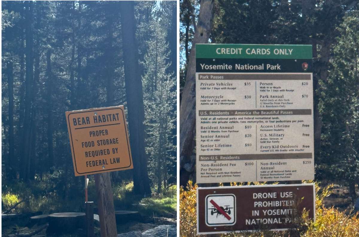
Yosemite National Park has rules for everything from entrance fees to food storage. The bears don't care how much you paid to get in
Is the America the Beautiful Pass Worth it?
The standard vehicle fee is USD 35 for seven consecutive days. Non-US residents aged 16+ also pay USD 100 each, unless covered by an eligible pass. The America the Beautiful annual pass costs USD 250 for nonresidents, or USD 80 for US citizens and residents.
For two international adults in one car, that’s USD 235 for one visit, versus USD 250 for the nonresident annual pass. I’d choose the pass if another covered national park were on my route; the difference is only USD 15.
The listed sights have no separate standard attraction tickets; rentals and tours cost extra. There is no timed entrance reservation requirement in 2026, but camping, accommodation, and Half Dome permits are separate. Recheck the policy for your travel year.
Three days in Yosemite sounds generous until you realize how much there is to see. This is why I keep coming back
This assumes a car and open Glacier Point and Tioga roads. Hotel-to-park driving comes on top; pack lunch. If you're renting a car for Yosemite, compare rental options on DiscoverCars before your trip. Having your own car makes reaching the trailheads and viewpoints much easier, especially when you're covering both the Valley and the high country.
Day 1 — Valley: arrive at Curry Village early for the Mist Trail to the Vernal Fall footbridge or top of Vernal Fall. Spend the afternoon around Lower Yosemite Fall, cycling or walking the Valley, and El Capitan. Fit Tunnel View into your arrival or departure, ideally in afternoon light. Continue to Nevada Fall? Cut the afternoon bike ride.
Day 2 — Glacier Point Road: park early at the Sentinel Dome/Taft Point trailhead and allow at least three hours for both viewpoints. Continue by car to Glacier Point for afternoon or sunset views. If Taft Point sunset is your goal instead, visit Glacier Point first, accept the later trailhead parking risk, and bring a headlamp.
Day 3 — Tioga Road: Olmsted Point, Tenaya Lake, then choose Lembert Dome or the easier meadow walk. Tuolumne Grove can replace the summit if sequoias matter more to you. Cathedral Lakes needs a hiking day with only brief roadside stops, rather than being added to this whole schedule. Continue over Tioga Pass only if your onward route heads east.
Yosemite in one day: stay in the Valley, combining the viewpoints and lower falls with either a short Mist Trail outing or cycling. Yosemite in 2 days: add Day 2. When seasonal roads are closed, replace the drive-up/high-country days with open Valley walks and ranger activities, following current trail restrictions.
No car? You can take a guided day trip to Yosemite from San Francisco instead. It's a long day, and you won't have the freedom of your own car, but it's a practical option if you want to see Yosemite without driving.
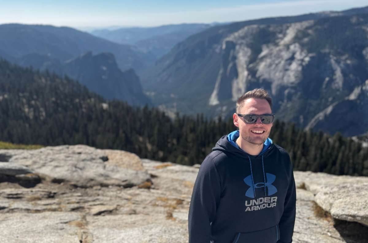
The views around Sentinel Dome and Taft Point are exactly why Yosemite is my favorite national park. Only took me four visits to discover them
I somehow managed three Yosemite visits without doing these two. On visit four, we spent roughly two hours walking and another hour just enjoying the views. After three days in Yosemite, my girlfriend finally understood why I wouldn’t shut up about it. 10/10 for the hike and views, and my first choice for manageable hiking with an enormous reward.
From Sentinel Dome, I loved the broad sweep of granite mountains. At Taft Point, the steep Valley cliffs reminded me of the fjords in Norway, about the only comparison I can make without insulting Yosemite. With Sentinel at 8,122 feet (2,476 m) and Taft around 7,500 feet (2,286 m), there’s plenty of Yosemite beneath you. I’d connect them rather than choose one.
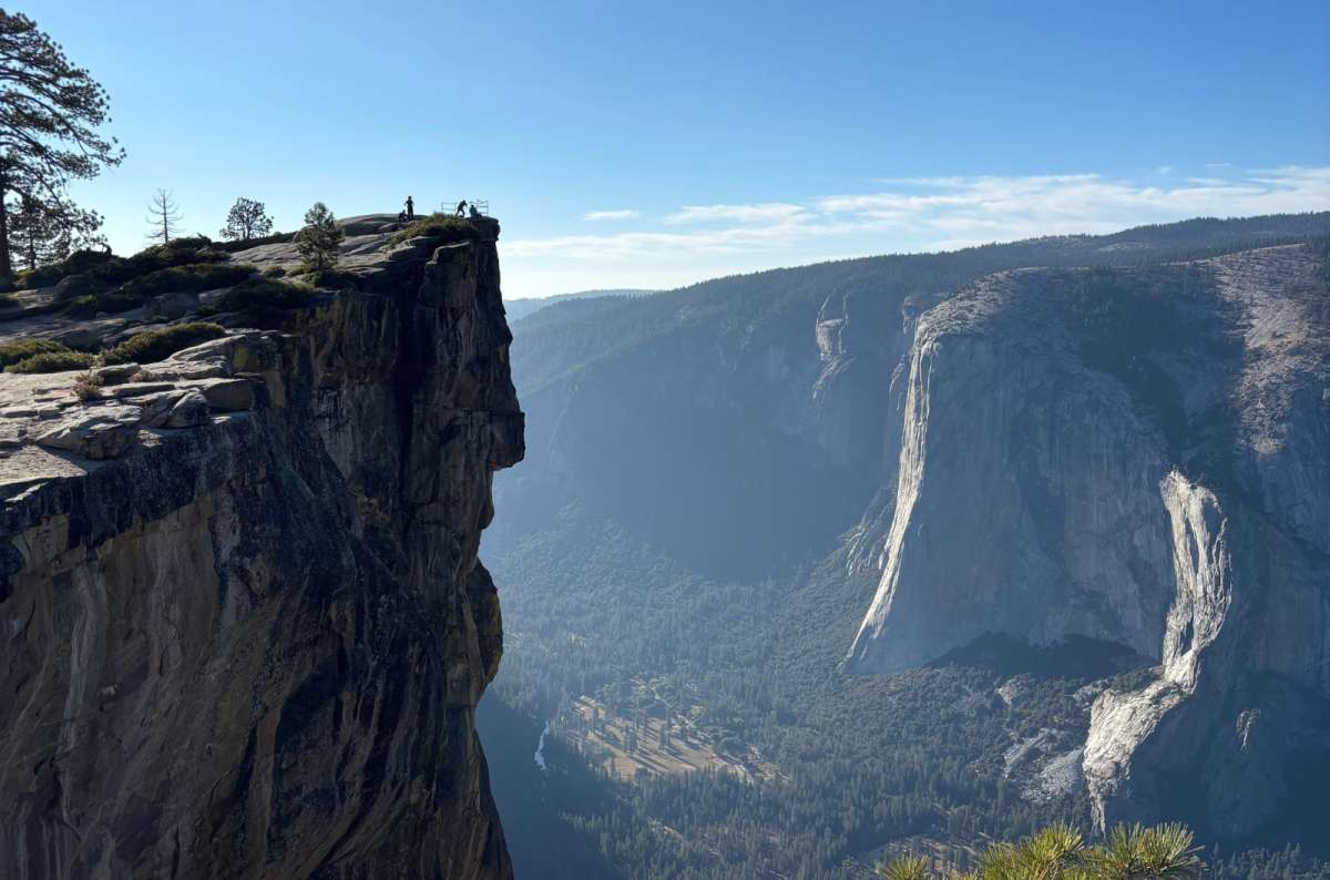
Taft Point is as close as Yosemite gets to a Norwegian fjord view. Except here, you're standing on top of a rather enormous granite cliff
The shared trailhead on Glacier Point Road filled quickly during my visit, so I’d arrive early. Individually, NPS lists Sentinel Dome at 2 miles round trip and Taft Point at 2.2 miles. The combined distance depends on your connecting route; don’t simply add those return distances. The road is seasonal.
Sunset here is my top pick. Bring a headlamp for the return, keep away from cliff edges, and stay off exposed domes during thunderstorms.

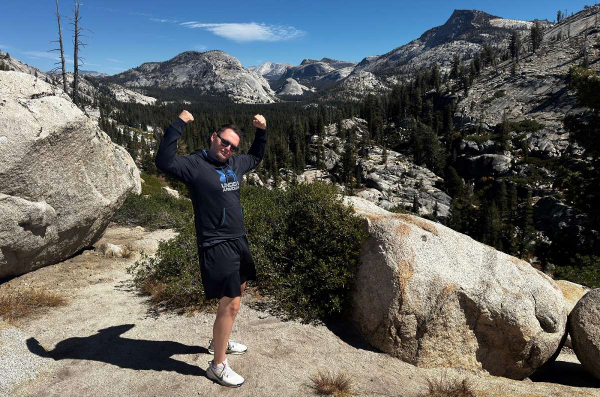
Olmsted Point gave me everything I love about Yosemite in one place: granite, pine trees, and views I couldn't stop photographing
Olmsted was another fourth-visit discovery. I couldn’t take enough pictures: granite is my favorite rock, pines are my favorite trees, and here I behaved like a little child pointing at both. Among the best viewpoints in Yosemite’s high country, it’s my first choice: 11/10.
At about 8,400 feet (2,560 m), I was looking toward Half Dome from the east, the enormous granite slopes around Clouds Rest, and Tenaya Lake. I should have stopped earlier.
Don’t settle for the car park view. From the signed Tioga Road turnout, the established trail runs 0.25 mile each way onto the point, where the landscape opens up. I’d allow 40–60 minutes for walking, photographs, and some staring. Bring a snack; there are worse places to eat it.
Those scattered boulders are glacial erratics left behind by melting glaciers. NPS explains the landscape and access: roadside views are accessible, but the hilly trail isn’t wheelchair accessible. Tioga Road must be open.
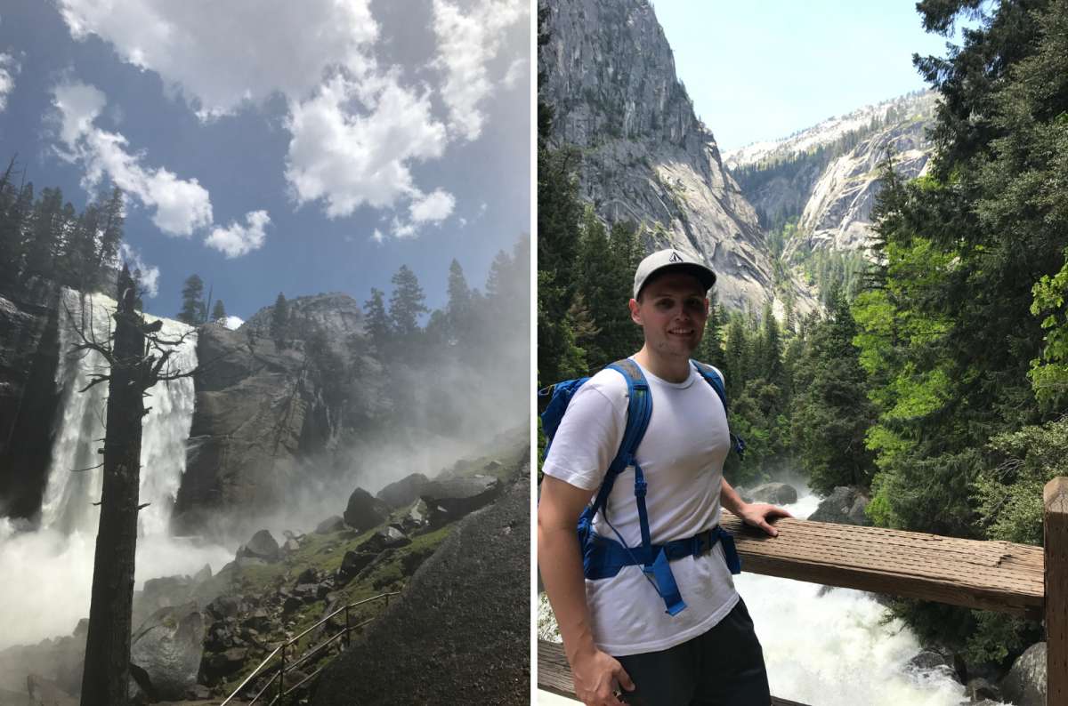
Vernal Fall on the Mist Trail is spectacular when the water is roaring. Just don't expect to reach the top with dry clothes
I’ve hiked here three times, with outings ranging from three hours to eight when continuing farther toward Half Dome. I also proposed to my ex-wife here. So yes, my affection goes beyond “nice waterfall, would recommend.”
What I remember most is how different the falls were between visits: sometimes much weaker, sometimes extraordinary. Vernal drops 317 feet (97 m) and Nevada 594 feet (181 m), and in early summer the water makes those heights count. I almost always ended up soaking wet: fine when warm, considerably less enjoyable when cold. Bring a rain layer and shoes with grip.
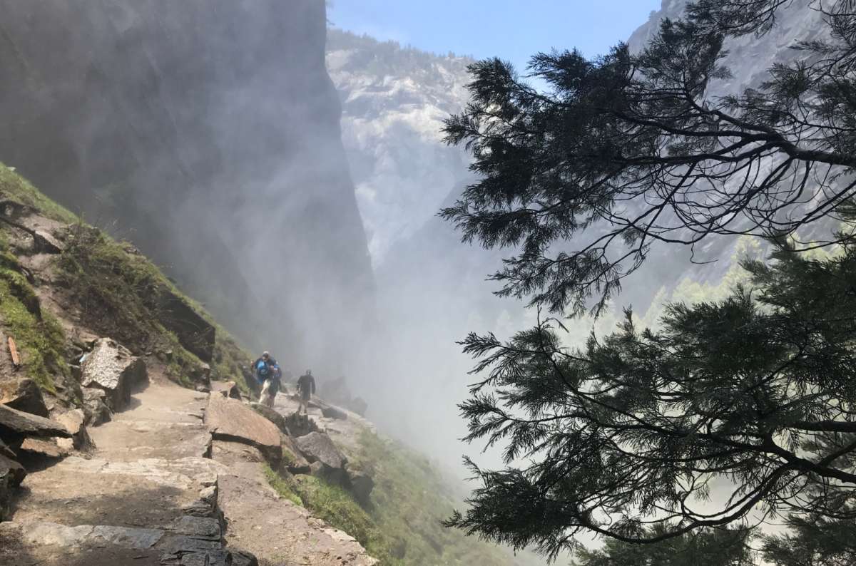
The Mist Trail really lives up to its name when Vernal Fall is flowing strongly. Waterproof clothing is less optional than you might think
I’d choose the endpoint before setting off. These NPS figures start at Happy Isles:
Park at Curry Village early; walking or shuttling to Happy Isles adds time. There’s no trailhead parking.
2026 repairs: July 27 through October, subject to change, the section above the footbridge to Vernal’s top normally closes Monday–Thursday, 7 am–3:30 pm; use the John Muir detour. Check the official page before visiting. Stay out of the river and behind barriers.
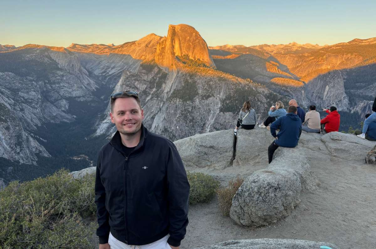
Half Dome at sunset from Glacier Point. I've seen this view three times, and somehow it still gets me every time
I’ve been to Glacier Point three times, including a ranger stargazing experience, and I still get mesmerized by the granite hills of the High Sierra. Late afternoon and dusk are my favorites: the light across Half Dome changes from orange to pink until the whole thing looks more like a painting. 11/10, and one of my favorite places anywhere.
I always loved the drop and the tiny cars below. The numbers explain it: 7,214 feet (2,199 m) above sea level, and 3,214 feet (980 m) above Curry Village.
It’s one of the easiest things to do in Yosemite for elevated views, with a short paved, wheelchair-accessible approach from parking. The hour-long drive from the Valley still amuses me: the lookout sits directly above the Valley. I’d allow another hour there and a 30-minute parking buffer in busy periods, based on my visits.
One visit brought bad weather. If clouds hide the view, I’d skip that drive. The road is seasonal; there’s no regular free Valley–Glacier Point shuttle. Paid tours are separate.
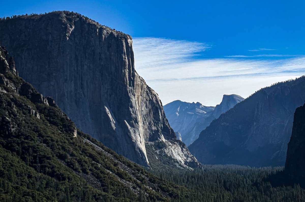
Tunnel View is probably Yosemite's most famous photo stop, and for once, I completely understand the hype
Tunnel View is one of the simplest things to do in Yosemite, and I’d find it almost impossible to skip. El Capitan on one side, Bridalveil Fall on the other, Half Dome farther away: this is my favorite way to capture the whole Valley. An easy 10/10.
I’d choose afternoon, with the sun behind me, and allow 10–20 minutes. The overlook is beside Wawona Road at the Valley end of the tunnel. Limited parking can turn the quick photo stop into a wait; use legal spaces and watch traffic crossing between parking and viewpoint.
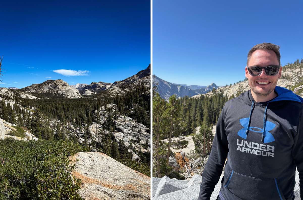
Tioga Road is the Yosemite I didn't appreciate enough on my first visits. Turns out five hours behind the wheel can actually be worth it
For things to do in Yosemite beyond the Valley, I’d start here. On each visit, the high country grew on me a little more. I’d drive east from the Valley for the more dramatic views.
The price of all that scenery is time behind the wheel. I’ve spent around five hours driving during a twelve-hour high-country day. The scenic stretch from Crane Flat to Tioga Pass alone is 47 miles (76 km), before your journey from the Valley or hotel. That’s why my Tioga Road stops would be Olmsted Point, Tenaya Lake, and one main hike or meadow walk.
Tioga Pass was the first place where I went above 3,000 m. It reaches 9,945 feet (3,031 m) at the entrance station: 8/10 for me. Even with that personal connection, I wouldn’t add the drive unless continuing toward Lee Vining, Mono Lake, or Death Valley.
Take food, water, a jacket, and downloaded directions. Check road conditions; seasonal closure cuts off these drive-up stops, and high-country services are limited.
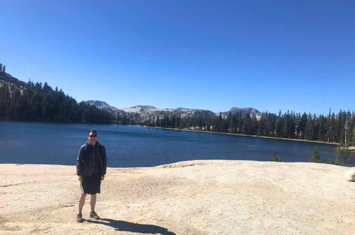
Cathedral Lakes made up for the rather uneventful forest hike. This is the part I'd happily spend another hour enjoying
Much of the approach was forest, which didn’t excite me. Then came the lake and granite scenery, and suddenly it was my favorite longer hike along Tioga Road: 9/10. We brought picnic food and snacks, and I’d do the same again rather than hurry back once reaching the reward.
I could feel the altitude, although having a slight fever hardly helped.
For planning, NPS lists Upper Cathedral Lake from Tuolumne Meadows Visitor Center at 7.6 miles round trip, 1,000 feet of gain, and 6–7 hours. Lower Lake uses a spur; your endpoint changes the route. Use current signed trailhead access.
I’d give this its own hiking day. If I wanted several high-country stops with less walking, I’d choose Olmsted and Tenaya instead.
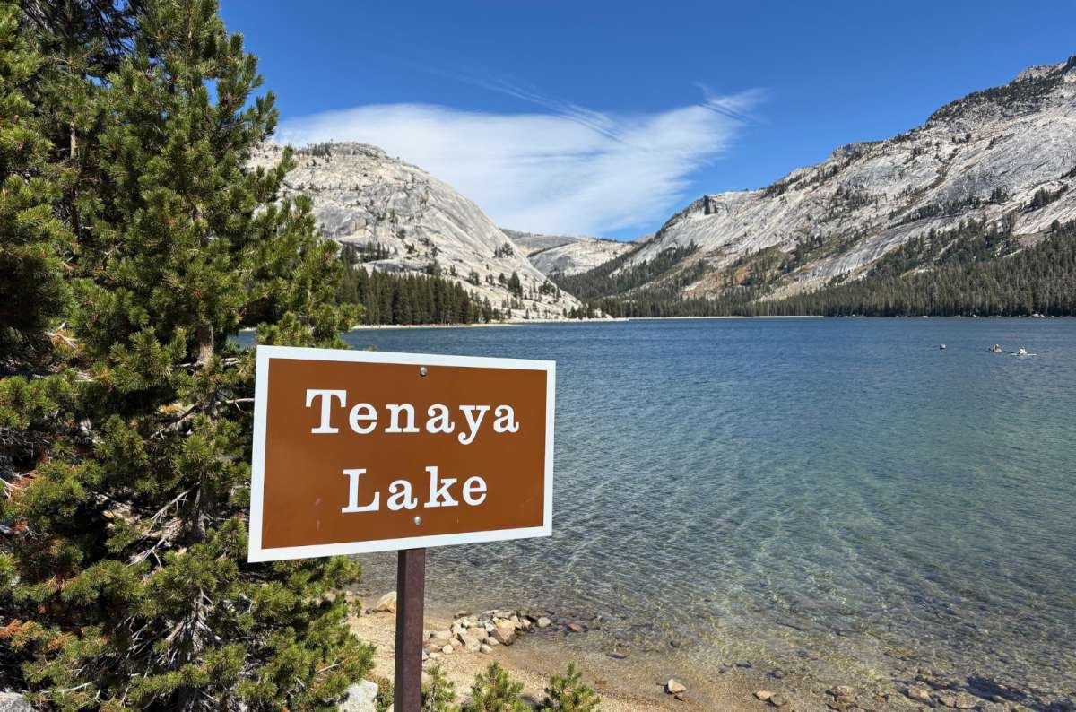
Tenaya Lake is one of those Yosemite stops that requires almost no effort for an absurdly good view. I should have spent more time here years ago
On earlier visits, I had long hikes in mind and didn’t give Tenaya enough time. That was a mistake. Clear water, granite peaks, very little effort: an absolute world-class stop and 10/10.
The lake sits at 8,150 feet (2,484 m) and is Yosemite’s largest frontcountry lake. I spent less than an hour on my walk around it, but much of the walking was forested. My favorite views were from the southwest shore; the eastern shores were quieter during my visit. Next time, I’d happily spend more of that hour enjoying the shore and a picnic.
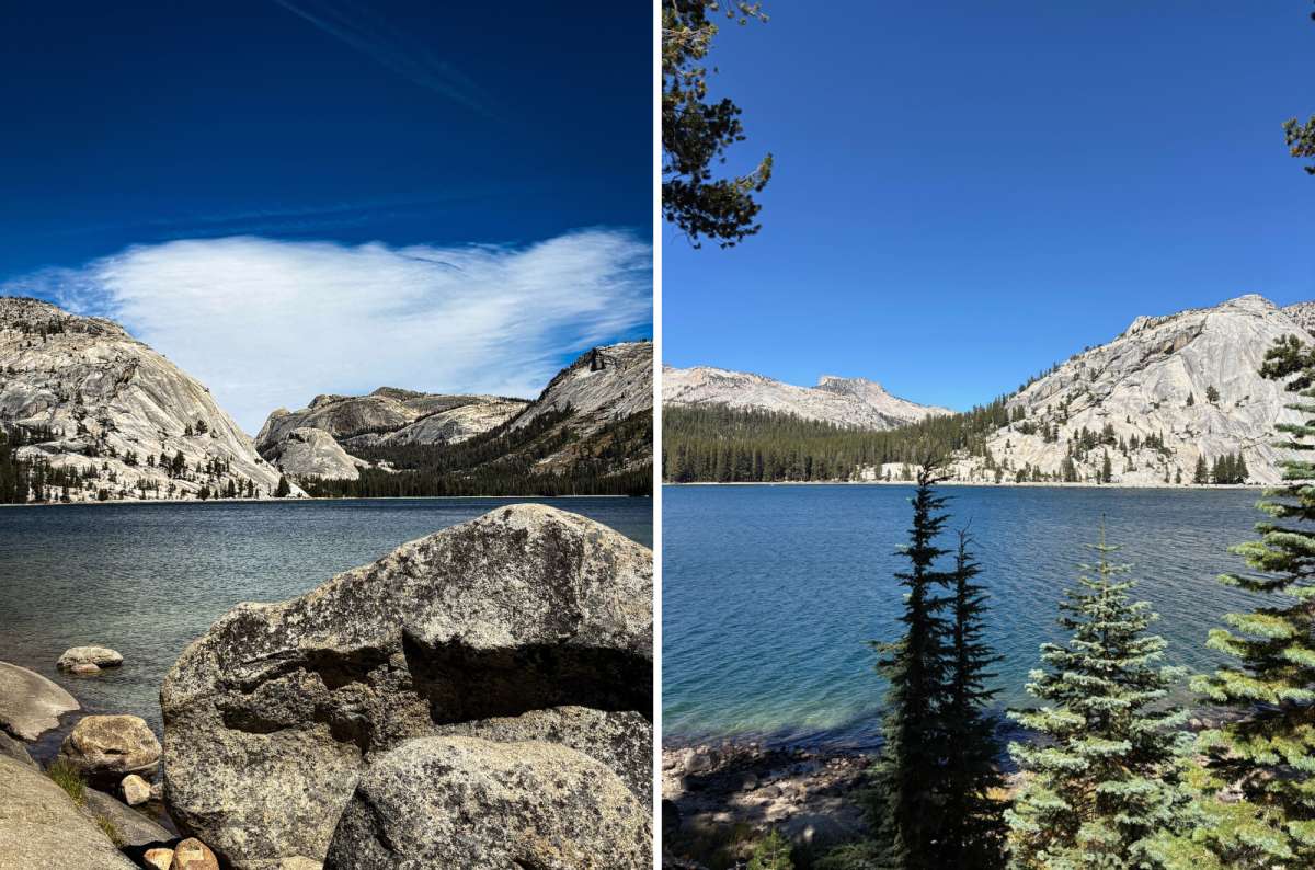
Two sides of Tenaya Lake, and neither requires a summit hike. I'd take a picnic on the shore over another hour in the forest
Coming from the Valley, don’t queue automatically at the first lot. Several signed parking areas give you other options. The east end has accessible parking and a paved viewing path.
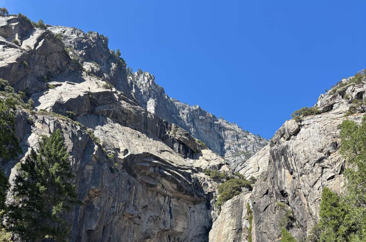
Even without a dramatic waterfall, Yosemite's granite walls are worth looking up at. Yosemite Falls is just much better when there's actually water
My one spring visit brought impressive water; on three others, I saw dry falls. Even dry, I found the rock face spectacular: 10/10 in spring and 8–9/10 in late summer.
At 2,425 feet (739 m), the total drop is enormous. It isn’t one uninterrupted fall: Upper Fall contributes 1,430 feet, the middle cascades 675 feet, and Lower Fall 320 feet.
With limited time, I’d start with the lower loop, about 1 mile, with an accessible eastern approach. That leaves hours for other Yosemite attractions.
For a day built around climbing, the upper hike is 7.2 miles round trip, 2,700 feet of gain, and 6–8 hours. Use Yosemite Falls parking across from Camp 4; Camp 4’s lot is for campers. Spring favors waterfall drama; late summer can mean little or no water.
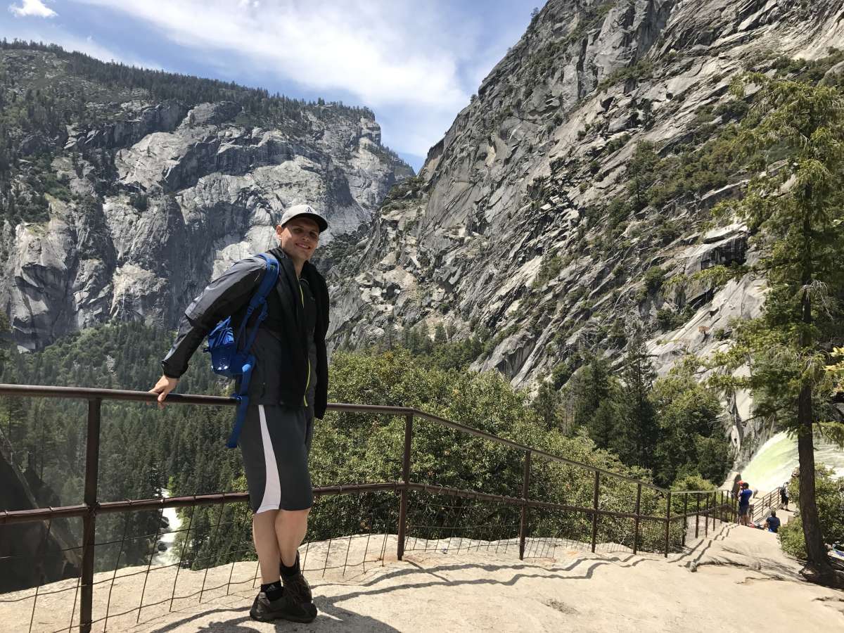
Yosemite Valley is surrounded by enormous granite cliffs, and the views are even better when you get out of the car. I'd rather explore at my own pace than spend the day driving between stops
I always find the Valley floor magical: from below, I can appreciate all those cliffs surrounding me. We rented bikes to explore it, and even though I’m not much of a cyclist, I still think that was the right idea. Driving between everything feels inappropriate; walking it all eats up the day.
The Valley is roughly 7 miles (11 km) long, with 12 miles (19 km) of designated paved bike paths. Unfortunately, our bikes were trash. If you sold them, I’m not convinced they’d be worth the day’s rental. With a decent bike: 10/10. With the bikes we had: 2/10.
The operator’s 2026 standard rentals cost USD 48 for a full day or USD 36.50 for a half day, at Yosemite Valley Lodge, Curry Village, and Yosemite Village. Seasonal, first come, first served. I’d bring my own if practical, or inspect the rental before paying. Ride designated paths; hiking trails aren’t bike trails.
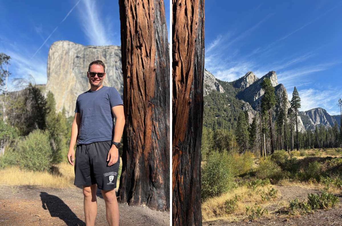
El Capitan looks massive even from a distance. Now imagine trying to spot someone climbing that 3,000-foot wall
My girlfriend absolutely adored El Capitan and kept talking about it. I can hardly blame her: the vertical face rises around 3,000 feet (914 m) above the Valley floor. As a sight, it’s an easy 10/10 for me.
We enjoyed listening to a ranger explain the climbing. Trying to spot climbers on that wall puts its size into perspective; it’s unbelievable that people actually do it. El Capitan Meadow gives you a good view. Use legal roadside parking and established paths. Hiking routes to the summit exist elsewhere; this is the vertical climbing wall you’re admiring.
Bridalveil hasn’t impressed me as consistently. Apart from one wetter visit, it usually had less water than I’d hoped. Its 620-foot (189 m) drop normally flows year-round, strongest in spring. I’d take the short walk from its signed parking area when conditions suit, but prioritize El Capitan if time were tight.
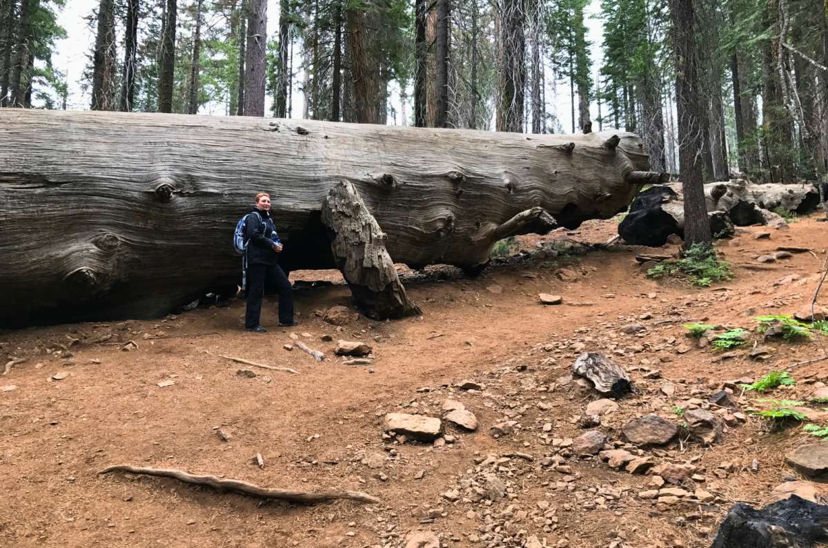
A fallen giant in Yosemite gives you a much better idea of the scale of these trees. Standing next to one certainly helps
Tuolumne was where I first saw giant sequoias, so it has a special place in my heart. I’ve visited three times and give it 8/10. Near Crane Flat, it also fits neatly into the western end of a Tioga day.
The downhill start is deceptive: the 2.5-mile round trip finishes with 500 feet of climbing back out. I’ve generally allowed 1–2 hours, longer for lingering among the roughly two dozen mature giant sequoias. Parking is limited; bring water, as none is available in the grove.
I’d include it if giant trees were new to me, but skip the duplication if Sequoia National Park were already on my trip. Mariposa Grove is the larger alternative near the South Entrance, with over 500 mature giant sequoias and a seasonal shuttle. My firsthand experience is Tuolumne; choose whichever fits your route.
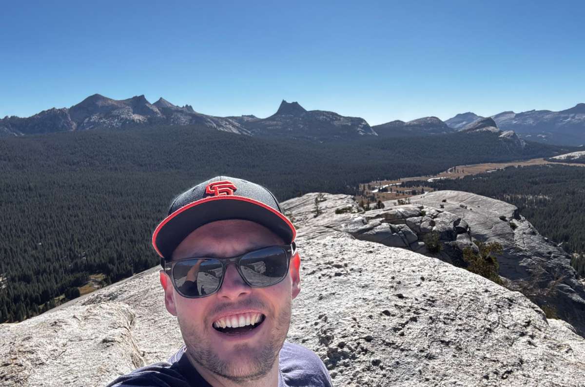
Lembert Dome is a classic case of a hike I liked less than the destination. The summit views did a very good job of changing my mood
Most of my walk was forest without much to look at. Then I reached the dome and got those spectacular views across Tuolumne Meadows and the granite peaks. That’s why my ratings are so different: 5/10 for the hike, 11/10 for the views, 8/10 overall.
I could feel the altitude, roughly 2,900 m (9,500 feet) at the summit. My outing took around two hours, including 45 minutes heading up with photo stops. The final granite section was steeper and needed attention.
Choose your exact route: NPS’s Dog Lake + Lembert combination is 3.8 miles, 850 feet of gain, and 3–4 hours; it isn’t interchangeable with my shorter outing. Stay off domes during thunderstorms. For one substantial high-country hike, I’d choose Cathedral Lakes first.
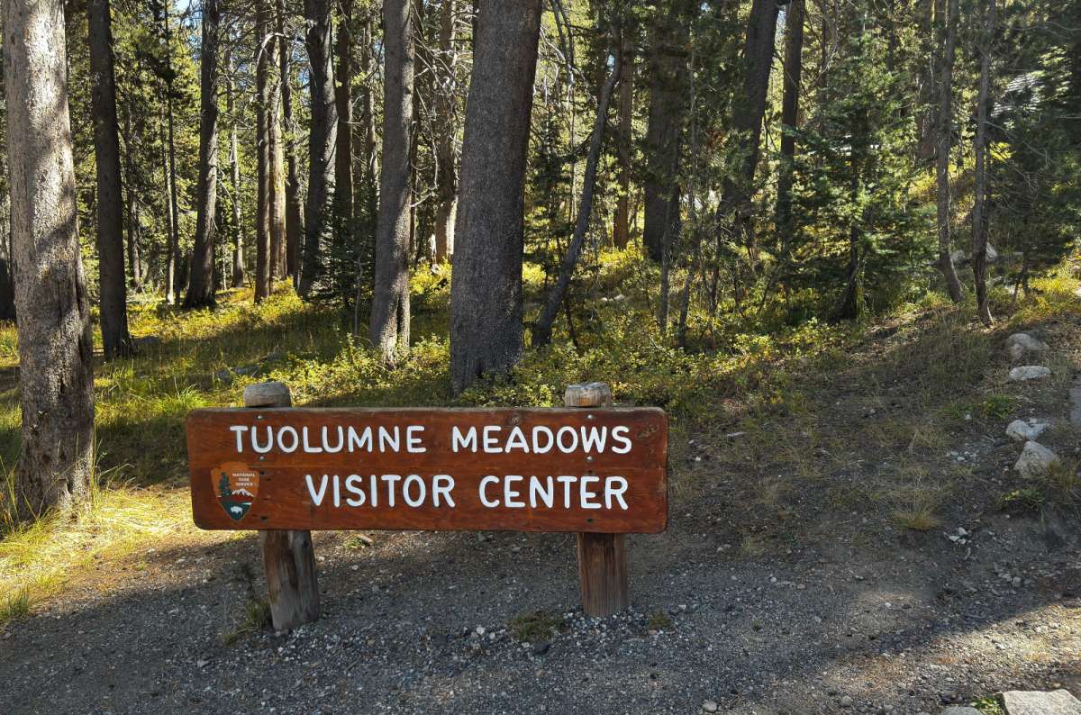
Tuolumne Meadows Visitor Center is a useful stop before exploring Yosemite's high country. I'd ask about trail conditions here before heading out
I loved these open meadows from my first visit. They felt tranquil and completely different from the enclosed Valley. The elevation changes too: about 8,575 feet (2,614 m) here versus 4,000 feet (1,219 m) on the Valley floor. I’d bring a layer rather than expect the same climate.
The Soda Springs and Parsons Lodge walk is 1.4 miles round trip, mostly flat, with cold carbonated water bubbling from the ground. 7/10 for me: pleasant, but I’d spend time on other high-country hikes first. After seeing the meadows from Lembert, I wouldn’t insist on adding it. Stay on established paths.
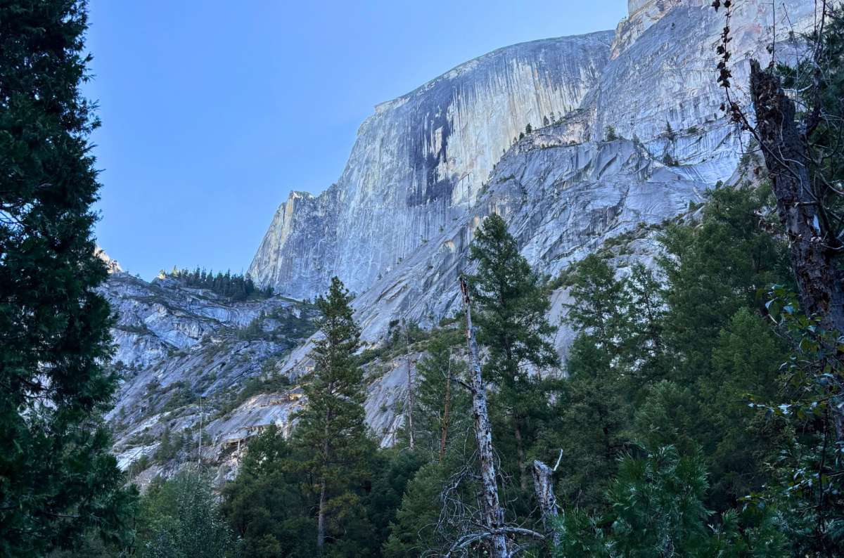
Mirror Lake had no water when I visited in September, which rather defeats the point of calling it a lake. The surrounding granite scenery was still worth the walk
I’ve been twice and give it 8/10, but it remains low on my priorities. There are good views below Half Dome; I simply think other Yosemite attractions are stronger on a short trip.
On my September visit, there wasn’t any water. A relevant detail for something called a lake. I’d favor spring or early summer for reflections; in late summer it often becomes meadow.
For a gentle family walk, I’d consider the shorter outing: 2 miles round trip from the trailhead, around an hour, rather than the full 5-mile loop. Allow access time from Curry Village parking or use the free shuttle to stop 17. The first paved stretch is easier; don’t assume the complete loop is equally accessible.
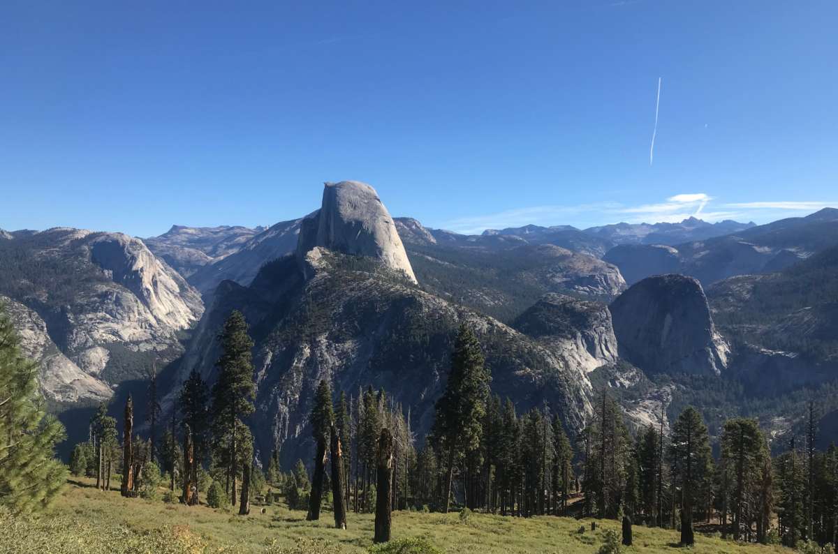
Half Dome is still on my Yosemite hiking list. The 14–16-mile hike and those famous cables deserve a day of their own
Half Dome and Clouds Rest: I haven’t climbed either, so they don’t outrank places I’ve visited repeatedly. Half Dome means 14–16 miles, 4,800 feet of climbing, and usually 10–12 hours, with a permit when the cables are up.
Panorama Trail: I walked part from Glacier Point, almost to Nevada Fall, then returned uphill. That wasn’t the full through-hike; a one-way descent needs a transport plan. Hetch Hetchy and Wawona are lower first-visit priorities for me.
One extra worth checking is a ranger program. I’ve joined several, including stargazing, and found them informative and enjoyable. Ask at a visitor center for the current schedule.
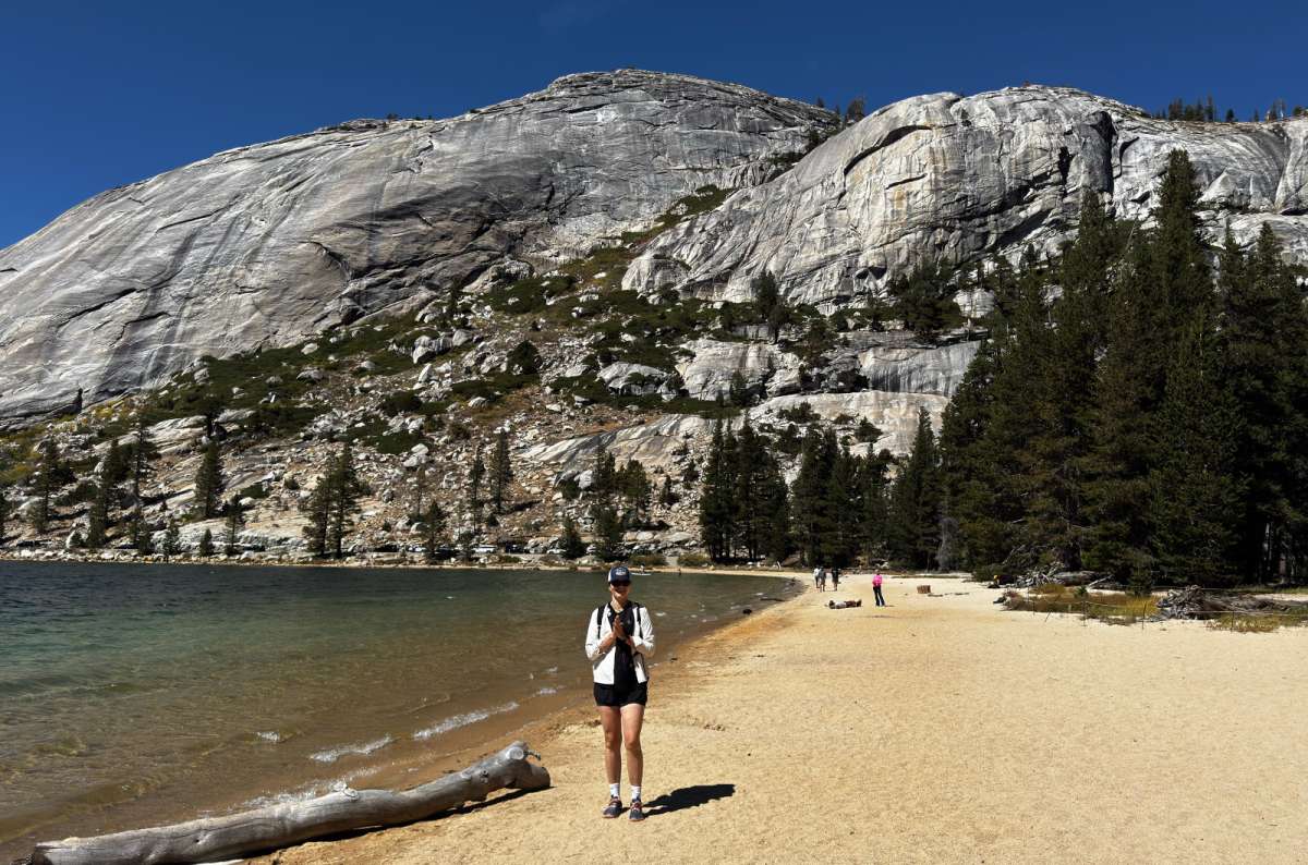
Tenaya Lake is a good reminder of why I'd choose summer or early fall for Yosemite's high country. When Tioga Road closes, this part of the park is a different trip entirely
For me, the best time to visit Yosemite comes down to what I want to see: spring for powerful Valley waterfalls; summer and early fall for the high country, when roads are open. I’d choose places to visit in Yosemite before the dates. My visits often brought 70–85°F (21–29°C) days, but that’s personal experience, not a forecast. Check snow, trail, and wildfire conditions.
I’ve stayed in Merced, Mariposa, and Oakhurst. Oakhurst is my favorite, especially Yosemite Southgate Hotel’s large rooms, parking, and nearby restaurants. Bee’s Bakery Cafe worked for breakfast; Smokehouse 41 had good food, despite a fast-food atmosphere.
Near the South Entrance doesn’t mean near Yosemite Valley. Compare your actual hotel-to-trailhead drive with Mariposa or El Portal before booking.
Arrive early, favor weekdays, and use the free Valley shuttle instead of moving your car constantly. Other buses may charge. Download directions before losing signal. Secure food, use bear-resistant bins, and respect speed limits: the red-bear signs mark places where vehicles killed bears.
This post contains affiliate links. I earn a small commission if you make bookings through my links, at no additional cost to you. Thank you for your support!
The best things to do in Yosemite at a glance
Entry costs and reservations in 2026
My short 3-day Yosemite itinerary
1. Hike to Sentinel Dome and Taft Point
3. Get soaked on the Mist Trail to Vernal and Nevada Falls
4. Enjoy Glacier Point sunset and stargazing
6. Drive Tioga Road for a different Yosemite
7. Make Cathedral Lakes your main high-country hike
8. Take a lakeside break at Tenaya Lake
9. See Yosemite Falls and decide how much climbing you want
10. Cycle Yosemite Valley and stop driving between every sight
11. Look up at El Capitan and add Bridalveil Fall if it’s flowing well
12. Walk among giant sequoias at Tuolumne Grove
13. Climb Lembert Dome for the summit view
14. Wander Tuolumne Meadows and Soda Springs
15. Visit Mirror Lake when a gentle walk fits the day


Hi, I’m Jan. I travel fast and intensely, whether I’m exploring the buzz of Tokyo in 3 days or road-tripping through mountains and beaches on a 3-week Thailand adventure. And no matter where I am, you’ll always find me in a comfortable hotel at night and eating the best food.
If that sounds like your kind of journey, hop on board, and let’s explore the world together!
I started this blog after realizing how tough it can be to find reliable, authentic travel info. You wouldn’t believe how many “travel bloggers” never even visit the places they write about! On Next Level of Travel, you can count on my full honesty and insights drawn from my firsthand experiences.
Here’s the deal: not every destination is all superlatives and unicorns. I’ll let you know if a tourist attraction isn’t worth your time, like skipping overrated stops in my 2-week Spain itinerary. And when I find something truly special—like the perfect mix of culture and nature in Cape Town—you can trust that it’s worth adding to your itinerary.

Comments | Thoughts? Give us a shout!