




The Best Things to Do in Big Sur at a Glance
Ragged Point and Willow Creek Viewpoints
Redwoods in Pfeiffer Big Sur State Park
Bixby Creek Bridge and Hurricane Point
A Realistic One Day in Big Sur Itinerary
How to Plan Your Big Sur Visit
Before Big Sur: Selected Stops from Los Angeles
The hardest part of choosing things to do in Big Sur is deciding what to leave out. On both occasions I drove this coast, it was a pain to plan the drive. There are too many places worth stopping and a surprisingly limited supply of daylight.
I’ve driven Big Sur northbound twice, most recently in 2026. I visited Pfeiffer Beach in 2014; when I returned in 2026, fire-related closures kept me out. I always felt like I needed more time at the stops and hadn't seen everything worth seeing.
My coast drives usually came toward the end of a California trip, after Yosemite and Death Valley. That is serious competition. Big Sur wasn't automatically the best thing I'd seen, but on returning I honestly didn't recall the coast being so beautiful.
Below are the Big Sur attractions I'd build a visit around, in south-to-north order rather than a personal ranking, plus a selective day plan. I've also included my preferred stops before and after Big Sur: Venice Beach, Getty Villa, Malibu Canyon, elephant seals, Carmel and Monterey. Those are extensions of the coastal journey, not places inside Big Sur.
Read more from my California travel guide.
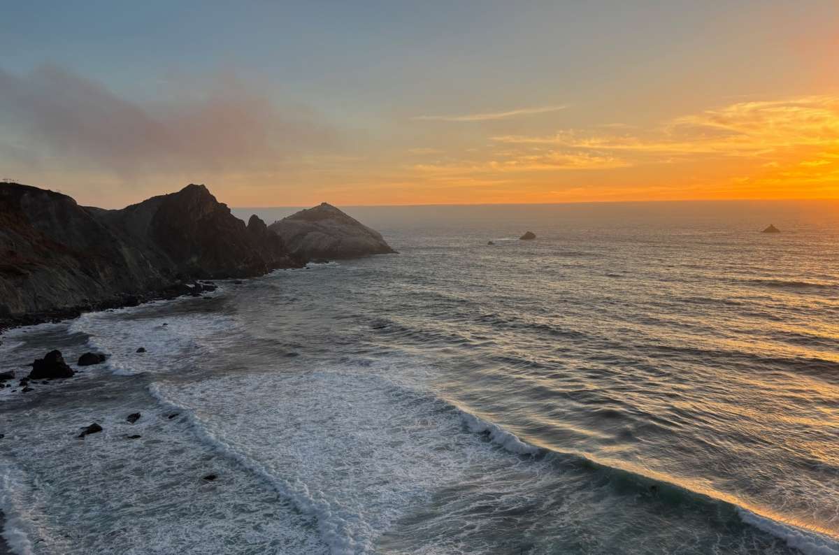
The Big Sur coast at sunset, which is exactly when you realize you planned three stops too many
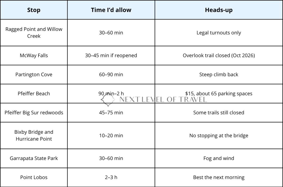
My Big Sur cheat sheet, times exclude driving and include no miracles
Coming from the south, Ragged Point is where the coast starts looking properly dramatic to me. The road climbs surprisingly high above the ocean. Then it's mostly a drive with viewpoints, and this is precisely where I want time available to stop.
On my northbound drives, the farther north I went, the wilder and greener it felt. We were very lucky with the weather: at one point we were driving above the clouds, and I saw one of the most beautiful sunsets I've ever seen. I can't promise you that particular arrangement of clouds, road and sun. I can recommend leaving enough daylight to notice what is outside the car.
I loved the vista point at Willow Creek. After the 2026 Plaskett Fire, the Forest Service listed the Willow Creek Beach day-use area as closed, and the inland Willow Creek road and trail remain closed into 2027, so check the site’s status before counting on it.
The smaller coastal stops matter here. It's easy to devote your entire plan to the famous bridge and waterfall and then rush through the landscape connecting them.
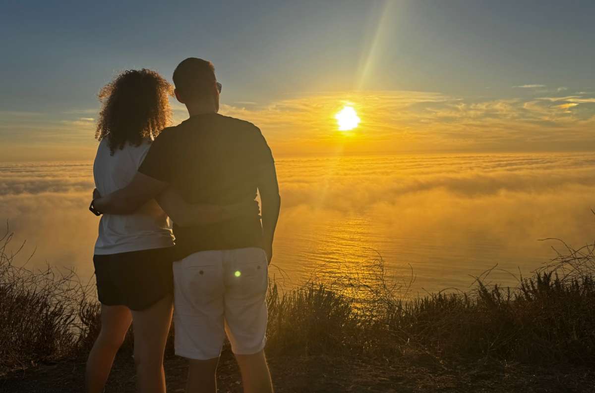
Sunset above the fog in Big Sur, the moment I stopped caring about the itinerary
For these southern Big Sur road trip stops, allow roughly 30–60 minutes of combined viewing time, spread across Ragged Point, Willow Creek, and whichever designated turnouts are safely available. That excludes driving between them. You don't need a long hike to appreciate the coast from above.
Pull completely off the road in permitted areas, and pass a turnout if it is full. Download your maps before setting off; I lost cell service along this coast, and finding the next stop shouldn't depend on a live connection.
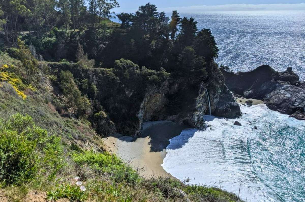
McWay Falls in Big Sur
Along with Bixby Bridge, McWay Falls is one of the most famous things to see in Big Sur. Admit it: this is the reason you want to drive the drive. It was for me the first time.
The familiar view is a waterfall dropping beside a small beach in a steep-sided cove. The practical problem is that the familiar photographs don't tell you whether you can currently reach the viewpoint.
As of October 2026, the McWay Falls Overlook Trail is closed for retaining-wall work. The official trail listing gives its usual length as 0.5 miles round trip, but that isn't an available walk while the closure remains. Check the Julia Pfeiffer Burns Trail status before giving it a fixed place in your day.
Don't descend to the beach or look for an unofficial route around the closure. Roadside stopping also needs to be legal and safe; a gap in traffic isn't a parking space.
If the trail reopens before your visit, allow about 30–45 minutes for a short viewpoint visit, including getting from the parking area. While it is closed, I wouldn't sacrifice another open stop to an uncertain view. McWay is a strong reason to want to visit Big Sur, but it shouldn't be the only reason your itinerary works.
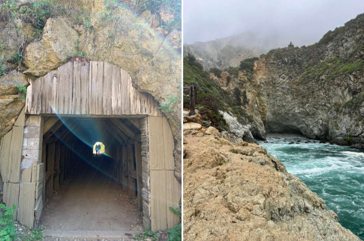
The tunnel at Partington Cove is the fun part; the uphill return is the part nobody photographs
Partington Cove is a useful choice if you want to get below the highway and do an actual walk. The official park description lists a 1-mile round trip, about 1.6 km, descending toward the coast and returning uphill. It was marked open when I checked.
Allow 60–90 minutes for the walk and time to look around. The short distance doesn't remove the climb back to the road. Wear shoes with grip and take water, rather than treating it as a quick step out of the car.
For a limited day, this competes with your forest walk or the Pfeiffer Beach detour. Choose it because you want a coastal walk, not because a list says you need to collect every stop. Stay on the established route; swimming and wading aren't appropriate here.
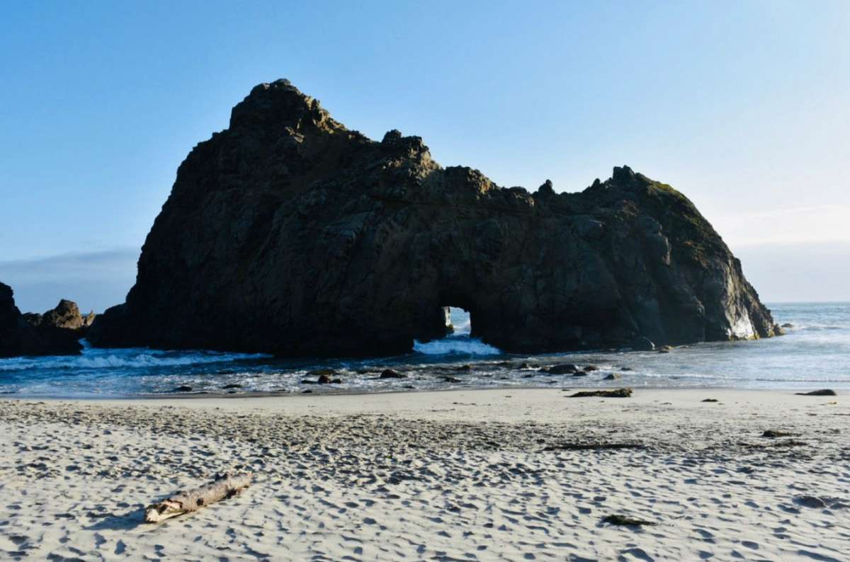
Keyhole Rock at Pfeiffer Beach, worth the narrow road and the parking lottery
I visited Pfeiffer Beach in 2014. On my 2026 trip, it was closed in connection with the fires, so I couldn't revisit it. That was my experience on the trip; the Forest Service currently lists the beach as open.
This is the beach with Keyhole Rock, accessed down Sycamore Canyon Road. It is not the waterfall beach at McWay Falls, and it is not the same place as Pfeiffer Big Sur State Park. The similar names make an unusually effective system for confusing visitors.
Pfeiffer Beach parking takes some planning: the narrow access road is about 2.2 miles / 3.5 km each way, and the lot holds only around 65 vehicles. The current day-use fee is $15, separate from state-park admission. Budget 90 minutes to two hours for the whole detour, rather than just the time on the sand.
Check the Forest Service beach page for access restrictions. The current road order excludes pedestrians and bicycles, so walking down from Highway 1 isn't a fallback when the lot is full. Rain can also interrupt road access.
Go for the rocks, beach, and scenery. Cold water and strong currents make swimming hazardous. If parking or weather consumes your margin, keep your forest stop instead; both are worthwhile options, but their access requirements are very different.
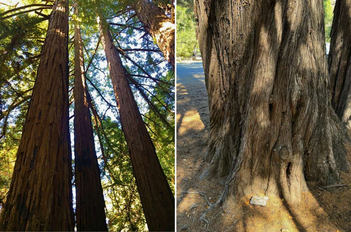
Pfeiffer Big Sur State Park redwoods, built for height rather than the sequoia waistline
The forest gives you a different Big Sur experience from the exposed coast. This is a good place to stop staring across the ocean and spend time under coast redwoods.
These are coast redwoods, rather than the giant sequoias of Sequoia National Park. If your California trip already includes that park, the Big Sur forest still offers a different setting. It also lets you choose a short walk instead of committing several hours to another hike.
For a compact visit, I would allow 45–75 minutes around an open forest route, with extra time if you want lunch or a longer walk. The River Path, Nature Trail, and Redwood Grove Boardwalk are useful starting points for checking the day's options. Ask at the entrance which route best fits your available time and mobility.
Access matters more than an old list of recommended hikes. Pfeiffer Big Sur State Park reopened on October 16, 2026, after the Timber Fire closure, but that did not reopen every trail. Pfeiffer Falls and Valley View remained closed at the time of this check. Use the park's current notices before choosing a waterfall hike.
Pfeiffer Beach and this park are separate visits with separate access. If you only have one day in Big Sur, a short forest walk is often easier to fit around other stops than the beach road and parking queue.
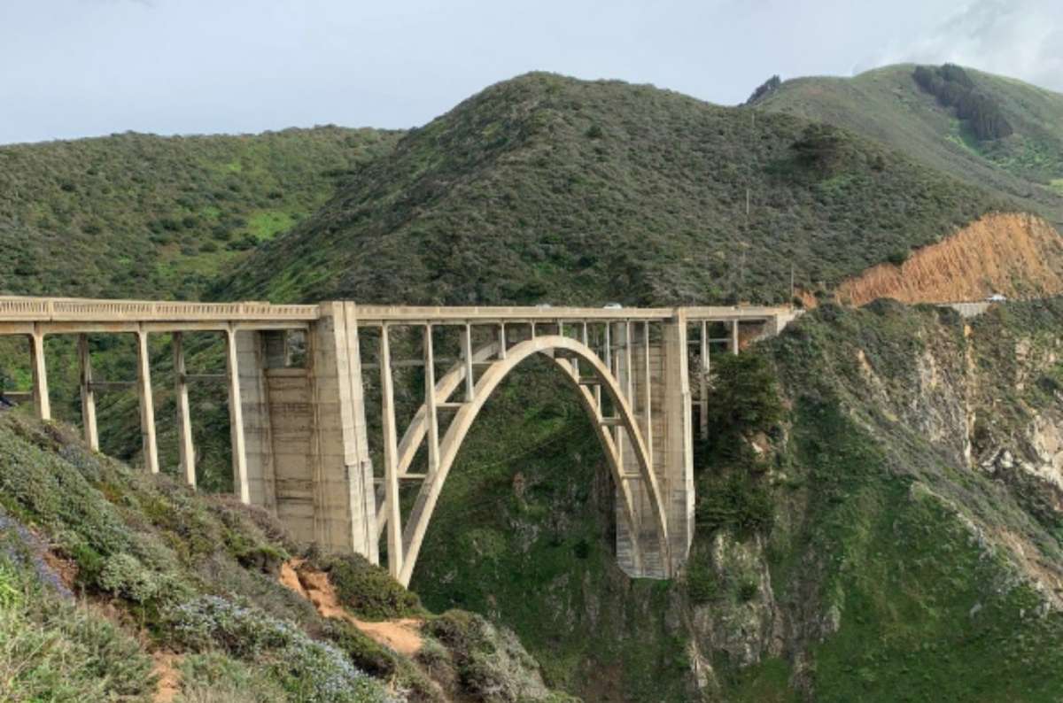
Bixby Creek Bridge in Big Sur, best experienced like the cars on top, without stopping
Bixby Creek Bridge is one of the recognizable Big Sur attractions, but the current visiting advice is important: don't plan a parking stop at either end of the bridge. Official visitor guidance prohibits stopping or parking there, excessively slow driving, and U-turns.
Experience the crossing as part of the drive. If someone else is driving, the passenger gets the easier sightseeing assignment. The driver still has a narrow, busy coastal road to concentrate on.
For a separate landscape stop, consider a clearly designated, legally available viewpoint in the Hurricane Point area, south of the bridge. Allow roughly 10–20 minutes if you find a safe space. Don't use that suggestion as permission to park on a shoulder or improvise a crossing of the highway.
The attraction here is the relationship between road, hills, and ocean, rather than simply proof that you stood beside the famous bridge. If the legal viewpoints are full, continue. Check the posted rules and current restrictions instead of relying on an old photograph showing cars beside the bridge.
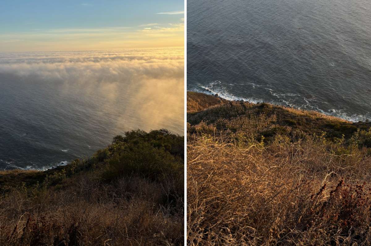
Fog on the Big Sur coast decides what you get to see, not the forecast for Carmel
Garrapata suits a shorter coastal walk near the northern end of Big Sur. It's a useful alternative if you've spent the day driving and want to leave the car without committing to a major hike.
Allow 30–60 minutes for a selected short coastal section, rather than assuming that covers every trail in the park. Choose your route from current signs, use designated access, and keep back from cliff edges. Fog can change what you see, and exposed paths can be windy even when Carmel feels comfortable.
This is also one of the things to do in Big Sur that I would leave flexible. With good visibility and time left, stop and walk. If you've already had several excellent coastal stops and still want Point Lobos, continue north. There is no benefit in turning two enjoyable walks into two rushed ones.
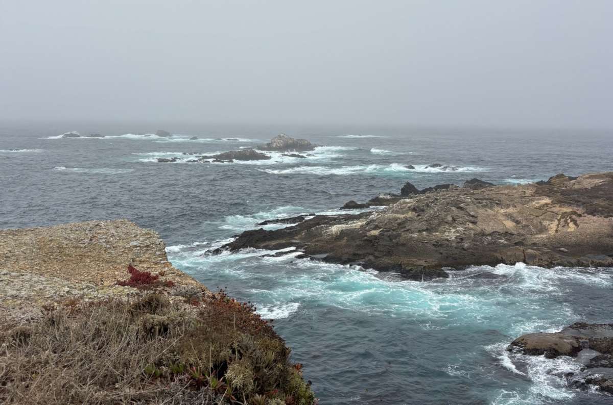
Point Lobos near Sea Lion Point, plenty of rocks for sea lions and no guarantee they’ll be on them
Point Lobos is a northern extension, close to Carmel, rather than another stop in the middle of Big Sur. I consider it one of the best individual places to see on the California coast.
The weather was a trickster when we visited. There was fog on the coast, while a few miles away in Carmel it was sunny. Don't assume the weather outside your hotel describes the reserve.
Sea Lion Point is an option for coastal wildlife watching, China Cove for the small pale-sand cove, and Cypress Grove for the trees and coastal scenery. Wildlife sightings aren't guaranteed, and these are separate walking choices. You don't have to complete every route to justify visiting.
Unfortunately, on one visit we had only four hours until our flight departed from San Francisco. That isn't four hours available to walk around Point Lobos. It explains why I couldn't give the reserve all the time I wanted.
For a visit without that particular scheduling achievement, allow two to three hours, choose a few walks, and leave room for parking. A short visit can work, but adding it after the other things to do in Big Sur is how you end up watching the clock rather than the coast.
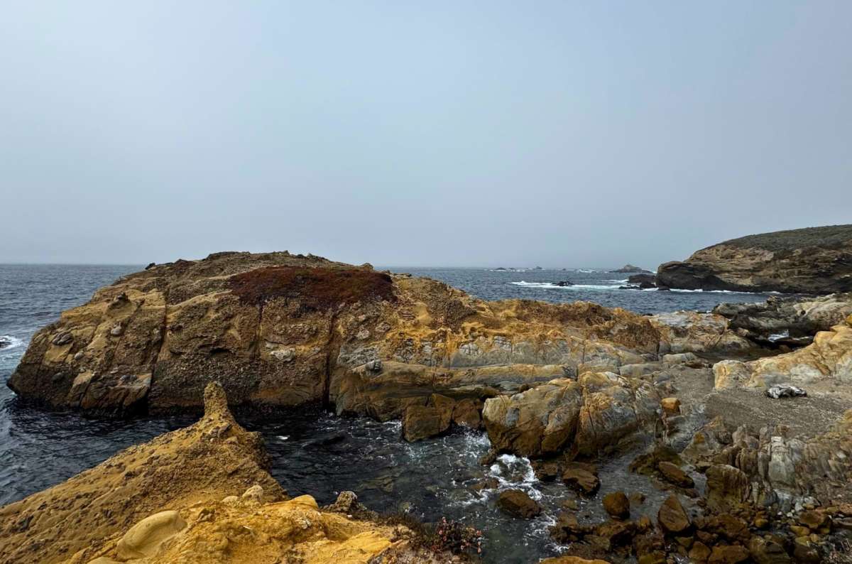
These Point Lobos rocks took millions of years to get like this, give them more than twenty minutes
Follow the reserve's current parking and trail instructions. Don't enter closed areas or approach marine animals. If Point Lobos is a priority, I would give it the following morning rather than whatever minutes survive a full northbound day.
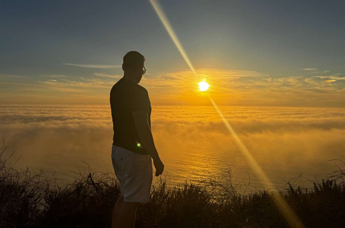
Above the clouds in Big Sur, the one stop no itinerary can plan for
For one day in Big Sur, choose a direction and a few substantial stops. This northbound plan starts at Ragged Point and finishes in Carmel; it assumes the through-road is available.
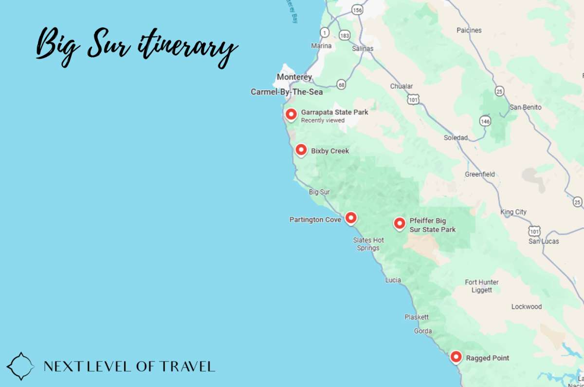
Here’s a map of the stops in this Big Sur itinerary, south to north
That version uses about 3¾–6 hours for sightseeing and lunch, depending on the choices. Add roughly 2½–3½ hours as a driving allowance from Ragged Point to Carmel, then at least 30–60 minutes of contingency for traffic controls, parking, and slower progress. These are planning ranges, not a guaranteed navigation estimate; check the actual route before leaving. The upper end needs a long day, so shorten the walks when daylight is limited.
Pfeiffer Beach replaces Partington Cove or a substantial part of the forest-and-Garrapata combination. It doesn't go on top automatically. McWay's closed overlook gets no scheduled walking time. Point Lobos belongs the next morning if you want a relaxed visit.
If you are returning to a Carmel or Monterey hotel, don't copy this through-drive schedule unchanged. Use Carmel–Pfeiffer Big Sur State Park–Carmel as a shorter return-route framework, with selected northern coast stops and a forest walk. Going all the way to Ragged Point adds a substantial southern leg in both directions.
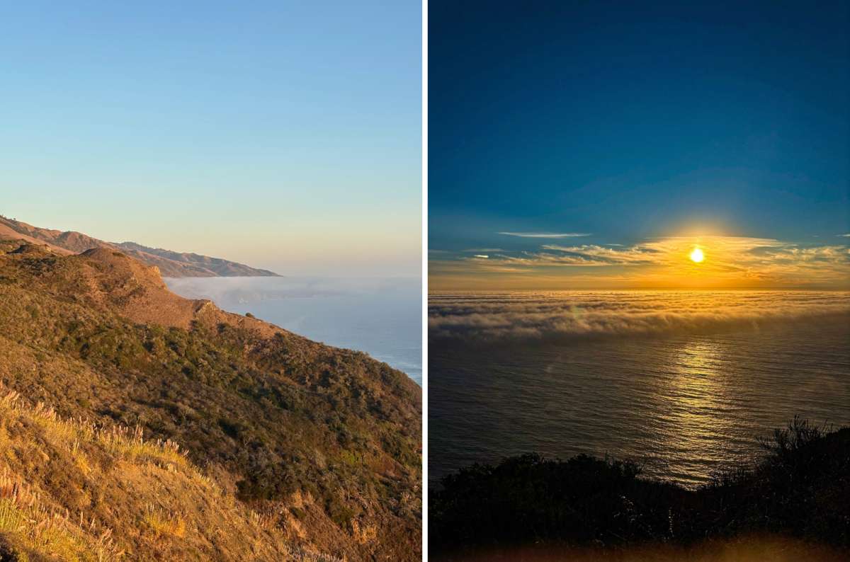
No long hike needed in Big Sur, the road climbs high enough for you
You can enjoy Big Sur without hiking far: the scenic drive, permitted viewpoints and a short forest walk already give you a varied day. Drop Partington Cove, and select only paths that fit your mobility and the day's conditions.
Short doesn't necessarily mean step-free. Beaches, uneven coastal paths and stairs need checking individually. The bridge restrictions also apply whether you want a five-minute photograph or a long stop.
First, remove distant extensions from the Big Sur day. Venice and Getty belong on a separate LA day; Pinnacles needs its own time. Then choose between the beach detour and a longer walk.
Keep the smaller viewpoints that actually appeal to you. My favorite parts weren't limited to the names everyone already knows. It's always about prioritization, and I would rather enjoy fewer stops than arrive at all of them with five minutes left.
Deciding which things to do in Big Sur fit your trip starts with access, daylight, and where you'll sleep. Fill the car before the remote coastal section, bring water and food, and download maps while you have a connection.
For a car rental, compare pickup and return locations before choosing the car. A one-way LA–San Francisco rental can have different terms and fees from a return to the same airport.
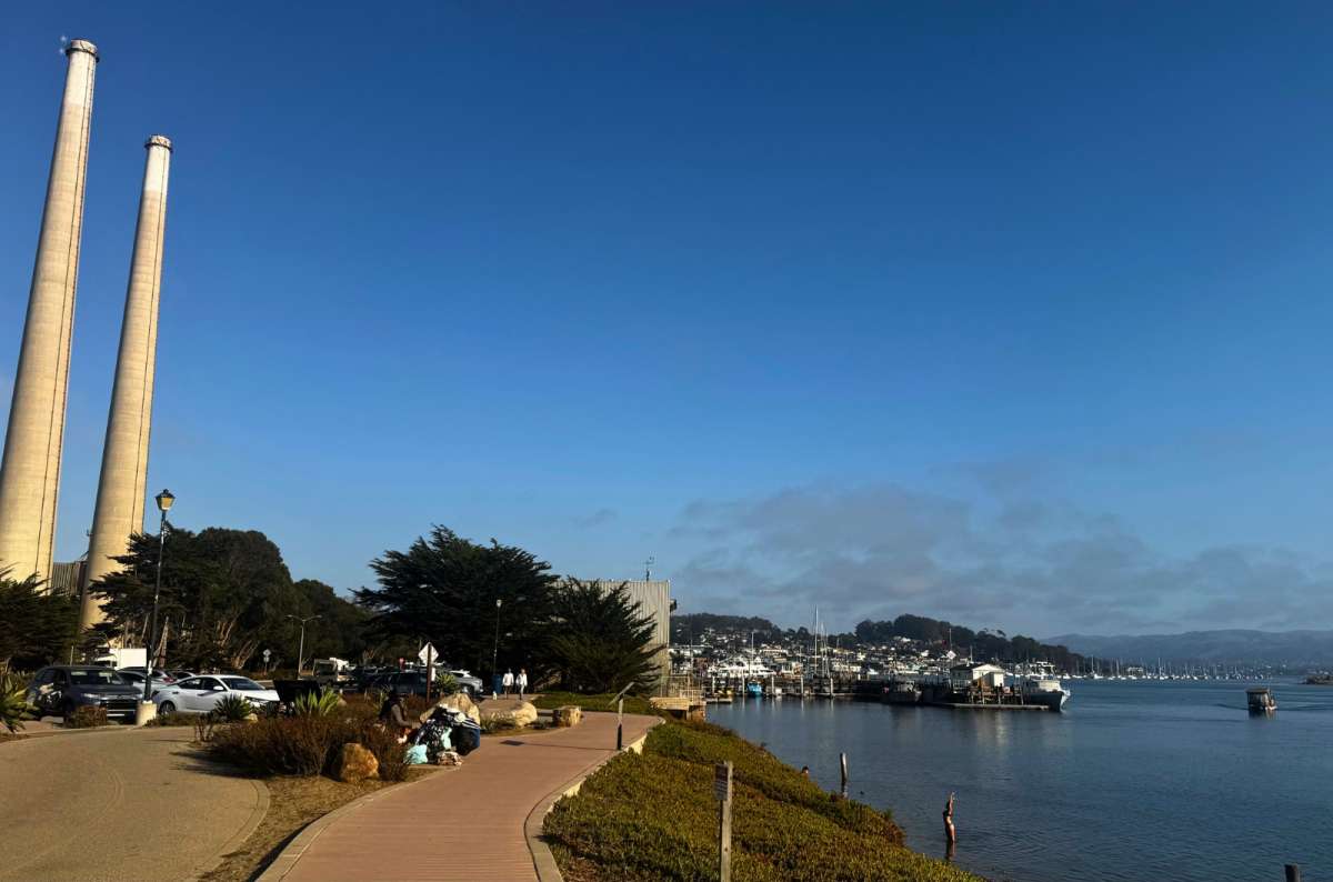
Morro Bay, a sensible place to fill the tank and the stomach before Big Sur gets remote
Give Big Sur one full sightseeing day at minimum for a selective visit, or two days if you want more walks, the beach, and Point Lobos without constant cuts. Half a day suits a shorter northern outing; it cannot cover all the things to see in Big Sur plus the extensions.
Big Sur drive time is only part of that calculation. Define your endpoints: Ragged Point to Carmel, Carmel to the village and back, and Los Angeles to San Francisco are very different journeys. Parking, access roads, and trail time don't appear in a simple highway driving estimate.
I have usually spread the wider coastal journey over roughly a full day and another half day, with a night around Carmel or Monterey. I still wanted more time. One day I'm going to give that wider drive the proper three days it deserves for me as a completist.
My drives were in August and September, and daylight still dictated what we could fit in. Late summer and early fall are worth considering, but there isn't a month that guarantees clear coastal views or open roads.
Summer can bring fog and cool beach weather. Winter rain can affect roads and access, while fire can disrupt trips outside winter. Check the forecast for the coast itself and bring a layer, even if you left a warm inland hotel.
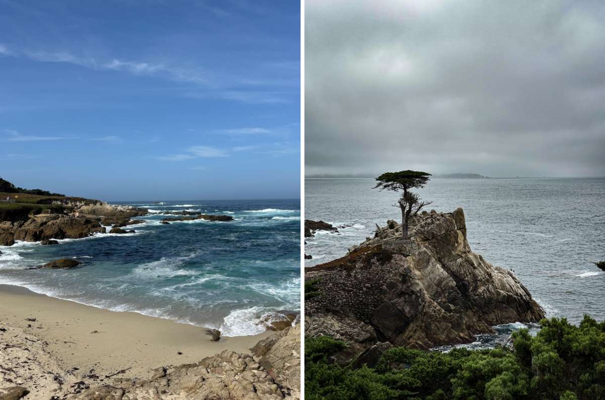
Fan Shell Beach and the Lone Cypress, a few photos apart on 17-Mile Drive and a completely different sky
For me, the best time to visit Big Sur is also a time when I can avoid arriving late. Clear weather is useful; two remaining hours of daylight still limit what you can do with it.
October 2026 access check: Caltrans lists one-way traffic controls at Mud Creek, near Point Sur Lighthouse, and at Rocky Creek Bridge. The McWay Overlook Trail remains closed. Pfeiffer Big Sur has reopened with some trails still closed, and Sand Dollar Beach is currently listed as closed by the Forest Service.
The Forest Service listed Willow Creek Beach as closed after the Timber and Plaskett fires, and a fire-area closure order covering the inland Willow Creek road and trail runs through January 31, 2027.
Check Caltrans Highway 1 conditions and the Pfeiffer Big Sur State Park notices before departure. Recheck conditions on the day, and obey local signs. A closure can require a different itinerary, not just a few additional minutes.
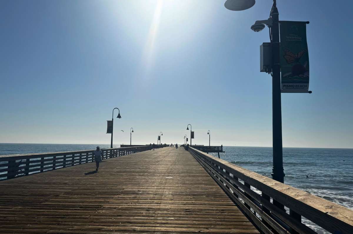
Pismo Beach pier, a stretch of the legs before the coast gets serious
These are additions to the wider coastal journey. None belongs inside the same sightseeing day as the full Big Sur plan above. I like including my own stops instead of repeating an identical highway itinerary every time.
Venice is 11/10 for me. I would always stop again. It's one of my favorite places in Los Angeles, and I particularly like it early in the morning with time for the promenade and breakfast.
I needed at least two hours plus breakfast. Give it a proper morning rather than pretending you can see it on the way out of LA in fifteen minutes. It suits people who enjoy the sea, beaches, and Venice's assortment of subcultures and unusual people. If that last part sounds exhausting, it may not be your beach.
As much as I like it, I would skip it on a single day reserved for Big Sur. The distance alone makes that decision straightforward.
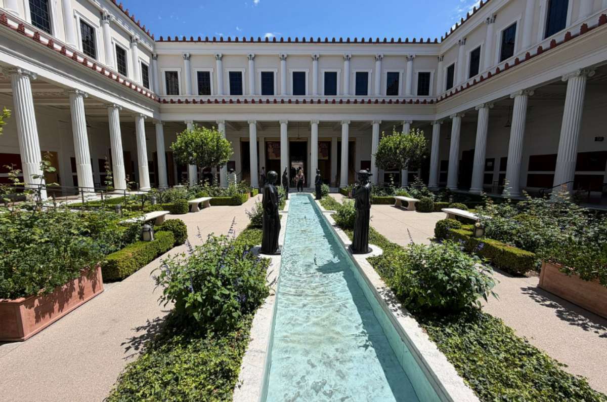
Getty Villa in Pacific Palisades
Getty Villa gets 10/10 from me. I loved it and would return. I needed about one to two hours inside, with travel and parking additional. This is the ancient-art museum in Pacific Palisades, not Getty Center.
Admission is free, but you need a timed reservation. It normally closes on Tuesdays; current parking is $25, or $15 after 3 p.m. Use the Getty Villa visitor information before planning around it.
It's a great extension for art and architecture, rather than an essential Big Sur experience. With limited time, save it for an LA visit. Free admission doesn't make its travel time disappear.
Malibu Canyon is super scenic during the day. I like including the drive as part of the approach instead of assuming every worthwhile mile must follow the shoreline.
Choose it when it fits your actual departure point and current road access. It isn't a universally faster route from every part of LA. Check local closures and navigation before leaving, and treat it as scenic driving rather than adding an unplanned hike.
For a base around here, I stayed at Cambria Hotel Calabasas–Malibu. The renovated rooms were attractive; my experience with the breakfast staff was horrible. I would keep both observations in mind before booking. This is an LA-area base, well south of Big Sur.
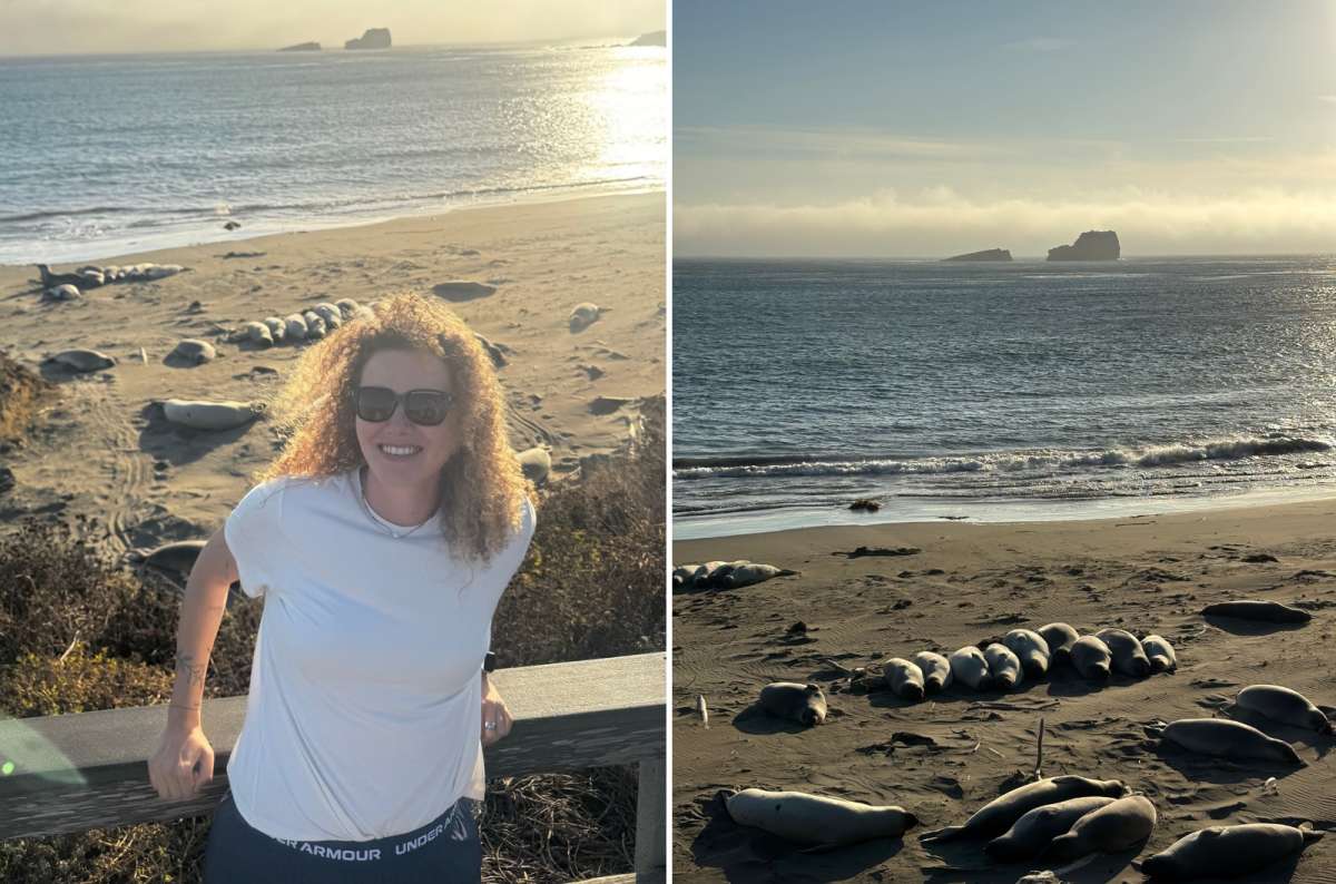
At San Simeon the seals get the beach and visitors get the railing, a fair deal
The elephant seals are among my top three stops on the wider coastal drive. Would I stop again? Always.
I spent 15–30 minutes here, and both times I was lucky with the sightings. The animals are the reason to stop, but the coast itself is beautiful too. It was also one of the busier places on my drives.
Use the designated viewing area, keep your distance, and leave the beach to the seals. Numbers and behavior vary through the year; don't assume my sightings guarantee yours. For the small amount of time involved, this is a stop I would protect in the southern approach, especially with children or anyone who loves animals.
These towns deserve time of their own. They're also practical northern bases when you don't want the final hour of every walk determined by a long onward drive.
Carmel smells so nice. Like forest meeting the sea. The town reminds me of Wales, which I love: half-timbered houses, trees and an old-English-village atmosphere in a rather unexpected location.
Ocean Avenue is the obvious place to walk, followed by Carmel Beach, which is dramatic in its own right. Allow two to three hours for a walk and a meal, longer if you want galleries or more beach time. I prefer Carmel to Monterey; it feels more upscale and more wooded.
If I were choosing somewhere to live in California, this area would be very high on my list. As a visitor, I'd at least avoid arriving so late that I only see the hotel entrance.
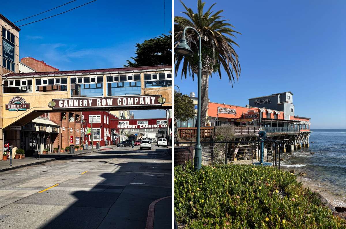
Cannery Row in Monterey, two cannery bridges and not a single sardine left
I enjoyed Cannery Row, the wharves, and the coastal walk. We had beautiful weather, though fog can be part of the experience here too. For breakfast, we ate at Wave Street Cafe.
Allow two to three hours for a waterfront visit and a meal. The aquarium is a separate decision: I haven't visited it, so I won't turn its reputation into my personal recommendation.
The nearby 17-Mile Drive deserves another substantial block of time. I loved the combination of cypress forest, dramatic coast, and extremely expensive houses. Allowing three to four hours for a selective drive is much more sensible than squeezing it into the end of an already full Big Sur day.
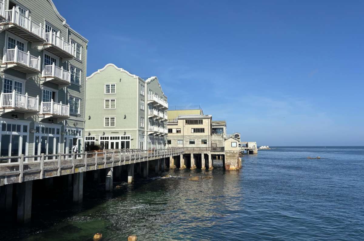
Monterey's waterfront on pilings, a practical northern base for a Big Sur day
I usually use the Carmel–Monterey area for the overnight break and continue in the morning. Carmel would be my choice for atmosphere; Hilton Garden Inn Monterey works well if the waterfront is part of your plan.
Compare location and parking as well as room price.
Sleeping within Big Sur is worth considering if you want more time on the coast and less returning north. Check the property's actual position against your chosen stops. For my own coastal trips, the northern base has been the usual choice.
My pick for sleeping within Big Sur is Alila Ventana Big Sur, which saves you the drive back to Carmel.
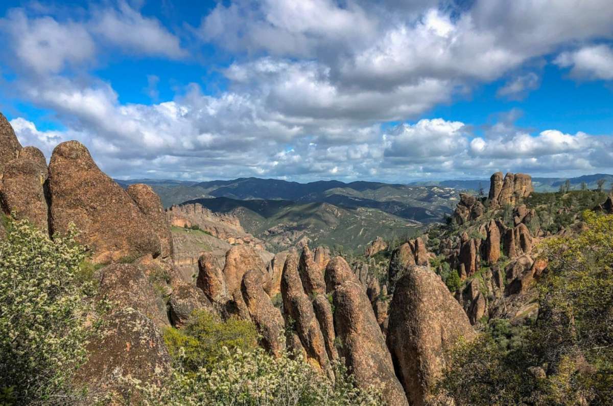
Pinnacles National Park, a completely different California just inland from the coast
I visited Pinnacles in 2014, and I consider it a good half-day park visit as an addition to a coastal trip. But the transfer is additional: half a day in the park doesn't mean half a day from Big Sur and back.
The east and west entrances are not connected by a road through the park. Choose your entrance around the walks you intend to do before setting the navigation. Coming from Monterey doesn't remove the need to make that choice.
The current private-vehicle entrance fee is $30, valid for seven days. Check NPS directions and current trail or cave restrictions before departure; don't assume every cave route is available. Carry water and account for heat on exposed walks.
With one day for Big Sur, I would leave Pinnacles out. With extra time and an interest in a different landscape, it becomes a much more reasonable addition. The coast already gave me enough reasons to wish I had another day.
This post contains affiliate links. If you make a booking through one of my links, I may earn a small commission—at no additional cost to you. Thank you for your support!
The Best Things to Do in Big Sur at a Glance
Ragged Point and Willow Creek Viewpoints
Redwoods in Pfeiffer Big Sur State Park
Bixby Creek Bridge and Hurricane Point
A Realistic One Day in Big Sur Itinerary
How to Plan Your Big Sur Visit
Before Big Sur: Selected Stops from Los Angeles


Hi, I’m Jan. I travel fast and intensely, whether I’m exploring the buzz of Tokyo in 3 days or road-tripping through mountains and beaches on a 3-week Thailand adventure. And no matter where I am, you’ll always find me in a comfortable hotel at night and eating the best food.
If that sounds like your kind of journey, hop on board, and let’s explore the world together!
I started this blog after realizing how tough it can be to find reliable, authentic travel info. You wouldn’t believe how many “travel bloggers” never even visit the places they write about! On Next Level of Travel, you can count on my full honesty and insights drawn from my firsthand experiences.
Here’s the deal: not every destination is all superlatives and unicorns. I’ll let you know if a tourist attraction isn’t worth your time, like skipping overrated stops in my 2-week Spain itinerary. And when I find something truly special—like the perfect mix of culture and nature in Cape Town—you can trust that it’s worth adding to your itinerary.

Comments | Thoughts? Give us a shout!