




2. Badwater Basin and Devil's Golf Course
4. Sunrise at Zabriskie Point and the Badlands
6. Artists Drive and Artists Palette
7. Stay Overnight at The Inn at Death Valley
8. Furnace Creek Visitor Center and Museum
13. Racetrack Playa: Still on My List
14. Father Crowley Vista Point
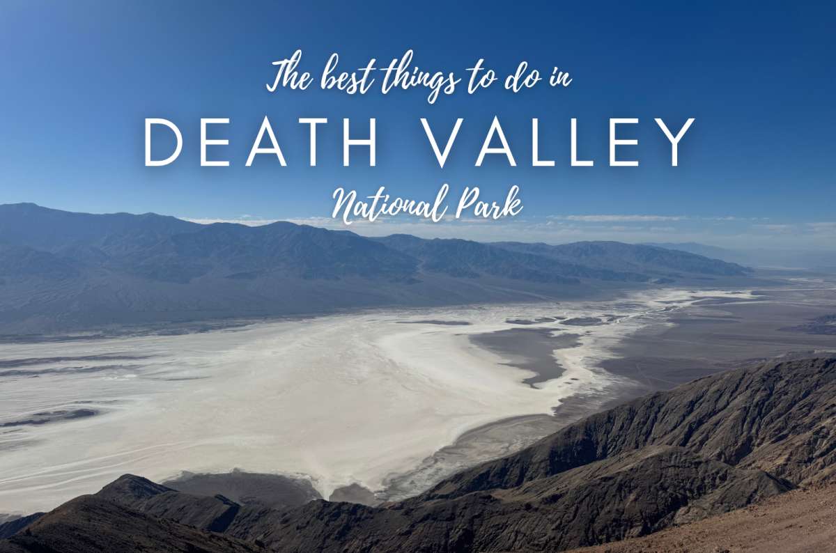
I've visited Death Valley in 2014, 2018, and 2026, and it's easily among my favorite places in California and the US. I love how desolate and vast it feels. All the high mountains and desert views. There are so many different things to do in Death Valley National Park that taking a photograph of the temperature and leaving really doesn't do it justice. I effectively did that on my first visit. Don't be like me.
This is my ranking, with the question that matters most: would I give this place my time again? The answer depends on the whole visit, including the drive. Racetrack Playa is the exception I haven't visited yet; it's always been too far out of the way, and I have it planned for visit number four.
If you're choosing things to do in Death Valley with limited daylight, my priorities are:
Staying overnight adds two of my favorite experiences: the night sky and Zabriskie at sunrise. Ubehebe is optional because of the distance; Golden Canyon depends on the weather. This ranking is personal preference, not driving order. The route suggestions below put the stops together geographically.
Read more from my California travel blog.
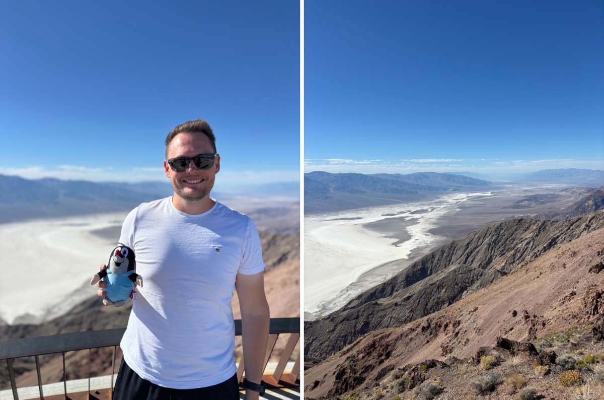
If there were only one place to visit, it should be this. Dante's View is among my most precious memories and viewpoints I've seen to this day. It's just so majestic. I've visited twice and loved it every time.
The views toward Telescope Peak and down over Badwater Basin are fantastic. The salt flats look like a river from up here, and you can see for miles in every direction. Without this viewpoint, you can't really appreciate the size of Death Valley. It's unbelievable and so vast.
You also climb more than 5,000 feet above the valley floor, so it's significantly cooler. The downside is the drive, mainly for a viewpoint. Is it worth that detour? Yes, absolutely. You don't need to add a long ridge hike to justify coming here.
Pro tip: Consider renting a car to make your drives around Death Valley National Park as smooth as possible.
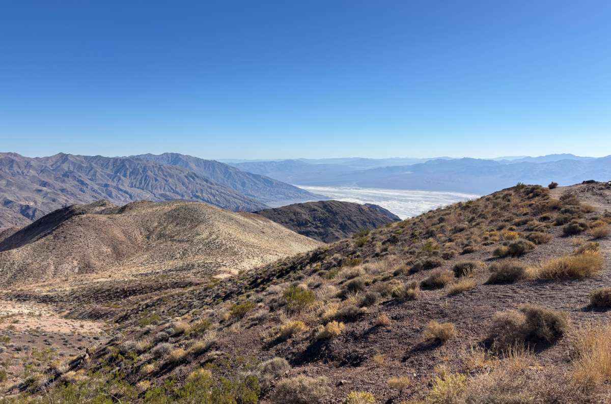
I spent about 15–30 minutes at the viewpoint, with an approach drive I remember taking roughly half an hour. For planning from Furnace Creek, the NPS Dante's View page allows about 45 minutes each way. Budget roughly 1¾–2 hours from Furnace Creek and back, including the view.
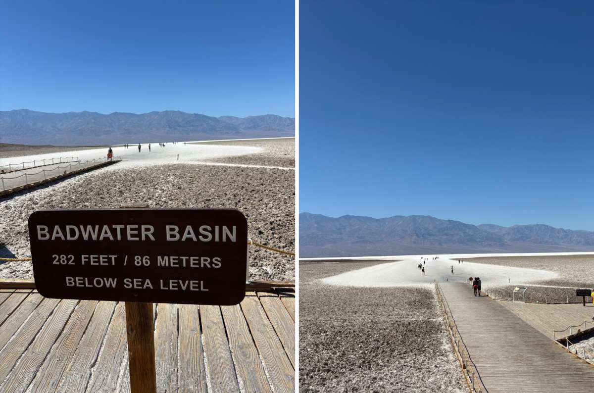
So incredibly cool, and very windy on my visits. A super-large salt pan in the lowest part of the valley, surrounded by colorful mountains. I love the white plain and the little brine pools.
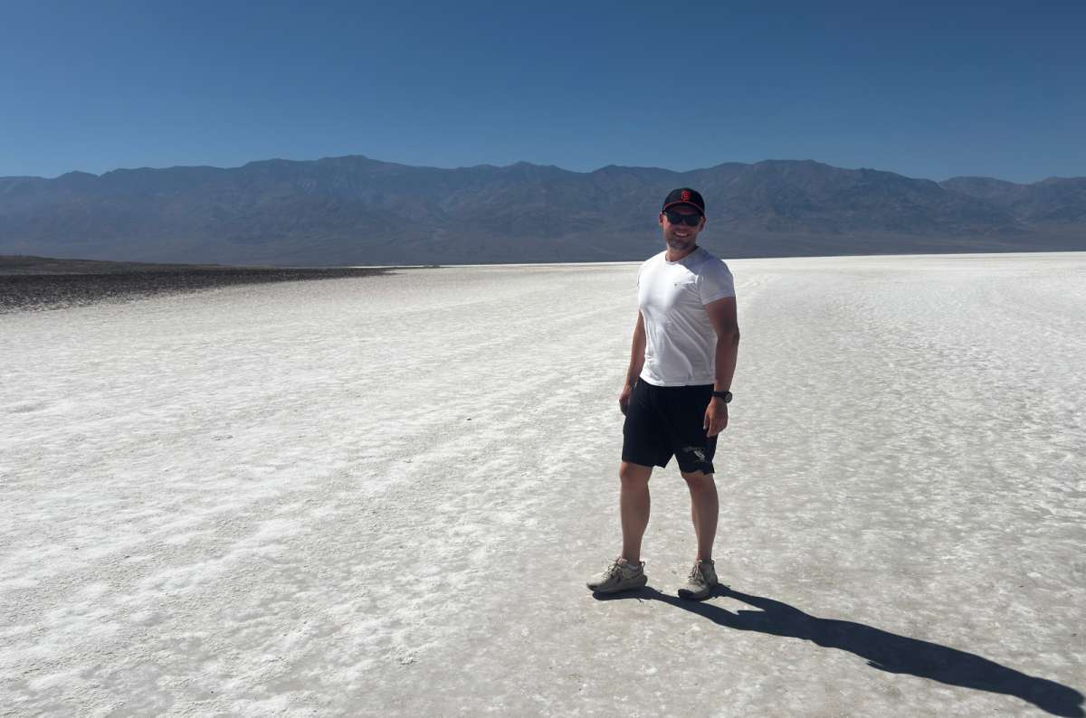
I first saw landscapes like this in the Atacama Desert in Chile. They were significantly cooler there, though. At Badwater, it was always over 104°F (40°C) when I visited. You can feel it in the warm wind. Everywhere.
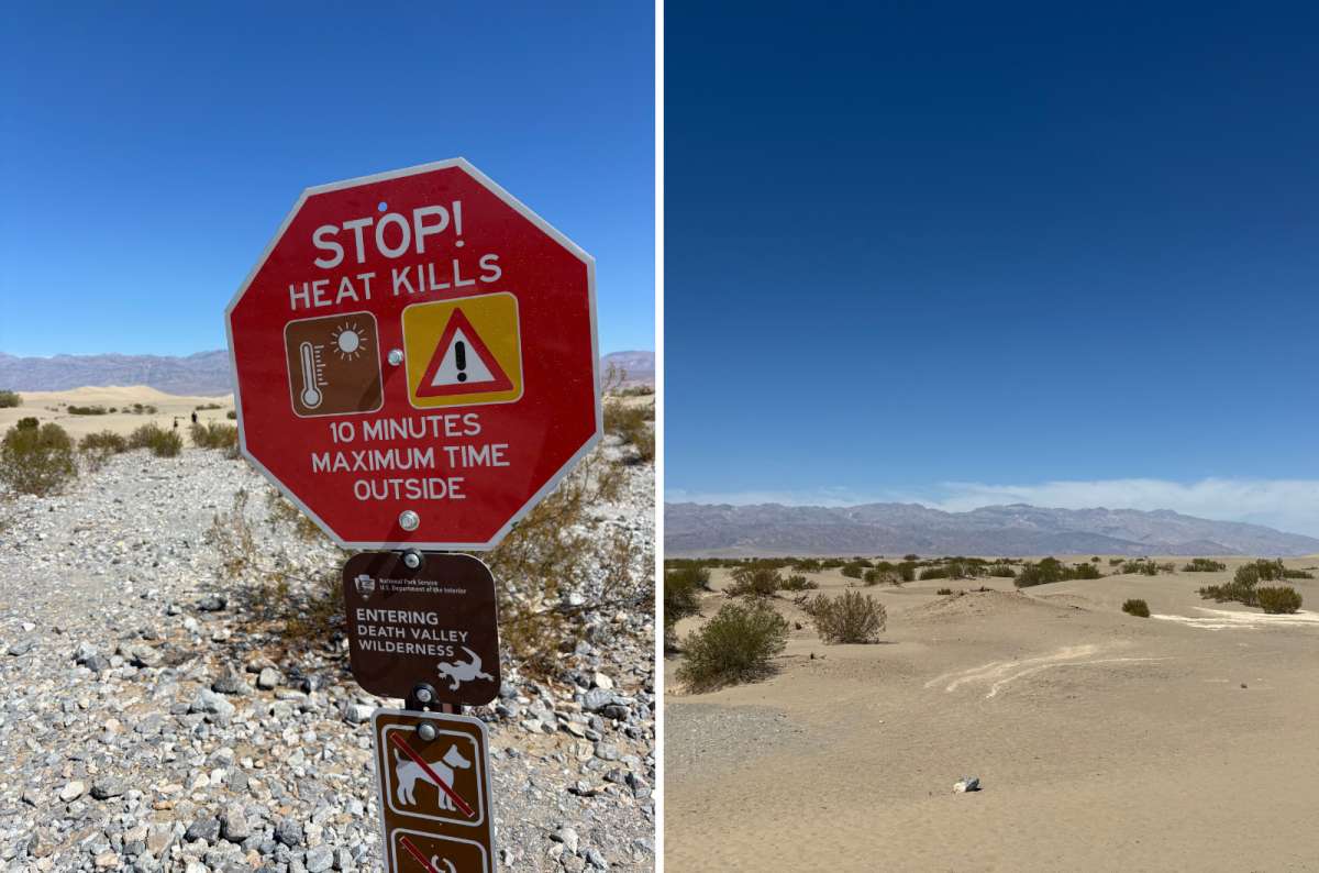
For me, it's usually a short walk of up to 30 minutes, and I do fairly well in hot weather. In summer, NPS recommends enjoying the view from your vehicle rather than hiking the salt flats.
Badwater sits 282 feet (86 m) below sea level. You can look from the parking area and boardwalk, or walk farther onto the flats in cool conditions. The distance to attractive salt patterns varies with the surface and recent rain, so don't treat a photograph of distant polygons as a promise of a five-minute walk.
My top tip is sunset. It's just beyond belief. So vast. It's also funny trying to take pictures in bright daylight because the sun is so strong you can't see your photos.
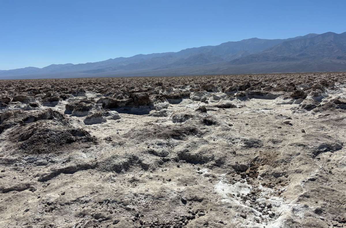
This is a super-short stop that complements Badwater: rough, jagged salt formations rather than a smooth white expanse. 9/10 for interest, but a maximum ten-minute stop for me. A high rating doesn't necessarily mean you need an hour.
Don't wander across the sharp salt. It cuts; I learned that in Chile. NPS also recommends looking from the parking area to avoid injury and damage to the formations.
The access road is dirt. It felt like a better fit for a vehicle with clearance to me, but NPS describes the compacted-gravel road as suitable for most vehicles in normal conditions. Flood damage can change that. Add it if access is straightforward; Badwater remains the priority if you need to cut something.

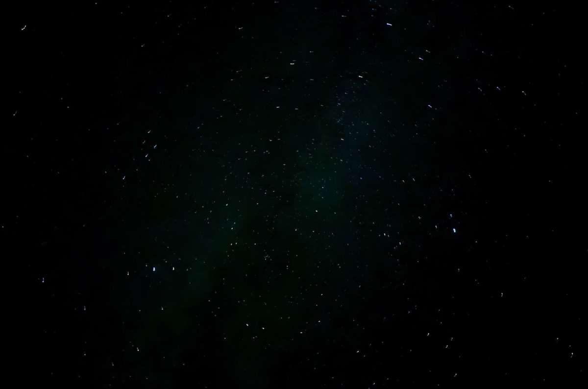
I've never seen such a starry sky as here. I tried stargazing when I was staying at The Inn at Death Valley, and it was one of the best things I did in the park. 10/10 for me. Even the hot, dry air at night feels special.
This is a good reason to give Death Valley more than a daylight drive-through. You can visit the viewpoints, stay for the stars, then see a completely different set of colors at sunrise.
The NPS night-sky recommendations include Harmony Borax Works, Mesquite Flat Sand Dunes, Badwater Basin and Ubehebe Crater. You don't need to make a remote drive just to find darkness; choose somewhere accessible near your base, away from building and road lights.
If you don't want to wander alone in the dark, you can also book a stargazing tour.
Cloud cover or a bright moon can change the experience. The night sky deserves a place in your plan, but don't drive hours to an isolated spot when somewhere closer has the same conditions.
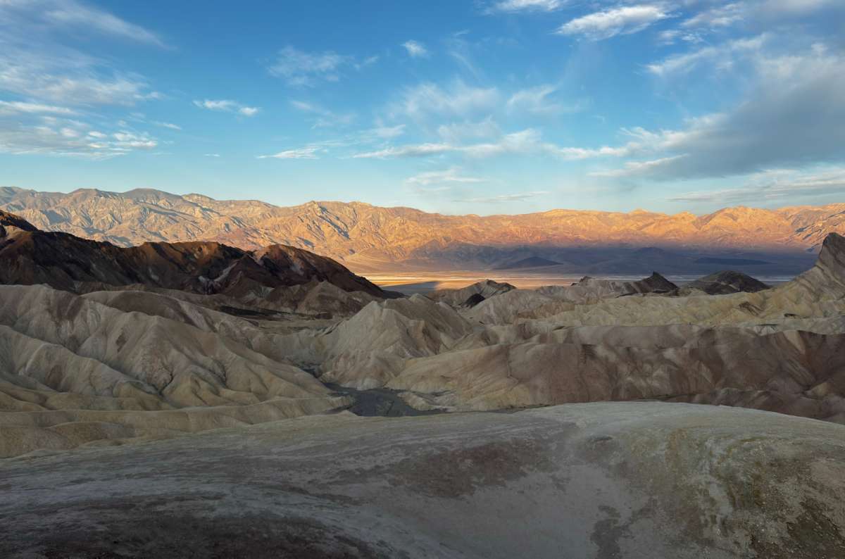
With Dante's View, I consider this the best place to visit in Death Valley. I've been here at sunset and, more recently, sunrise. Do both if you have the chance.
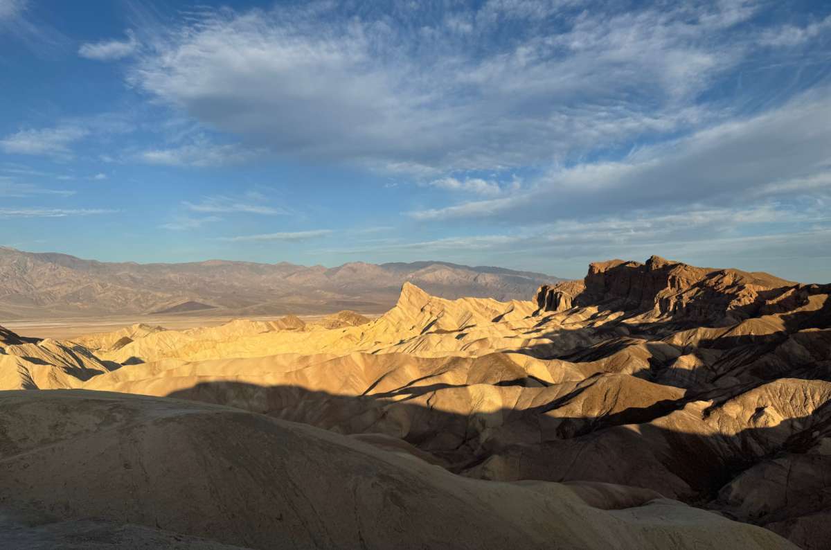
Sunrise at Zabriskie is absolutely otherworldly, with pink mountains behind the valley and salt flats. It's so pretty it's unbelievable. The colors go from pink to orange to yellow. Even during the day, these are some of the best views in the park, with colors from white through pink to green and brown.
I always like how little it rains in Death Valley and how big an effect water has on the local rock formations. Here you can see the ridges and channels it has carved through the badlands. Manly Beacon stands out among them, with the Panamint Mountains beyond.
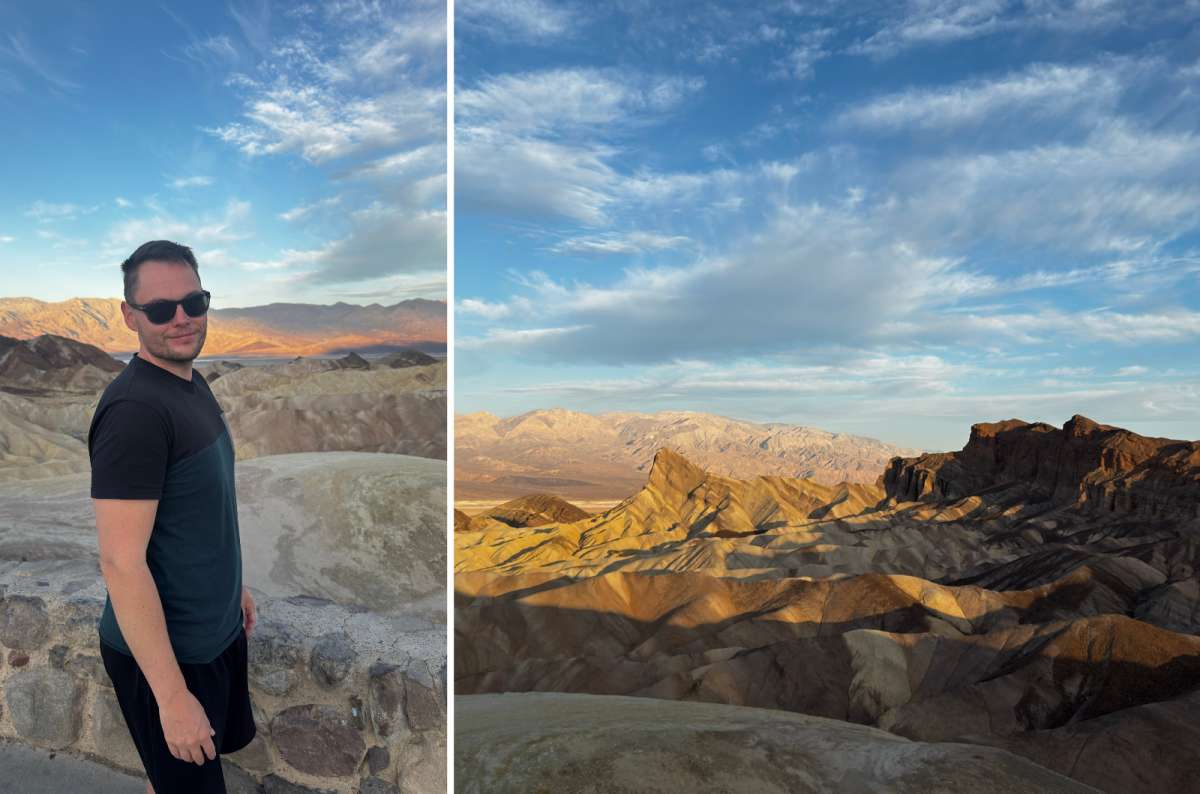
For me, the Zabriskie Point sunrise is worth arranging an overnight stay around. September or later also makes the alarm less unpleasant than a midsummer sunrise. Check the local sunrise time and arrive before it; waiting until the sun is already visible means missing part of the changing light.
It got hot very quickly after sunrise on my visit. I'd enjoy the view first, then decide whether the weather still makes a badlands walk sensible. You don't have to earn this view with a long hike.
Among the things to do in Death Valley, this is one of the easiest priorities to keep when time is tight. Golden Canyon is the extra, not a condition of enjoying Zabriskie.
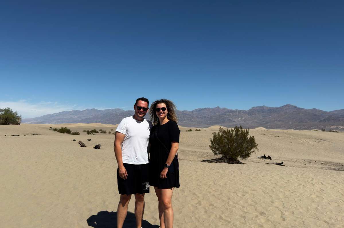
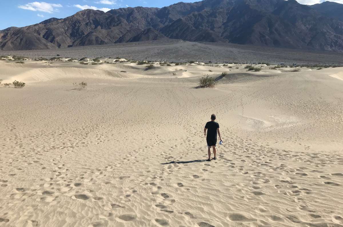
I genuinely like dunes. Visually, they're so different and unique. Mesquite Flat has always been among my favorite places in Death Valley, surrounded by mountains with this completely different landscape in the middle.
You can explore on your own because there are no official trails. Early morning is the best time for a walk. So of course I did it at midday.
Count on anywhere from ten minutes to an hour for a short visit. It's so worth stopping even if you don't walk far. Choosing how far to go matters much more than ticking off a particular dune.
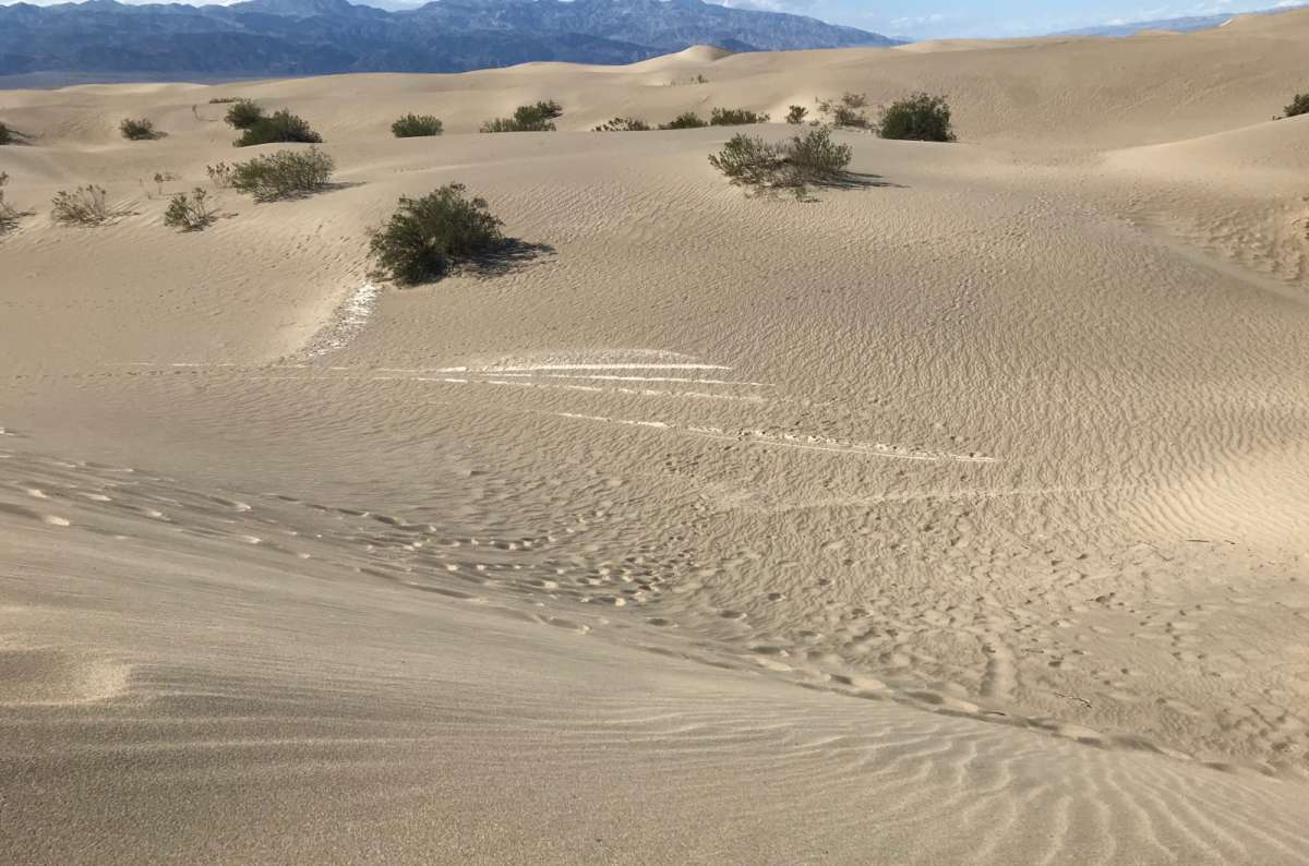
Seeing Mesquite Flat Sand Dunes at sunrise gives you low-angle light, stronger shadows, and cooler sand than later in the day. Sunset is another good option. NPS describes the walk to the tallest dune and back as roughly 2 miles (3.2 km); soft sand makes it slower than the distance suggests.
Don't copy my midday timing. In summer, NPS advises against hiking on the hot sand. Of all the Death Valley attractions here, the dunes are especially easy to enjoy briefly without committing to the longest walk.
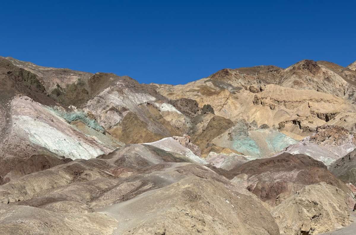
Drive slowly. The road is the experience. I've seen people speed through it, realize that was the attraction, then go around again. Well, I learned that myself on the first visit.
Artists Drive is a proper car hike. Enjoy the green and pink rocks, the twists and dips, and the views toward Badwater Basin. The colorful mountains remind me of Salta and Jujuy in Argentina again. It's one of the most enjoyable places in Death Valley and all of California.
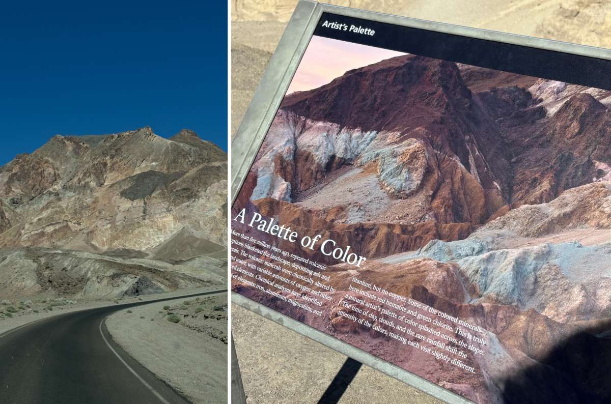
Artists Palette is very nice, but not such a banger as the drive itself for me. My girlfriend thought this was the best, though. My rating is 9/10: it's short, and part of the view is back over the salt flats again, but I love the drive.
The full Artists Drive scenic loop is 9 miles (14.5 km), paved and one-way. It took me about 20 minutes each time I drove it. For a more relaxed visit, NPS recommends 25–45 minutes; add time if you want to explore on foot.
The hills' colors come from volcanic deposits of different compositions. Afternoon light brings them out especially well, so this fits nicely after Badwater on your way north.
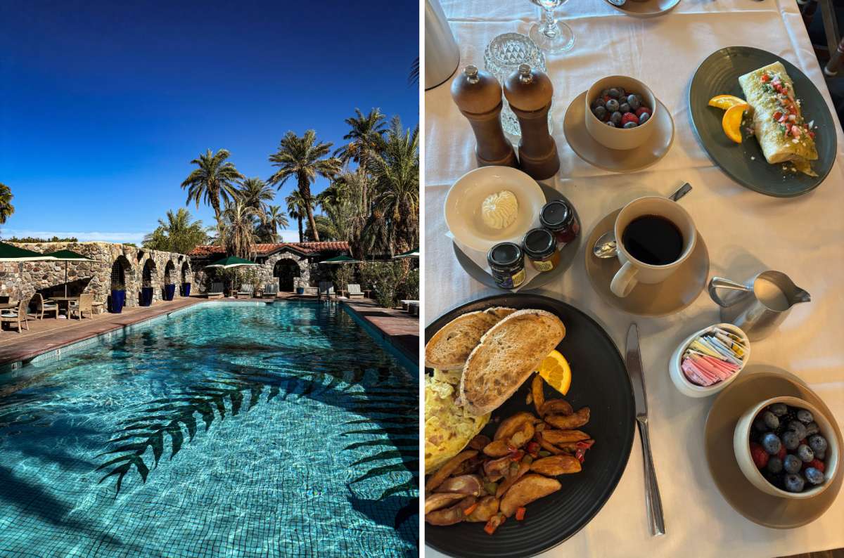
It's not just a hotel; staying overnight in the park is an experience. The Inn is so well placed for Zabriskie and the badlands early in the morning. If the reason were just sunrise, I'd consider it worth it. But it's not just that.
There are so many quirks: the stargazing terrace, the tunnel to the elevator, and having a golf cart with your room. I had one with my casita, and it was so much fun. The room was large, comfortable, nice, and clean. I loved the date palms everywhere.
And the pool. For me, it's the best in the world. Always warm. The hotel currently lists its spring-fed pool at 87°F (31°C), and its casitas still include a golf cart for getting around the property.
The historic hotel opened in 1927. There was also à la carte breakfast, with wonderful views. For the standard and location, I thought the price was good, although rates depend heavily on your dates.
My rating: 8/10. I was mainly sorry I didn't have more days here. If I think about it, I'm almost always sorry not to have more days in Death Valley.
Compare rates for The Inn at Death Valley on Booking.com with the hotel's direct offers. Check whether you're booking a casita or a main-building room; the room type changes the experience. Prioritize the overnight location first if the Inn stretches your budget.
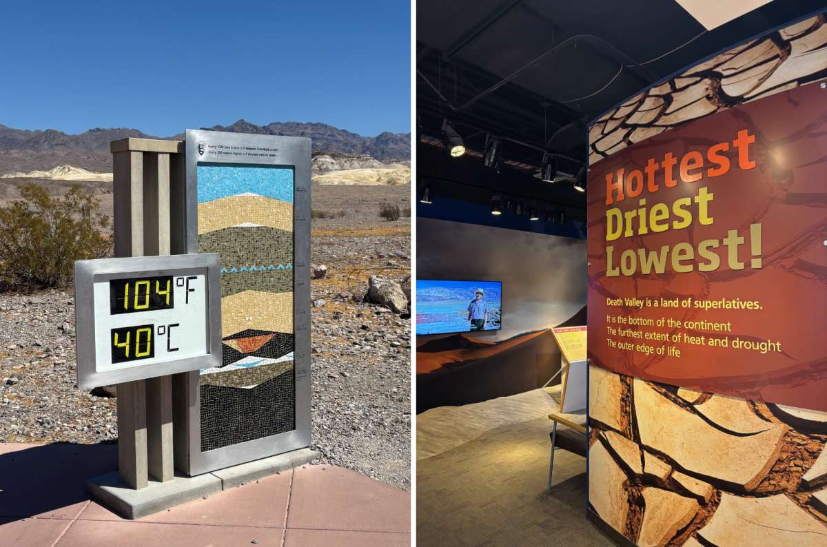
I spent almost an hour here. I recommend it: the museum is large and full of interesting facts about water in the park, why it's hot, local animals, and the transition from mining to tourism.
The gift shop is really nice, too. I liked its illustrated look; it's among the better national park shops for souvenirs.
This is useful context before exploring the Death Valley attractions around Furnace Creek. It's also where I'd ask about a questionable dirt road or a trail after a storm, rather than relying on an old description.
Allow 45–60 minutes if you want the exhibits and the 20-minute park film. Check current opening hours, especially if you're fitting it between sunrise and a drive. A visitor-center stop makes more sense in the warmer middle of the day than another exposed hike.
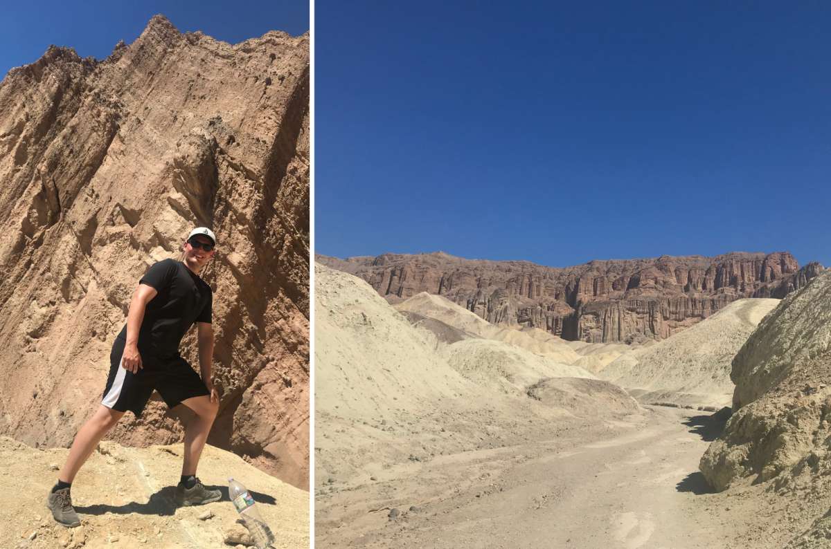
I walked Golden Canyon to Zabriskie and back on my second visit. It was hot and hard even in October. I liked the hike—the relief and colors are incredible—but if you're short on time, you're fine stopping at Zabriskie Point.
I'd treat the Golden Canyon hike as optional when it's already the middle of the day. Don't add it because the trailhead happens to be nearby if the weather has made the walk a bad idea.
For a defined shorter alternative to the connected badlands routes, NPS lists Golden Canyon to Red Cathedral as 3 miles (4.8 km) out and back, taking about 1½–2 hours. It starts at Golden Canyon Trailhead on Badwater Road and involves some scrambling. That is a different route from my walk to Zabriskie.
The NPS route descriptions and map also cover Gower Gulch and the longer circuit. Choose an actual route before setting off; connecting trail names don't all describe the same mileage. In hot weather, keep the viewpoint and leave the hike.
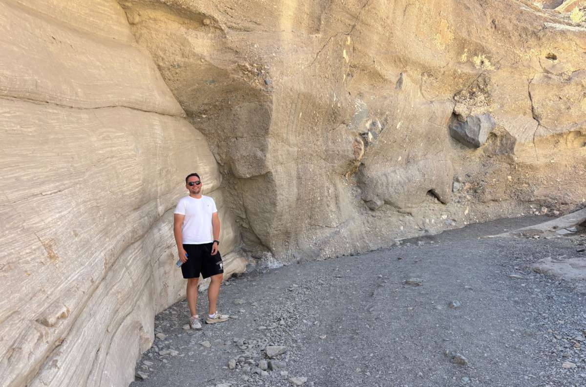
It's a strange place, and I like it. It's not my absolute top because the park is full of top things to do, but the rock formations are fairly unique. There are superb views from the trailhead parking lot, too.
I made a shorter visit just to see the rock formations. Allow around an hour for a short look at the first narrows. Smooth marble walls and fragments cemented into the rock give the canyon its name and character. The narrows begin only about a quarter-mile from the trailhead, so you can see something interesting without completing the whole hike.
For the full Mosaic Canyon hike, NPS gives 4 miles (6.4 km) out and back and 2½–3 hours, with scrambling and obstacles farther in. It is not a loop. Turn around if the terrain exceeds what you're comfortable with.
The approach is 2.3 miles (3.7 km) on an unpaved road from Stovepipe Wells. It felt rough to me, but NPS says it is typically passable in a sedan. Check the actual surface after rain. Some canyon shade doesn't make a hot-day hike safe; choose the short visit or skip it when conditions are wrong.
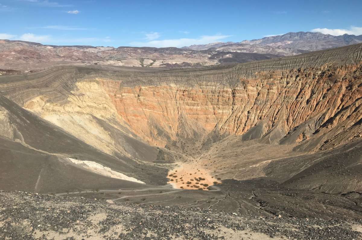
I visited Ubehebe on my second trip. I walked the rim and loved it, though I love volcanic rocks and volcanoes in general. The lightness of the rock is fascinating. 9/10 for me.
It's a bit out of the way. That's why I'd call it optional because of the distance, rather than something everyone must squeeze into their first day.
The crater is roughly half a mile across and 600 feet deep, formed by a volcanic steam explosion. You can see it from the parking lot or do the 1.5-mile (2.4 km) rim loop, allowing about an hour. The footing is loose and the edges exposed; stay on the trail.
For planning from Furnace Creek, I'd reserve roughly half a day, including the drive and rim walk. Access matters: North Highway was closed after flooding when checked on October 23, 2026. Check the current NPS road status before building a day around Ubehebe.
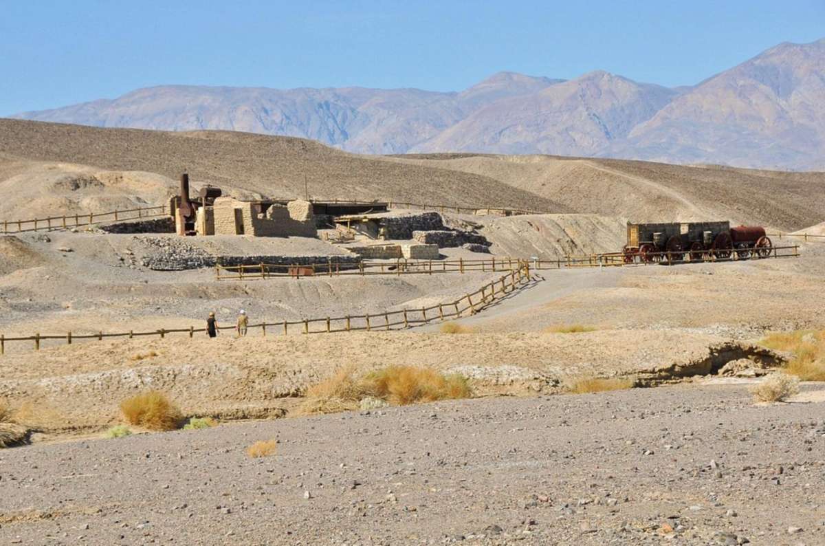
I visited once and spent about an hour. I liked this little stop a lot. It's an old borax works, conveniently close to Furnace Creek, and it gives you the mining context behind the landscape. Surprisingly, I learned about local animals here, too.
It's nice for people who like context or industrial history, and I am both. 7/10 for me. The ruins, equipment, and twenty-mule-team wagon make a useful change of viewpoint.
The interpretive route is a 0.4-mile (0.6 km) paved loop; NPS suggests about 30 minutes. I stayed longer to take it in. It fits well around a visitor-center stop or near your overnight base. I would keep this modest historical stop ahead of adding another drive simply to increase the number of places visited.
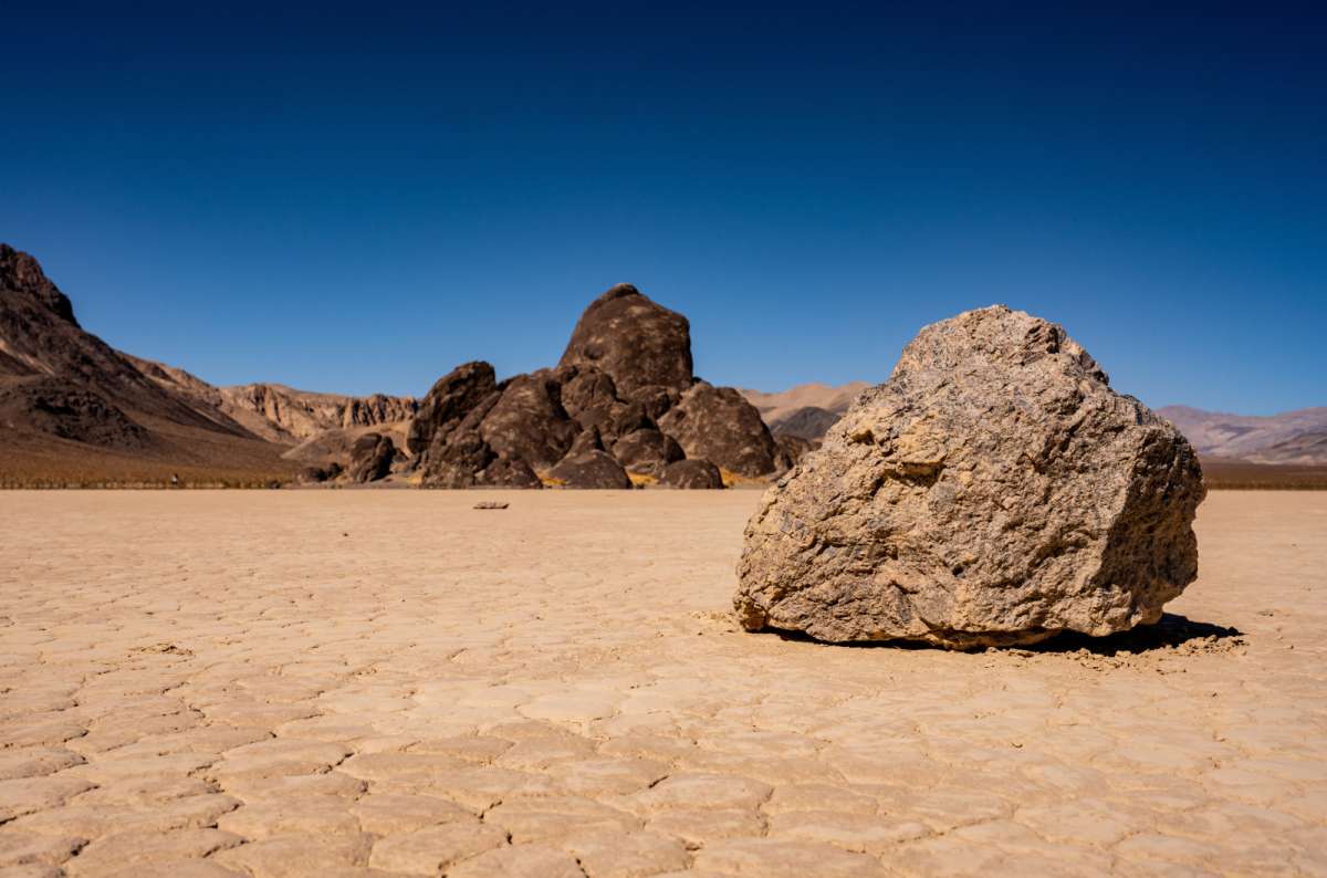
I haven't visited Racetrack Playa. It has always been completely out of the way for my route, but I have it planned for my fourth Death Valley visit.
The attraction is the dry lakebed and the tracks left by its moving rocks. The practical catch is enormous: NPS says at least 3½ hours each way from Furnace Creek. Add your time on the playa, and you're committing most of a day.
The rough road generally needs high clearance, 4WD, and good tires; ordinary rental vehicles are not recommended. There is no cell coverage. Keep vehicles on designated roads and stay off the playa when it's wet. I wouldn't sacrifice the main Death Valley sights for this on a first, short trip.
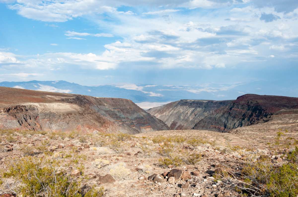
This is worth the short stop if you're arriving from the west on Highway 190. I liked the desert scenery from here: dark volcanic rock, Rainbow Canyon below, and the mountains and Panamint Valley beyond.
For me, it's 8/10, and I'd allow about 20 minutes for the stop. It works naturally when your road trip already brings you this way from the Eastern Sierra or the western approaches.
The geographic condition is the important part. Among the places to visit in Death Valley, this belongs on a west-side drive. I wouldn't make it a separate priority from Furnace Creek or add it to an eastern arrival from Las Vegas just to complete the list. Dante's View and Zabriskie come first for me.
Choosing what to do in Death Valley National Park is easier once you separate the central sights from long side trips. The following plans assume open roads and suitable weather. They start inside the park, not at your Las Vegas hotel.
For the main things to do in Death Valley, I'd use this order in cool conditions:
Budget roughly 8–10 hours with driving, food, and a buffer; longer if waiting for sunset or walking farther. In summer, shorten this substantially and keep outdoor stops brief. I would leave Golden Canyon and Ubehebe out of this day.
Two days let you keep the central Death Valley attractions, stay for the stars, and put the dunes or a canyon walk in a cooler morning slot.
Use one day for the Furnace Creek/Badwater/Artists area and Dante's View. Use the other for Mesquite and a short or full Mosaic Canyon visit, depending on conditions. Add Harmony Borax Works near your base. A Golden Canyon hike replaces another substantial activity; it isn't a free extra.
With a third day, consider Ubehebe if its road is open and the long drive appeals. Racetrack is a separate, properly equipped expedition. Twenty Mule Team Canyon is skippable for me; I wouldn't give it time ahead of these priorities. Natural Bridge and Telescope Peak are other options I haven't done, not additions you need to complete this ranking.
My three trips were in August, September, and late October. Late October was the best of those for exploring, although it was still around 100°F (38°C) or more. It got hot early, even around 7–7:30 am on some visits.
I'd choose February to April for a visit with more walking, with the actual forecast deciding the hikes. NPS describes November to March as the main low-elevation hiking season. Early spring or late fall still doesn't guarantee comfortable hiking weather.
The best time to visit Death Valley depends on what you want to do. Summer can work for a cautious drive through the scenery, but NPS advises against low-elevation hiking in summer. My heat tolerance and past walks are not a safety threshold. Carry plenty of water, remain close to your air-conditioned vehicle in extreme heat, and avoid canyons when storms threaten.
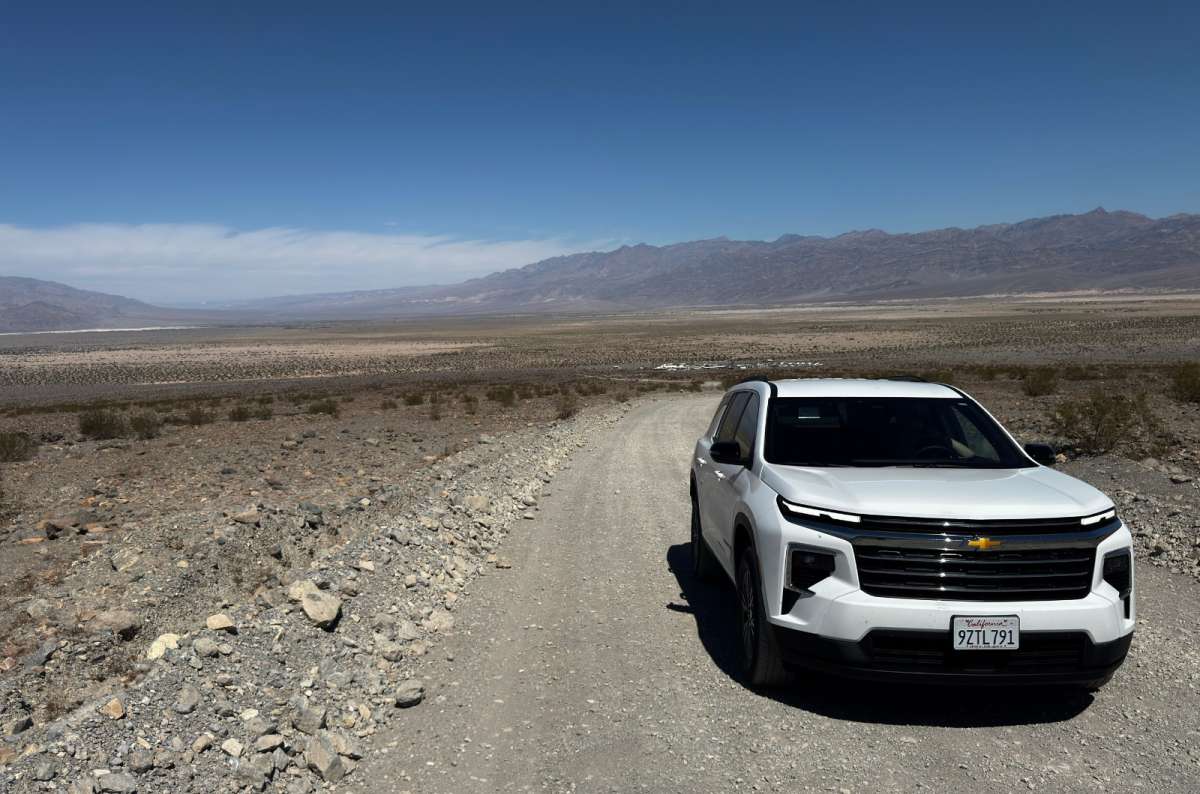
Most of the main paved-road Death Valley attractions don't require one. A normal car can reach the main lots at Zabriskie, Badwater, Mesquite, and Dante's View, subject to closures and vehicle-length limits.
Unpaved doesn't automatically mean 4WD-required: Mosaic Canyon Road is normally sedan-passable, while Racetrack is a much more demanding proposition. Clearance, tires, current damage, and rental conditions matter as well as driven wheels. Check the specific road rather than treating an SUV as permission to go anywhere.
Pro tip: Plan your routes and, based on that, rent a car that fits your needs.
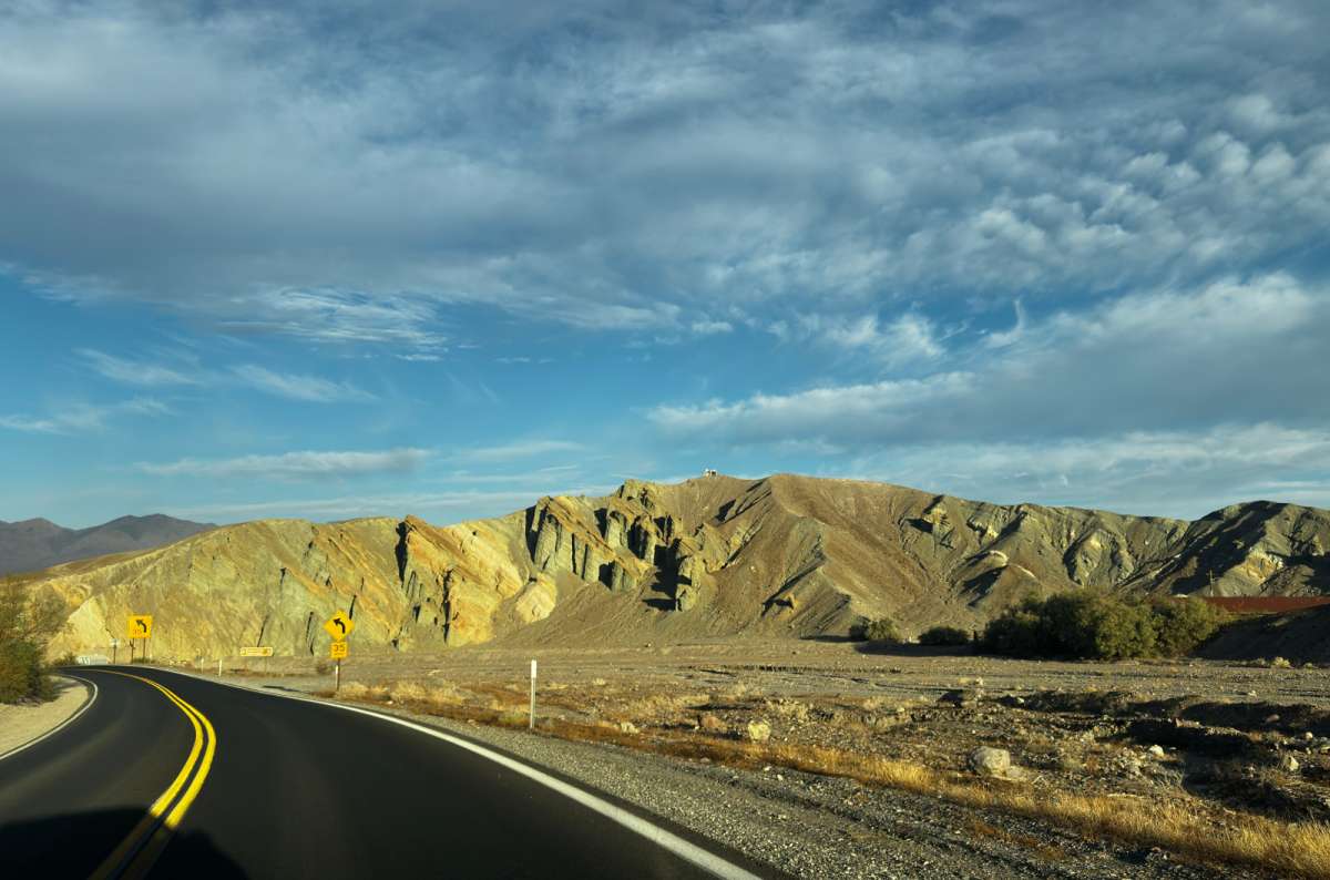
The standard entrance fee is $30 per private vehicle for seven days, including its passengers and non-US residents. No reservation is required simply to enter. Pay by card or the supported online method; the park is cashless.
Fill your tank before visiting. Stations are sparse, and fuel inside the park is expensive. Download maps before losing signal. Death Valley is huge, even though many of the central things to do in Death Valley are reasonably close together.
Recheck NPS road conditions before driving: the October 23, 2026 update listed North Highway and Beatty Cut-off closed after flooding, with debris on Badwater Road.
Give the park at least a day if you can, and two or three if your route allows. Don't drive for hours just to take a picture. I love the colors, the scale, and the variety here—and I'm almost always sorry I haven't left myself more time.
This post contains affiliate links. I earn a small commission if you make bookings through my links, at no additional cost to you. Thank you for your support!
2. Badwater Basin and Devil's Golf Course
4. Sunrise at Zabriskie Point and the Badlands
6. Artists Drive and Artists Palette
7. Stay Overnight at The Inn at Death Valley
8. Furnace Creek Visitor Center and Museum
13. Racetrack Playa: Still on My List
14. Father Crowley Vista Point


Hi, I’m Jan. I travel fast and intensely, whether I’m exploring the buzz of Tokyo in 3 days or road-tripping through mountains and beaches on a 3-week Thailand adventure. And no matter where I am, you’ll always find me in a comfortable hotel at night and eating the best food.
If that sounds like your kind of journey, hop on board, and let’s explore the world together!
I started this blog after realizing how tough it can be to find reliable, authentic travel info. You wouldn’t believe how many “travel bloggers” never even visit the places they write about! On Next Level of Travel, you can count on my full honesty and insights drawn from my firsthand experiences.
Here’s the deal: not every destination is all superlatives and unicorns. I’ll let you know if a tourist attraction isn’t worth your time, like skipping overrated stops in my 2-week Spain itinerary. And when I find something truly special—like the perfect mix of culture and nature in Cape Town—you can trust that it’s worth adding to your itinerary.

Comments | Thoughts? Give us a shout!