


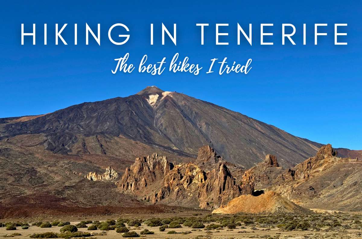


If you’re considering hiking Tenerife, you’re choosing between three landscapes that barely look like they belong on the same island.
I’ve hiked in both Anaga and Teide. Anaga was the biggest surprise. I originally planned 1 day there and ended up spending 3. Roque de Taborno gave me some of the best mountain-and-ocean views I found anywhere on the island, while Sendero de los Sentidos showed me the completely different, almost prehistoric-looking cloud forest.
Teide impressed me for the opposite reason. The volcanic landscape is so barren and strange that even relatively short walks can feel like you've gone much farther than the distance suggests. And once I got above 3,000 m (9,843 ft), my lungs made it very clear that a short walk at altitude is not necessarily an easy walk.
This isn't a database of every Tenerife hiking trail. I’m only ranking hikes I actually completed, based on scenery, effort, access, and whether I’d genuinely do them again. There are several major Tenerife hikes I still want to tackle, particularly in Teno, and I’ll list those separately rather than pretend I know what they're like.
If you want the wider picture before choosing your trails, start with my Tenerife travel guide.
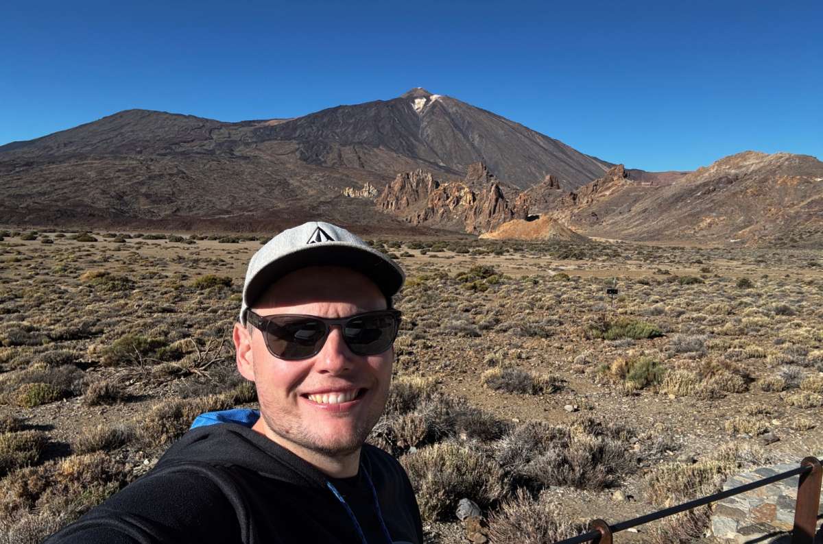
Teide looks calm from here. My lungs at 3,000 m would disagree
Hiking in Tenerife is so varied. Anaga, Teide, and Teno offer completely different landscapes and hiking experiences, so I’d decide what kind of scenery you want first rather than simply looking for the highest-rated trail.
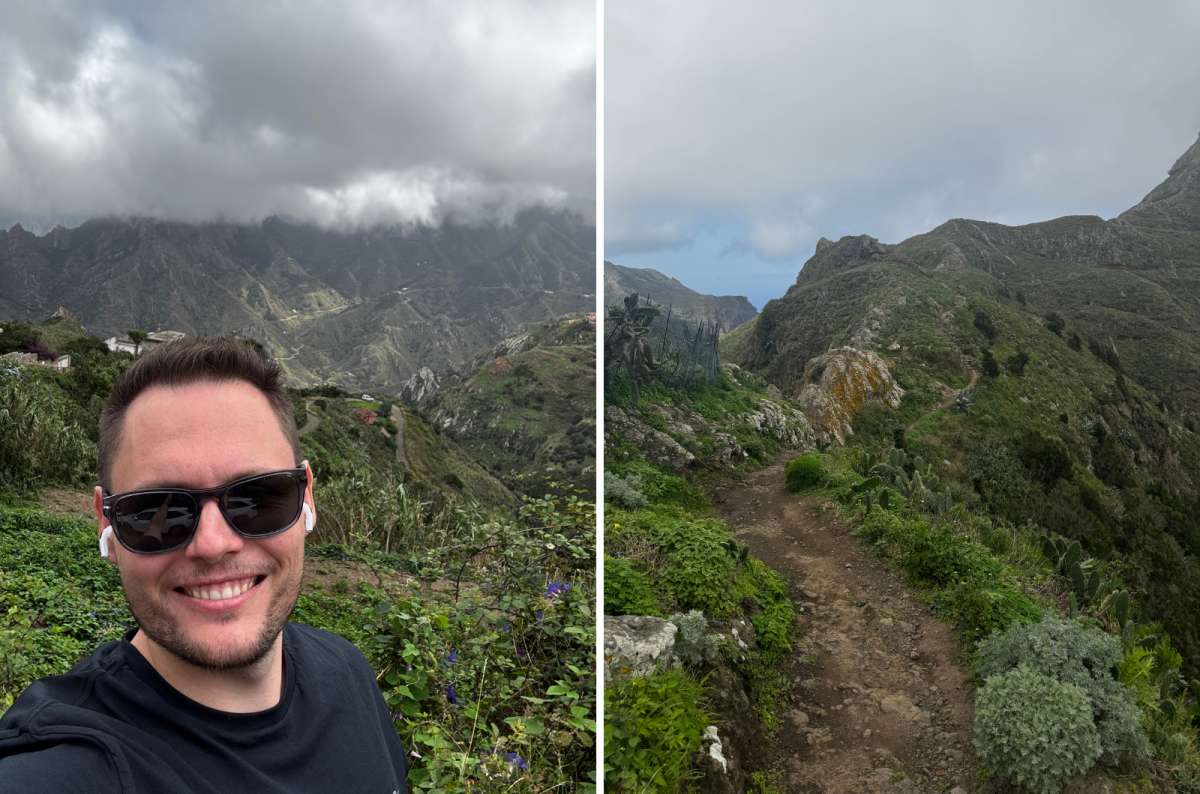
Anaga's weather has one setting: unpredictable
Anaga is my pick for green scenery and dramatic views without necessarily committing to a long hike. You get laurel forest, steep mountain ridges, and trails overlooking the Atlantic, sometimes all within a relatively short distance.
The downside is that Anaga’s weather can make or break a hike. Fog can wipe out the views completely, rain makes some trails slippery, and the narrow mountain roads aren't particularly relaxing. Parking is probably the biggest practical headache—I learned quickly that arriving early matters here.
Teide is the complete opposite. The landscape is dry, exposed, and volcanic, and even the shorter Tenerife hikes here can deliver an enormous visual payoff. Roques de García was my favorite easy hiking option, while Minas de San José is another worthwhile stop for getting out among the pale volcanic formations without committing to a long trail.
Altitude changes the equation. I noticed it above 3,000 m (9,843 ft), even without doing a particularly long hike. Add strong sun, wind, rapidly changing conditions, and the logistics around permits and the cable car, and Teide requires more preparation than the distances alone suggest.
For detailed permits, tickets, and cable-car logistics, see my Mount Teide guide.
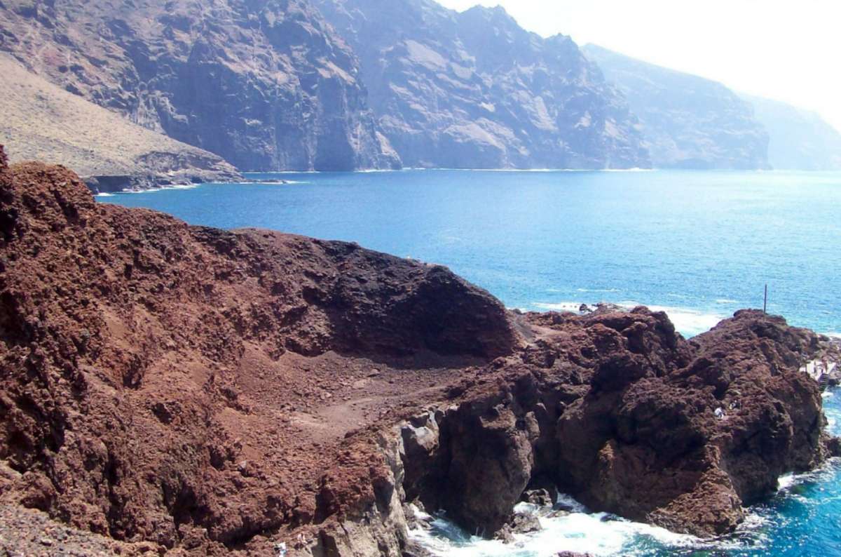
Teno's coastline doesn't do subtle
Teno is the option I'd look at for deeper ravines, huge cliffs, and more demanding mountain routes. The scenery around Masca alone gives you an idea of how rugged western Tenerife gets.
But this is also where I need to draw a clear line between experience and research. I explored Teno extensively by car, but I haven't completed one of its major hikes yet. Access restrictions, reservations, transport arrangements, and occasional closures can also make hiking here more complicated than simply arriving at a trailhead and setting off.
So, if you're choosing between the three, my firsthand hiking experience is strongest in Anaga and Teide. Teno is still one of the regions I most want to return to with hiking boots rather than just car keys.
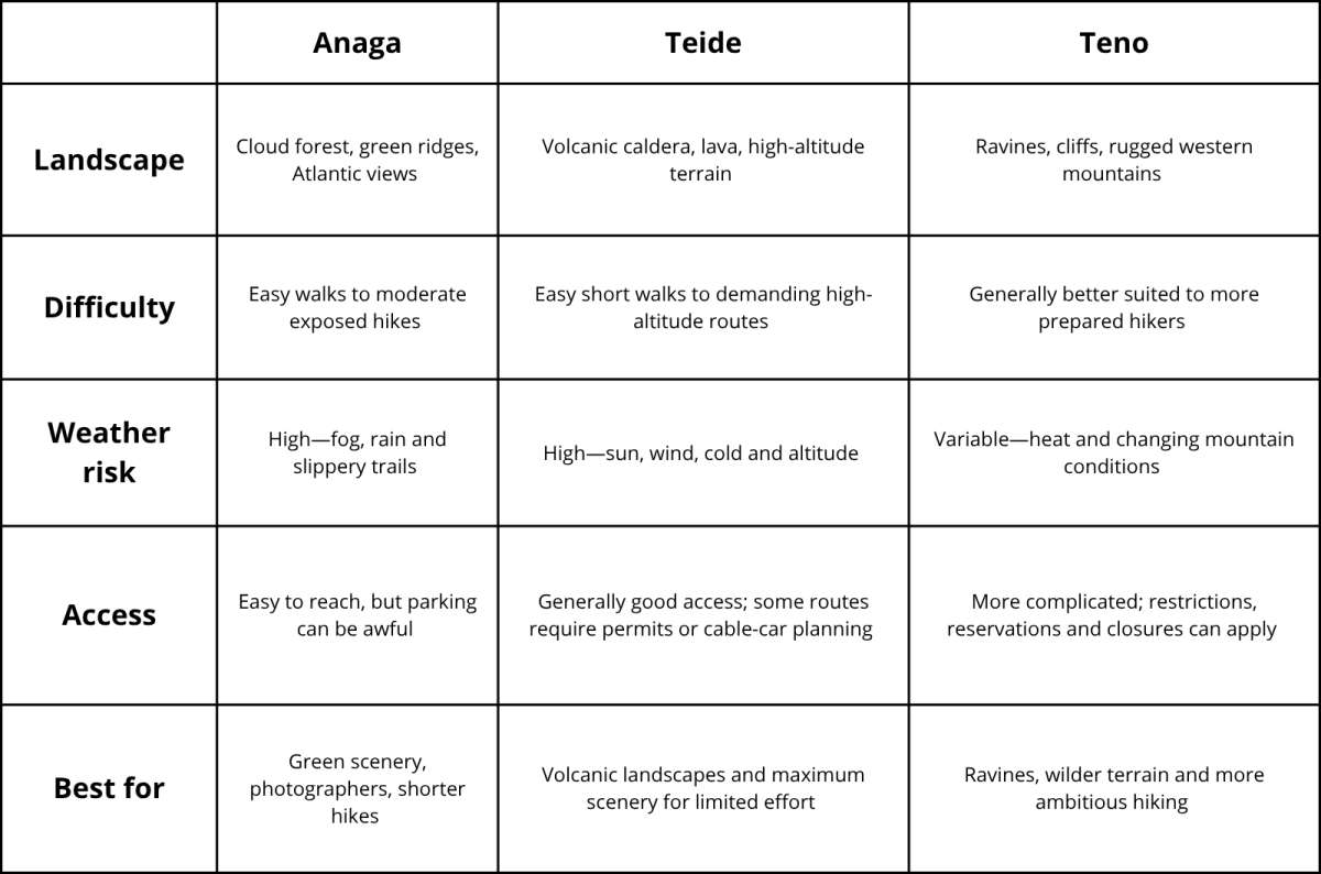
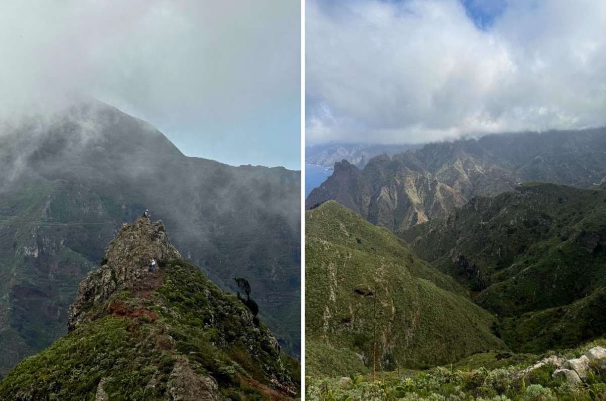
I got fog and clear views on the same ridge at Taborno. Don't trust the forecast either way
If I had to choose one of the Tenerife hikes I completed purely for scenery, Roque de Taborno would win. It’s short enough to fit easily into a day in Anaga, but the views feel completely out of proportion to the effort.
I started the hike directly in the tiny village of Taborno, and the scenery kicks in almost immediately. Green mountains and cliffs drop toward the Atlantic, and unlike plenty of hikes where you spend most of your time working toward one big viewpoint, this one keeps giving you views almost the entire way.
The 3.8 km route has a fairly mild ascent, so the physical effort isn't particularly high. That doesn't mean I'd treat it as an easy stroll, though. Parts of the path run across exposed terrain, and bad weather can make things slippery enough that you really don't want to be testing your balance here.
Weather is also the gamble with this hike. I had clouds rolling through the mountains, which actually made the scenery even more dramatic at times. But with heavier fog, you could lose the mountain and ocean views that are the entire reason I'd choose Taborno in the first place.
Then there’s parking. There is basically none. Taborno is tiny, the road in is narrow, and finding a space can easily become the most annoying part of the hike. This is one place where arriving early is worth it.
Compared with Sendero de los Sentidos, Roque de Taborno takes more effort and has more exposure, but the scenic payoff is much higher. If you want an easy introduction to Anaga’s cloud forest, choose Sendero de los Sentidos. If you want the best mountain-and-ocean views I found while hiking in Tenerife, choose Taborno. You can see more of my favorite places in the region in my Tenerife nature guide.
My verdict: My favorite complete hike in Anaga and the best overall scenery of the Tenerife trails I tried. The two things you can't control are also its biggest weaknesses: parking and whether Anaga decides to let you see anything.
Route map:
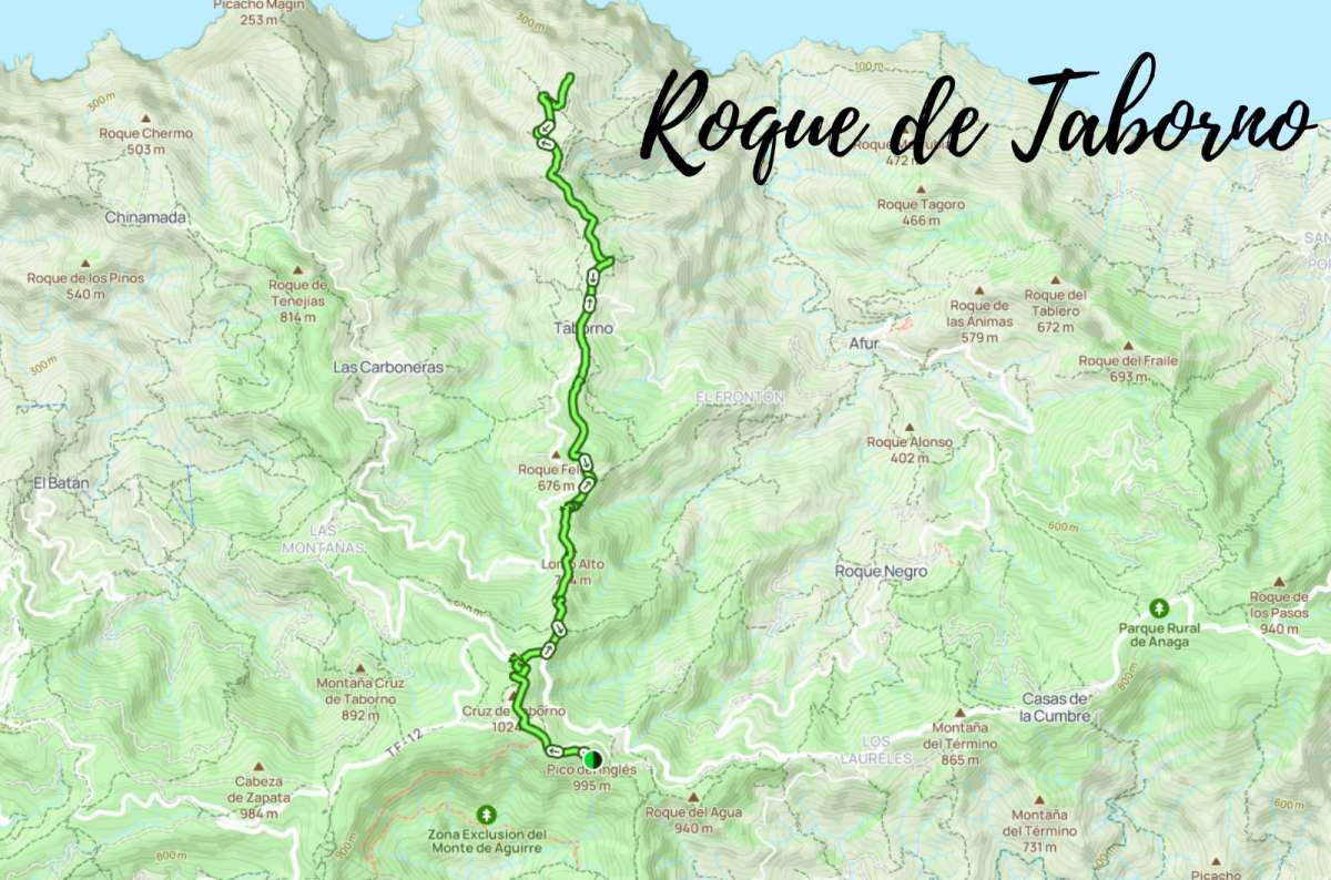
Alltrails.com map of Roque de Taborno hike
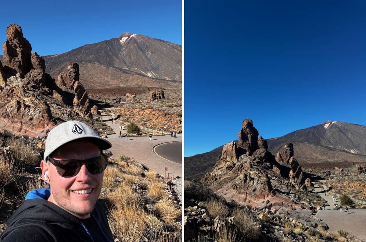
Roques de García
Roques de García is the hike I’d choose if you want to actually walk through Teide’s volcanic landscape without turning it into a major hiking day. For the amount of effort involved, the scenery is ridiculously good.
I walked part of the Roques de García trail rather than completing the full loop, and around 40 minutes was enough to get a proper feel for the landscape.
The rock formations are the obvious attraction. They looked tiny when I saw them from higher up on Teide, but standing beside them was completely different. They're massive, surrounded by volcanic terrain, with views across the caldera and a dramatic drop of around 200 m (656 ft) separating its different levels.
There’s no long approach or difficult navigation. You park, get onto the trail, and almost immediately you’re walking among some of the most recognizable volcanic formations in Teide National Park.
Of course, everybody else knows this too. Roques de García is popular, and both the trail and parking area can get busy. The landscape is also extremely exposed, so don't underestimate the sun just because you're only walking for 40 minutes.
Compared with Pico Viejo, this is the much simpler Teide hiking option. You don't get the same altitude or crater views, but you also don't need a cable-car ticket or nearly as much planning.
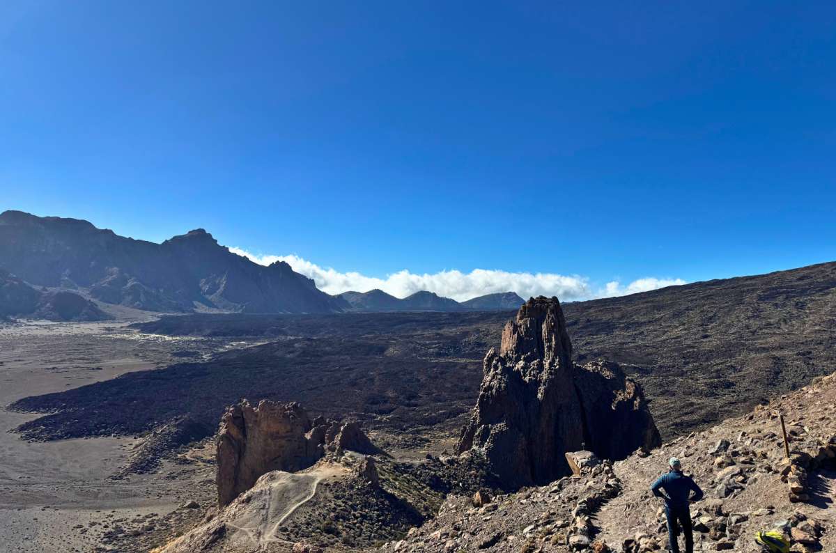
This is the view you get for barely any effort at Roques de García
My verdict: The best short hike I tried in Teide National Park and probably the highest scenery-to-effort ratio of any walk I did on Tenerife. The only real downside is sharing it with everyone else who has figured that out.
Route map:
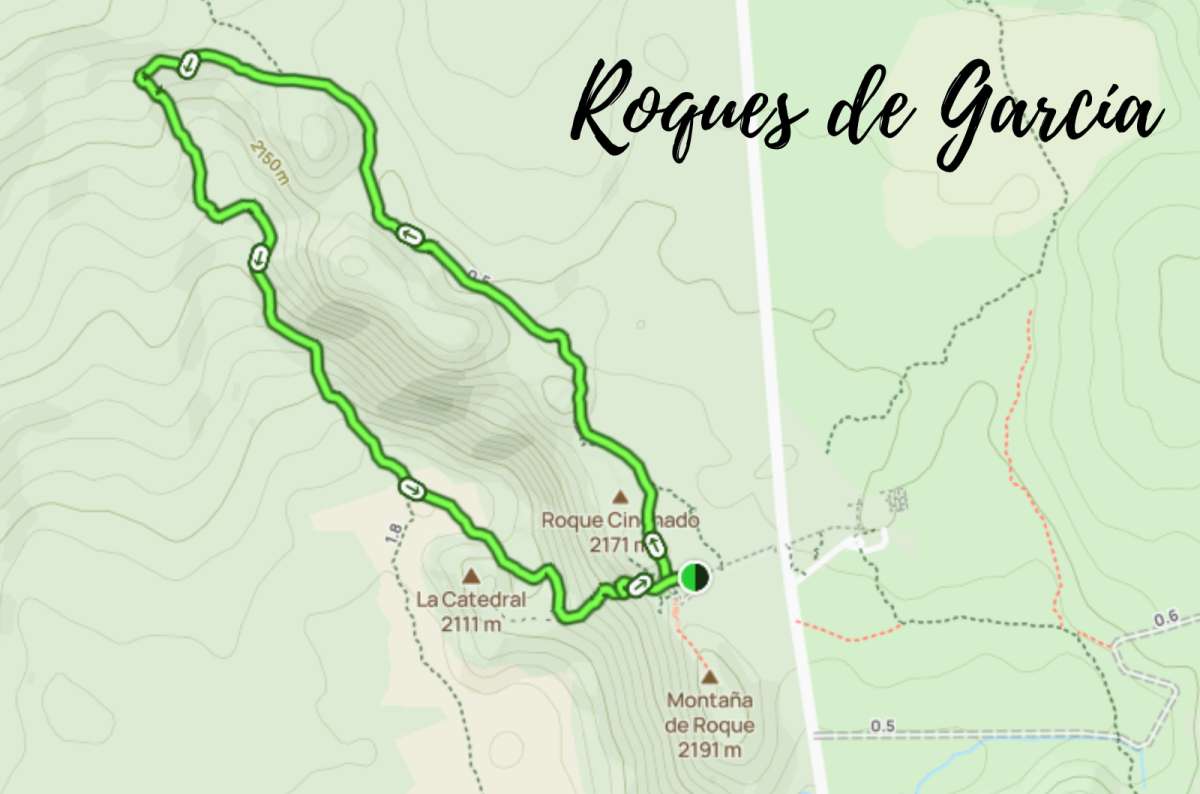
Alltrails.com map of Roques de García hike

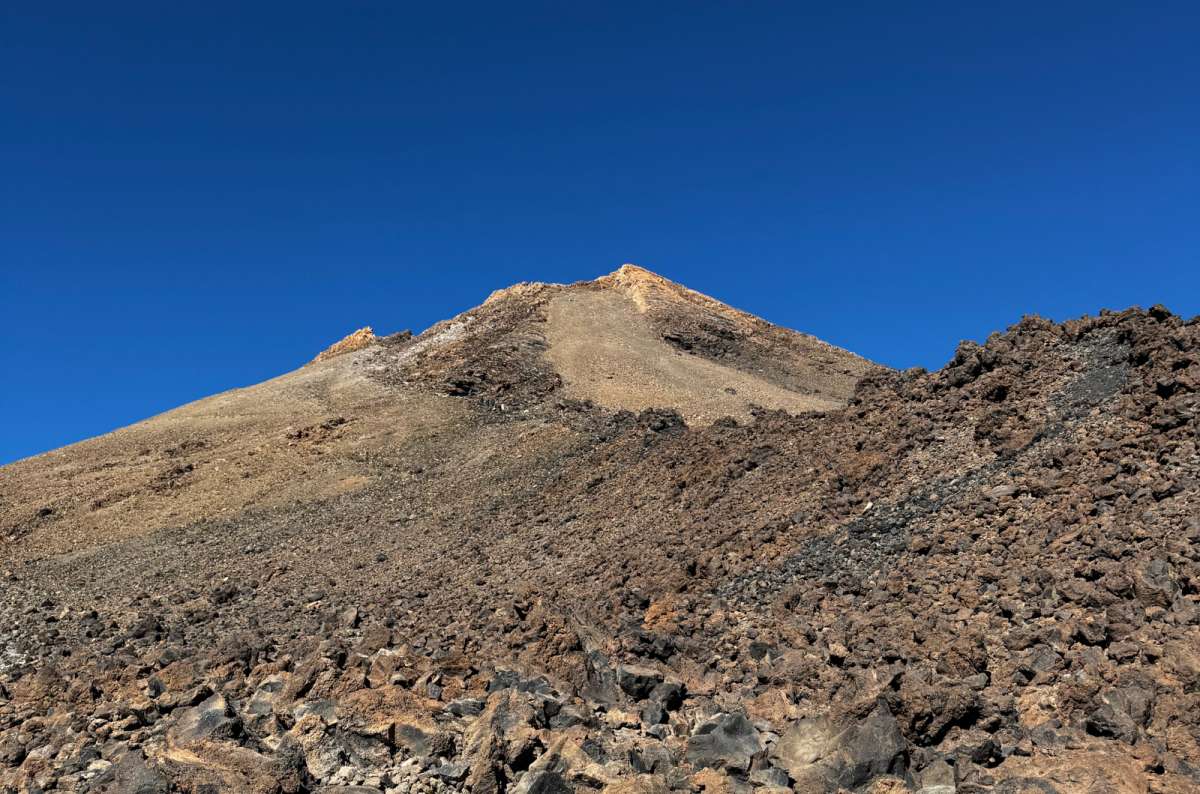
Above 3,000 m on Teide, this is what barren actually looks like
Pico Viejo was my first real lesson that distance means very little once you’re walking above 3,000 m (9,843 ft). I did the shorter high-altitude version from Teide’s upper cable-car station rather than hiking all the way up from the bottom, and it still felt considerably more demanding than the distance would suggest.
From the upper station, I headed toward the Pico Viejo viewpoint rather than the absolute summit of Teide. That distinction matters. You don’t have to stand on Spain’s highest point to get a proper high-altitude hiking experience here.
The landscape is almost completely barren: volcanic rock, huge open views across the caldera, and Pico Viejo’s enormous crater below. On a clear day, the views stretch far beyond Teide itself. What surprised me most, though, was how much I noticed the altitude. The route isn't especially long, but above 3,000 m my pace slowed down, and the effort felt completely different from hiking at sea level.
Weather is the other variable. There’s very little protection from the wind or sun up here, and conditions around the upper station can be completely different from the coast. Cable-car operations are also weather-dependent, which means this isn't a hike I'd build into an itinerary without checking conditions beforehand.
Compared with Roques de García, Pico Viejo asks more from you in basically every way. It costs more because you're using the cable car and it requires more planning. Roques de García is easier and gives you fantastic volcanic scenery almost immediately. Pico Viejo wins if what you want is the sensation of actually being high on Teide, looking across a huge volcanic crater from above.
Would I say you need to continue to the absolute summit to make the trip worthwhile? No. Pico Viejo was enough to give me the high-altitude Teide experience I wanted without making reaching the highest possible point the entire purpose of the day.
My verdict: The best Tenerife hike I tried for experiencing serious altitude without doing a serious-length hike. Roques de García wins on scenery-to-effort and simplicity; Pico Viejo wins on altitude, scale, and the feeling of actually being up on the volcano.
Route map:
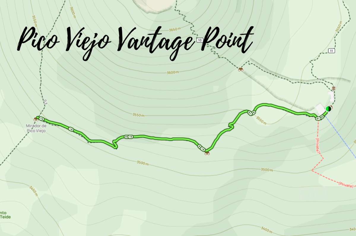
Alltrails.com map of Pico Viejo Vantage Point hike
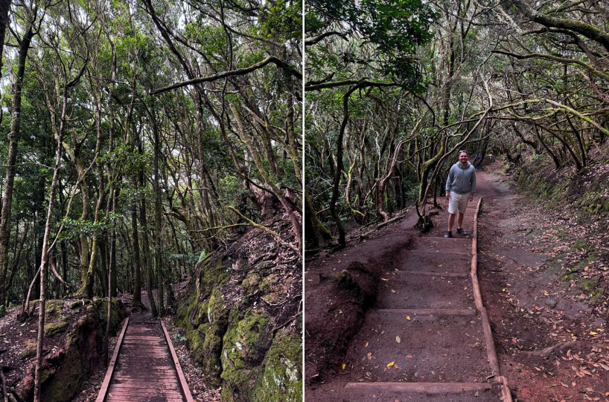
Sendero de los Sentidos in under 100 m of elevation gain. Feels like a different planet anyway
Sendero de los Sentidos is almost the opposite of Roque de Taborno. You don't come here for huge mountain views or exposed ridges. You come for the forest itself—and if you want an easy introduction to hiking in Anaga, this is where I’d start. These details are for route 3, the longest of the three Sentidos routes.
I showed up expecting a quick little forest walk and instead felt like I’d stepped into a completely different climate. The trail runs through Anaga’s laurel forest, with moss-covered trees, wooden walkways, and mist hanging between the branches. At times it feels more prehistoric than subtropical.
If you're an experienced hiker looking for a proper mountain route, Sendero de los Sentidos will probably feel too short. You also don't get the constant panoramic views of Taborno. The payoff is atmosphere instead: ancient forest, mist, moss, and a version of Tenerife that feels nothing like the dry south.
Accessibility depends on which section of the trail you take, so I wouldn't describe the entire route as universally accessible. Trail #3 was straightforward; parking and crowds at Cruz del Carmen were the bigger problem. I literally kept bumping into people when it got busy, which somewhat ruins the whole enchanted-cloud-forest thing. I'd arrive around 8 am, before it gets busy.
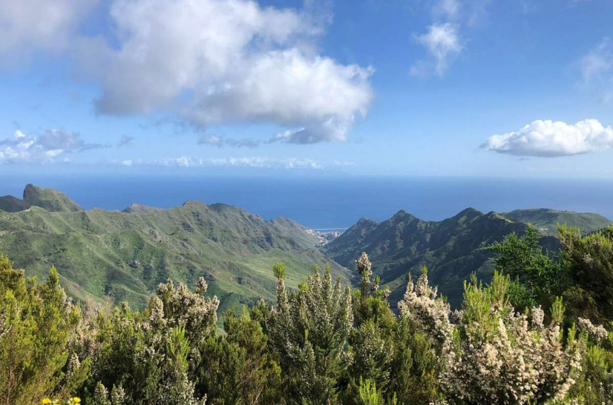
Sendero de los Sentidos promises forest, not views. This one snuck in anyway
My verdict: The easiest of the Anaga hikes I tried and the one I'd recommend to beginners and families. Roque de Taborno wins easily for views; Sendero de los Sentidos wins if you want Anaga's cloud forest without much effort or exposure.
Route map:
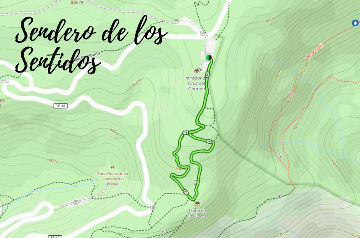
Alltrails.com map of Sendero de los Sentidos hike
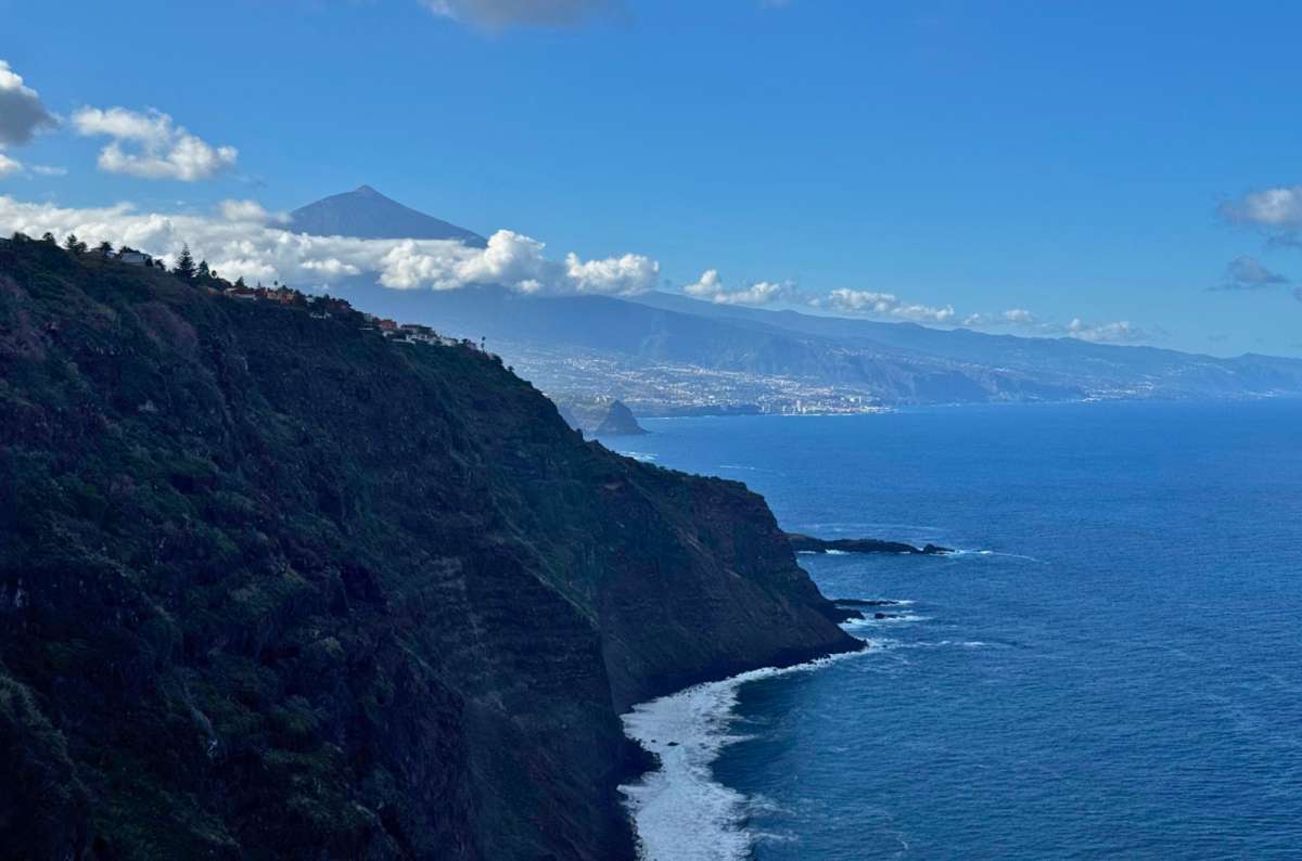
Mirador 500 Escalones gives you Teide and the coast for free, no stairs required
Mirador 500 Escalones is a strange one. It’s hidden in what looks like a completely normal residential area, and then suddenly there’s a huge staircase dropping toward the coast with views of Teide and a black-sand beach below.
Despite the name, I’m pretty sure there aren't actually 500 stairs. I counted closer to 200.
This isn't really a hike in the same sense as Roque de Taborno or Pico Viejo. It's more of a short coastal workout, and I think that's the right expectation to have before going.
The funny thing is that some of the best views are right near the beginning. You don't necessarily need to walk all the way down and then climb every stair back up just to get the payoff. On a clear day, you can see along the coast, down toward the black-sand beach, and back toward Teide.
If you do decide to walk the whole staircase, obviously remember that everything you walk down has to be climbed again. It's not particularly difficult, but if your knees hate stairs, I'd skip it.
Would I make a special trip across Tenerife for it? No. I gave it 6.5/10 for the detour. But the time payoff is excellent: you need no more than about 30 minutes; it was low-key when I visited, and you can get good coastal and Teide views without committing to a proper hike.
My verdict: A good quick stop if you're already nearby, and I'd happily do it again under those circumstances. Just don't come expecting a major Tenerife hiking trail—or 500 stairs.
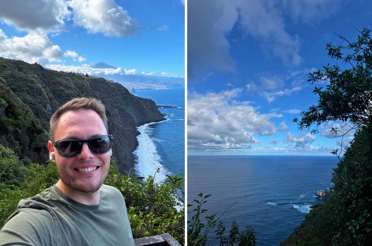
Skip counting the stairs and just go for the first viewpoint. That's the one worth the stop
Major Tenerife hiking trails still on my list
The five hikes above are routes I actually completed. The three below aren't. I researched them while planning my Tenerife trips, but I haven't walked them yet, so I'm not going to rate them or tell you what they're “really like.” They're here because each would fill a genuine gap in my current hiking experience on the island.
This is the Anaga hike I'd come back for when I want something much more substantial than Roque de Taborno or Sendero de los Sentidos.
The appeal is the scale. Instead of a short forest or ridge walk, Benijo to Faro de Anaga turns the northeastern coast into a proper hiking day, crossing much more demanding terrain through one of the wildest-looking parts of Anaga.
That's exactly why it remains on my list. I've spent plenty of time exploring Anaga and completed some of its shorter trails, but I haven't yet done the long coastal route that would show me what the region is like over a full day.
Why it's still on my list: A demanding Anaga hike that would be completely different from the shorter routes I've already completed.
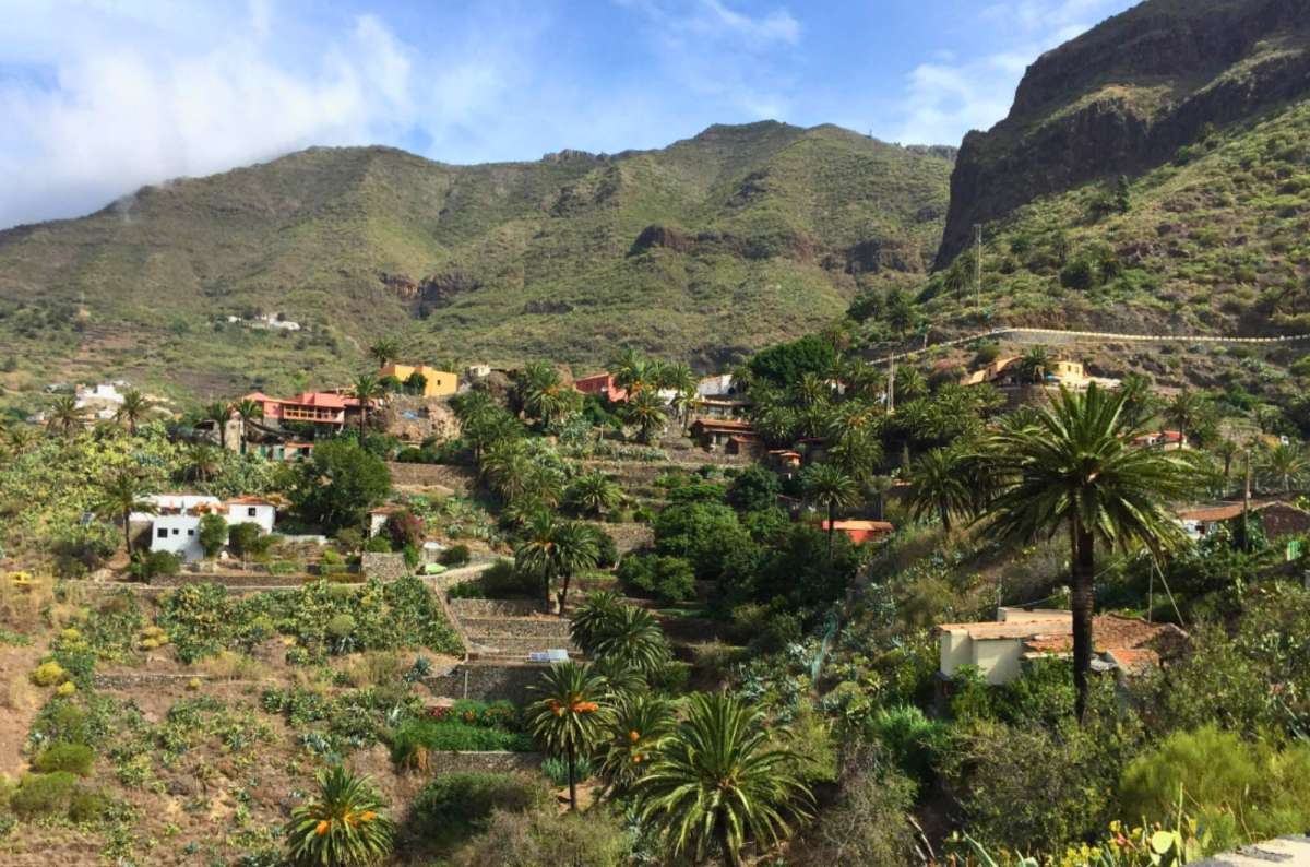
This is as far as I've gotten in Masca. The gorge is still on the list
If there's one major hole in my firsthand Tenerife hiking experience, it's Teno—and Masca Gorge is the route I'd most like to use to fix that.
The currently regulated route descends approximately 5 km (3.1 mi) from Masca, starting at around 750 m (2,461 ft) and finishing at sea level. The official site rates the descent as high difficulty and estimates about four hours.
This one now requires considerably more planning than simply driving to Masca and setting off. Under the current system, hikers need a reservation, must reach Masca using the required TITSA 355 service from Santiago del Teide, and need a separately booked boat ticket for the journey out from Masca Bay. Private vehicles cannot be used to arrive at the trail entrance.
Conditions can also close the gorge or jetty at short notice, so I'd check the official status immediately before going.
Why it's still on my list: It would finally give me a major completed hike in Teno rather than only experiencing those mountains from the road.
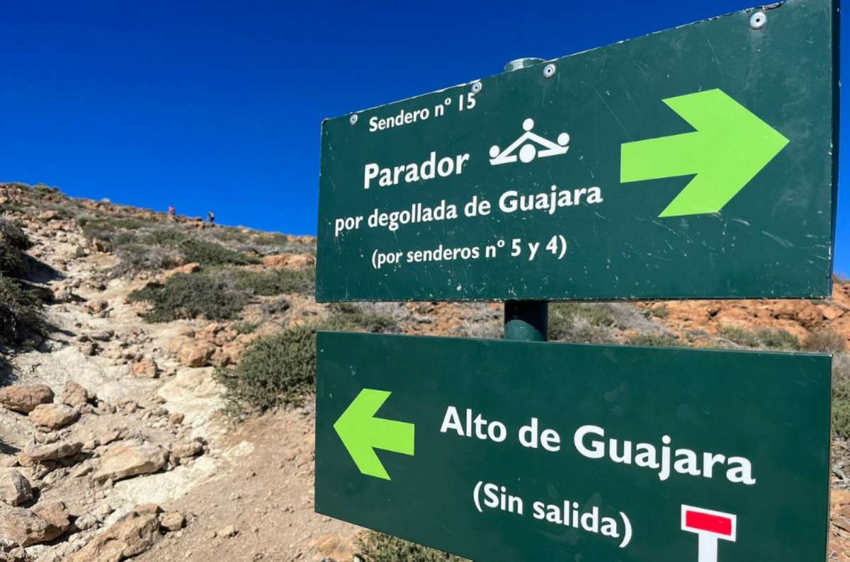
Sendero 15 is as close to Guajara as I've gotten so far
Montaña Guajara is the Teide route I'm missing for a different reason. I've already experienced the national park through shorter volcanic walks and the high-altitude Pico Viejo route, but I haven't done a proper mountain ascent here independently of the cable car.
That's what would make Guajara worthwhile for me. It isn't filling the same role as Roques de García, and it isn't another variation on taking the cable car high onto Teide. It's the more serious mountain day that's currently missing from my Teide hiking experience.
Why it's still on my list: A proper Teide mountain ascent and the most obvious next step beyond the shorter routes I've already completed.
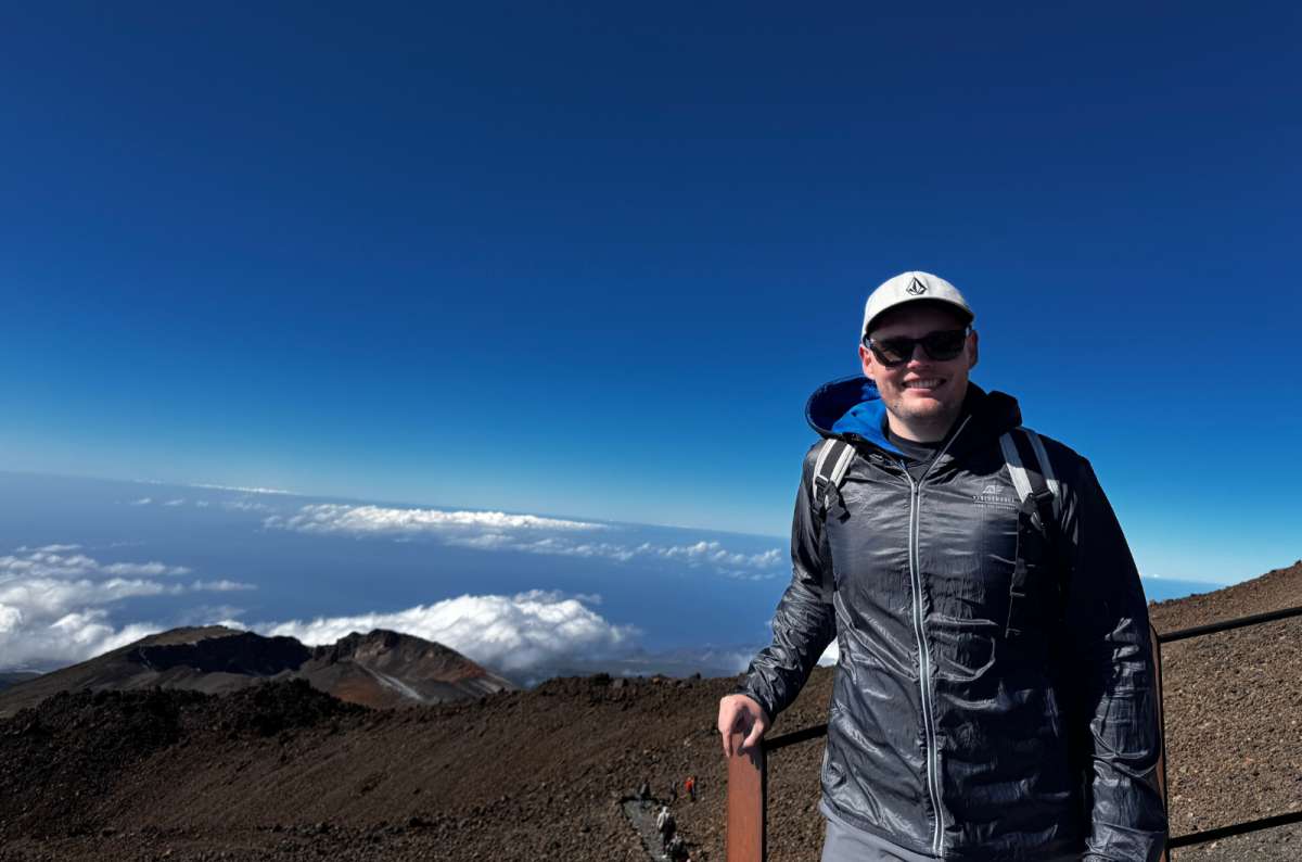
Teide's altitude sneaks up on you. So does the sun up here
Hiking in Tenerife comes with a few problems that aren't obvious when you're sitting on the coast looking at blue skies. The biggest one is how quickly conditions change between regions and elevations.
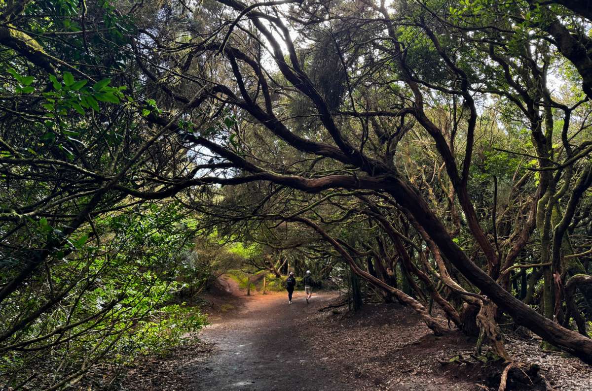
Anaga's laurel forest, somewhere between two trailheads
Where you stay can make a big difference if hiking is one of the main reasons you're visiting Tenerife. There isn't one perfect base for every trail, so I'd choose according to the region you expect to explore most.
For Anaga, northern Tenerife or La Laguna puts you much closer to the cloud forest and trailheads and saves you repeatedly driving up from the south. For Teide, La Orotava or somewhere in the northern interior gives you convenient access into the national park.
If Teno is your priority, Santiago del Teide or western Tenerife makes more sense, particularly if you're planning one of the longer routes around Masca. The southern resorts are still perfectly workable if you value beaches, restaurants, and convenience, but expect longer drives to reach many of Tenerife's best hiking areas.
I wouldn't choose a specific hotel based on one trail. Choose the region first, then the accommodation. I cover the different bases and their trade-offs in my where to stay in Tenerife guide.
My personal recommendation: If you're staying in Puerto de Mogán, the Radisson Blu Resort & Spa is the one I'd book.
After hiking in Tenerife, I don't think there's one trail I'd recommend to everybody. Roque de Taborno was my favorite overall, but the best choice depends much more on how much time you have, what scenery you want, and how comfortable you are with altitude or exposure.
First time hiking in Tenerife
Roque de Taborno
My best all-rounder for scenery, manageable distance, and a proper mountain feel.
Beginner
Sendero de los Sentidos
Easy terrain, short distance, and Anaga's laurel forest without the exposed sections of Taborno.
Families
Sendero de los Sentidos
The easiest option I tried, although I'd still choose the route variant carefully depending on children's ages and mobility.
Photographers
Roque de Taborno
The strongest combination of mountains, ocean, cliffs, and changing cloud conditions.
Only one hour
Roques de García
About 40 minutes for a real walk through Teide's volcanic landscape and an excellent scenery-to-effort ratio.
Half a day
Roque de Taborno
Enough time to hike without rushing and deal with Anaga's roads and limited parking.
Want volcanic scenery
Roques de García
The simplest way to walk among Teide's volcanic formations without cable-car logistics or serious altitude.
Want green forest
Sendero de los Sentidos
This is the one for laurel forest, moss, mist, and the atmospheric side of Anaga.
Affected by altitude
Roque de Taborno or Sendero de los Sentidos
I'd stay away from Pico Viejo. I felt the altitude noticeably above 3,000 m despite the walk itself being short.
Dislike exposure
Sendero de los Sentidos
Choose this over Roque de Taborno, where parts of the route cross exposed terrain.
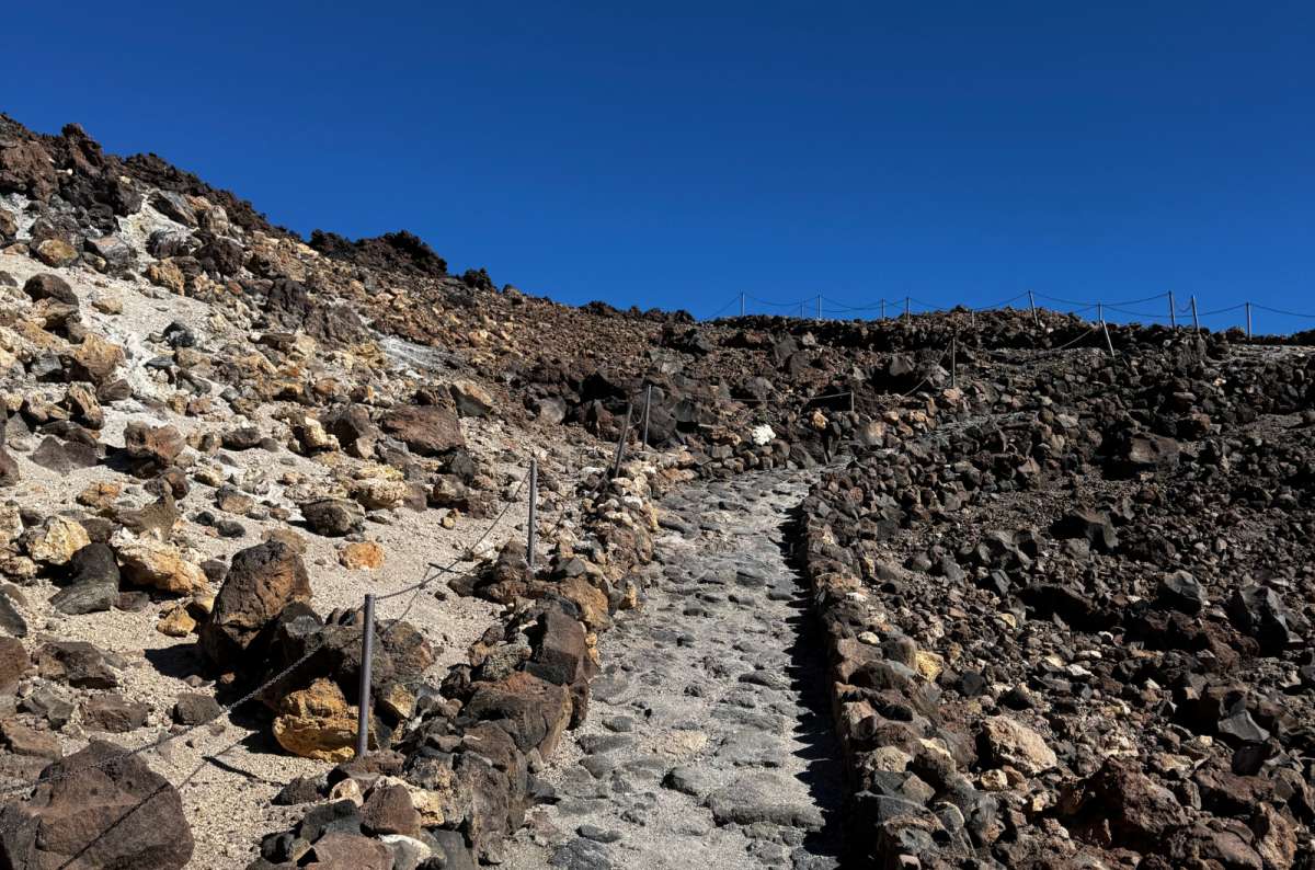
Ropes and volcanic rubble. That's the terrain Teide asks you to walk through
Absolutely. What surprised me most about hiking in Tenerife wasn't the number of trails, but how different the hiking can be on one relatively small island. Anaga gave me green ridges, ocean views, and cloud forest; Teide gave me barren volcanic terrain and hiking above 3,000 m (9,843 ft).
If I had to sum up my experience:
So this isn't my definitive list of every great Tenerife hiking trail—and I don't want it to be. My firsthand coverage is strongest in Anaga and Teide, and that's where I'd currently send most hikers first. Teno is the obvious reason for me to come back.
And considering I originally planned one day in Anaga and ended up spending three there, I don't think I'll need much convincing. Tenerife is the kind of place where one hike quickly turns into a reason to plan the next one.
This post contains affiliate links. If you make a booking through one of my links, I may earn a small commission—at no additional cost to you. Thank you for your support!


Hi, I’m Jan. I travel fast and intensely, whether I’m exploring the buzz of Tokyo in 3 days or road-tripping through mountains and beaches on a 3-week Thailand adventure. And no matter where I am, you’ll always find me in a comfortable hotel at night and eating the best food.
If that sounds like your kind of journey, hop on board, and let’s explore the world together!
I started this blog after realizing how tough it can be to find reliable, authentic travel info. You wouldn’t believe how many “travel bloggers” never even visit the places they write about! On Next Level of Travel, you can count on my full honesty and insights drawn from my firsthand experiences.
Here’s the deal: not every destination is all superlatives and unicorns. I’ll let you know if a tourist attraction isn’t worth your time, like skipping overrated stops in my 2-week Spain itinerary. And when I find something truly special—like the perfect mix of culture and nature in Cape Town—you can trust that it’s worth adding to your itinerary.


Comments | Thoughts? Give us a shout!