
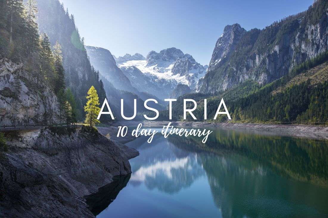
Where to find the best places to hike in Austria
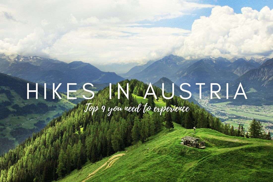
Best hikes in Austria—List of my 9 favorite day trails from 4 base cities
Map of the best hikes in Austria
1. Grossglockner hike (and drive?)—One of the best places in Austria for high-altitude drama
2. Hochkeil hike—An easy hike with panoramic views and no tourists
3. Krimml Waterfalls hike—Top place to hike in Austria with Europe’s tallest falls!
4. The Sigmund Thun Gorge Trail—One of the easiest hikes in Austria with serious waterfall energy
5. Liechtensteinklamm Hike—An easy hike with waterfalls, spirals, and 440 stairs to glory
6. Dachstein Krippenstein hike—World Heritage views... and an alpine shark statue?
8. Prossau Valley hike—Easy alpine trail in Austria with real Yosemite vibes
9. Seefelder Spitze Trail—The best hike in Austria if you want to suffer for your summit
Living next door in the Czech Republic—a beautiful but tragically mountainless land—I’ve spent the better part of my adult life escaping south into Austria to hike in the Alps. I’ve tried dozens of trails over the years, which is why I’ve curated this list of day hikes in Austria that are actually worth it—for those of you that are here for the results of my research, not for a generic list of trails you can find anywhere.
The thing is, I love hiking, but I also have standards and am a busy guy. Mediocre views or touristy goat paths? No thanks. I want the best of the best and nothing less! And so do you, I assume.
Most of the hikes here are easy to moderate, deliver big on scenery, and don't waste your time. That means you can knock them out in half a day and still make it to dinner with your knees intact.
I’ve also selected a few longer or tougher ones—they’re still day hikes, but they come close to the kind of payoff you’d expect from a multi-day trek, which could be just what your Austria itinerary is looking for.
Pro tip: For maps of the best hiking trails in Austria, I recommend komoot.com, which I prefer slightly over AllTrails in Austria.
Austria’s Alps cover 60% of the country, which is why it’s so damn perfect for hiking. After all, it is what Austria is known for. But with that many trails, knowing where to base yourself is half the battle. If you’re looking for the best places to hike in Austria and prefer a way that doesn’t just spit unpronounceable region names at you, you’re in the right spot.
I’ve organized this list by the best towns to stay in for hiking in Austria—places that not only give you trail access but are actually worth spending time in:
Below, you'll find a quick summary of the top hikes near each of these towns, followed by in-depth trail descriptions with real stats, my honest commentary, and zero sugarcoating.
Let’s go.
The Austrian Alps really feel like a place straight from a fairytale
Pro tip: If you're continuing into Italy after Austria, don't miss the things to do in Aosta Valley. It's one of my favorite Alpine regions for mountain scenery, hiking, and castles.
Pro tip: All of these base cities are within a 2–3-hour drive of each other, so you could easily build a 7–10-day trip around them. If you're starting in Salzburg or Vienna, Zell am See is a smart first stop. Or wait, I’ve already planned a 10-day Austria itinerary for you! It doesn’t include all of the hikes here, but go ahead and make it your own with some tweaks.
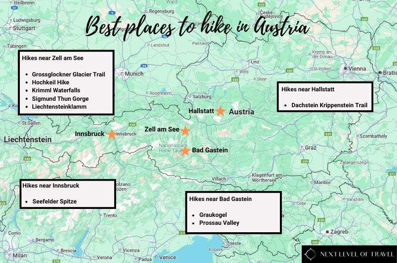
Here’s where you should be basing yourself if you’re looking for the best day hikes in Austria, whether that’s easy hikes or some more challenging trails
The most versatile base for hiking in Austria. You’ve got waterfalls, gorges, glacier views, and trails that range from easy to hard. Read more about Zell am See. And if you want to combine it with a city stay, get some inspo on things to do in Salzburg.
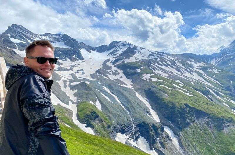
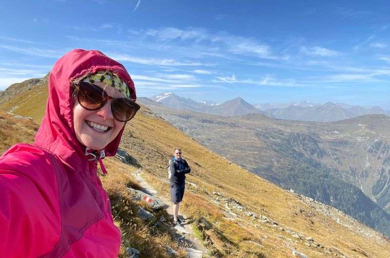
The majestic views of the Alps were simply breathtaking!
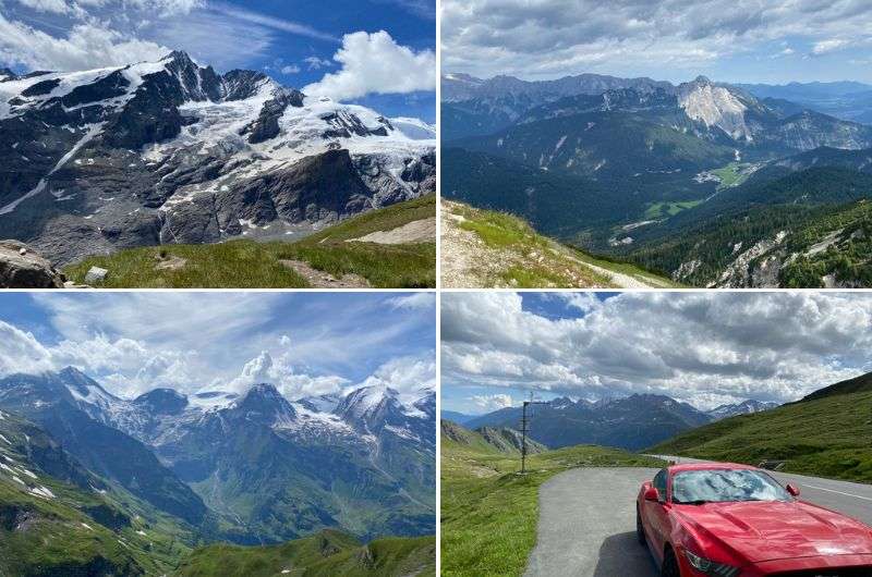
This is Austria’s most dramatic day hike—period. You get views of Austria’s highest peak at t 3,798 m (12,461 ft), some cable-assisted scrambling (don’t worry, it’s fun), and scenery that makes every drop of sweat feel worth it. It’s short, steep, and ridiculously scenic. Bonus: You start the hike from a place that feels more like a Bond villain’s lair than a parking lot.
This hiking trail leads you from Kaiser Franz Joseph Höhe to Pasterze, the largest glacier in the Eastern Alps. And that's something you definitely want to see. Be prepared for steep descents at the beginning and rocks where you sometimes have to use steel cables to safely cross them. At least you don't end up with sand everywhere like I did during even some of the best day hikes in South Africa.
This hike isn't particularly long, but it's quite challenging. If you're imagining a relaxed walk up a gentle hill, then choose a less demanding route. But if you're a badass like me, then you'll be thrilled.
This Grossglockner hike is not the easiest, but certainly one of the most beautiful I’ve been on
Getting to this hike is on par in excitement and beauty as the hike itself: you’ll need to drive the Grossglockner High Alpine Road! If you read my article about the Best places to visit in Austria, you'll see that the Grossglockner High Alpine Road is spectacular and, for me at least, the best experience you can have in the country.
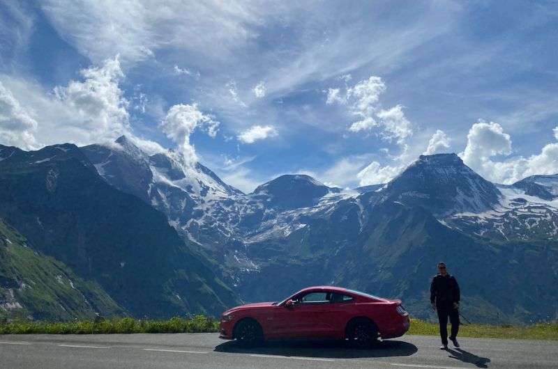
Just me, my car and the Alps
Good to know: Before you blindly get into your car and head towards the High Alpine Road, check the calendar, because this road has opening times! It’s open roughly from late April to early November (depending on the weather and snow conditions).
You can park (for free) in what’s probably the most scenic parking garage I’ve ever seen, simply called Parkhaus Kaiser Franz Josefs Höhe. Next to it is an information center.
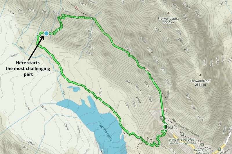
Quite a hard hike, but it’s a really good one that only takes 2.5 hours (see the map on Alltrails.com)
I loved this moderate hike with a beautiful view!
This is one of the best easy hikes in Austria if you’re craving high-mountain views without a high-mountain effort. It’s got everything: wildflower meadows, killer summit views, and almost zero crowds. It’s short, sweet, and somehow still feels like a big adventure.
Pro tip: If you're fond of watching the sunrise or sunset, this is the ideal summit for you. Even in terms of terrain, the path isn't particularly rocky, allowing it to be completed by moonlight or headlamp.
For me, ascending Hochkeil ranks among the most beautiful hikes in the Alps. I love a good loop trail that isn’t too long, but still delivers epic view after epic view.
Once you leave the village of Arthurhaus, you won't encounter any advanced civilization (like a restaurant), so don't forget to bring refreshments. The entire route is lined with typical Alpine meadows where, in summer, you might come across herds of cows.
In the background of these meadows, you'll witness the stunning exposed Alpine massifs, including my favorite, Hochkönig, measuring 2,980 m (9,777 ft), and even Dachstein and Grossglockner.
The elevation profile of the trail is constant, so you'll steadily ascend until you reach the summit. Hochkeil's peak sits at 1,783 m (5,850 ft), offering a beautiful panoramic view in all directions.
From the summit of Hochkeil, there's a stunning view in all directions—picture dramatic cliffs jutting out of the mountain range everywhere you look; you’d almost expect a bunch of dragons to fly past like they’re straight out of Avatar!
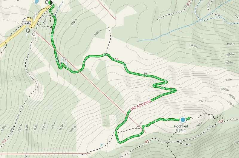
A map of the Hochkeil hike (get it on Alltrails)
Pro tip: If you're fond of watching the sunrise or sunset, this is the ideal summit for you. Even in terms of terrain, the path isn't particularly rocky, allowing it to be completed by moonlight or headlamp.
Turns out nature has better pressure than my shower @ Krimml Waterfalls
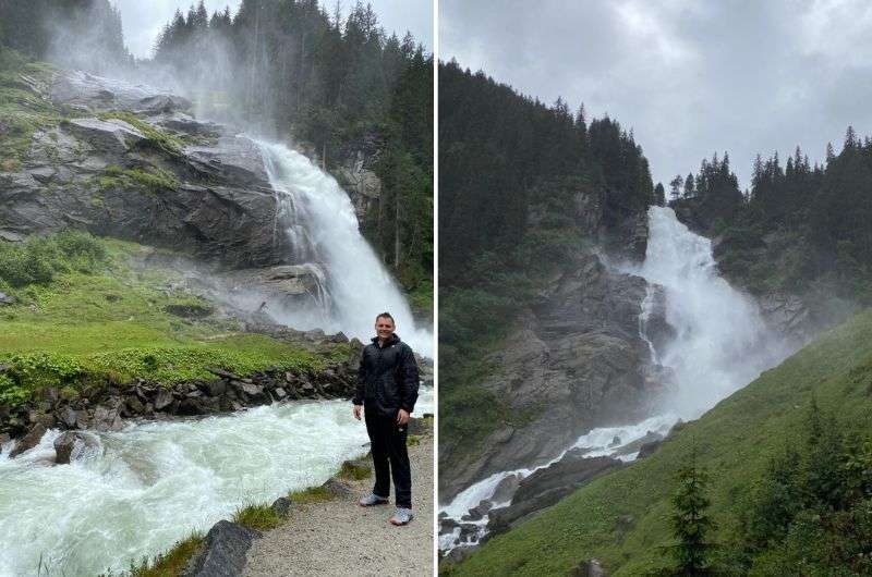
Yes, it’s popular. Yes, there might be busloads of selfie hunters. But you’re here for Europe’s highest waterfall (380 m (1,247 ft)), and that’s exactly what you get—plus a surprisingly legit workout on the way up. Go early, power through the crowds, and enjoy a hike that’s far more rewarding than you’d expect.
This hike isn't exactly a leisurely stroll around Zell am See’s town square (the city that you can base yourself for this hike), but you won’t feel like one bad step and your life will be over, either. As the name suggests, you'll head to the Krimml Waterfall. The Krimml Waterfalls, with a total height of 380 m (1,247 ft), are the highest waterfalls in all of Europe.
The starting point for this hike is Kürsingerplatz at 1,070 m (3,510 ft). You can, unfortunately, tell just how popular the trail is when you get there. If you're not a fan of crowds (like me), I recommend setting out early in the morning and at least beating out those who take too long to roll out of bed and eat breakfast.
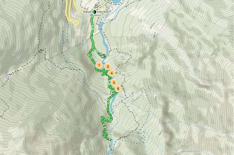
Map of a beautiful Krimml Waterfall trail (see the map on Alltrails)
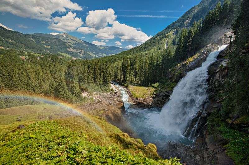
A 380 m (1,247 ft) waterfall—The Krimml Waterfalls in sunny weather
I reached the lowest waterfall in about 15 minutes, and then it was about an additional hour-long journey to the top.
What I found great is that along the way, there are plenty of viewpoints offering breathtaking vistas of the waterfalls and benches for resting. Not that I need rest, I’m so young and strong that I rarely ever sit, even when I’m at home! But you might appreciate a bench, so now you know they have them there.
Basically, this hike has nothing to do with wild nature trekking, and I’m ok with it. It’s still gorgeous, even in terrible weather (ask me how I know)
Pro tip: The Krimml Waterfall trail is open continuously from approximately mid-April to the end of October at all daylight hours. Before you set off, I recommend checking the official website to make sure it’s open.
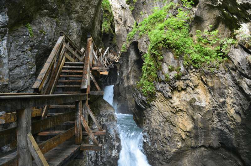
Sigmund Thun Gorge
This is your low-effort, high-reward hike: wooden walkways, churning waterfalls, and an easy stroll that still makes you feel like you saw something epic. If you’re short on time, energy, or patience, this is the one. It’s basically the definition of an easy hike in Austria that doesn’t suck.
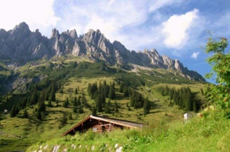
Another gorge that completely enchanted me (Klamm=gorge in German). A hike alongside it surely can't be missing from this list.
Liechtenstein Gorge originates from glaciers. It's associated with plenty of myths and legends, and I must say, at times, I could almost feel the mystical dangers, too. Interestingly, it got its name from Johann II of Liechtenstein, who contributed 600 gold coins to the opening of the monument, enabling the locals from St. Johann im Pongau to fulfill a long-standing dream. Locals are still proud of the gorge to this day, as it ranks among the longest and deepest gorges in the Alps.
This hike genuinely deserves a spot on my 10-day Austria itinerary.
They say “don’t go chasing waterfalls”, but we'll ignore that tip from TLC and do the complete opposite.
This hike is more of a pleasant stroll. You can easily walk the main part of the trail through the gorge it in about 30 minutes. But don’t give up, there are continuous for another hour or so, all the way to the nearby pretty alpine lake and back.
Water you doing if you’re not chasing waterfalls? @ Sigmund Thun Gorge
Narrow and slippery wooden walkways and bridges run alongside the river. I was really impressed by the magnificent views from every part of the way. The entire path is really easy except for the last part, where the path steeply descends, but nothing you can't handle.
Just beware, you’ll probably get a little wet, so watch your camera (I recall seeing them sell waterproof covers for your gear at the ticket desk).
After you go through the gorge, my tip is to extend your experience by including the Klammsee loop (to a small alpine lake just beyond the gorge), which adds up to an hour or more of relaxed walking. It’s a beautiful little addition.
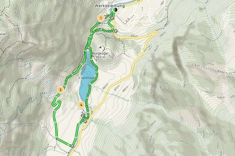
A map showing the full hiking trail to the Sigmund Thun Klamm Waterfall (map from Alltrails)
Pro tip: If you’re planning a trip to the Sigmund Thun Klamm Waterfall and it’s getting close to winter or it’s not quite full springtime yet, visit the official website first. The trail is closed between November and the end of April most years.
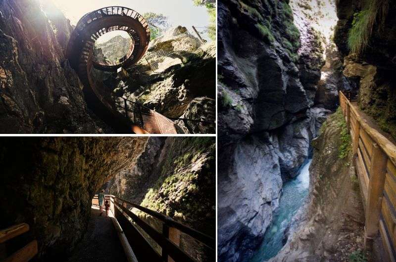
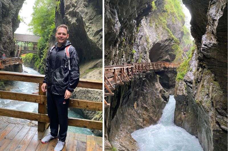
Liechtensteinklamm is the one with the rare, variously twisted wooden walkway
This is hands-down one of the most unique places to hike in Austria. The trail’s mystical and carved straight into a gorge. You’re walking on wooden walkways under cliffs and beside crashing waterfalls, and the spiral staircase halfway through is pure fantasy land (in a good way).
Another gorge that completely enchanted me is Liechtensteinklamm.
Liechtenstein Gorge originates from glaciers. It's associated with plenty of myths and legends, and I must say, at times, I could almost feel the mystical dangers, too.
Interestingly, it got its name from Johann II of Liechtenstein, who contributed 600 gold coins to the opening of the monument, enabling the locals from St. Johann im Pongau to fulfill a long-standing dream. Locals are still proud of the gorge to this day, as it ranks among the longest and deepest gorges in the Alps.
I set off in the morning from my fantastic 4-star hotel, Aktivhotel Alpendorf. Even though the journey to the gorge only took 15 minutes, I started quite early, which was a smart decision.
According to the official website, the gorge is visited by 170,000 visitors annually. Heaven forbid we all show up there on the same day! I left the car in the parking lot, which is a short distance from the ticket counter, about 400 m (1,300 ft). There’s a restaurant there, too, which has outdoor seating.
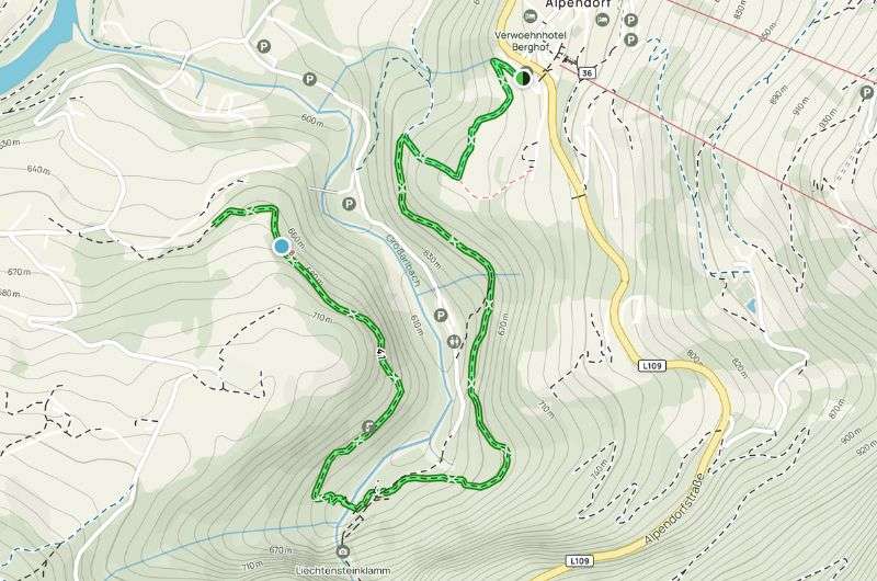
Map of out & back Lichtenstein Klamm hike (see full details on Alltrails)
The path through the gorge itself is magnificent. I walked along a wooden walkway under various overhangs, tunnels, and valleys bordering transparent waterfalls. At one point, the trail turns into a helix, a spiral staircase.
Even though the trail is relatively easy, I recommend wearing comfortable shoes for climbing all those stairs. There are quite a lot of them here—I counted 440 (just kidding, I looked it up online).
If you were planning on going with a stroller, leave it in the car. Not the kid, the stroller (use a carrier if you can’t get it to hike yet).
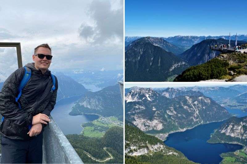
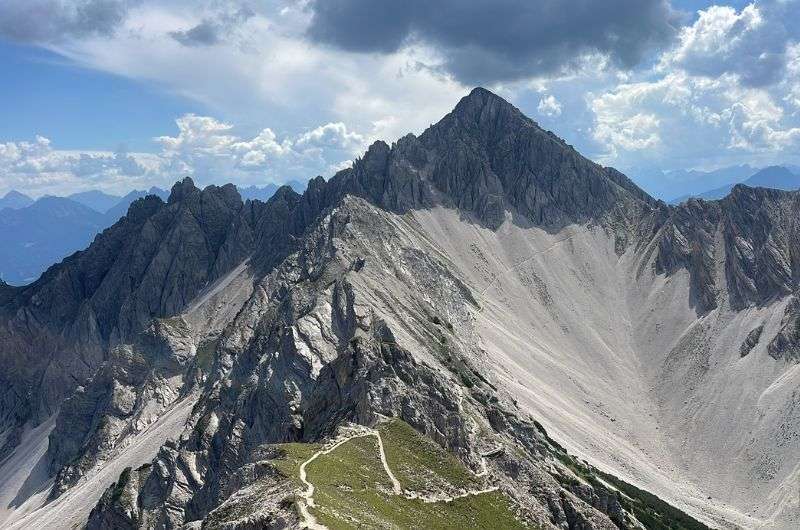
You’re here for the glacier views, odd summit features, and that rare combo of epic scenery + easy logistics. As if that wasn’t enough, Hallstatt itself is to die for.
Me at the 5 Fingers lookout platform on Dachstein Krippenstein
You get it all: glacier panoramas, quirky stops like the 5 Fingers platform and a random steel shark, plus a mellow descent that your knees won’t hate you for. This one’s easy to moderate depending on how many mountain cable cars you take, scenic as heck, and surprisingly uncrowded if you get there early. A solid pick for anyone who wants that "wow" factor without mountaineering gear. Not to mention that Hallstatt is by far one of the best cities in Austria.
When someone mentions Dachstein, most people think of the glacier and ski slopes. Like the rest of Austria, however, Dachstein offers activities even in the summer months. And in this case, it's really worth it.
This trail is atypical because it can be completed in two ways: the harder version is where you ascend from the valley to the summit, while the easier version is the opposite, where you take the cable car up and descend into the valley on your own two feet.
Pro tip: As part of my trip, I visited the Dachstein ice caves, as I described in detail in my Dachstein Guide, so I opted for the easier variant of the hike.
First, a little tip: If you're not in a hurry to get down to the valley, I recommend visiting the 5 Fingers lookout platform before starting the trail.
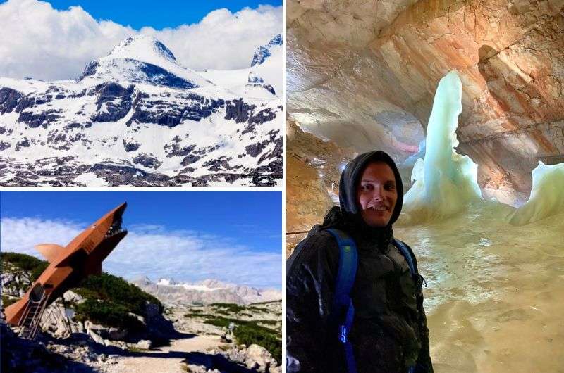
An array of experiences on Dachstein Glacier!
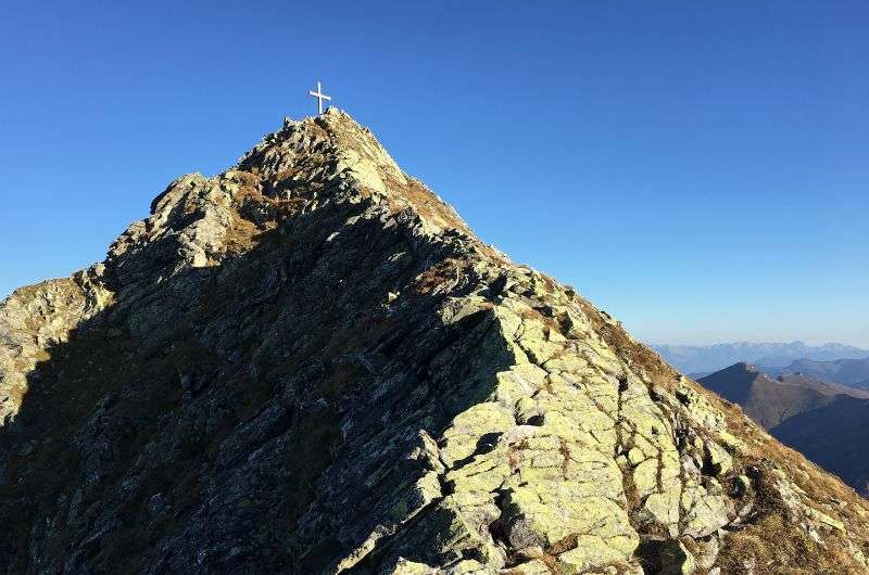
After about 30 minutes of descending, you'll reach another tourist stop, a large metal statue of a shark. Random, I know. After another 30 minutes, you'll come across a cross. Crosses are found on every significant and insignificant peak in the Alps, so it's not surprising. This one is called the Heilbronner Kreuz and stands here in memory of 10 students and 3 teachers who perished here in 1954 due to a sudden weather change that brought heavy snow. The entire trail was named in their memory.
Beyond the cross, a brisk descent begins into the valley, where you transition from sharp rocky peaks to a more overgrown environment full of greenery and the first trees. The trail ends at the cable car, where you can refresh yourself and head back to your accommodation.
Pro tip: Save some of your vacation time for one day in Hallstatt.
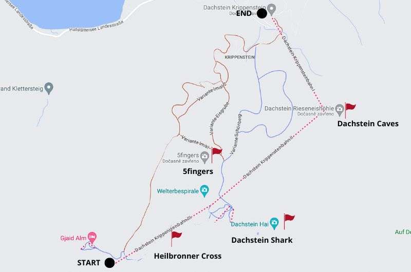
Map of a hike from the summit to the valley
Bad Gastein is a spa town turned hiking hub. Great for higher-altitude trails without the tourist stampede. And you can soak your sore legs afterward. Bad Gastein itself isn’t the most exciting city, BUT it does have a waterfall running down the middle of it, so there’s that.
My hotel recommendation: Johannesbad Hotel Palace
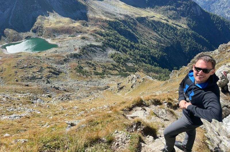
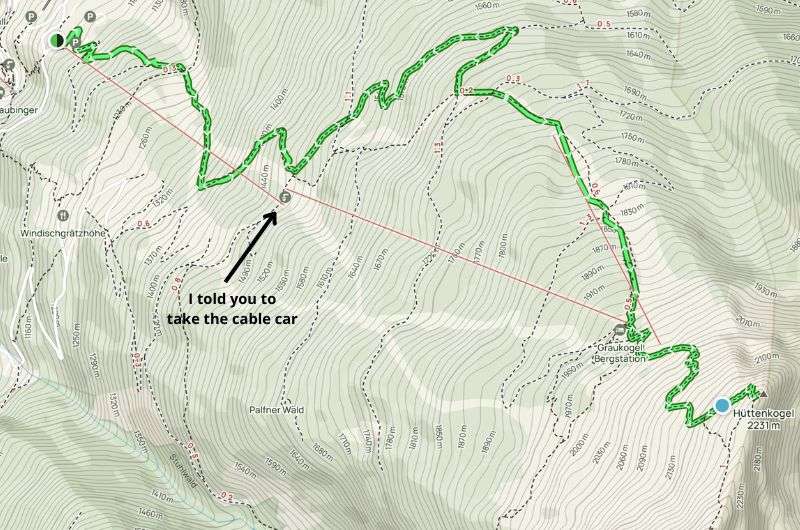
Conquering the rugged Graukogel trail
This hike has a heavier and lighter version. You can use the cable car for part of the trail, or you can go ahead and climb it yourself.
Graukogel is your perfect type-2 fun hike: hard enough to feel accomplished, but with views that make you forget your thighs are on fire. And if you’re smart and take the cable car halfway, you still earn the summit without dying. Pro tip: We were almost able to skip lunch because of all the blueberries we snuck on the way!
The hike to the summit of Graukogel, standing at 2,492 m (8,176 ft), can be quite an experience OR a leisurely hike, depending on whether you do the entire journey on foot or jump on the cable car. I vote for the cable car!
I recommend taking the cable car up and then starting the ascent on foot from 1,950 m (6,398 ft). It's much better because once you get off the cable car, the path practically turns into stairs, which is much easier on your knees than traversing through the mud in the forest.
Plus, by choosing the cable car, you'll save about 950 m (3,117 ft) of elevation gain, without sacrificing any of the best scenery. That's a win in my book.
(I tried walking on foot from Bad Gastein, so I can advise you to definitely NOT follow in my footsteps.)
Also, good news for you if you're a blueberry lover! Along the way up the mountain, you can collect millions of them, so you can basically skip lunch.
The views from the summit are fantastic. The only downside is the rather dangerous last 300 m (984 ft) along the cliffs. I don't understand why Austria hasn't secured that section yet.
The way back is the same as the way up... on the flip side, you can then take the cable car back down to Gastein (your knees will thank you).
Reaching the summit of Graukogel, one of the best hikes in Austria
Map of the hike from Bad Gastein to Graukogel. See route details on Alltrails
Tip: If this hike isn't challenging enough for you, you can merrily continue another 45 minutes to the summit of Hüttenkogel at 2,231 m (7,320 ft) from Graukogel.
After a demanding ascent, treat yourself to some relaxation at the Alpentherme Gastein. Wonderful baths and thermal spas for a few bucks. Huge parking, super modern equipment. With my phobia of slipping on wet tiles, I appreciate the anti-slip floor in and around the entire pool. And the sauna world, in my opinion, one of the best I’ve seen. Absolutely awesome and just 5 minutes by car from Bad Gastein.
Not far from Graukogel is another fun spot @ Stubnerkogel
Only the Milka cow is missing from this beautiful Austrian scenery!
This one flies under the radar, and that’s exactly why you should do it. It’s a beautiful high-alpine valley with zero hype and even fewer people. One short incline aside, it’s mostly easy, making it a perfect nature fix if you’re not in the mood to sweat through your socks.
I’m including this hike in Prossau Valley specifically for nature and tranquility lovers. This trail isn't as well-known, so if you set off early in the morning, you'll have it all to yourself. After trying some of the more popular hiking trails in Austria, which will sound like music to your ears, I promise.
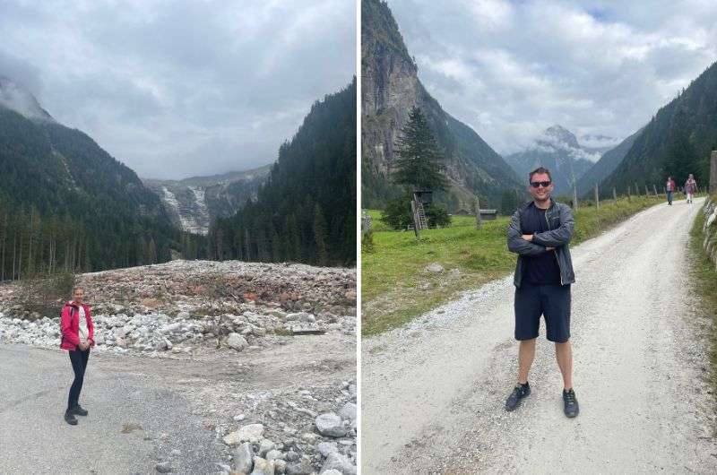
The calm and uncrowded trails of Prossau Valley
I expected a very easy hike and got a medium level because there's one challenging section on the trail with an elevation gain of about 300 m (984 ft), and also, an 11 km (6.8 mi) round trip is quite a bit.
Regarding the hike, the main feature is an amazing rock wall that's about 300 m (984 ft) high, and judging by my well-traveled experience, it's beautiful and worth seeing.
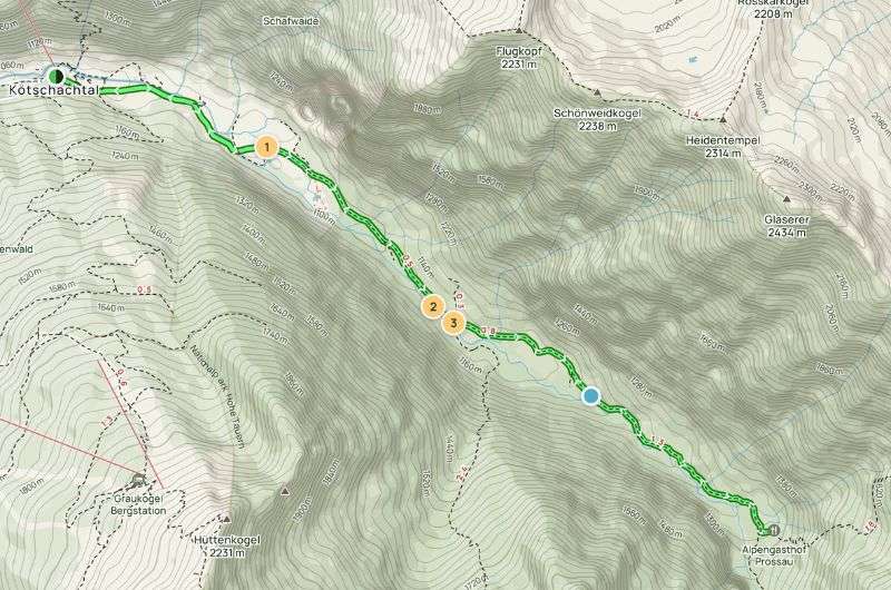
Three hours stroll in nature, which reminded me of Yosemite Valley (see the map on Alltrails)
For me, the most breathtaking part, where even the staunchest opponents have to pull out their phones and capture the beauty, was the final part of the trail. It was so epic that it reminded me of Yosemite Valley.
Funny story: During our journey, apparently, some logging was happening in the forest, so we heard strange sounds. We thought it was a bear, so we really picked up our pace.
Then I realized that there are no bears in Austria... but then I remembered that bears are in Aosta Valley in Italy, and those could make their way over the border, right? So we sped up even more (something between running and speed walking). Fortunately, we soon realized it was just logging, so we could return to our comfortable pace.
So, for now, I can calmly say that there really are no bears in Austria!
You want a more challenging hike? Tyrol delivers, and Innsbruck is an urban base that meets serious summit hiking mecca. There’s so much to do in the are you’ll need to spend at least 2–3 days here.
My hotel recommendation: Hotel Innsbruck
Seefelder Spitze—this one is challenging!
This is for the overachievers. It’s long, steep, and definitely not easy—but the views at the top make you feel like you just conquered half the Alps. If you’re looking for a proper challenge on a day hike in Austria, this one’s going to deliver. And punish. But mostly deliver.
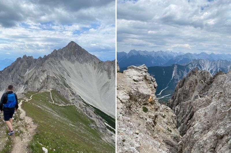
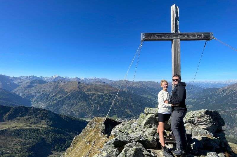
The hike to the 2,221 m (7,287 ft) high summit of Seefelder Spitze is definitely not for the faint-hearted.
We set off from the town of Seefeld in Tirol, which is less than 30 minutes from Innsbruck. It's a smaller, relatively unassuming town, but if you're a winter sports enthusiast, you'll be in heaven here. In fact, the Winter Olympics were held here twice, in 1964 and 1976. The area is very popular for hiking in the summer, so be prepared not to be alone on the trail. The hike to Seefelder Spitze through the mountain pass Seefelder Joch was seriously demanding, so if you want a real challenge, head for the summit.
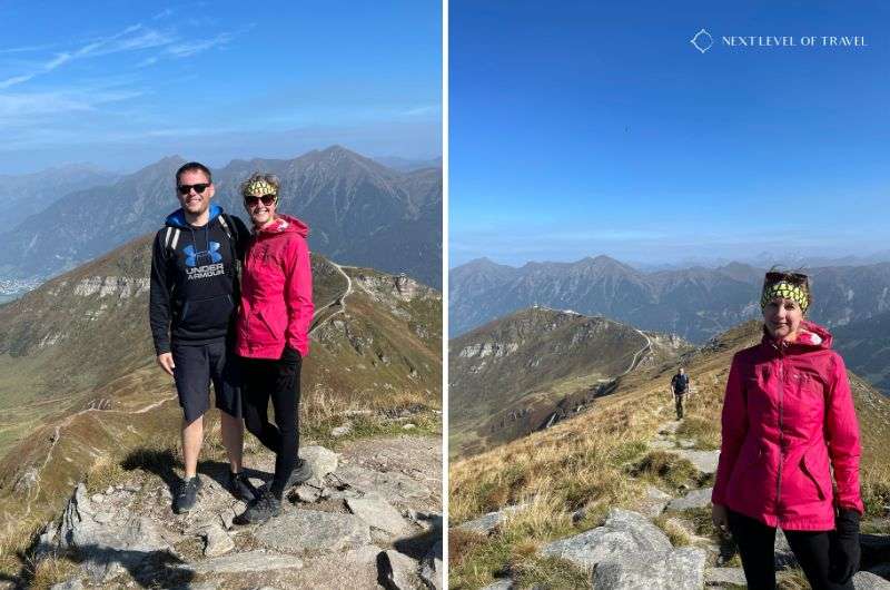
Exploring one of the best hiking trails in Austria near Innsbruck
Definitely wear sturdy, high-quality footwear as the trails are unstable in some places. Be ready for endless uphill sections on the way up, no flat terrain, and some physically taxing, extremely steep uphill stretches. Sounds lovely, doesn’t it?
However, the breathtaking views at the summit and along the way will reward you. Thanks to the good weather, we even saw the Zugspitze summit in Germany.
Good to know: In May, there may still be snow at the top.
Pro tip: Everyone should visit Vienna at least once in their life, these unusual things to do in Vienna make the visit worth it.
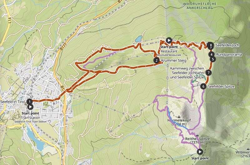
One of the best hiking trails in Austria, from Seefeld in Tirol to Seefelder Spitze Hike (See route details on kamoot)
This post contains affiliate links. If you make a booking through one of my links, I may earn a small commission—at no additional cost to you. Thank you for your support!
Where to find the best places to hike in Austria
Best hikes in Austria—List of my 9 favorite day trails from 4 base cities
Map of the best hikes in Austria
1. Grossglockner hike (and drive?)—One of the best places in Austria for high-altitude drama
2. Hochkeil hike—An easy hike with panoramic views and no tourists
3. Krimml Waterfalls hike—Top place to hike in Austria with Europe’s tallest falls!
4. The Sigmund Thun Gorge Trail—One of the easiest hikes in Austria with serious waterfall energy
5. Liechtensteinklamm Hike—An easy hike with waterfalls, spirals, and 440 stairs to glory
6. Dachstein Krippenstein hike—World Heritage views... and an alpine shark statue?
8. Prossau Valley hike—Easy alpine trail in Austria with real Yosemite vibes
9. Seefelder Spitze Trail—The best hike in Austria if you want to suffer for your summit


Hi, I’m Jan. I travel fast and intensely, whether I’m exploring the buzz of Tokyo in 3 days or road-tripping through mountains and beaches on a 3-week Thailand adventure. And no matter where I am, you’ll always find me in a comfortable hotel at night and eating the best food.
If that sounds like your kind of journey, hop on board, and let’s explore the world together!
I started this blog after realizing how tough it can be to find reliable, authentic travel info. You wouldn’t believe how many “travel bloggers” never even visit the places they write about! On Next Level of Travel, you can count on my full honesty and insights drawn from my firsthand experiences.
Here’s the deal: not every destination is all superlatives and unicorns. I’ll let you know if a tourist attraction isn’t worth your time, like skipping overrated stops in my 2-week Spain itinerary. And when I find something truly special—like the perfect mix of culture and nature in Cape Town—you can trust that it’s worth adding to your itinerary.

Comments | Thoughts? Give us a shout!