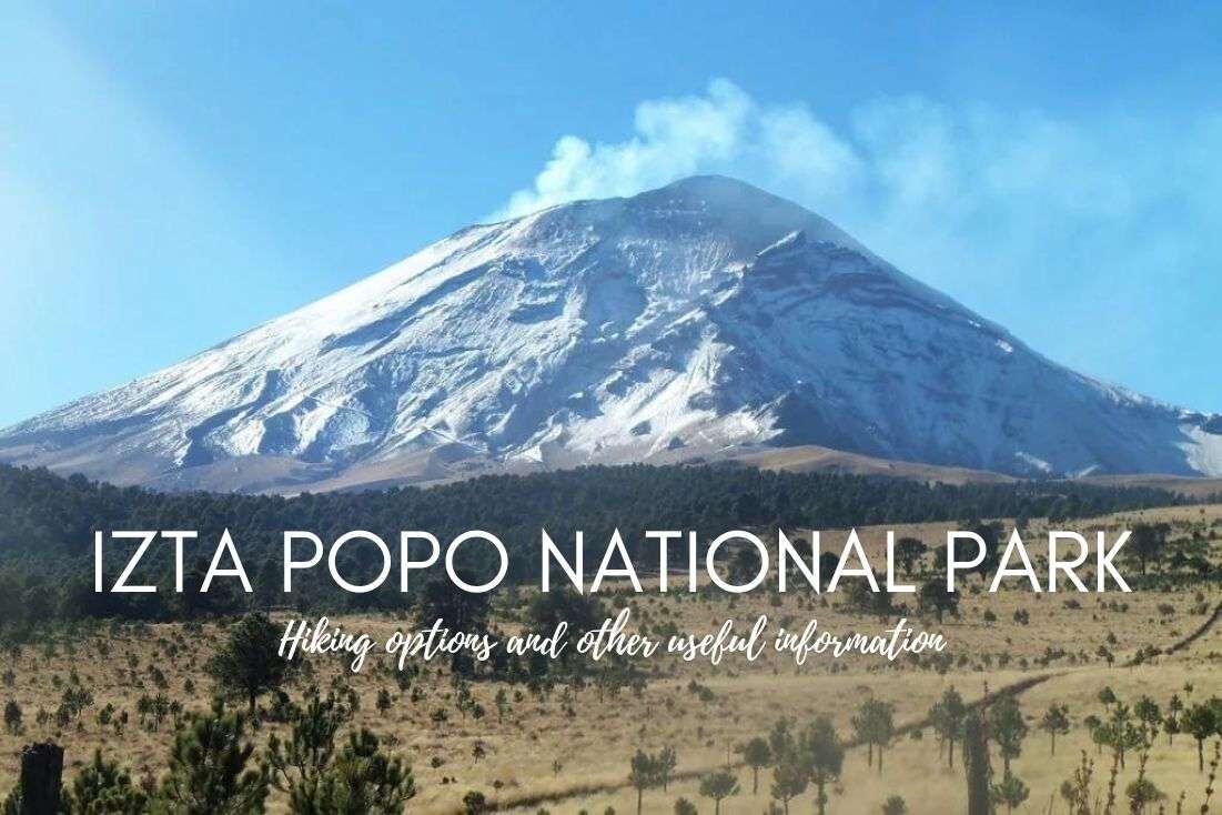
Izta Popo National Park Guide: Paso de Cortes Hiking, Popocatepetl Access & Tips

At a glance: Planning a visit to Izta Popo National Park
You might also be interested in reading:
Introduction to Iztaccíhuatl Popocatépetl National Park
Weather conditions & best time to visit Izta Popo National Park
Why hiking Popocatépetl is not allowed
Izta Popo hiking trails of various difficulty levels
1. Closest to Popocatepetl: Paso de Cortez hike
2. Hike to Aztec ruins on Monte Tlaloc
3. Iztaccihuatl volcano hike (standard La Joya route)
Other hikes in Izta Popo National Park
How to get to Izta Popo National Park from Mexico City?
In this article, I’ll talk about how to access Izta Popo National Park and the top hiking options within it, including my experience hiking Paso de Cortés, the best non-climbing trail with epic views that leads right between Popocatepetl and Iztaccihuatl volcanoes.
Iztaccíhuatl Popocatépetl National Park is about surreal views, crispy air, and enormous volcanoes encased in snow towering over you. Just a 1-hour drive from Mexico City, it’s easy to reach, but not that easy to explore. The majority of the accessible areas are above 3,000 m (9,800 ft), meaning altitude sickness is a real possibility.
I’ll share 3 hikes of various difficulty, my travel tips based on real experience in the park, prices, access points, trail details, and even my favorite restaurants in the area. And of course, I’ll address the question “Can you hike Popocatepetl?” After spending weeks all over Mexico, I’ve got a lot of worthwhile insights to share with you.
Read more from my Mexico travel blog.
At a glance: Planning a visit to Izta Popo National Park
Visiting Izta Popo National Park and curious about Popocatépetl hiking, trail options, and practical details? Here’s the essential information in one quick overview. I go into details in the article.
- Location of Izta Popo National Park: 70 km (43 mi) southeast of Mexico City, about a 1.5-hour drive (I recommend renting a car)
- Main entrance: Paso de Cortés
- Altitude range: Most visitors hike between 3,600–3,900 m (11,800–12,800 ft), Iztaccíhuatl summit: 5,230 m (17,160 ft), Popocatépetl: 5,428 m (17,802 ft)—closed to climbers
- Can you climb Popocatépetl? No. It’s permanently forbidden due to volcanic activity. Popocatépetl is currently erupting as of 2026, with regular ash and gas emissions reported.
- Can you hike Iztaccíhuatl? Yes.
- Most popular hike in Izta Popo: Paso de Cortés → La Joya hike (15 km/9.5 mi round trip)
- Entrance fee (2026): 120–125 MXN (7–8 USD) per person
- Best months to visit: November–April (dry season, clearer skies)
- Gear essentials:
- Layers (cold mornings, strong wind)
- Sun protection (high UV at altitude!)
- Plenty of water
- Good hiking shoes
- For summit attempts: proper alpine gear + experience (ice axe in winter)
- Permits & registration:
- Entrance fee required for all visitors
- Summit attempts on Iztaccíhuatl require additional registration (details in section at the end of this article)
- Hotel in Mexico City: I stayed at Hotel Fiesta Americana Viaducto Aeropuerto and it was perfect for easy access to Izta Popo National Park. I love how stylish and welcoming the hotel is.
- Hotel in Puebla: The Hilton MM Grand Hotel was my choice in Puebla. Loved the breakfast!
You might also be interested in reading:
- Yucatán Itinerary—2 Weeks Full of the Best Places to Visit
- Safety in Mexico—Is It Safe to Travel There?
- The Best Food in Mexico: 11 Things You Should Try + 3 You Shouldn’t
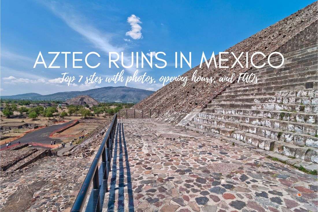
- 7 Best Aztec Ruins in Mexico
- 33 Mexico Travel Tips from Our Own Experience
Sometimes, all you need to do is take the first step... I've filtered out the best hotels in Mexico City for you
Save it for yourself to come back to later, or share with your friends on social media!
I've already planned your ititnerary for the trip, complete with my travel tips.
Find more travel content, photos, and fun on:
Introduction to Iztaccíhuatl Popocatépetl National Park
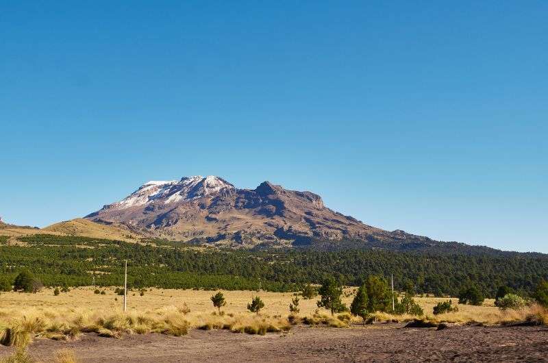
The beautiful and majestic Iztaccihuatl (the one you can actually climb)
Also known as Iztaccíhuatl-Popocatépetl Zoquiapan National Park or Iztaccíhuatl-Popocatépetl, everyone just calls it Izta Popo National Park for obvious reasons (try saying the full name 3x fast). It’s part of the UNESCO World Network of Biosphere Reserves. The park covers a vast area, encompassing both volcanoes and their surrounding landscapes. The mountains here are among Mexico's highest peaks.
The park lies right on the Trans-Mexican Volcanic Belt on the border of Estado de México and Puebla, with Amecameca de Juárez as the main gateway town. Most tourists visit from Mexico City or Puebla.
The highlights of the park are two of the country’s most iconic mountains named after the Aztec legend of the lovers Iztaccíhuatl (“Sleeping Woman”) and Popocatépetl (“Smoking Mountain”). They are the country’s second- and third-highest mountains: Popocatépetl rises 5,428 meters (17,802 feet) above sea level, and Iztaccíhuatl is at an impressive 5,230 meters (17,160 feet) of elevation. That’s quite an altitude—don’t underestimate the big 3 of altitude sickness!
Hiking options include Paso de Cortes and La Joya
People come here to walk, hike, or attempt serious high-altitude climbs. Climbing Popocatépetl is strictly forbidden; it’s an active volcano and permanently closed to the public.
Iztaccíhuatl is open, but summiting it is a demanding alpine climb at over 5,000 m (16,40 ft) and not something you just “try.”So don’t.
That’s why most visitors—myself included—stick to hiking down below, around Paso de Cortés and La Joya. You walk between Iztaccihuatl and Popocatepetl volcanoes at pretty high altitude, but without gambling with lava or your lungs.
Tip: If you’re a hiking lover like me, see my top 10 best hikes in Mexico.
The perfect day trip from Mexico City or Puebla
Izta Popo National Park is about 70 km (43 mi) from Mexico City and roughly 55 km (34 mi) from Puebla, making it an easy half-day or full-day trip from either city. Driving time is around 1.5 hours, depending on traffic and weather.
Most visitors enter the park via Paso de Cortés, a high mountain pass at about 3,600 m (11,800 ft) that sits between the two volcanoes and serves as the main access point and parking area. Arriving by private vehicle is the most convenient option.
From here, you can take the wide dirt road toward La Joya, the primary trailhead for hikes on Iztaccíhuatl. La Joya is higher still (around 3,900 m / 12,800 ft) and marks the popular starting point for serious ascents—or simply a scenic alpine walk with ridiculous views of both volcanoes.
Did you know that the highest peak of Mexico is the 5,636 m (18,491 ft) Pico de Orizaba in Veracruz?
Weather conditions & best time to visit Izta Popo National Park
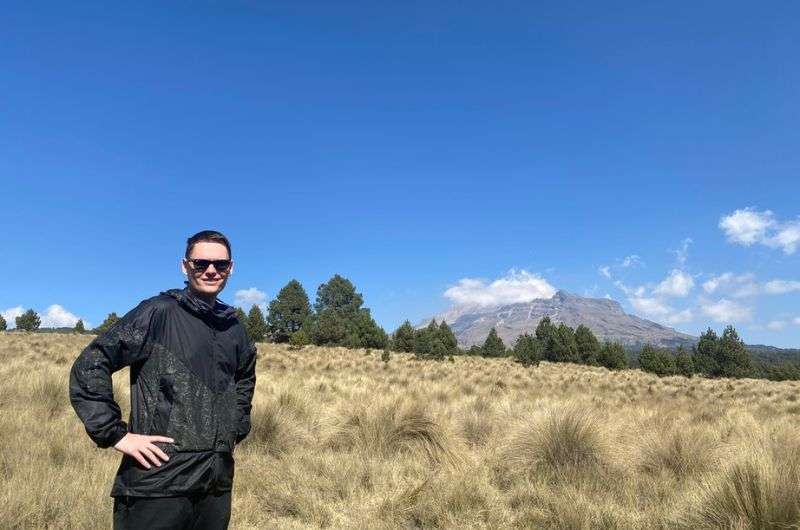
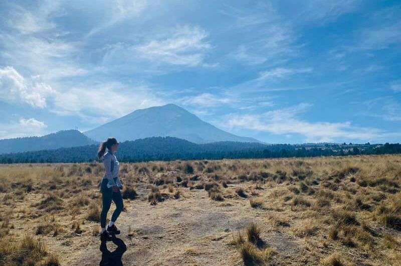
Me, with good clothes and sunscreen on, ready for Iztaccíhuatl Popocatépetl National Park!
In Izta Popo National Park, you will escape the heat of sunny Mexico whether you want to or not. Since most of the park lies more than 3,000 m (9,840 m) above sea level, you’ll have to handle crisp air and low temperatures, even during warm months. That means two things:
- Any hike will be harder than you expect, even without much elevation gain, because you already start out at a high altitude. Don’t underestimate this—acclimatize if you can, hydrate yourself, and take breaks..
- You will need sunscreen. I’m not kidding, bring protection. The sun is cruel at these treacherous altitudes. Even if the temperature drops, sun exposure doesn’t. There are very few trees along the higher trails.
Weather window: Weather conditions are alpine and can be unpredictable. Mornings are usually clear, while clouds, wind, and storms often roll in by early afternoon. Start early if you want views and stability. And if you’re visiting in colder months, remember that after 3–4 pm, temps drop quickly.
Seasonal access: During the rainy season (roughly May–October), dirt roads and trails can turn muddy and occasionally very challenging or even impassable, especially after heavy rain. In winter, higher elevations get snow and ice, which can make hikes significantly more technical and require proper gear. Always check local conditions before heading up, and get a guide if you’re climbing.
Best months to visit
The best time to visit Itza Popo National Park is March or April for dry days and less cold temps.
November to April (dry season) is when skies are clearest and trails are in good condition. From May to October is rainy season, when afternoon storms are common and dirt roads can turn muddy. Winter (December–February) offers the clearest views—but also freezing mornings.
Daytime temperatures at Paso de Cortés
- Winter: mornings often around or below 0 °C (32 °F), daytime 8–15 °C (46–59 °F)
- Rest of dry season: daytime 12–18 °C (54–64 °F)
- Rainy season: daytime 12–20 °C (54–68 °F), cooler when storms roll in
Read details about tickets and getting to Izta Popo at the end of my article.
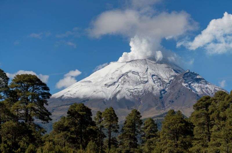
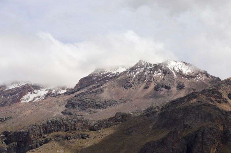
Popocatépetl
Why hiking Popocatépetl is not allowed
Popocatépetl is encased in snow and ice, but that’s not the problem. Lava is.
Popocatepetl is actively erupting
Popocatépetl isn’t nicknamed the “Smoking Mountain” for nothing. It’s an active volcano and has been erupting on and off since 2004, regularly sending ash and rocks into the air.
It’s considered one of the world’s more dangerous volcanoes—in the same league as Mount Vesuvius and Cotopaxi—and in a worst-case scenario, it could destroy nearby mega-cities like Mexico City and Puebla.
But don’t worry, volcanologists heavily monitor the area and visiting Izta Popo is safe. Hiking up Popocatepetl, however, is not happening.
Iztaccíhuatl is a different story. It’s technically active but dormant—its last eruption was in 1868 (yes, the year Ulysses S. Grant became U.S. president). These days, it mostly just sleeps, so people can hike to the top.
Izta Popo hiking trails of various difficulty levels
Hiking on Izta Popo is quite challenging. Get ready!
Hiking near Popocatépetl and Iztaccíhuatl was a once-in-a-lifetime experience for me. We arrived to Izta Popo full of anticipation but the thrilling sceneries were even better than we imagined.
These are three trails you can take, the first one ”easy”, the second one hard, and the last one super hard.
Impotant note: I recommend hiking in Izta Popo only if you’re in good physical condition. Again, the high altitude of the park makes even flatter trails harder than they seemIf you don’t feel strong enough to hike, don’t. I guarantee that even staying on the paved roads and visiting the park by car and staying in the marvelous surroundings is worth a trip. Or you can choose one of my other favorite hikes in Mexico to find a different, more suitable hike for you.
Did you know that altitude sickness is a real issue? It can surprise you at high elevations because of lower levels of oxygen, making you dizzy or even causing vomiting. It can occur if you're above 2,500 m (8,000 ft). Have some ibuprofen and enough fluids ready to treat it, and don’t go any higher if you start to feel weak or nauseous.
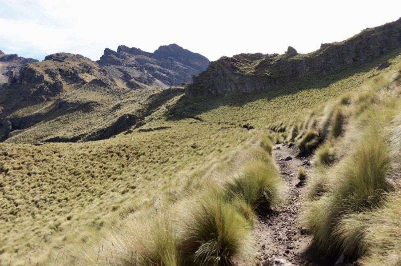
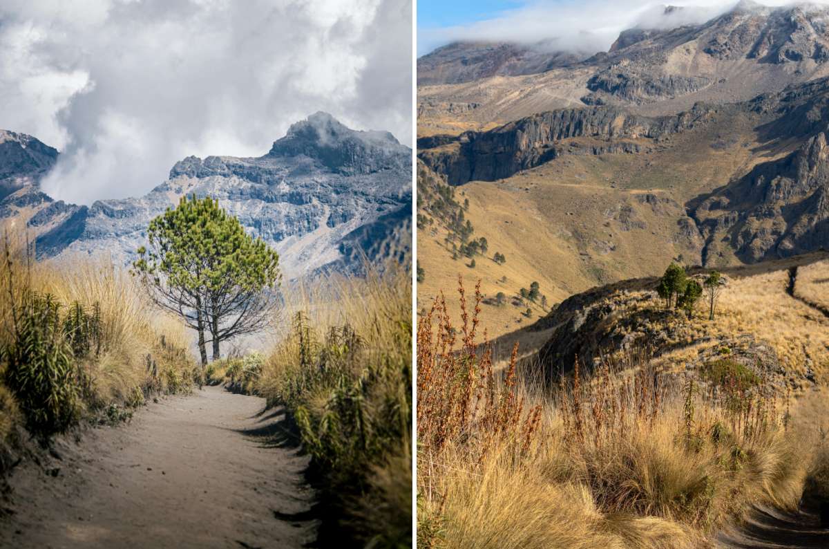
1. Closest to Popocatepetl: Paso de Cortez hike
From Paso de Cortés straight to La Joya and back!
Paso de Cortes hike details:
- Difficulty: easy (but mind the altitude)
- Length: 15.3 km (9.5 mi) there and back total
- Paso de Cortés (trailhead) elevation: 3,600 m (11,800 ft)
- Elevation at La Joya: 3,900 m (12,800 ft)
- Elevation gain: 300 m (1,000 ft)
- Time needed: 4 hours
Paso de Cortés is the historic mountain pass between Popocatépetl and Iztaccíhuatl. It’s a legitimate trailhead and scenic area within the park, and the elevation gain is doable, if the altitude doesn’t get you. It’s technically simple, but physiologically not.
First, you have to register and pay entrance fees at Paso de Cortés or at the CONANP office in Amecameca before hiking.
This trail starts in a parking lot called, surprisingly, Paso de Cortés. We set off towards La Joya on a wide dirt road, occasionally meeting personal vehicles.
The road is mostly flat and already offers surreal views of the national park and its highest peaks. We walked between the two legendary giants—Popocatépetl on one side, Iztaccíhuatl on the other—with open alpine scenery all around. Getting unobstructed views of Popocatepetl, an active volcano, was incredible.
There’s very little shade, the air felt thin from the start, but it’s simply beautiful. Even I shut up for once and just took it all in.
It took us about 2 hours to cover the almost 8 km (5 miles) to La Joya. The route is well signed, lined with resting places.
After you reach La Joya, you will turn back and head to Paso de Cortés again.
Tip: You can make your trip a bit harder if you want an extra challenge. After La Joya, you can climb part of the steep slope of Iztaccíhuatl and then turn the same way back to La Joya when you’ve had enough.
The total distance from Paso de Cortés to La Joya and back is 15.3 kilometers (9.5 miles); the rest—climbing a bit of Iztaccíhuatl—depends purely on how much you’re willing to walk. The route is well signed, lined with resting places.
2. Hike to Aztec ruins on Monte Tlaloc
Monte Tlaloc hike details:
- Difficulty: hard
- Length: 20 km (12.5 mi)
- Trailhead elevation: 3,000–3,200 m (9,800–10,500 ft), depending on exact starting point near Río Frío
- Summit elevation: 4,150 m (13,500 ft)
- Elevation gain: 1,176200 m (3,858900 ft)
- Time needed: 6–9 hours total
Monte Tlaloc is a completely different experience from Paso de Cortés and great for those that want a tougher hike, fewer people, and something beyond just volcano views. It’s especially appealing to history buffs—the summit hosts one of the highest known archaeological temple sites in the world, dedicated to the Aztec rain god Tlaloc.
Note: This hike is not for close-up views of Popocatépetl. Choose Paso de Cortés if you want iconic volcano scenery.
The trailhead is near Río Frío, about 1–1.5 hours by car from Paso de Cortés, so the two hikes are not realistically combined in one day. Choose Monte Tlaloc if you want a serious workout, solitude, and a unique archaeological site at over 4,000 meters.
On the Monte Tlaloc trail, you’ll conquer the elevation gain of 1,176 m (3,858 ft) to see the highest temple site in the world, located at the altitude of 4,151 m (13,619 ft) above sea level. The mountain was a sacred place for the Aztecs, who performed human sacrifice at the summit.
The hike starts in the town of Rio Frio de Juárez and leads through the forest, trying to discourage you by a steep slope. But if you go on, phenomenal views from the peak will be your reward. The trail goes the same way out and back, and is a little over 20 kilometers (12.5 miles) long.
By the way, the Aztecs were bloodthirsty butchers. Read more about Aztec culture in Mexico.
3. Iztaccihuatl volcano hike (standard La Joya route)
Iztaccihuatl
Iztaccíhuatl hike details:
- Difficulty: very hard, guide strongly recommended with a guide
- Length: 13.4 kilometers (8.3 miles)
- La Joya trailhead elevation: 3,900 m (12,800 ft)
- Refugio de los Cien (mountain hut) elevation: 4,780 m (15,680 ft)
- Iztaccíhuatl summit (Pecho peak): 5,230 m (17,160 ft)
- Elevation gain: 1,387 m (4,550 ft)
I haven’t done this one myself, and unless you’re comfortable above 5,000 m with real mountain exposure, you probably shouldn’t treat it lightly either. Based on local guidance I gathered and experienced climbers’ reports, this is a serious alpine route. Don’t underestimate it!
The dry rocky slope of Iztaccíhuatl is here for all experienced adventure hunters. Emphasis on the word experienced. The slope is steep, and the elevation gain is enormous. Climbing the Iztaccíhuatl is recommended with a guide, especially if it's your first time above 5,000 m.
You must register and obtain your bracelet/permit before ascending, either in the CONANP office in Amecameca or in Paso de Cortés. In winter and shoulder seasons, microspikes or crampons may be necessary.
I want to be clear: At 5,230 meters, Iztaccíhuatl is higher than any peak in the continental United States.
The trail starts at the parking lot called La Joyita, often shrouded in clouds, surprising tourists with sudden weather changes. A narrow path leads up the mountain, sometimes slippery because of the rocks and snow. A mountain cabin—Refugio de los Cien—offers a roof over travelers’ heads near the peak.
After you reach the summit, you will head the same way back.
Most summit attempts start in the depths of the night, at around 3 am, with a goal of reaching the peak around sunrise. Clouds roll in in the afternoon, so it’s best to be gone by then.
Tip: What I really recommend is looking the place up in Google Maps and displaying the Street View of the trail. That will give you an idea of what the path looks like.
High-altitude trail on Iztaccíhuatl (5,230 m), steep and for experienced hikers only
A popular alternative to the full summit attempt is taking the trail only to Tercer Portillo and then turning back. This follows the first section of the classic Iztaccíhuatl hike but turns around before the more technical upper slopes.
In that case, the trail is about 5.5 kilometers (3.4 miles) long. The elevation gain is still 500–600 m (1,650 –1,950 ft), so not minor, but certainly more merciful than the full climb.
Other hikes in Izta Popo National Park
There are more hikes in Izta Popo National Park than the three I described above.
Around Paso de Cortés, you’ll find shorter alpine walks and ridge routes with constant views of Popocatépetl and Iztaccíhuatl. From La Joya, you can hike to Tercer Portillo or continue toward the Refugio de los Cien without committing to a full summit attempt.
On the lower, forested side of the park near Río Frío, there are quieter pine-forest trails and routes toward waterfalls such as La Burbuja, offering a completely different, less alpine experience.
If you’re unsure which route fits your fitness level or the current conditions, local guides in Amecameca can point you in the right direction.
How to get to Izta Popo National Park from Mexico City?
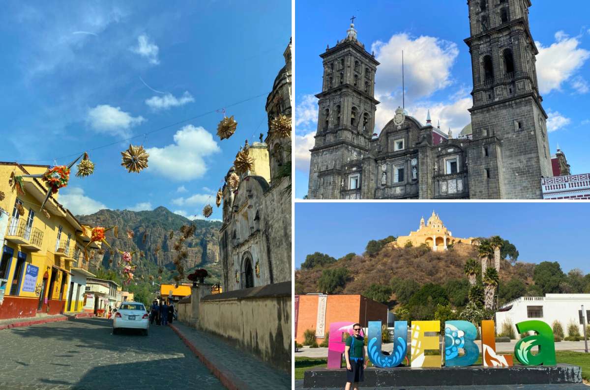
Tepoztlán, Puebla Cathedral, and Santuario de los Remedios in Cholula, Mexico showcasing some of central Mexico’s most iconic landmarks
Iztaccíhuatl–Popocatépetl National Park is about 70 km (43 miles) southeast of Mexico City. I always rent a car when I travel (I recommend DiscoverCars), because I think it gives you the most freedom and makes the experience much smoother. Here’s how to get to Izta Popo:
By car (recommended)
- Distance: about 70 km (43 mi)
- Driving time: 1.5 hours
- Route: Drive toward Amecameca, then continue up to Paso de Cortés
- Roads are paved most of the way; the final stretch becomes steeper and mountainous
- Parking is available at:
- Paso de Cortés (main entrance)
- La Joya / La Joyita (trailhead for Iztaccíhuatl)
- Streets in Río Frío de Juárez (Monte Tlaloc access)
Arrive early. On weekends and holidays, Paso de Cortés can fill up by mid-morning. Afternoon weather is also less predictable year-round.
Also, I’d recommend you read my 16 Things You Need to Know about Driving in Mexico article, so you don’t get in trouble on Mexican roads.
By public transportation
- Take a bus from Mexico City (TAPO station) to Amecameca
- From Amecameca, get a taxi to Paso de Cortés
- Total travel time: 2.5–3.5 hours one way
- Limited flexibility for early starts or late returns
You may need to stand while waiting for buses or taxis, especially during busy times. Basic Spanish skills are helpful for buying tickets and asking for directions, as English is not widely spoken in this area.
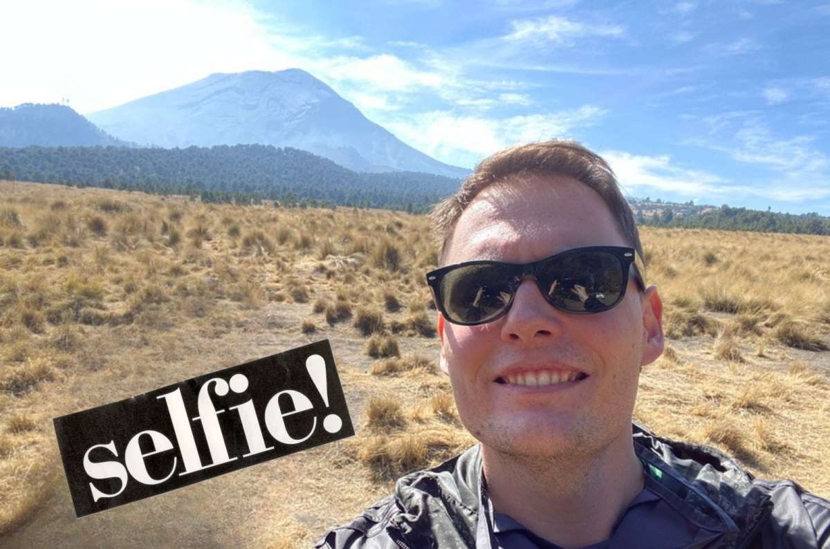
Selfie at Paso de Cortés in Iztaccíhuatl–Popocatépetl National Park
On a guided tour
If for some reason you don’t want to rent a car and drive yourself, I think the next best option is taking a guided tour straight from Mexico City to Paso de Cortez. There’s also Izta Popo tours directly from Puebla if that’s your staring point (it’s also cheaper than from Mexico City). A guide will give you interesting information about the landscape and flora too, which you probably won’t learn about when going on a DIY trip.
Tickets & fees
- Parking is free.
- Park entrance fee is 125 MXN (8 USD) per person (2026).
- Bring cash.
- You’ll receive a wristband or receipt after payment.
Permits & registration
- Paso de Cortés → La Joya hike: You only pay the park entrance fee at the gate. No special permit required.
- Monte Tlaloc: Standard park entrance fee applies. No technical climbing permit required.
- Iztaccíhuatl hike summit attempts (above Tercer Portillo / toward Refugio de los Cien and Pecho): Registration is required in addition to paying the park fee.
Fees and current regulations are managed by CONANP. Always check the latest status before heading up, especially if planning a summit.
Best places to eat near Izta Popo National Park?
Izta Popo is a busy place. Good for you; thanks to the number of tourists, there are basic restaurants to eat at. And nothing tastes as good as Mexican food after a challenging hike.
If you're hiking near Popocatepetl (to hike to La Joya or the Iztaccíhuatl hikeú, the most convenient option is to eat at Tacos doña Jessi, a restaurant located next to the Paso de Cortés parking lot. Should you choose the Monte Tlaloc trail, you’ll stumble upon several restaurants in Rio Frio de Juárez. But if you don’t mind driving and eating outside the park, you’ll find nicer restaurants in the nearby town of Amecameca.
Tip: Don’t rely just on restaurants and pack a snack in your backpack. Together with a big bottle of water.
Final thoughts on visiting Izta Popo National Park
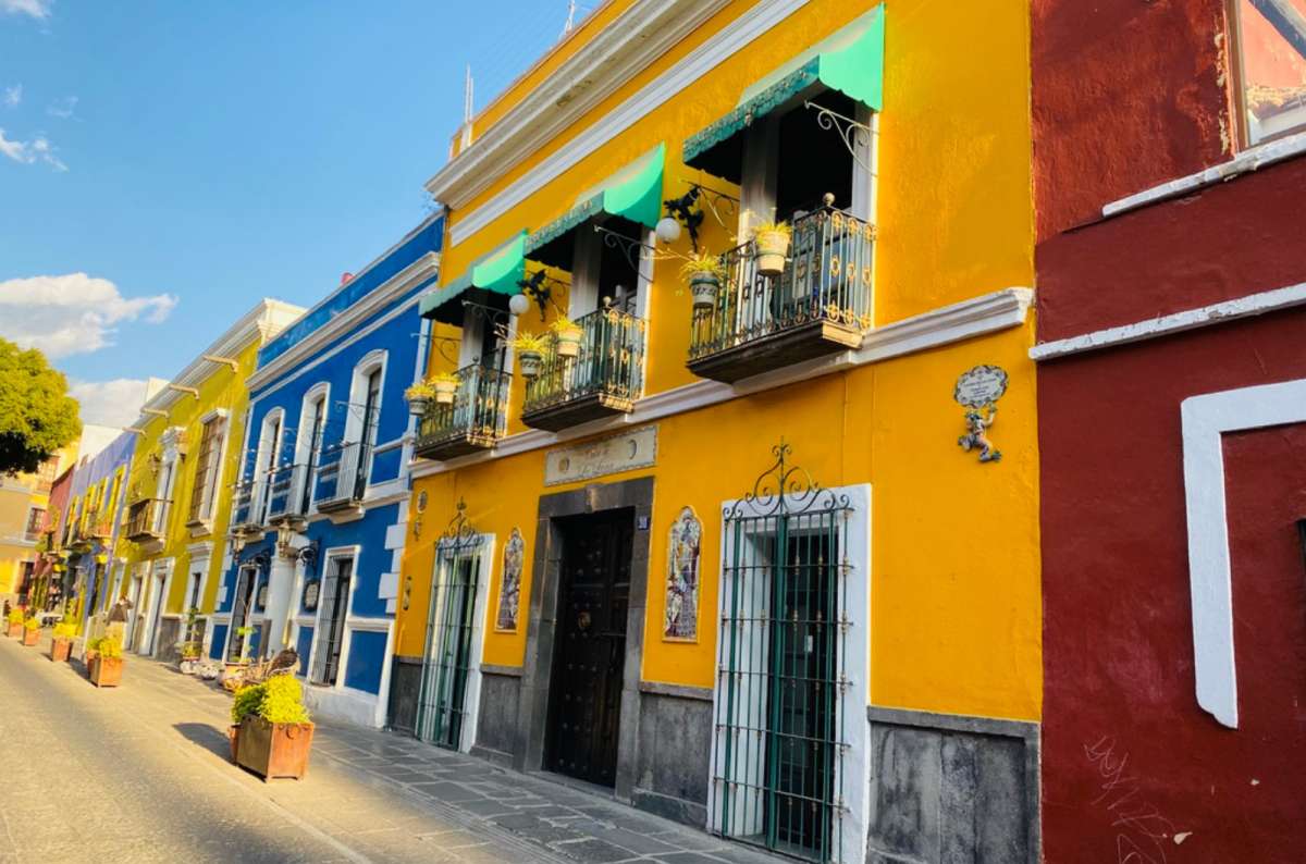
Bright colonial streets in Puebla, Mexico—an easy add-on after visiting Izta Popo
Iztaccíhuatl–Popocatépetl National Park is one of the most dramatic day trips you can take from central Mexico. You don’t have to summit a 5,000-meter volcano to appreciate it—even a walk from Paso de Cortés delivers massive scenery and that rare feeling of standing between two giant volcanoes.
Where to next? A big tip from me is to take time to explore the nearby city of Puebla as well, it’s in my top 3 American cities!
Planning a longer trip? Add Izta Popo into a bigger route through the country with my complete Mexico itinerary, where I break down how to combine culture, food, ruins, and nature without wasting time.
Sometimes, all you need to do is take the first step... I've filtered out the best hotels in Mexico City for you
Save it for yourself to come back to later, or share with your friends on social media!
I've already planned your ititnerary for the trip, complete with my travel tips.
Find more travel content, photos, and fun on:
This post contains affiliate links. If you make a booking through one of my links, I may earn a small commission—at no additional cost to you. Thank you for your support!
At a glance: Planning a visit to Izta Popo National Park
You might also be interested in reading:
Introduction to Iztaccíhuatl Popocatépetl National Park
Weather conditions & best time to visit Izta Popo National Park
Why hiking Popocatépetl is not allowed
Izta Popo hiking trails of various difficulty levels
1. Closest to Popocatepetl: Paso de Cortez hike
2. Hike to Aztec ruins on Monte Tlaloc
3. Iztaccihuatl volcano hike (standard La Joya route)
Other hikes in Izta Popo National Park
How to get to Izta Popo National Park from Mexico City?


Comments | Thoughts? Give us a shout!