


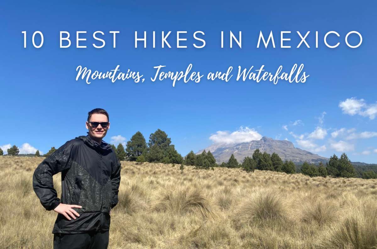


Which Mexico hiking trail is right for you?
How I chose the best hikes in Mexico
Izta Popo: Paso de Cortés: An easy shortcut to volcano views
Izta Popo: Iztaccíhuatl: A guided tour on a volcano
Desierto de los Leones National Park: A calm city escape
La Malinche: The hiking route for Mexico's best mountain views
Tepozteco: A tricky hike to an Aztec temple
Boca de Tomatlán: A behind-the-scenes look at real Mexico
Famous Mexico hikes still on my list
Other outdoor experiences in Mexico that involve walking
Canyon Sumidero: More than a hiking destination
El Chiflón: A scenic waterfall walk in Chiapas
El Aguacero: Beat the bugs, earn a bath
La Ruta de los Cenotes: Iconic Yucatán geology, but not a classic hike
I hiked throughout Mexico, from volcanic summits to canyon viewpoints and cloud forests—yes, this country has all of these things! There’s so much more hiking in Mexico than people realize.
Which means I can confidently tell you about the best hikes in Mexico. These aren’t based on popularity or whatever pops up first when you Google where to go. I’ve personally done all of these hikes in Mexico, and I know firsthand whether or not they’re actually worth your time.
I haven’t hiked every famous trail in Mexico, obviously. There are still some big ones on my list, so I’ve included those separately rather than pretending I’ve personally tested them (but I’ll tell you why they are on my list). Leaving them out completely wouldn’t give you a very useful picture of hiking in Mexico, and this way you can compare the hikes I know firsthand with the famous ones I haven’t done yet.
I’ve sorted them by difficulty, length, uniqueness, and a bunch of other bonus factors, too. Vamonos, let’s get hiking in Mexico!
Read more from my Mexico travel blog.
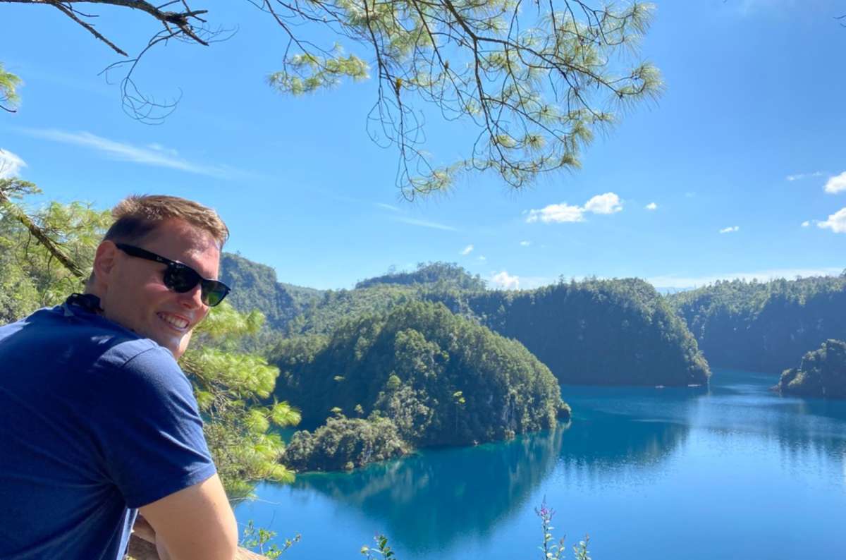
If this is your first glimpse of Chiapas, trust me—the best is yet to come
You might also be interested in reading:
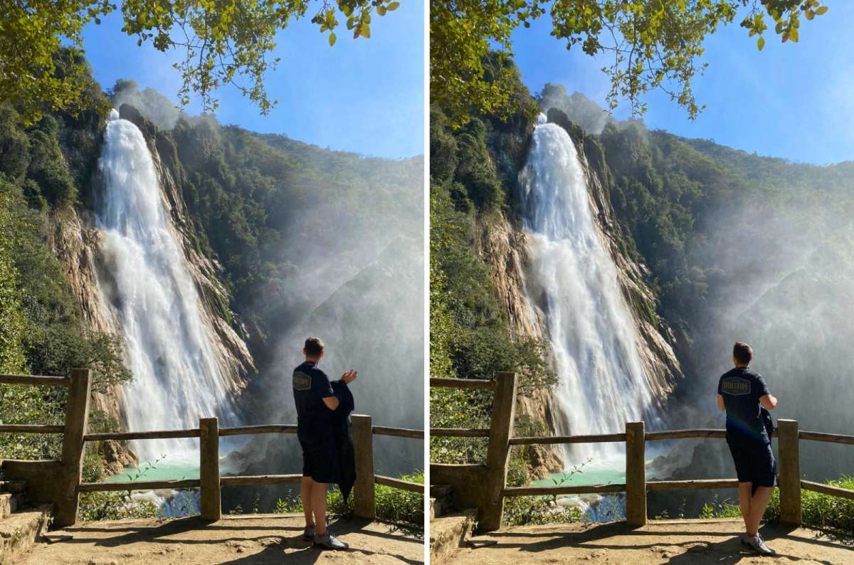
Cascada El Chiflón—one of the easier hikes
If you’re looking for a proper trail, mountain climb, or summit hike, these are, for me, the best hikes in Mexico:
I’ve done all four, and I’ll cover them below because they’re still worthwhile active experiences. But I wouldn’t put them in exactly the same category as climbing Iztaccíhuatl or La Malinche.
And the winners of my favorite hikes I’ve personally done in Mexico are (drumroll, please!):
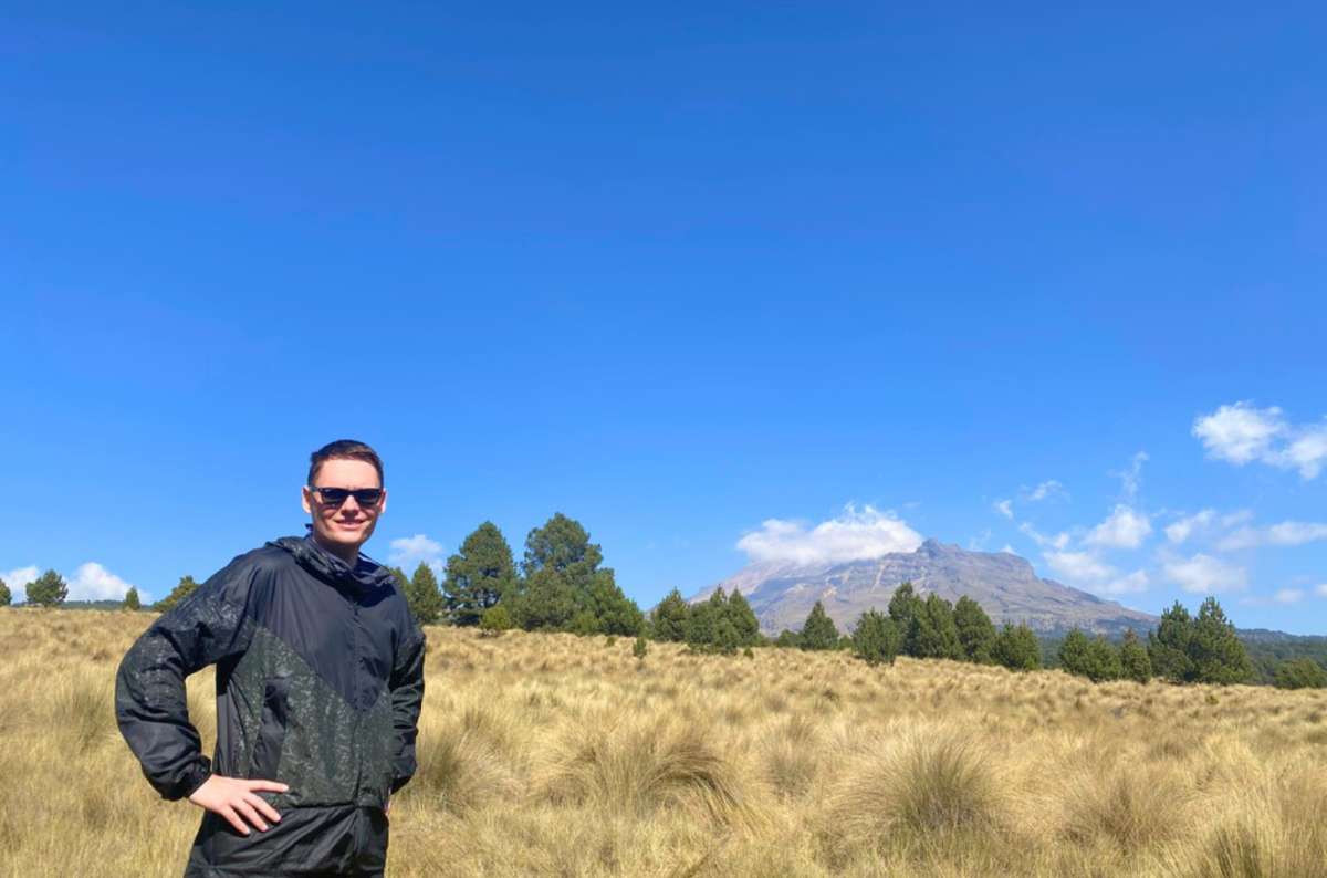
I used my own 5-point criteria system when ranking these Mexico hiking trails:
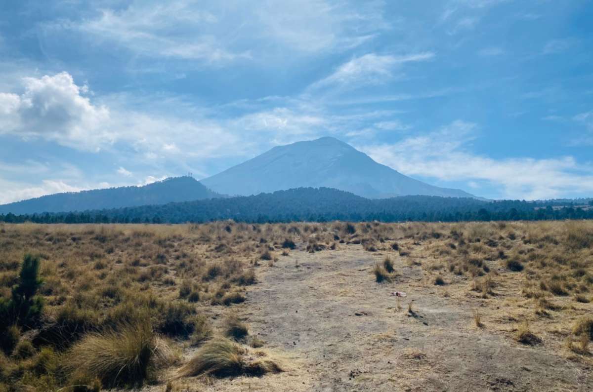
Check out the view from the Paso de Cortés
The Izta Popo: Paso de Cortés hike is the easiest way to see volcanoes in Mexico. Granted, they’re from a distance, but do you wanna get up close to an eruption? I didn’t think so. And when I say ‘volcano,’ I’m talking about the famously dangerous one with the unpronounceable name: Popocatépetl.
And don’t worry, the Paso de Cortés hike is one of the easier trails in Izta Popo National Park. It will lead you on a wide, flat road with spectacular sights of Popocatépetl and Iztaccíhuatl, Mexico’s second- and third-highest peaks, in the distance. This trail is kind of like a cheat code to epic volcano views.
The starting point of the trail is the Paso de Cortés parking lot. From there, the path leads to La Joya on the foothills of Iztaccíhuatl, and then the same way back. The odds of seeing a little eruption of Popocatépetl from a distance are pretty good. Maybe you’ll manage to capture it on camera, but I didn’t.
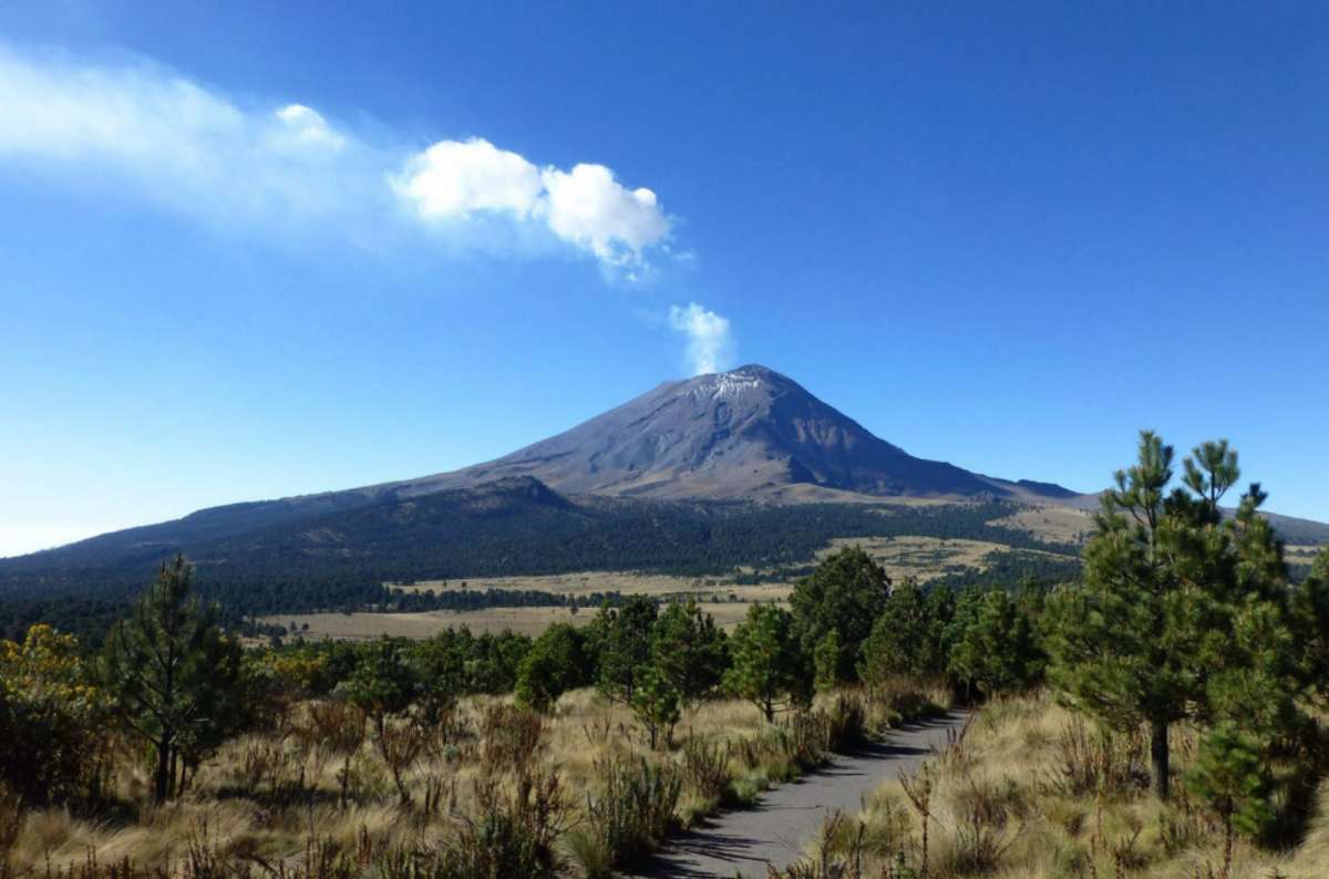
Paso de Cortés is one of the easiest places to get a close-up view of Popocatépetl without a serious hike
It’s best to organize the hike as a day trip from Mexico City. You can easily get there by car (check my instructions on driving in Mexico), and conveniently park in the parking lot called Paso de Cortés. The admission fee to the national park is MXN 125 (USD 7) per person.

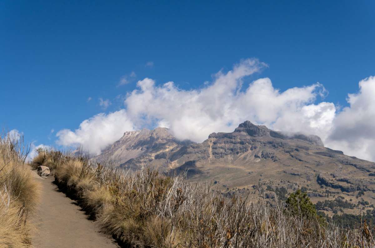
Iztaccíhuatl covered in fog
Iztaccíhuatl is a 5,230 m (17,160 ft) tall dormant volcano in Izta Popo National Park. Those bare, steep, rocky slopes, sometimes covered in snow, are hard terrain to climb. That’s why the hike is recommended only for very experienced adventurers, ideally with a guide. My feet are aching thinking about it. Would I do it again, though? Hell freaking yes… it’s one of the best hikes in Mexico, in my humble opinion!
The route I did started at the La Joyita parking lot and followed the trail up Iztaccíhuatl before returning the same way. We started super early in the morning. Don't expect to sleep in, even on weekends. And make sure to bring some food, you'll be hiking with your group throughout the entire afternoon.
Then it goes up the hill with absolutely merciless elevation gain. Everything in front of me was up, up, up. Until we reached the peak, that is, obviously. After that, we just went back down the same way. The sigh of relief I breathed...
This is one of the best hikes in Mexico because it’s one of those unforgettable ones. I mean, you don’t just climb an entire volcano and never think about it again.
The Izta Popo National Park is located only an hour's drive from Mexico City; that’s why the hike makes for a perfect day trip from the capital. The parking lot called La Joyita stands just under the mountain, and admission to the park costs MXN 125 (USD 7) per person. If you want to drive up to La Joya, you now need to make a reservation in advance through CONANP. Don’t forget to pack enough water and snacks, as the hike is really challenging and took me about six hours.

Hotel tip: I’d recommend staying at the Banyan Tree Hotel in Puebla.
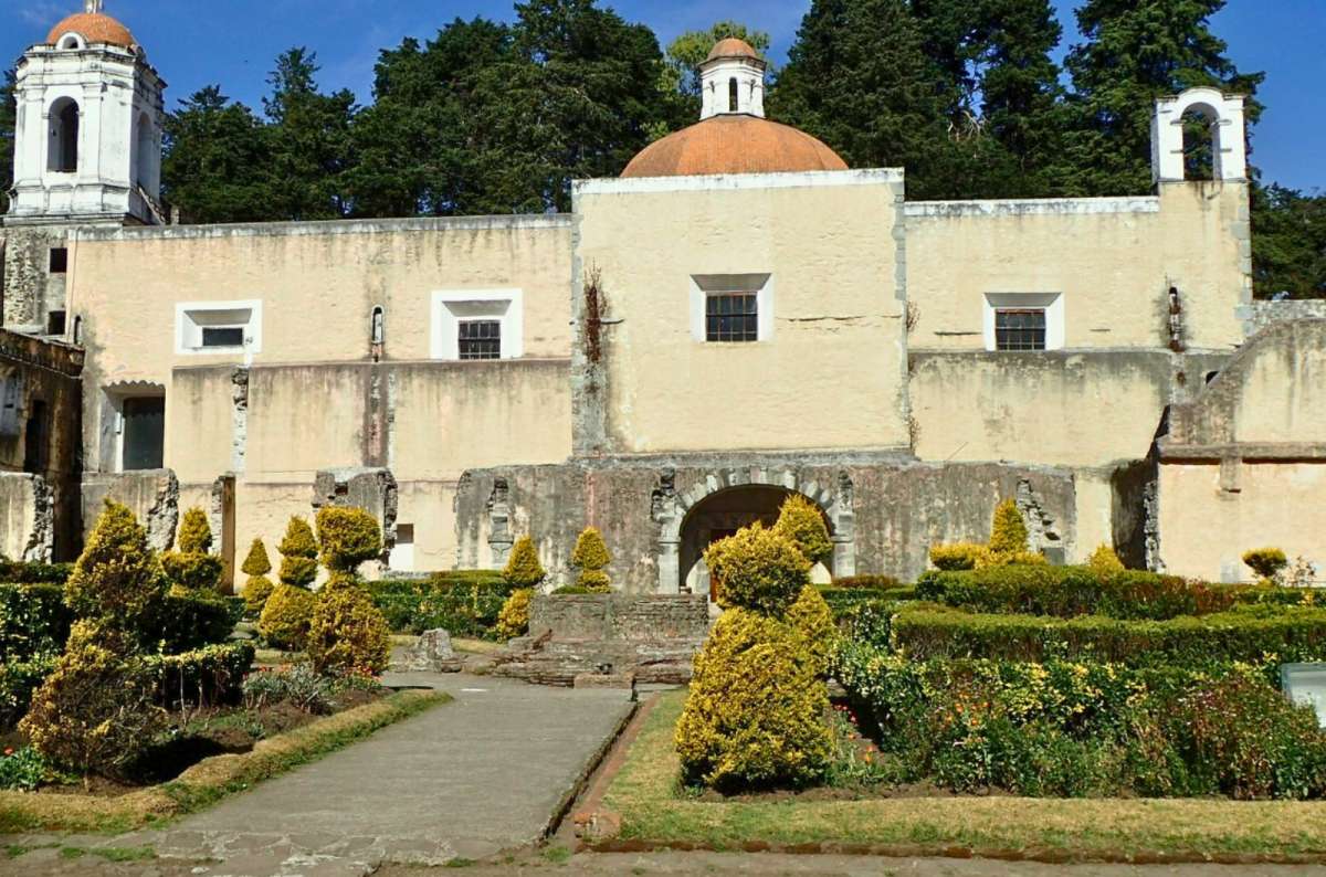
Ex Convento del Desierto de los Leones
This is a loop that goes through the dense forest trails in Desierto de los Leones National Park—the Desert of the Lions in translation. It’s a nice day trip if you want to escape the rush of Mexico City and enjoy trees, rivers, and views from the hilltops instead of cars, shops, and museums.
The fresh air here is much better than in the heart of Mexico City, and you definitely don't need to be an experienced hiker to enjoy these views.
I would recommend going during the dry season, though the rainy season means one word: mud. Which would be extra annoying because of all the mountain bikers zipping past. You don’t want those wheels splashing up mud onto your pants. I was also surprised by the treat at the end: an old convent, which was kind of creepy looking, to be totally honest. But hey, that’s not necessarily a bad thing. Maybe you’re into creepy old ex-convents. For me...shivers.
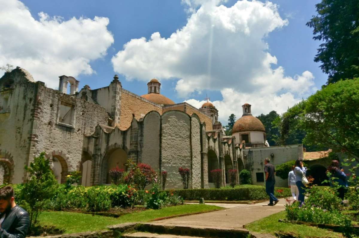
Wandering through the courtyards of Ex Convento del Desierto de los Leones
It might be a bit harder to find the trail—it starts at a tiny parking lot in the southernmost point of the road connecting Santa Rosa Xochiac and La Venta, southwest of Mexico City. Right here:
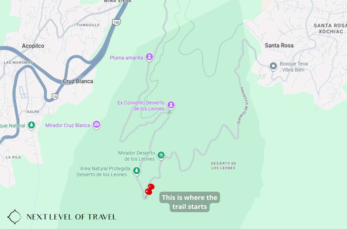
This is where the trail starts
In case you don’t want to rely on tourist signs on the spot, you can find the whole trail on a tourist map made by Alltrails.
The convent is open Tuesday to Sunday from 10:00 am to 5:00 pm. Tickets cost only MXN 19 (USD 1).
Another Mexico City hike on my list: Desierto de los Leones isn’t the only option around Mexico City. Ajusco, particularly the hike up Pico del Águila, is a proper mountain hike and one of the major routes I still haven’t done. I’ll come back to that one later in the article with the other famous Mexico hikes still on my list.
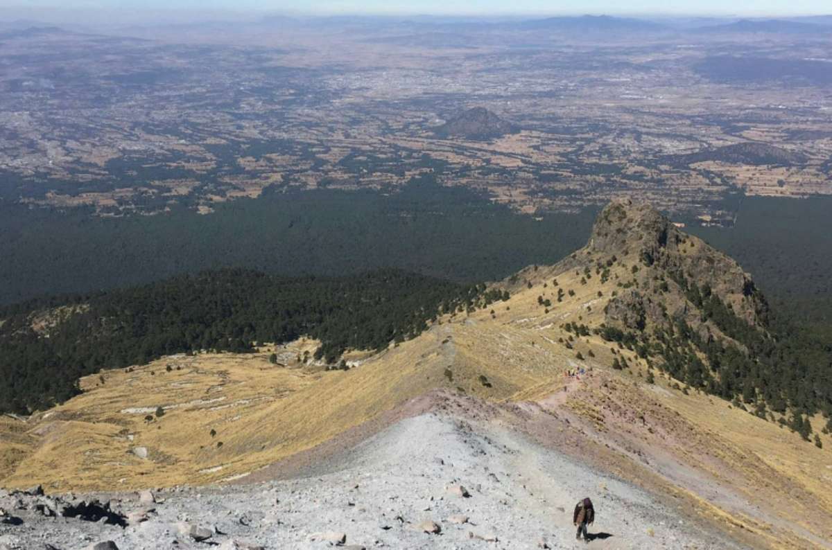
The final push on La Malinche is steep, dusty, and absolutely worth it for the views
La Malinche National Park is another one of the best hikes in Mexico. It’s named after its highest peak, La Malinche Volcano (4,462 m—14,639 ft—above sea level). The trail offers stunning views of Mexico’s first- and second-highest mountains, Pico de Orizaba and Popocatépetl, and is used by mountaineers for high altitude acclimatization.
By the way, Pico de Orizaba is located in Veracruz State—I’ve been there too, and I’ve written a separate article about it. Just to be clear, though, I haven’t climbed Pico de Orizaba. Getting to the summit is a serious high-altitude mountaineering objective rather than a casual hike, so I’m keeping that one on my “still to do” list.
The hike goes from Resort IMSS Malintzi on a wide, well-signed road in the forest. The harder part came after I got above the tree line; there's a pretty steep and rocky path there, and to add on, it was poorly signed. After you reach the summit, the trail goes the same way down.
The highlight was getting to see Pico de Orizaba, Mexico’s highest mountain, which I hadn’t been able to see on any other hike.
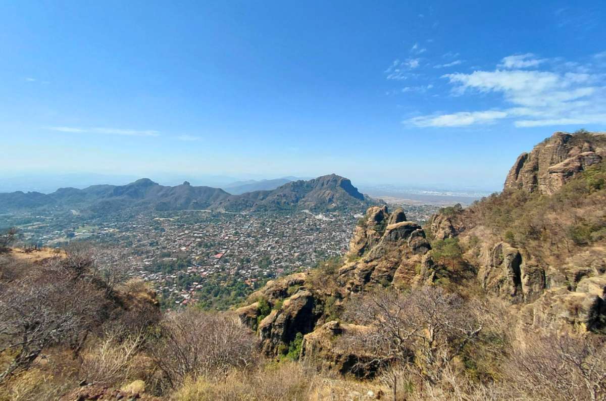
The Tepozteco hike is totally worth it!
Short but steep—that’s the hike to Tepozteco, the Aztec temple built on the peak of a hill just above the town of Tepoztlán. Treacherous tree roots and rocks block the path and make the trip rather challenging. It completely makes up for a gym—quoting myself from my 7 Best Aztec Ruins in Mexico article. Check it out!
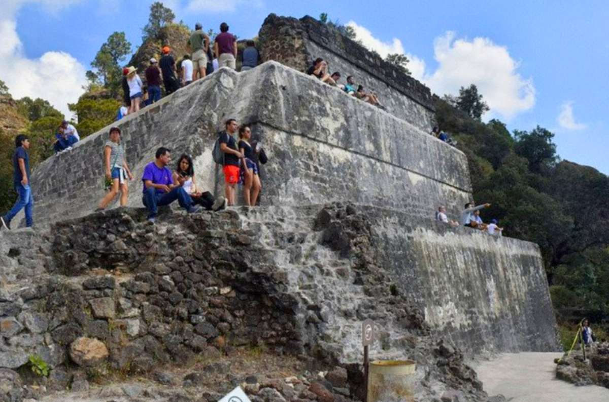
The reward for hiking up to Tepozteco? Ancient ruins, mountain views, and a well-earned stop to catch your breath
The temple isn’t open at all times — you can visit it between 9 am and 4 pm from Wednesdays to Sundays (last entry at 3 pm). The admission fee for the archaeological zone at the top of the mountain is MXN 210 (USD 12). If you travel by car, don’t go straight to the beginning of the trail—the city is full of one-way streets, and it’s very hard to find a parking lot there. It’s much better to look around for a parking space in one of the private gardens that locals offer for parking (expect roughly MXN 50–100 (USD 3–6) per day) and walk to the start of the trail.
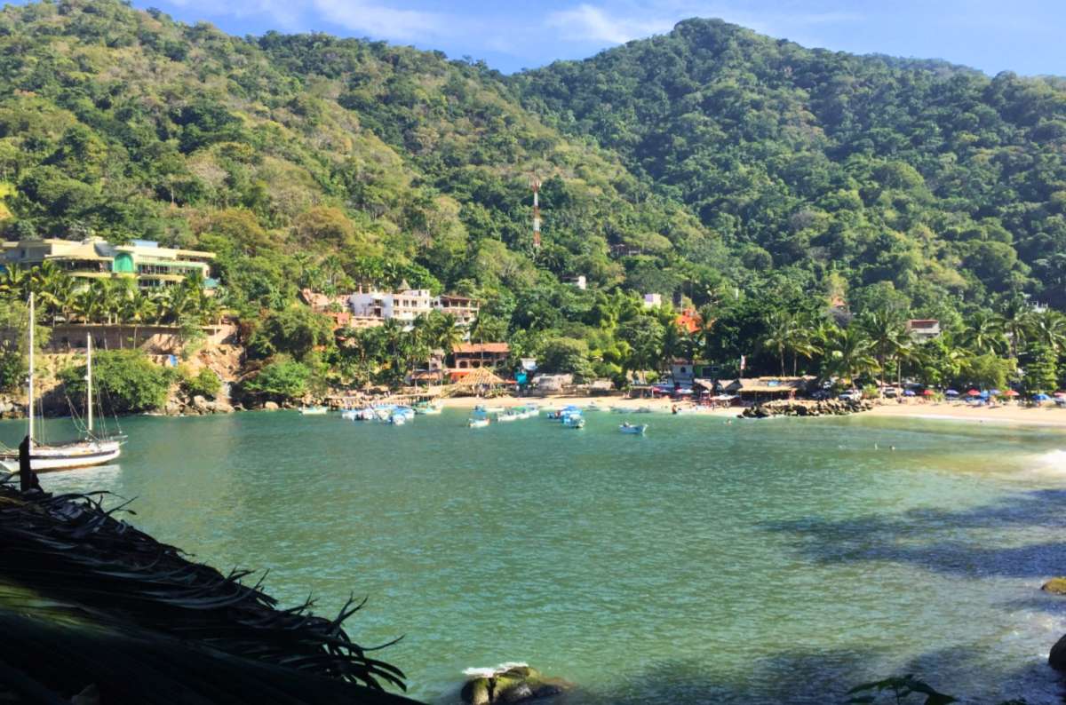
Boca de Tomatlán
Route note: The classic coastal hike from Boca de Tomatlán usually follows the coast through Colomitos to Las Ánimas, with the option to continue farther toward Quimixto. I did a longer version of the route, so the 17.2 km refers to my route—not the standard Boca de Tomatlán–Las Ánimas trail.
Emerald water, sun-splashed beaches, and palms. Believe it or not, this postcard-like view is real, and it’s why Boca de Tomlatán made it on my best hikes in Mexico list. This is a traditional fishing village on the western coast of Mexico, where I felt like I got to peek behind the curtain and experience true rural Mexico.
The village is a starting point of several trails—one of them heading to the Quimixto Waterfall and back. It’s a wonderful road off the beaten path, leading along little homesteads and several beaches. I got a little worn out during the hike, so we grabbed a water taxi for some MXN 100 (USD 5) per person. And bought a lemonade in one of the many bars along the way.
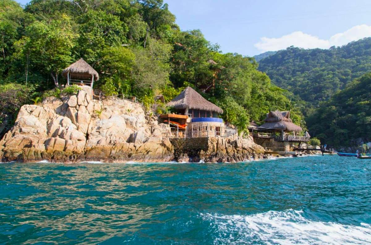
Boca de Tomatlán is where the road ends and the jungle-meets-ocean vibes begin
Boca de Tomatlán is a 40-minute drive from Puerto Vallarta in Jalisco. The easiest way to get there is by car. Don’t you know where to get it or how to drive in Mexico? Read my article with 16 things you need to know when driving in Mexico.
I’ve hiked a lot in Mexico, but I haven’t hiked everything—and I’m not going to pretend I have. There are some seriously famous Mexico hikes that are still on my list:
Nevado de Toluca: One of Mexico’s most famous high-altitude hiking destinations, with the Lagunas del Sol y de la Luna inside the volcanic crater. A high-altitude volcano hike around crater lakes sounds exactly like the kind of trail I usually enjoy, so this is probably the biggest omission from my own Mexico hiking experience.Important: access to the protected area is currently closed until further notice, including the crater, lakes, and hiking trails, so check the latest CONANP information before planning a visit.
Ajusco and Pico del Águila: If you want a proper mountain hike near Mexico City, this is an obvious one. I did Desierto de los Leones instead, so Pico del Águila is still waiting for me. It looks much closer to the kind of proper summit hike I’d normally seek out, which is exactly why it’s on my list.
Paricutín: You can hike through the volcanic landscape from around Angahuan or Nuevo San Juan Parangaricutiro toward the crater, with the remains of the buried church of San Juan Parangaricutiro another highlight of the area. This one interests me more for the landscape than for adding another summit to my list—the combination of a young volcano and a buried church makes it very different from the volcano hikes I’ve already done.
Pueblos Mancomunados, Sierra Norte Oaxaca: This is much more than one trail—the mountain communities are connected by hiking routes, so this is somewhere to look for a broader Sierra Norte trekking experience rather than one famous summit trail. I usually prefer day hikes to multi-day trekking, but that’s exactly why I’d like to try this one—it would be something completely different for me.
Copper Canyon: Copper Canyon is an entire region, not one hiking trail. One specific option I’ve put on my to-do list is the Bacajipare route, which descends from the canyon rim toward the Rarámuri community of Bacajipare. The sheer scale of Copper Canyon is the reason I’d want to hike here, but it’s also the reason I wouldn’t just improvise a route. This is one where I’d want local guidance rather than wandering into the canyon and hoping for the best.
Pico de Orizaba: Mexico’s highest mountain is in another league. Reaching the summit is a serious high-altitude mountaineering objective rather than something I’d lump in with a normal day hike. Obviously, climbing Mexico’s highest mountain has some appeal, but this one is much farther outside the type of hiking I normally do. I haven’t climbed it and am not planning on it anytime soon (I’m not an overnight camping kinda guy).
Not everything I did involved following a proper hiking trail, but these places still involved plenty of walking, sweating, and getting outside—and they’re worth mentioning. Just don’t expect them to be the same kind of hiking experience as climbing Iztaccíhuatl or La Malinche.
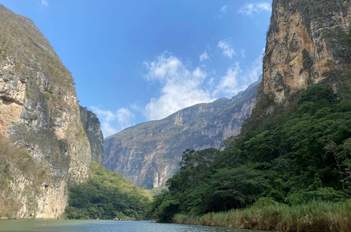
Canyon Sumidero
Why it’s on the list: You can decide how much you want to see and do, but no matter what, you’ll be treated to classic, gorgeous Mexican nature. It’s one of my favorite outdoor experiences in Mexico!
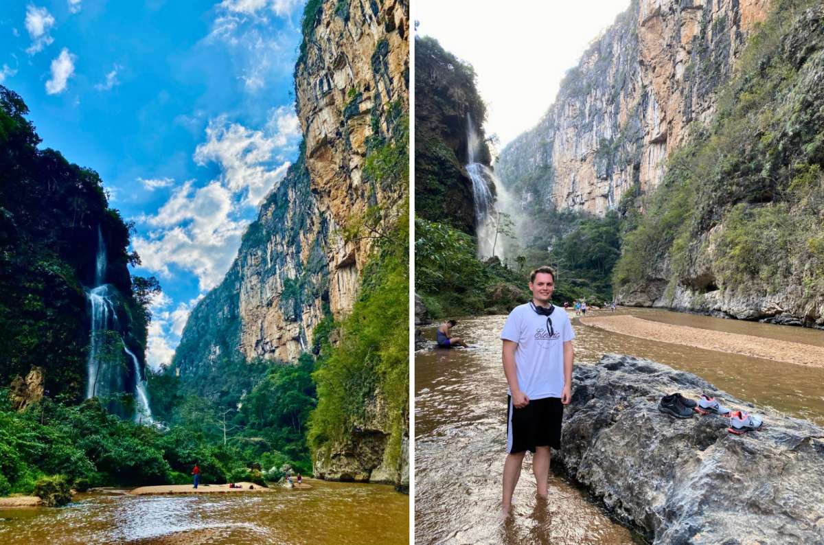
Canyon Sumidero is the most beautiful place in Mexico, with its 1,000 m (3,280 ft) tall walls rising above the Grijalva River and leading it to the Chicoasén Dam.
But Sumidero Canyon isn’t one defined hiking trail, and I don’t want to pretend it is. Our visit combined some of the easier walking with sightseeing in the national park rather than following one major named hiking route.
Personally, we opted for some of the easier trails to save energy for the tougher Mexico hiking trails later in our itinerary. But we still got to see plenty of waterfalls, rapids, caves, and rock formations, and diverse vegetation like palms, orchids, and cactuses. Endangered wildlife live in the park—such as crocodiles or jaguars—but no viewings were in the cards for us, oh well.
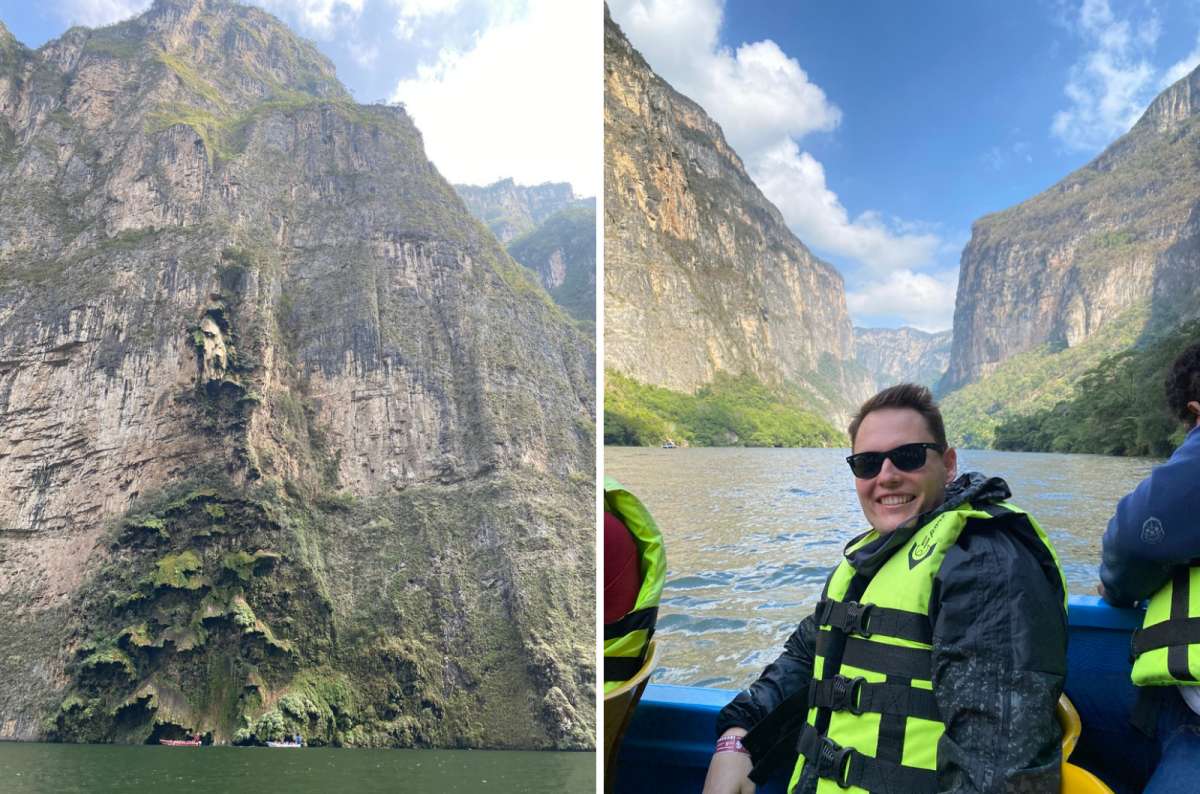
The cliffs of Sumidero Canyon rise up to 1,000 m above the river (on the left: the "Christmas Tree" waterfall)
Personal tip: Book a boat trip through Sumidero Canyon to experience its towering cliffs from the water.
Sumidero Canyon lies in Chiapas, Mexico. There are plenty of ways to get there—you can drive from Tuxtla Gutiérrez or from San Cristóbal de las Casas, or you can take a bus to Chiapa de Corzo and explore the canyon from there.
The admission fee to the national park is MXN 125 (USD 7), but the price of the boat trip depends on the operator you choose.
Pro tip: It’s good to know that the bathrooms are paid for; it’s therefore necessary to have some coins with you. Unless you want to powder your nose next to a jaguar.
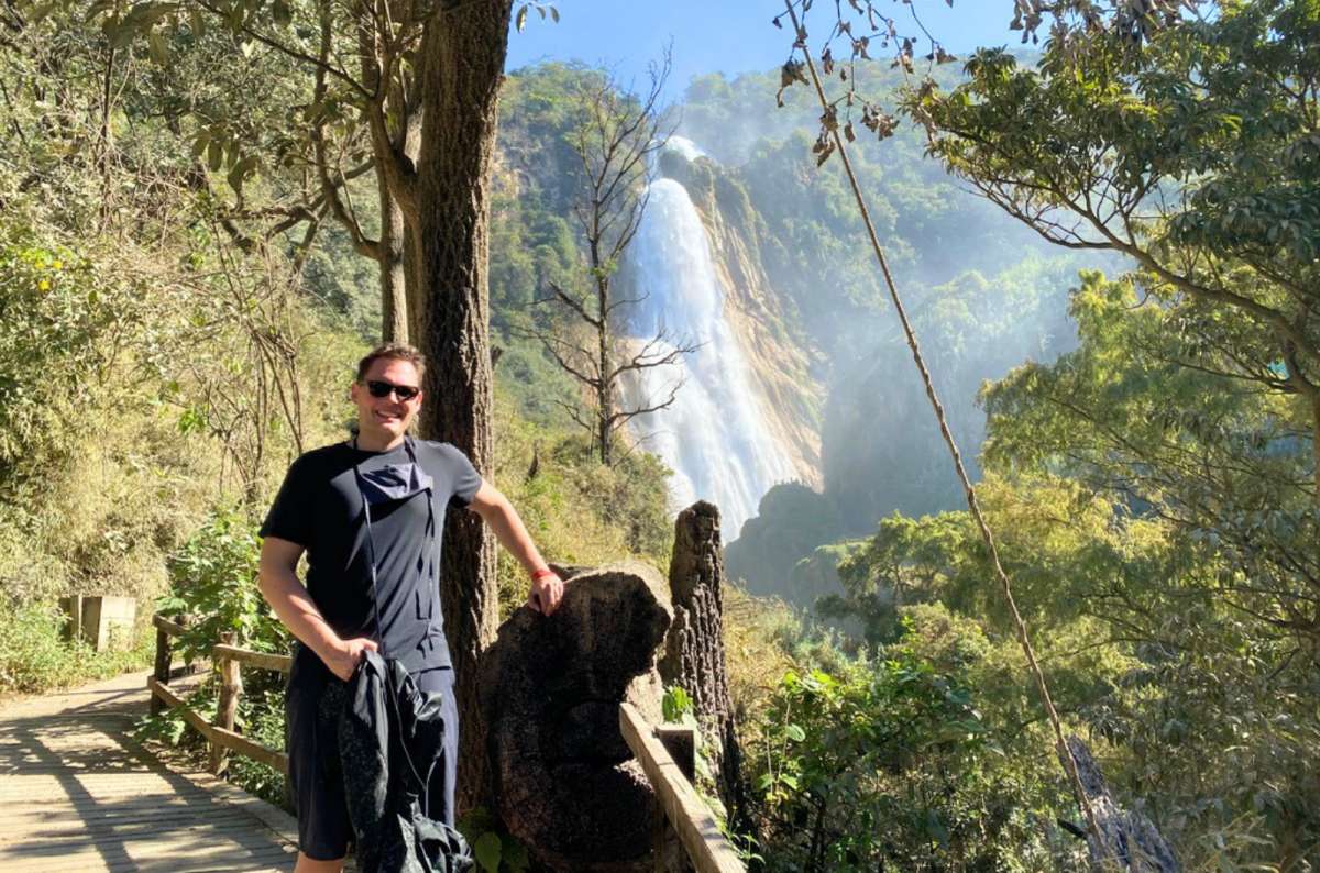
Me and El Chiflón Waterfall
El Chiflón is an easy, beautiful Mexico hiking trail along the river with a series of not one, not two, but five waterfalls in a row. Which means it definitely checks off my ‘personal experience’ box: I saw a lot in a little bit of time. I’m talking roaring waterfalls, crystal-clear pools, and a turquoise river.
The tallest fall in the cascades is Cascada Velo de Novia, roaring and pouring water down from a height of 80 m (260 ft). But what’s even better than observing waterfalls? Bathing under them! In certain parts of the river, swimming is allowed, so I took a couple of refreshing dips. I even got to zipline over the river! El Chiflón is not a place to get bored.
Warning: Swimming in unsigned pools is dangerous; deadly currents occur under the water. Bathe only in the locations clearly designated for swimming. I’d recommend reading my other 33 Mexico travel tips to avoid any inconvenience.
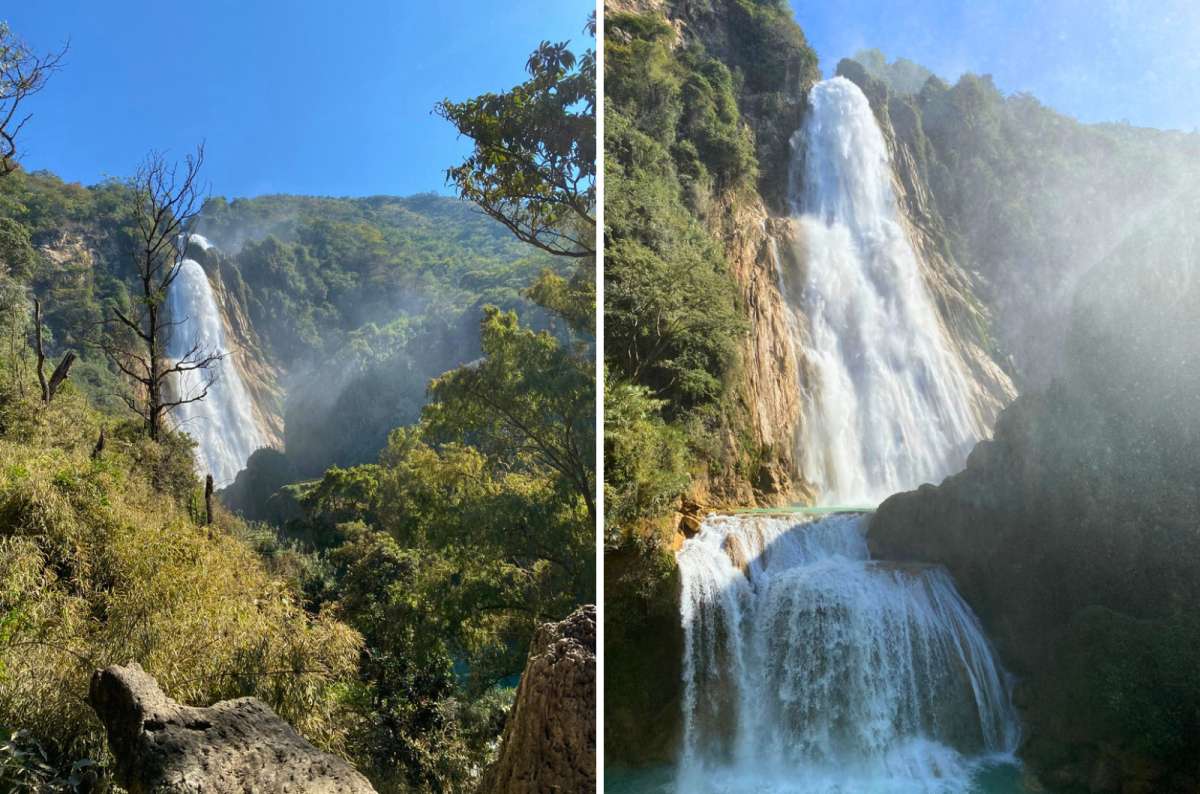
I knew El Chiflón would be nice. I did not expect it to be this nice
The cascades are reachable by car from Comitán (a 45-minute drive) or San Cristóbal (a 2.5-hour drive). They are open daily from 8 am to 5 pm, but the earlier you arrive, the better—as the day goes on, the place starts getting crowded. The entrance fee is MXN 80 (USD 4.50).
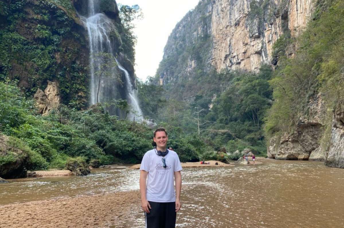
Me and El Aguacero
I think the best hikes in Mexico are those that offer more than walking—that’s why I enjoyed the hike to the El Aguacero waterfall so much. Apart from walking, you can spice up the trail by bathing in the river and admiring the spectacular waterfall, one of the nicest in Chiapas.
The trail starts in front of Centro Turístico El Aguacero, and goes up a narrow path through the jungle—hot, wet, and full of mosquitoes. But if you keep on and scramble up, you’ll get to a canyon and instantly fall in love—the river is warm, and the waterfall is photogenic. That’s all you need. Or at least all I needed.
The 700+ stairs down to Cascada El Aguacero are optional. The 700+ stairs back up are not
The hike is short, but you should reserve at least a five-hour-long window in your itinerary for it, if you want to spend some time bathing and admiring the waterfall. Before entering the trail, you have to pay the admission fee (MXN 125—USD 7) at the tourist center, which is open from 9 am to 5 pm every day.

Marriott Tuxtla Gutiérez Hotel: The most beautiful atrium I’ve ever seen!
Hotel tip for Tuxtla Gutiérrez: We enjoyed our stay at Marriott Tuxtla Gutiérrez Hotel. Great location, nice personnel, gym, pool, and tasty breakfast—what else could you wish for?
La Ruta de los Cenotes
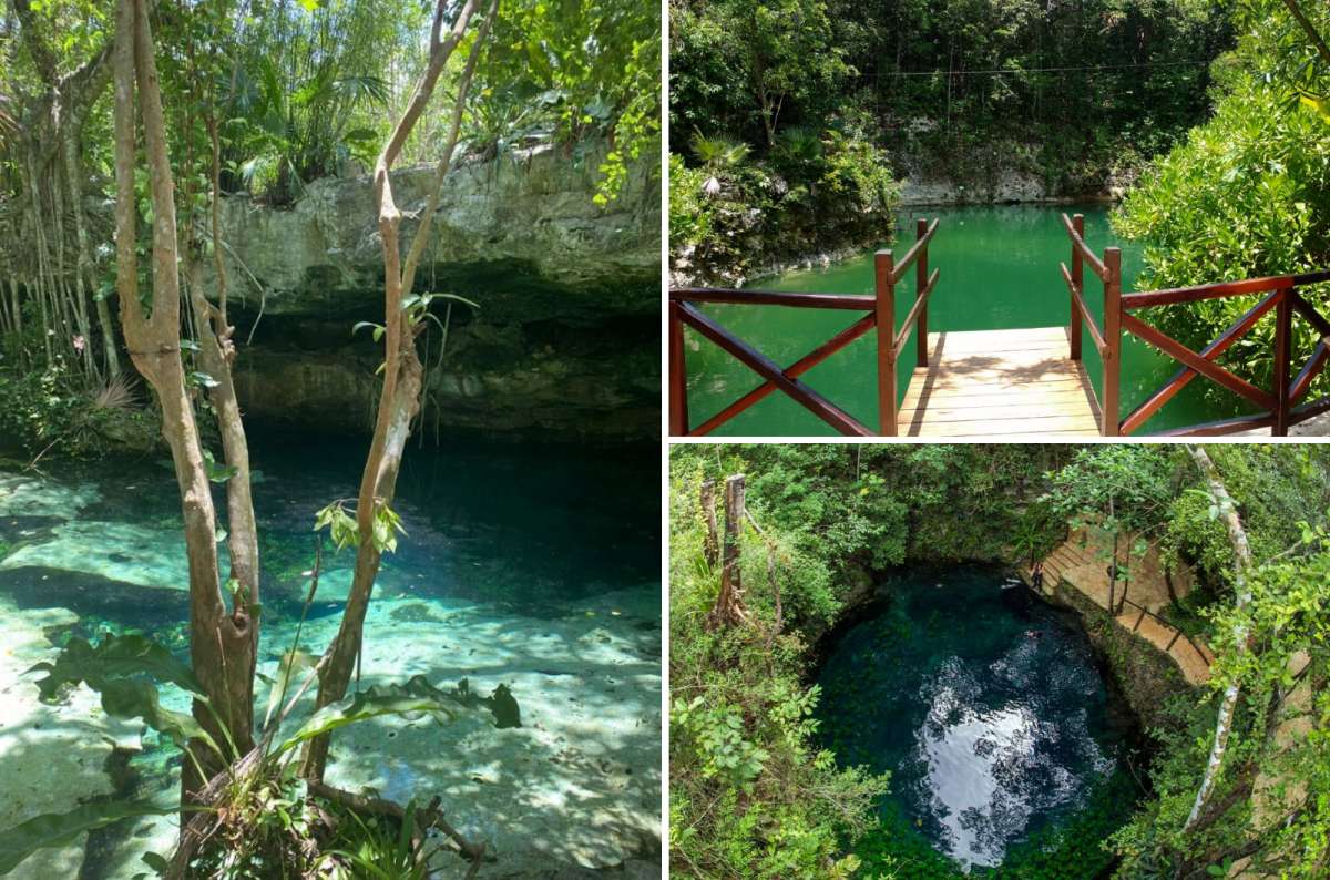
La Ruta de los Cenotes is one of my favorite active experiences in Mexico for enjoying the phenomenon typical of Yucatán—cenotes, natural sinkholes filled with water, which I can best describe as “underground caves without ceilings.”
The route is a paved road that connects several cenotes. You don’t need to walk the whole distance, just explore as many sinkholes as you want, and then turn back.
While you're in Yucatán, you should also check out its top 9 places to see.
Some of the cenotes were impressive just because of their crystal-clear water and pure silence. Others? They’re basically mini adventure parks with zip lines and swimming activities. Yeah, I indulged in both. I’m a kid at heart.
You’ll find the route on the Yucatán Peninsula near Cancún; the road leads from Puerto Morelos to Leona Vicario. Some of the cenotes have bathrooms and changing rooms. The admission fee varies in different cenotes; simple admission can start at around MXN 150 (USD 8), while more developed cenotes and adventure parks cost considerably more. And bring cash. A lot of them don’t take cards.

Hotel Casona 61 by GuruHotel—a great place in the center of Mérida (no, not in Cancun, because I don't like to stay there)
Hotel Casona 61 is my kind of hotel—rooms and interior of modern design, great pool, and delicious breakfast. The only problem was complicated parking. Apart from that, I was happy with everything. (I don’t like staying in Cancun itself, but I did spend a few nights in Fiesta Americana Condesa Cancun, and it was fine. Would stay again if I had to stay in the city.)
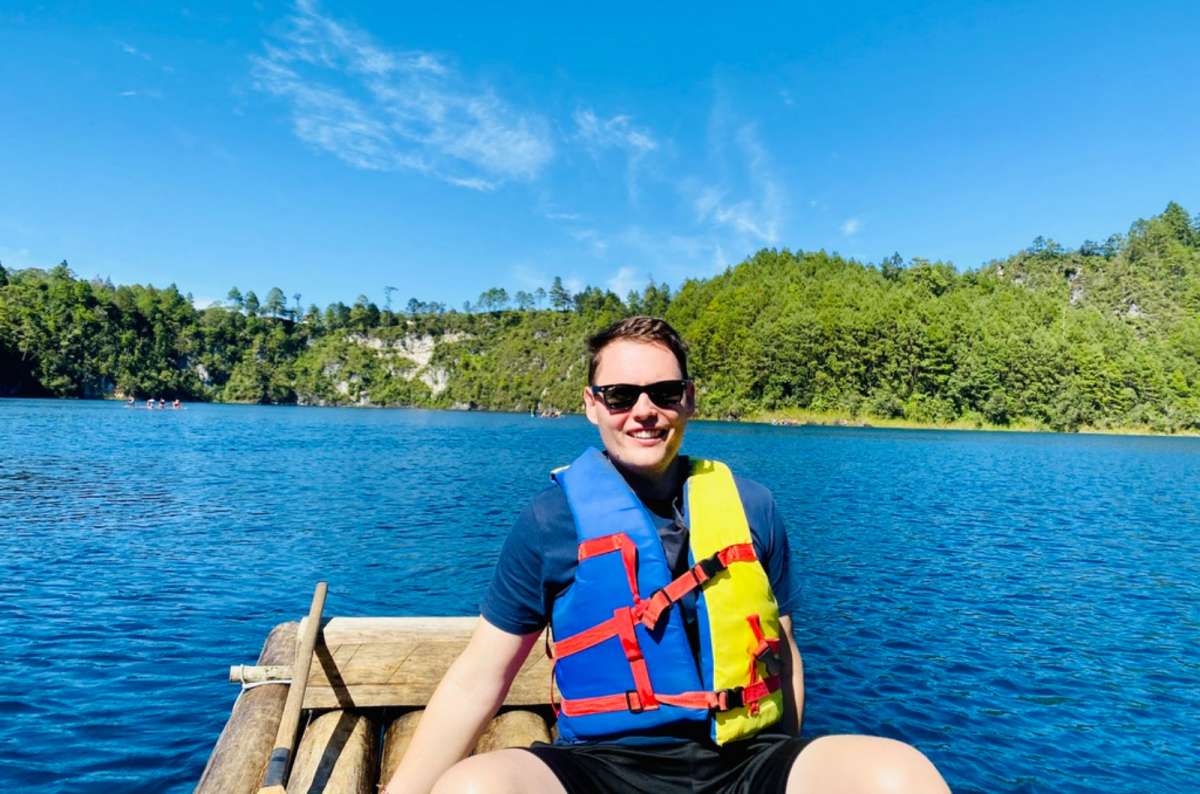
Not every great day in Mexico requires a hike. If you're looking for more ideas, don't miss my guide to the best places to visit in Mexico
This post contains affiliate links. I earn a small commission if you make bookings through my links, at no additional cost to you. Thank you for your support!
Which Mexico hiking trail is right for you?
How I chose the best hikes in Mexico
Izta Popo: Paso de Cortés: An easy shortcut to volcano views
Izta Popo: Iztaccíhuatl: A guided tour on a volcano
Desierto de los Leones National Park: A calm city escape
La Malinche: The hiking route for Mexico's best mountain views
Tepozteco: A tricky hike to an Aztec temple
Boca de Tomatlán: A behind-the-scenes look at real Mexico
Famous Mexico hikes still on my list
Other outdoor experiences in Mexico that involve walking
Canyon Sumidero: More than a hiking destination
El Chiflón: A scenic waterfall walk in Chiapas
El Aguacero: Beat the bugs, earn a bath
La Ruta de los Cenotes: Iconic Yucatán geology, but not a classic hike


Hi, I’m Jan. I travel fast and intensely, whether I’m exploring the buzz of Tokyo in 3 days or road-tripping through mountains and beaches on a 3-week Thailand adventure. And no matter where I am, you’ll always find me in a comfortable hotel at night and eating the best food.
If that sounds like your kind of journey, hop on board, and let’s explore the world together!
I started this blog after realizing how tough it can be to find reliable, authentic travel info. You wouldn’t believe how many “travel bloggers” never even visit the places they write about! On Next Level of Travel, you can count on my full honesty and insights drawn from my firsthand experiences.
Here’s the deal: not every destination is all superlatives and unicorns. I’ll let you know if a tourist attraction isn’t worth your time, like skipping overrated stops in my 2-week Spain itinerary. And when I find something truly special—like the perfect mix of culture and nature in Cape Town—you can trust that it’s worth adding to your itinerary.



Comments | Thoughts? Give us a shout!